

$2,300
Total Monthly Price
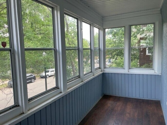
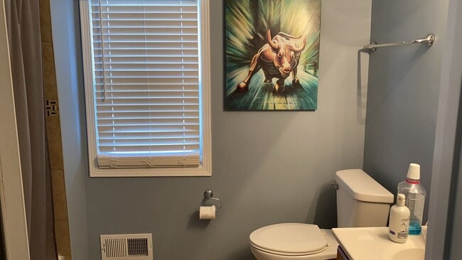
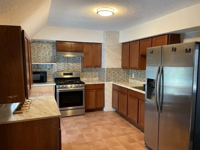
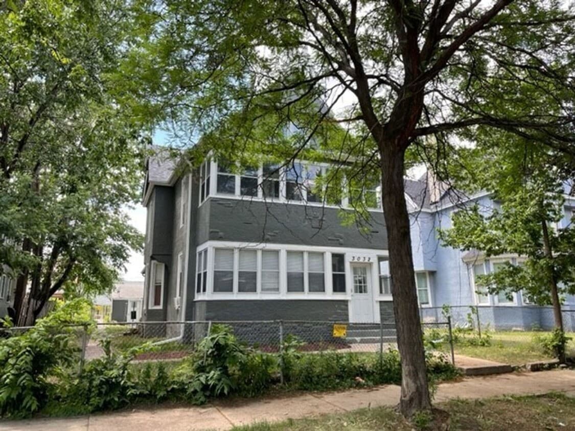
3032 3rd Ave S Unit 2
Minneapolis, MN 55408
1 Day Ago
Favorites
952-452-9254
-
Bedrooms
4
-
Bathrooms
1
-
Square Feet
1,800 sq ft
-
Available
Available Now
3032 3rd Ave S Unit 2

Favorites
Characterized by single-family homes and low-rise multi-family rentals along tree-lined streets, the Central neighborhood of Minneapolis lies about three miles due south of the city center. Bordered on the west by I-35, the Central area provides its residents with a convenient location and easy access to the amenities of the greater Minneapolis-St. Paul region.
Stroll well-kept sidewalks or the walking paths at Powderhorn Park, a 66-acre spread providing picnic facilities, an ice skating rink, a fishing pier, and athletic fields. For a change of pace, visit Central Gym Park on the neighborhood's south side to play tennis or shoot hoops indoors. Then drop into the highly popular Café South Side for a soup and sandwich, a fresh-baked pastry, or a cup of coffee brewed from organic beans.
Learn more about living in Central
Education
| Colleges & Universities | Distance | ||
|---|---|---|---|
| Colleges & Universities | Distance | ||
| Drive: | 6 min | 2.0 mi | |
| Drive: | 7 min | 2.2 mi | |
| Drive: | 7 min | 2.3 mi | |
| Drive: | 9 min | 4.4 mi |
3032 3rd Ave S Unit 2 is within 6 minutes or 2.0 miles from North Central University. It is also near University of St. Thomas and Minneapolis College.
Transportation options available in Minneapolis include Lake Street/Midtown Station, located 1.8 miles from 3032 3rd Ave S Unit 2. 3032 3rd Ave S Unit 2 is near Minneapolis-St Paul International/Wold-Chamberlain, located 10.6 miles or 18 minutes away.
| Transit / Subway | Distance | ||
|---|---|---|---|
| Transit / Subway | Distance | ||
|
|
Drive: | 5 min | 1.8 mi |
|
|
Drive: | 6 min | 2.4 mi |
|
|
Drive: | 7 min | 2.5 mi |
| Drive: | 8 min | 2.6 mi | |
|
|
Drive: | 9 min | 3.0 mi |
| Commuter Rail | Distance | ||
|---|---|---|---|
| Commuter Rail | Distance | ||
|
|
Drive: | 10 min | 3.1 mi |
|
|
Drive: | 19 min | 12.2 mi |
|
|
Drive: | 19 min | 12.3 mi |
|
|
Drive: | 34 min | 23.3 mi |
|
|
Drive: | 35 min | 25.0 mi |
| Airports | Distance | ||
|---|---|---|---|
| Airports | Distance | ||
|
Minneapolis-St Paul International/Wold-Chamberlain
|
Drive: | 18 min | 10.6 mi |
Time and distance from 3032 3rd Ave S Unit 2.
| Shopping Centers | Distance | ||
|---|---|---|---|
| Shopping Centers | Distance | ||
| Walk: | 5 min | 0.3 mi | |
| Walk: | 15 min | 0.8 mi | |
| Drive: | 4 min | 1.3 mi |
3032 3rd Ave S Unit 2 has 3 shopping centers within 1.3 miles, which is about a 4-minute walk. The miles and minutes will be for the farthest away property.
| Parks and Recreation | Distance | ||
|---|---|---|---|
| Parks and Recreation | Distance | ||
|
Bryant Square Park
|
Walk: | 17 min | 0.9 mi |
|
Painter Park
|
Walk: | 20 min | 1.1 mi |
|
Clinton Field Park
|
Drive: | 4 min | 1.2 mi |
|
Washburn Fair Oaks Park
|
Drive: | 4 min | 1.2 mi |
|
Whittier Park
|
Drive: | 4 min | 1.2 mi |
3032 3rd Ave S Unit 2 has 5 parks within 1.2 miles, including Bryant Square Park, Clinton Field Park, and Washburn Fair Oaks Park.
| Hospitals | Distance | ||
|---|---|---|---|
| Hospitals | Distance | ||
| Walk: | 16 min | 0.9 mi | |
| Drive: | 3 min | 1.2 mi | |
| Drive: | 7 min | 2.4 mi |
3032 3rd Ave S Unit 2 has 3 hospitals within 2.4 miles, the nearest is Abbott Northwestern Hospital which is 0.9 mile away and a 16 minute walk.
| Military Bases | Distance | ||
|---|---|---|---|
| Military Bases | Distance | ||
| Drive: | 14 min | 8.5 mi |
3032 3rd Ave S Unit 2 is 8.5 miles and a 14 minute drive from Fort Snelling Military Reservation.
You May Also Like
-
Nolan Mains
3945 Market St
Edina, MN 55424
$9,786 - $11,337 Total Monthly Price
4 Br 3.7 mi
-
Marshall Suites Furnished Luxury Apartments
1975-1977 Marshall Ave
Saint Paul, MN 55104
$2,975 - $3,300 Plus Fees
4 Br 12 Month Lease 4.4 mi
-
Ames Lake Neighborhood
1144 Barclay St
Saint Paul, MN 55106
Call for Rent
4 Br 12 Month Lease 11.7 mi
Similar Rentals Nearby
-
-
-
-
-
-
-
-
Total Monthly Price New
$756
Total Monthly PriceBase Rent$756Utilities & EssentialsVariesTotal Monthly Price$75612 Month Lease4 Beds
SpecialsPets Allowed Fitness Center Pool Clubhouse Grill Courtyard Elevator
-
-


What Are Walk Score®, Transit Score®, and Bike Score® Ratings?
Walk Score® measures the walkability of any address. Transit Score® measures access to public transit. Bike Score® measures the bikeability of any address.
What is a Sound Score Rating?
A Sound Score Rating aggregates noise caused by vehicle traffic, airplane traffic and local sources
3032 3rd Ave S
Minneapolis, MN 55408