
$9,600
Total Monthly Price
12 Month Lease
292 Foster St Unit 44
Boston, MA 02135
2 Weeks Ago
|
Edit
Favorites
-
Bedrooms
4
-
Bathrooms
2
-
Square Feet
1,200 sq ft
-
Available
Available Sep 1
292 Foster St Unit 44

Favorites
About This Home
12 Month Lease,
$38,400 deposit,
Available Sep 1
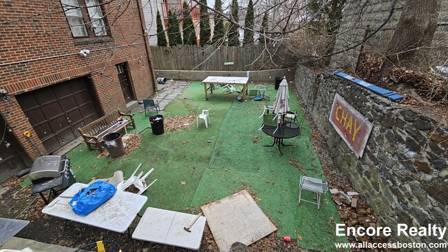
Heat and Hot Water included. Laundry in building. Convenient location. Close to T-green line.
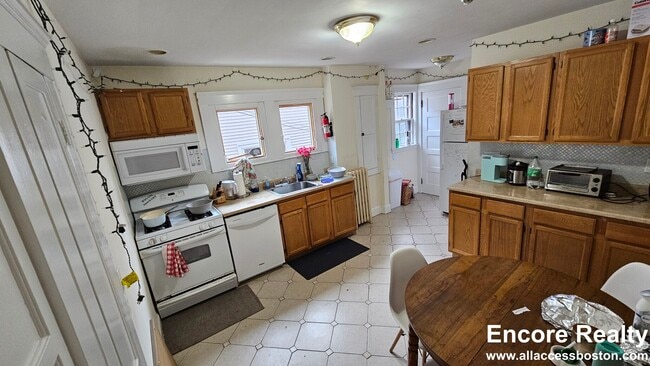
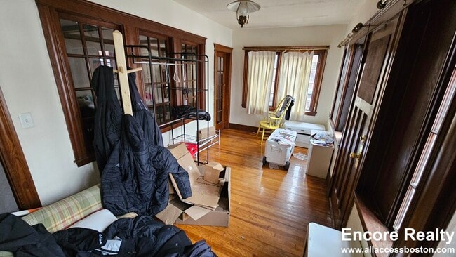
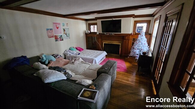
4br/2bath in Brighton | Renting NOW for September 2026. Huge apartment close to BC and T-Green line. It will easly fit 6 people. Eat-in kitchen with lots of counterspace, featuring a dishwasher and a microwave. Basement access, cool back yard, parking available. Laundry in building. Two tandem parking spots included. First Month's Rent: $9600 Last Month's Rent: $9600 Security Deposit: $9600 Key & Lock: $50 Brokerage Fee: $9600 Total: $38,400 Move-in costs may be negotiable for well-qualified applicants.
292 Foster St is an apartment community located in Suffolk County and the 02135 ZIP Code. This area is served by the Boston Public Schools attendance zone.
* Price shown is total price based on community-supplied monthly required fees. Excludes user-selected optional fees and variable or usage-based fees and required charges due at or prior to move-in or at move-out. Price, availability, fees, and any applicable rent special are subject to change without notice.
* Square footage definitions vary. Displayed square footage is approximate.
Apartment Features
- Instant Hot Water
- Laundry Facilities
- Elevator
Fees and Policies
The fees listed below are community-provided and may exclude utilities or add-ons. All payments are made directly to the property and are non-refundable unless otherwise specified.
- Cats Allowed
-
Fees not specified
-
Weight limit--
-
Pet Limit--
Details
Utilities Included
-
Water
-
Heat
Property Information
-
2 units
Contact
- Contact
Location
Get Directions
Saint Elizabeth’s is a Brighton neighborhood situated about 10 miles away from Boston. Thanks to Saint Elizabeth’s top border sitting on Highway 20, commuting in and out of Brighton is easy. Some residents travel by car, but buses and railways make commuting via public transportation a breeze.
The neighborhood’s best amenities are two world-renowned hospitals, Saint Elizabeth’s Medical Center and Franciscan Children’s, that sit on the edge of town. Other great amenities of Saint Elizabeth’s include many local parks like Ringer Playground and Chestnut Hill Reservoir, which has great trails and greenspace. This neighborhood is also equipped with cozy coffee shops, restaurants serving international and American classics, and shopping plazas with grocers and convenience stores.
Saint Elizabeth’s has several rental options ranging from apartments to single-family homes.
Learn more about living in St Elizabeth's
Education
| Colleges & Universities | Distance | ||
|---|---|---|---|
| Colleges & Universities | Distance | ||
| Walk: | 9 min | 0.5 mi | |
| Walk: | 12 min | 0.7 mi | |
| Drive: | 6 min | 3.3 mi | |
| Drive: | 7 min | 3.7 mi |
292 Foster St Unit 44 is within 9 minutes or 0.5 mile from Boston College, Brighton. It is also near Boston College and Boston University.
Schools


Public Elementary School
Grades PK-6
349 Students
Attendance Zone
Public Elementary & Middle School
Grades PK-8
455 Students
Attendance Zone
Public Middle & High School
Grades 7-12
609 Students
Attendance Zone
Public Middle & High School
Grades 7-12
2,382 Students
Attendance Zone
Charter Middle & High School
Grades 6-12
450 Students
Attendance Zone
Public High School
Grades 9-12
27 Students
Attendance Zone
Private Elementary & Middle School
Grades PK-8
408 Students
Nearby
Private Elementary School
Grades PK-6
103 Students
Nearby
Private High School
Grades 9-12
34 Students
Nearby
School data provided by
 The GreatSchools Rating helps parents compare schools within a state based on a variety of school quality indicators and provides a helpful picture of how effectively each school serves all of its students. Ratings are on a scale of 1 (below average) to 10 (above average) and can include test scores, college readiness, academic progress, advanced courses, equity, discipline and attendance data. We also advise parents to visit schools, consider other information on school performance and programs, and consider family needs as part of the school selection process.
View GreatSchools Rating Methodology
Data provided by GreatSchools.org © 2026. All rights reserved.
View GreatSchools Rating Methodology
Data provided by GreatSchools.org © 2026. All rights reserved.
Transportation options available in Boston include South Street Station, located 0.2 mile from 292 Foster St Unit 44. 292 Foster St Unit 44 is near General Edward Lawrence Logan International, located 10.5 miles or 19 minutes away.
| Transit / Subway | Distance | ||
|---|---|---|---|
| Transit / Subway | Distance | ||
|
|
Walk: | 3 min | 0.2 mi |
|
|
Walk: | 8 min | 0.4 mi |
|
|
Walk: | 8 min | 0.5 mi |
|
|
Walk: | 10 min | 0.6 mi |
|
|
Walk: | 14 min | 0.7 mi |
| Commuter Rail | Distance | ||
|---|---|---|---|
| Commuter Rail | Distance | ||
|
|
Drive: | 8 min | 3.4 mi |
| Drive: | 9 min | 4.2 mi | |
|
|
Drive: | 9 min | 4.5 mi |
|
|
Drive: | 8 min | 4.6 mi |
|
|
Drive: | 10 min | 5.2 mi |
| Airports | Distance | ||
|---|---|---|---|
| Airports | Distance | ||
|
General Edward Lawrence Logan International
|
Drive: | 19 min | 10.5 mi |
Time and distance from 292 Foster St Unit 44.
| Shopping Centers | Distance | ||
|---|---|---|---|
| Shopping Centers | Distance | ||
| Drive: | 3 min | 1.4 mi | |
| Drive: | 3 min | 1.6 mi | |
| Drive: | 5 min | 1.7 mi |
292 Foster St Unit 44 has 3 shopping centers within 1.7 miles, which is about a 5-minute drive. The miles and minutes will be for the farthest away property.
| Parks and Recreation | Distance | ||
|---|---|---|---|
| Parks and Recreation | Distance | ||
|
Chestnut Hill Reservation
|
Walk: | 11 min | 0.6 mi |
|
Hammond Pond Reservation
|
Drive: | 3 min | 1.7 mi |
|
Frederick Law Olmsted National Historic Site
|
Drive: | 5 min | 2.3 mi |
|
John Fitzgerald Kennedy National Historic Site
|
Drive: | 5 min | 2.8 mi |
|
Coit Observatory
|
Drive: | 7 min | 3.8 mi |
292 Foster St Unit 44 has 5 parks within 3.8 miles, including Chestnut Hill Reservation, Hammond Pond Reservation, and Frederick Law Olmsted National Historic Site.
| Hospitals | Distance | ||
|---|---|---|---|
| Hospitals | Distance | ||
| Drive: | 3 min | 1.1 mi | |
| Drive: | 4 min | 1.9 mi | |
| Drive: | 5 min | 2.8 mi |
292 Foster St Unit 44 has 3 hospitals within 2.8 miles, the nearest is St. Elizabeth's Medical Center which is 1.1 miles away and a 3 minute drive.
| Military Bases | Distance | ||
|---|---|---|---|
| Military Bases | Distance | ||
| Drive: | 21 min | 12.5 mi | |
| Drive: | 27 min | 15.1 mi |
292 Foster St Unit 44 is 12.5 miles from US Military Reservation, and is convenient to other military bases, including Hanscom Air Force Base.
Amenities
- Instant Hot Water
- Laundry Facilities
- Elevator
292 Foster St Unit 44 Photos
What Are Walk Score®, Transit Score®, and Bike Score® Ratings?
Walk Score® measures the walkability of any address. Transit Score® measures access to public transit. Bike Score® measures the bikeability of any address.
What is a Sound Score Rating?
A Sound Score Rating aggregates noise caused by vehicle traffic, airplane traffic and local sources

292 Foster St
Boston, MA 02135