
$3,200 / Month
28 Haslet St Unit 2
Boston, MA 02131
Today
Favorites
401-256-7925
-
Bedrooms
3
-
Bathrooms
1
-
Square Feet
970 sq ft
-
Available
Available Now
Highlights
- Medical Services
- Deck
- Property is near public transit
- Wood Flooring
- Jogging Path
- Enclosed patio or porch
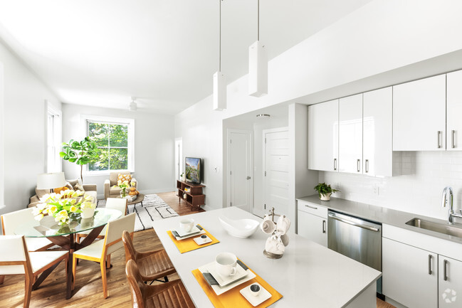
28 Haslet St Unit 2

Favorites
About This Home
$3,200 deposit,
Available Now
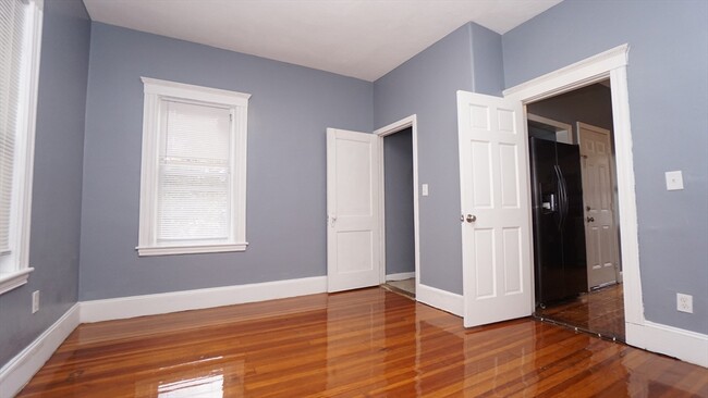
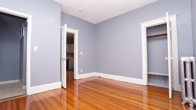
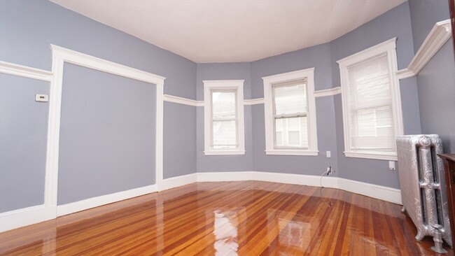
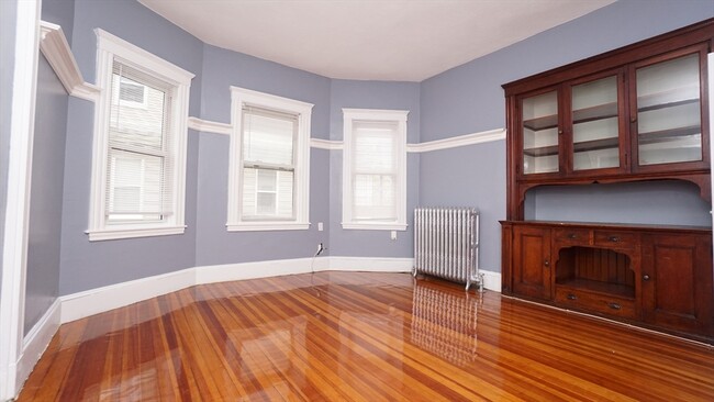
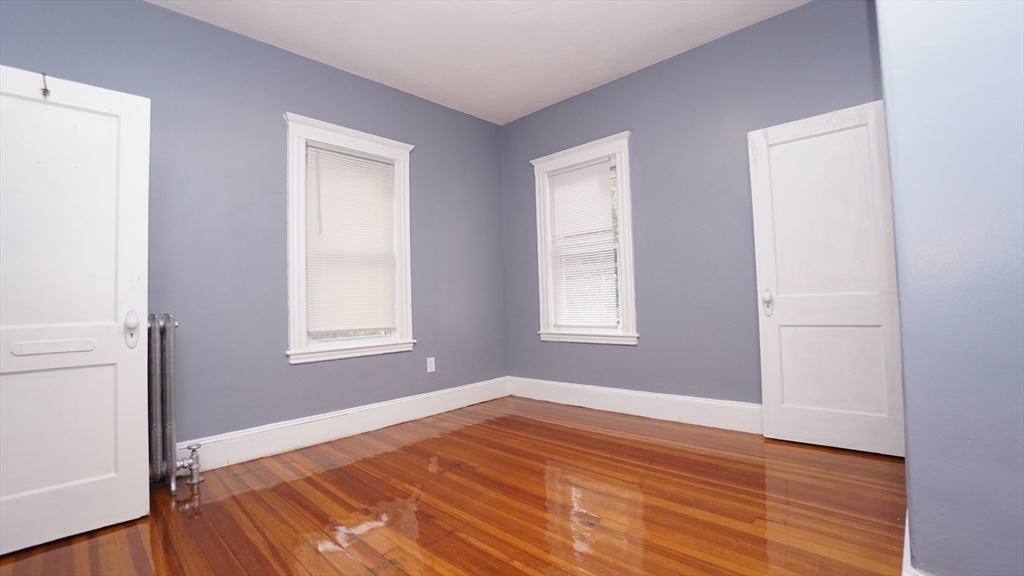
Don't miss out on this spacious 3-bedroom gem! Ideal for commuters,it's conveniently located near Roslindale village,MBTA bus stop; this second-floor apartment at 28 Haslet St boasts generously sized bedrooms,a renovated bathroom,and an inviting eat-in kitchen. Gleaming hardwood floors and large windows create a bright atmosphere. You won't need a car with Roslindale Village just 2 minutes away and easy access to bus and train stations—excellent credit and income are required. Book your private showing today! The first month's rent,security deposit,and broker fee are due at lease signing. Sorry,no pets and no parking available. Enjoy the heart of Roslindale's shops and restaurants. Act fast - this apartment won't last! Available for an ASAP move-in.
28 Haslet St is an apartment community located in Suffolk County and the 02131 ZIP Code.
* Price shown is base rent and may not include non-optional fees and utilities.
Price, availability, fees, and any applicable rent special are subject to change without notice.
* Square footage definitions vary. Displayed square footage is approximate.
Home Details
Year Built
Built in 1920
Accessible Home Design
Entry on the 2nd floor
Bedrooms and Bathrooms
Primary bedroom located on second floor
1 Full Bathroom
3 Bedrooms
Home Design
Apartment
Interior Spaces
Wood Flooring
970 Sq Ft Home
Kitchen
Stove
Range
Oven
Microwave
Dishwasher
Listing and Financial Details
Security Deposit $3,200
Assessor Parcel Number W:20 P:00304 S:000,1389109
Rent includes water, sewer
Location
Property is near public transit
Property is near schools
Lot Details
4,950 Sq Ft Lot
Outdoor Features
Deck
Enclosed patio or porch
Utilities
No Cooling
Heating System Uses Natural Gas
Community Details
Amenities
Medical Services
Shops
Coin Laundry
Overview
No Home Owners Association
Pet Policy
No Pets Allowed
Recreation
Jogging Path
Park
Bike Trail
Fees and Policies
The fees below are based on community-supplied data and may exclude additional fees and utilities.
Contact
- Listed by Alexander Parmenidez | Coldwell Banker Realty
- Phone Number
-
Source
 MLS Property Information Network
The property listing data and information set forth herein were provided to MLS Property Information Network, Inc. from third party sources, including sellers, lessors and public records, and were compiled by MLS Property Information Network, Inc. The property listing data and information are for the personal, non-commercial use of consumers having a good faith interest in purchasing or leasing listed properties of the type displayed to them and may not be used for any purpose other than to identify prospective properties which such consumers may have a good faith interest in purchasing or leasing. MLS Property Information Network, Inc. and its subscribers disclaim any and all representations and warranties as to the accuracy of the property listing data and information set forth herein. All properties are subject to prior sale, change or withdrawal. Copyright © 2025 MLS Property Information Network, Inc. All rights reserved.
Location
Get Directions
Amenities
- Dishwasher
- Microwave
- Range
- Refrigerator
- Porch
- Deck
Metropolitan Hill-Beech Street is a predominantly residential portion of Roslindale, brimming with colorful historic buildings strewn along quiet tree-lined streets. Metropolitan Hill-Beech Street also contains a slew of locally owned shops and diverse eateries on Washington Street in addition to the vibrant Roslindale Village Main Street, which is commonly referred to as Rozzie Square.
Area residents enjoy a small-town feel, and quick access to lush green spaces like Bellevue Hill Park, West Roxbury Parkway, Sherrin Woods, and the George Wright Golf Course. The expansive Franklin Park and its many attractions are just a few minutes north of the area as well. Convenience to the MBTA Needham Line makes commuting and traveling into Boston a breeze.
Learn more about living in Metropolitan Hill-Beech St
Education
| Colleges & Universities | Distance | ||
|---|---|---|---|
| Colleges & Universities | Distance | ||
| Drive: | 12 min | 4.5 mi | |
| Drive: | 11 min | 4.8 mi | |
| Drive: | 11 min | 4.9 mi | |
| Drive: | 11 min | 5.2 mi |
28 Haslet St Unit 2 is within 12 minutes or 4.5 miles from Curry College. It is also near Wentworth Inst. of Technology and MCPHS University, Boston.
Transportation options available in Boston include Forest Hills Station, located 1.7 miles from 28 Haslet St Unit 2. 28 Haslet St Unit 2 is near General Edward Lawrence Logan International, located 10.1 miles or 22 minutes away.
| Transit / Subway | Distance | ||
|---|---|---|---|
| Transit / Subway | Distance | ||
|
|
Drive: | 5 min | 1.7 mi |
|
|
Drive: | 7 min | 2.7 mi |
|
|
Drive: | 7 min | 3.0 mi |
|
|
Drive: | 8 min | 3.3 mi |
|
|
Drive: | 9 min | 3.6 mi |
| Commuter Rail | Distance | ||
|---|---|---|---|
| Commuter Rail | Distance | ||
|
|
Walk: | 6 min | 0.3 mi |
|
|
Walk: | 12 min | 0.7 mi |
|
|
Drive: | 4 min | 1.4 mi |
|
|
Drive: | 5 min | 1.7 mi |
|
|
Drive: | 6 min | 2.4 mi |
| Airports | Distance | ||
|---|---|---|---|
| Airports | Distance | ||
|
General Edward Lawrence Logan International
|
Drive: | 22 min | 10.1 mi |
Time and distance from 28 Haslet St Unit 2.
| Shopping Centers | Distance | ||
|---|---|---|---|
| Shopping Centers | Distance | ||
| Drive: | 5 min | 1.6 mi | |
| Drive: | 5 min | 1.8 mi | |
| Drive: | 5 min | 2.2 mi |
28 Haslet St Unit 2 has 3 shopping centers within 2.2 miles, which is about a 5-minute drive. The miles and minutes will be for the farthest away property.
| Parks and Recreation | Distance | ||
|---|---|---|---|
| Parks and Recreation | Distance | ||
|
Arnold Arboretum of Harvard University
|
Drive: | 3 min | 1.4 mi |
|
Stony Brook Reservation
|
Drive: | 4 min | 1.8 mi |
|
Mass Audubon's Boston Nature Center and Wildlife Sanctuary
|
Drive: | 7 min | 2.2 mi |
|
Brook Farm Historic Site
|
Drive: | 7 min | 3.4 mi |
|
Franklin Park Zoo
|
Drive: | 10 min | 3.7 mi |
28 Haslet St Unit 2 has 5 parks within 3.7 miles, including Arnold Arboretum of Harvard University, Stony Brook Reservation, and Mass Audubon's Boston Nature Center and Wildlife Sanctuary.
| Hospitals | Distance | ||
|---|---|---|---|
| Hospitals | Distance | ||
| Drive: | 4 min | 1.7 mi | |
| Drive: | 5 min | 1.9 mi | |
| Drive: | 8 min | 3.3 mi |
28 Haslet St Unit 2 has 3 hospitals within 3.3 miles, the nearest is Brigham and Women's Faulkner Hospital which is 1.7 miles away and a 4 minute drive.
| Military Bases | Distance | ||
|---|---|---|---|
| Military Bases | Distance | ||
| Drive: | 27 min | 14.8 mi |
28 Haslet St Unit 2 is 14.8 miles and a 27 minute drive from US Military Reservation.
You May Also Like
Similar Rentals Nearby


What Are Walk Score®, Transit Score®, and Bike Score® Ratings?
Walk Score® measures the walkability of any address. Transit Score® measures access to public transit. Bike Score® measures the bikeability of any address.
What is a Sound Score Rating?
A Sound Score Rating aggregates noise caused by vehicle traffic, airplane traffic and local sources
28 Haslet St
Boston, MA 02131