$1,375 / Month
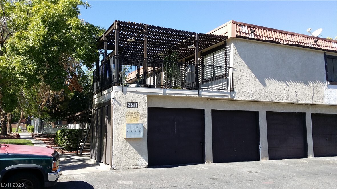
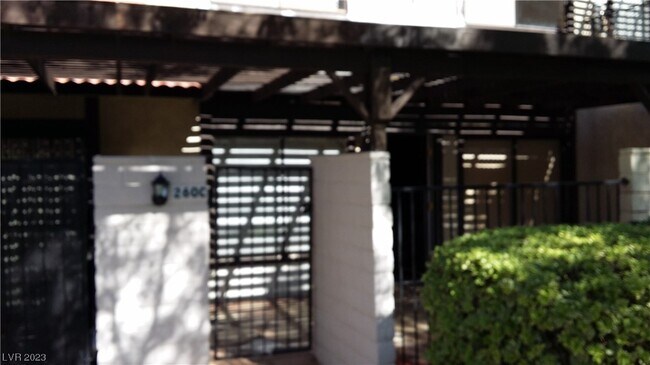
260 Shadybrook Ln Unit C
Las Vegas, NV 89107
2 Weeks Ago
Favorites
260 Shadybrook Ln Unit C

Favorites
Check Back Soon for Upcoming Availability
| Beds | Baths | Average SF |
|---|---|---|
| 2 Bedrooms 2 Bedrooms 2 Br | 2 Baths 2 Baths 2 Ba | 1,092 SF |
Fees and Policies
The fees below are based on community-supplied data and may exclude additional fees and utilities.
- Parking
-
Garage--
-
Other--
About This Property
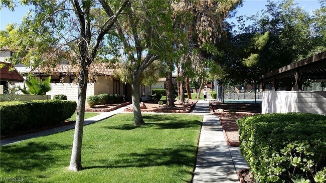
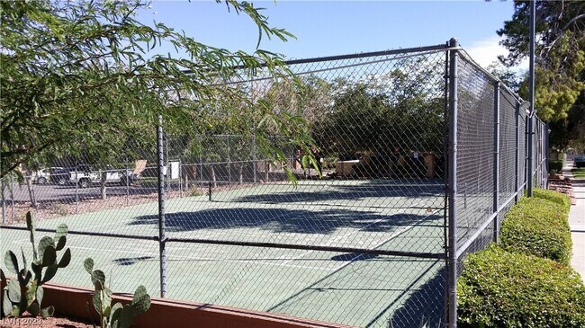
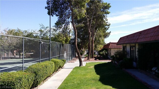
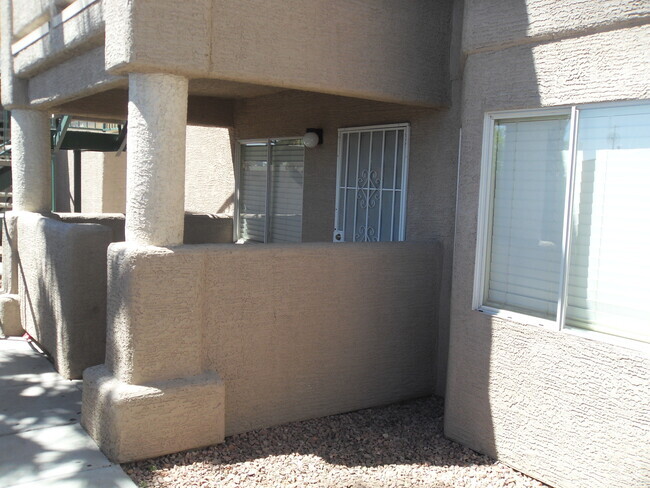
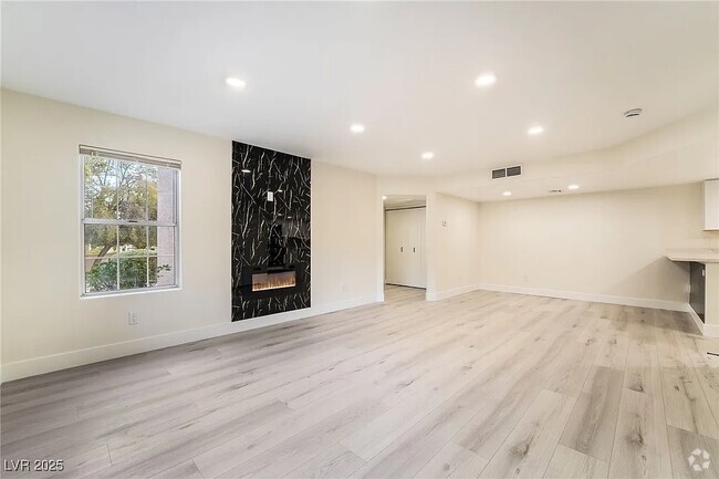
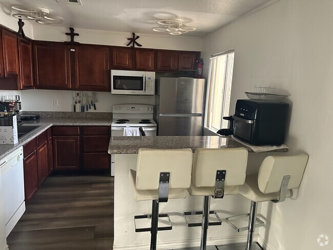
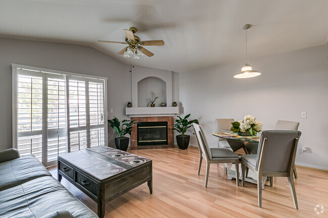
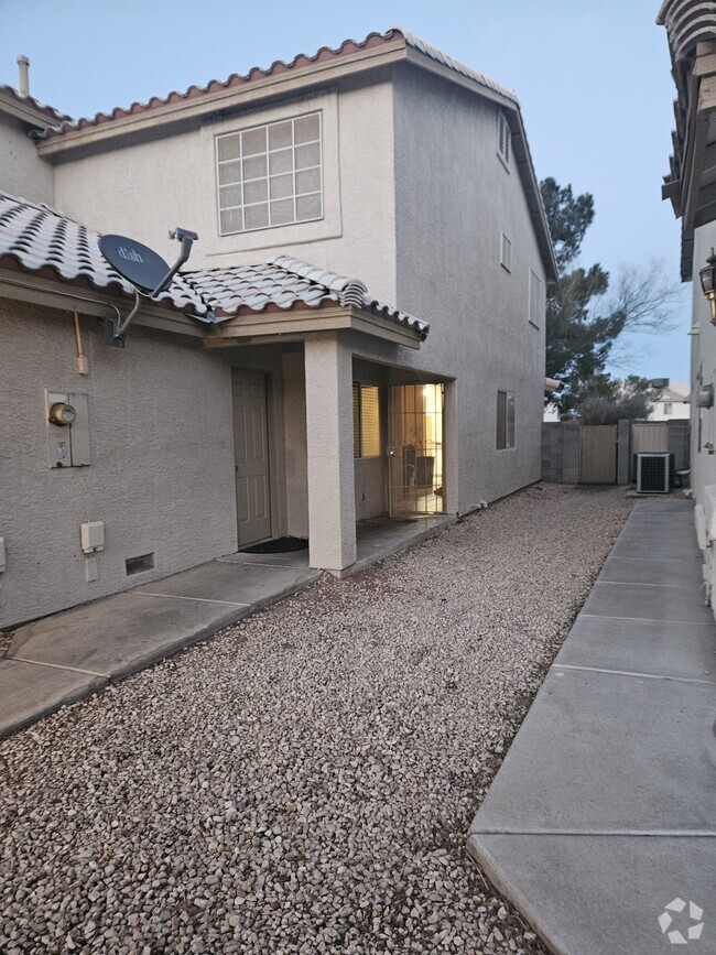
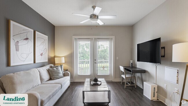
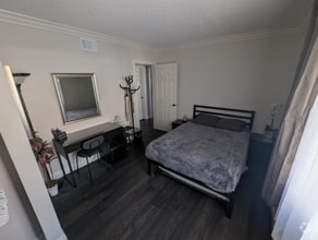
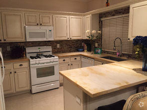
ALL APPLIANCES! NEW FLOORING DOWNSTAIRS, 2 CAR GARAGE! 2 BEDROOM UNIT, PATIO!, COMMUNITY FEATURES POOL & TENNIS COURTS! ALL ELECTRIC UNIT, READY LATE NOV,
260 Shadybrook Ln is a condo located in Clark County and the 89107 ZIP Code. This area is served by the Clark County attendance zone.
Condo Features
Washer/Dryer
Air Conditioning
Dishwasher
Microwave
- Washer/Dryer
- Air Conditioning
- Ceiling Fans
- Dishwasher
- Disposal
- Microwave
- Range
- Refrigerator
- Vinyl Flooring
Location
Get Directions
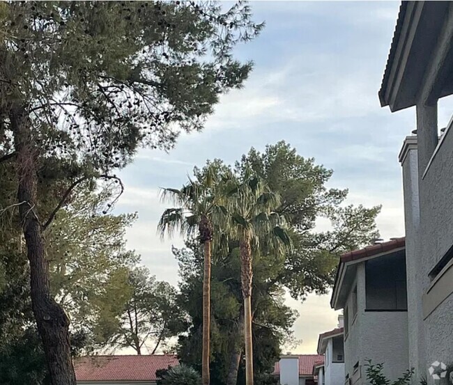
Tucked between Rancho Drive and the 95, Michael Way encompasses a number of prime suburban hotspots, all of them just six miles from the famous Las Vegas Strip. The area is classic Vegas with its towering palm trees, succulent gardens, and stucco homes. Three parks and the Las Vegas Golf Club round out Michael Way’s green space access, making for plenty of recreational escape from the desert landscape.
Chain restaurants and well-known retailers cater to most needs, but with the Strip so close there’s more unique fare and shopping to experience in just a matter of minutes. Domestic travelers will get plenty of use out of the North Las Vegas Airport that sits just across the 95, and those who commute for work by car are right next to the 15 and 95 junction.
Learn more about living in Michael WayBelow are rent ranges for similar nearby apartments
Amenities
- Washer/Dryer
- Air Conditioning
- Ceiling Fans
- Dishwasher
- Disposal
- Microwave
- Range
- Refrigerator
- Vinyl Flooring
Education
| Colleges & Universities | Distance | ||
|---|---|---|---|
| Colleges & Universities | Distance | ||
| Drive: | 7 min | 2.0 mi | |
| Drive: | 11 min | 6.3 mi | |
| Drive: | 17 min | 10.9 mi | |
| Drive: | 21 min | 11.3 mi |
260 Shadybrook Ln Unit C is within 7 minutes or 2.0 miles from Southern Nevada, Charleston. It is also near Nev. State Coll., Shadow Lane and UNLV.
Schools


Public Elementary School
Grades PK-5
533 Students
Attendance Zone
Public Middle School
Grades 6-8
1,079 Students
Attendance Zone
Public High School
Grades 9-12
2,949 Students
Attendance Zone
Private Elementary & Middle School
Grades PK-8
253 Students
Nearby
Private Elementary, Middle & High School
Grades K-12
153 Students
Nearby
Private Elementary, Middle & High School
Grades K-12
69 Students
Nearby
School data provided by
 The GreatSchools Rating helps parents compare schools within a state based on a variety of school quality indicators and provides a helpful picture of how effectively each school serves all of its students. Ratings are on a scale of 1 (below average) to 10 (above average) and can include test scores, college readiness, academic progress, advanced courses, equity, discipline and attendance data. We also advise parents to visit schools, consider other information on school performance and programs, and consider family needs as part of the school selection process.
View GreatSchools Rating Methodology
View GreatSchools Rating Methodology
Transportation options available in Las Vegas include Sahara Station, located 8.2 miles from 260 Shadybrook Ln Unit C. 260 Shadybrook Ln Unit C is near Harry Reid International, located 12.5 miles or 23 minutes away, and Boulder City Municipal, located 32.5 miles or 42 minutes away.
| Transit / Subway | Distance | ||
|---|---|---|---|
| Transit / Subway | Distance | ||
|
Sahara Station
|
Drive: | 14 min | 8.2 mi |
|
Las Vegas Hilton Station
|
Drive: | 16 min | 8.6 mi |
|
Las Vegas Convention Center Station
|
Drive: | 15 min | 8.8 mi |
|
Harrah's/Imperial Palace Station
|
Drive: | 17 min | 9.5 mi |
|
Flamingo/Caesars Palace Station
|
Drive: | 17 min | 10.1 mi |
| Airports | Distance | ||
|---|---|---|---|
| Airports | Distance | ||
|
Harry Reid International
|
Drive: | 23 min | 12.5 mi |
|
Boulder City Municipal
|
Drive: | 42 min | 32.5 mi |
Time and distance from 260 Shadybrook Ln Unit C.
| Shopping Centers | Distance | ||
|---|---|---|---|
| Shopping Centers | Distance | ||
| Walk: | 8 min | 0.5 mi | |
| Walk: | 11 min | 0.6 mi | |
| Walk: | 17 min | 0.9 mi |
260 Shadybrook Ln Unit C has 3 shopping centers within 0.9 mile, which is about a 17-minute walk. The miles and minutes will be for the farthest away property.
| Parks and Recreation | Distance | ||
|---|---|---|---|
| Parks and Recreation | Distance | ||
|
Springs Preserve
|
Drive: | 8 min | 4.1 mi |
|
Spring Mountains National Recreation Area
|
Drive: | 10 min | 6.1 mi |
|
DISCOVERY Children's Museum
|
Drive: | 11 min | 7.2 mi |
|
Las Vegas Natural History Museum
|
Drive: | 10 min | 7.2 mi |
|
Old Las Vegas Mormon State Historic Park
|
Drive: | 11 min | 7.4 mi |
260 Shadybrook Ln Unit C has 5 parks within 7.4 miles, including Springs Preserve, Spring Mountains National Recreation Area, and Las Vegas Natural History Museum.
| Hospitals | Distance | ||
|---|---|---|---|
| Hospitals | Distance | ||
| Drive: | 5 min | 2.0 mi | |
| Drive: | 9 min | 3.8 mi | |
| Drive: | 7 min | 3.8 mi |
260 Shadybrook Ln Unit C has 3 hospitals within 3.8 miles, the nearest is Southern Nevada Adult Mental Health Services which is 2.0 miles away and a 5 minute drive.
| Military Bases | Distance | ||
|---|---|---|---|
| Military Bases | Distance | ||
| Drive: | 31 min | 18.8 mi |
260 Shadybrook Ln Unit C is 18.8 miles and a 31 minute drive from Nellis Air Force Base.
You May Also Like
Similar Rentals Nearby
What Are Walk Score®, Transit Score®, and Bike Score® Ratings?
Walk Score® measures the walkability of any address. Transit Score® measures access to public transit. Bike Score® measures the bikeability of any address.
What is a Sound Score Rating?
A Sound Score Rating aggregates noise caused by vehicle traffic, airplane traffic and local sources

260 Shadybrook Ln
Las Vegas, NV 89107