$2,100 / Month
24 Colgate Rd Unit 13
Boston, MA 02131
Today
Favorites
617-201-6838
-
Bedrooms
1
-
Bathrooms
1
-
Square Feet
600 sq ft
-
Available
Available Now
24 Colgate Rd Unit 13

Favorites
About This Home
$2,100 deposit,
Available Now
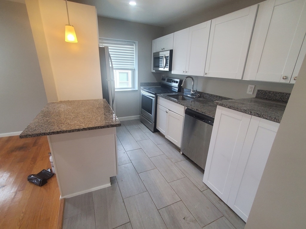
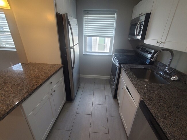
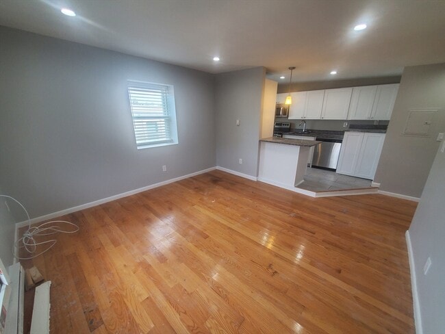
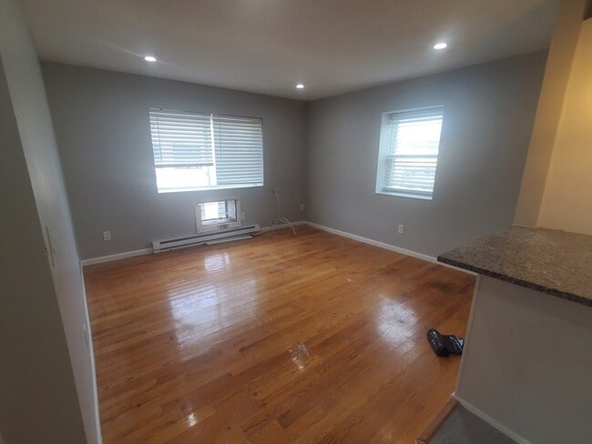
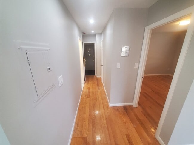
NEAR ROSLINDALE SQUARE AND FOREST HILL T! Located on a quiet,dead end street off of Washington St. this spacious one bedroom has hardwood floors,lots of natural light,and updated kitchen with granite counters,new bathroom,A/C,Coin op laundry,and parking. Short walk to Forest Hills T,Rozzy Square,Village Market,buses,Commuter Rail,and local restaurants. Pets are OK,$50 monthly for a dog and $25 for a cat. MLS# 73418384
24 Colgate Rd is an apartment community located in Suffolk County and the 02131 ZIP Code.
* Price shown is base rent and may not include non-optional fees and utilities.
Price, availability, fees, and any applicable rent special are subject to change without notice.
* Square footage definitions vary. Displayed square footage is approximate.
Features
Dishwasher
Microwave
Refrigerator
Range
- Dishwasher
- Microwave
- Range
- Refrigerator
Fees and Policies
The fees below are based on community-supplied data and may exclude additional fees and utilities.
Pet policies are negotiable.
Contact
- Listed by Douglas Bosse | Olde Towne Real Estate Co.
- Phone Number
-
Source
 MLS Property Information Network
The property listing data and information set forth herein were provided to MLS Property Information Network, Inc. from third party sources, including sellers, lessors and public records, and were compiled by MLS Property Information Network, Inc. The property listing data and information are for the personal, non-commercial use of consumers having a good faith interest in purchasing or leasing listed properties of the type displayed to them and may not be used for any purpose other than to identify prospective properties which such consumers may have a good faith interest in purchasing or leasing. MLS Property Information Network, Inc. and its subscribers disclaim any and all representations and warranties as to the accuracy of the property listing data and information set forth herein. All properties are subject to prior sale, change or withdrawal. Copyright © 2025 MLS Property Information Network, Inc. All rights reserved.
Location
Get Directions
Amenities
- Dishwasher
- Microwave
- Range
- Refrigerator
Lower Washington-Mount Hope is a walkable neighborhood about eight miles south of Boston via Interstate 93 or public transit. Despite this area’s dense population, Lower Washington-Mount Hope has many wooded areas, and large parks like Bussey Brook Meadow and Franklin Park surround the neighborhood. Along with residential neighborhoods, a few shops and eateries can be found in town along American Legion Highway. Many residents travel to the western corner of town to get to the shopping plaza off Corinth Street for all the necessities. The western part of the neighborhood is also where most of the rentals in this area are located. Apartments, condos, and townhomes ranging from moderately priced to luxury can be found here.
Learn more about living in Lower Washington-Mount Hope
Education
| Colleges & Universities | Distance | ||
|---|---|---|---|
| Colleges & Universities | Distance | ||
| Drive: | 8 min | 3.7 mi | |
| Drive: | 8 min | 4.1 mi | |
| Drive: | 8 min | 4.2 mi | |
| Drive: | 10 min | 4.6 mi |
24 Colgate Rd Unit 13 is within 8 minutes or 3.7 miles from Wentworth Inst. of Technology. It is also near MCPHS University, Boston and MassArt.
Transportation options available in Boston include Forest Hills Station, located 0.7 mile from 24 Colgate Rd Unit 13. 24 Colgate Rd Unit 13 is near General Edward Lawrence Logan International, located 9.0 miles or 18 minutes away.
| Transit / Subway | Distance | ||
|---|---|---|---|
| Transit / Subway | Distance | ||
|
|
Walk: | 14 min | 0.7 mi |
|
|
Drive: | 4 min | 1.7 mi |
|
|
Drive: | 5 min | 2.2 mi |
|
|
Drive: | 5 min | 2.6 mi |
|
|
Drive: | 8 min | 3.3 mi |
| Commuter Rail | Distance | ||
|---|---|---|---|
| Commuter Rail | Distance | ||
|
|
Walk: | 14 min | 0.7 mi |
|
|
Walk: | 15 min | 0.8 mi |
|
|
Drive: | 5 min | 1.7 mi |
|
|
Drive: | 6 min | 2.2 mi |
| Drive: | 7 min | 3.6 mi |
| Airports | Distance | ||
|---|---|---|---|
| Airports | Distance | ||
|
General Edward Lawrence Logan International
|
Drive: | 18 min | 9.0 mi |
Time and distance from 24 Colgate Rd Unit 13.
| Shopping Centers | Distance | ||
|---|---|---|---|
| Shopping Centers | Distance | ||
| Drive: | 5 min | 1.7 mi | |
| Drive: | 5 min | 1.9 mi | |
| Drive: | 6 min | 2.3 mi |
24 Colgate Rd Unit 13 has 3 shopping centers within 2.3 miles, which is about a 6-minute drive. The miles and minutes will be for the farthest away property.
| Parks and Recreation | Distance | ||
|---|---|---|---|
| Parks and Recreation | Distance | ||
|
Arnold Arboretum of Harvard University
|
Walk: | 17 min | 0.9 mi |
|
Mass Audubon's Boston Nature Center and Wildlife Sanctuary
|
Drive: | 6 min | 1.9 mi |
|
Franklin Park Zoo
|
Drive: | 6 min | 2.6 mi |
|
Lower Neponset River Trail
|
Drive: | 7 min | 2.8 mi |
|
Frederick Law Olmsted National Historic Site
|
Drive: | 8 min | 3.4 mi |
24 Colgate Rd Unit 13 has 5 parks within 3.4 miles, including Arnold Arboretum of Harvard University, Mass Audubon's Boston Nature Center and Wildlife Sanctuary, and Franklin Park Zoo.
| Hospitals | Distance | ||
|---|---|---|---|
| Hospitals | Distance | ||
| Drive: | 3 min | 1.2 mi | |
| Drive: | 5 min | 1.9 mi | |
| Drive: | 4 min | 2.1 mi |
24 Colgate Rd Unit 13 has 3 hospitals within 2.1 miles, the nearest is Brigham and Women's Faulkner Hospital which is 1.2 miles away and a 3 minute drive.
| Military Bases | Distance | ||
|---|---|---|---|
| Military Bases | Distance | ||
| Drive: | 27 min | 15.0 mi |
24 Colgate Rd Unit 13 is 15.0 miles and a 27 minute drive from US Military Reservation.
You May Also Like
Similar Rentals Nearby


What Are Walk Score®, Transit Score®, and Bike Score® Ratings?
Walk Score® measures the walkability of any address. Transit Score® measures access to public transit. Bike Score® measures the bikeability of any address.
What is a Sound Score Rating?
A Sound Score Rating aggregates noise caused by vehicle traffic, airplane traffic and local sources

24 Colgate Rd
Boston, MA 02131