
The Grove
8200 Sunbury Ln,
Houston, TX 77095
$785 - $1,359
1-2 Beds
Bedrooms
1 bd
Bathrooms
1 ba
Square Feet
700 sq ft
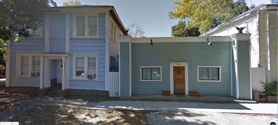
2014 Taft St offers a mixture of style and comfort. You'll find this community in the Montrose area of Houston. The leasing staff will assist you in finding your perfect home. Drop by the leasing office to discuss your new apartment and see 2014 Taft St.
2014 Taft St offers a mixture of style and comfort. You'll find this community in the Montrose area of Houston. The leasing staff will assist you in finding your perfect home. Drop by the leasing office to discuss your new apartment and see 2014 Taft St.
2014 Taft St is an apartment community located in Harris County and the 77006 ZIP Code. This area is served by the Houston Independent attendance zone.
Montrose, also known as “The Heart of Houston,” sits in west-central Houston, on the cusp of vibrant neighborhoods like Downtown Houston, Midtown Houston, the Museum District, and Memorial Park. Montrose is filled with historic bungalows as well as modern lofts and condominiums available for rent, many of which are within walking distance of numerous restaurants, bars, coffee shops, and boutiques strewn along Westheimer Road.
Should you choose to rent in Montrose, you will have the chance to catch an indie flick at the historic River Oaks Theatre, see the extensive collection of art and artifacts assembled in the Menil Collection, visit Rothko Chapel, find sweet deals at River Oaks Shopping Center, and run the trails situated along Buffalo Bayou. You can also attend lively community events such as the Houston Greek Festival and the Houston Art Car Parade.
Learn more about living in MontroseCompare neighborhood and city base rent averages by bedroom.
| Montrose | Houston, TX | |
|---|---|---|
| Studio | $1,429 | $1,059 |
| 1 Bedroom | $1,826 | $1,179 |
| 2 Bedrooms | $2,930 | $1,492 |
| 3 Bedrooms | $6,556 | $1,906 |
| Colleges & Universities | Distance | ||
|---|---|---|---|
| Colleges & Universities | Distance | ||
| Drive: | 3 min | 1.4 mi | |
| Drive: | 4 min | 1.6 mi | |
| Drive: | 8 min | 3.1 mi | |
| Drive: | 7 min | 3.1 mi |


Transportation options available in Houston include Mcgowen, located 0.9 mile from 2014 Taft St. 2014 Taft St is near William P Hobby, located 13.8 miles or 25 minutes away, and George Bush Intcntl/Houston, located 22.1 miles or 29 minutes away.
| Transit / Subway | Distance | ||
|---|---|---|---|
| Transit / Subway | Distance | ||
|
|
Walk: | 16 min | 0.9 mi |
| Drive: | 2 min | 1.2 mi | |
|
|
Drive: | 3 min | 1.3 mi |
|
|
Drive: | 3 min | 1.4 mi |
|
|
Drive: | 4 min | 1.8 mi |
| Commuter Rail | Distance | ||
|---|---|---|---|
| Commuter Rail | Distance | ||
|
|
Drive: | 6 min | 2.4 mi |
| Airports | Distance | ||
|---|---|---|---|
| Airports | Distance | ||
|
William P Hobby
|
Drive: | 25 min | 13.8 mi |
|
George Bush Intcntl/Houston
|
Drive: | 29 min | 22.1 mi |
Time and distance from 2014 Taft St.
| Shopping Centers | Distance | ||
|---|---|---|---|
| Shopping Centers | Distance | ||
| Walk: | 2 min | 0.1 mi | |
| Walk: | 8 min | 0.5 mi | |
| Walk: | 9 min | 0.5 mi |
| Parks and Recreation | Distance | ||
|---|---|---|---|
| Parks and Recreation | Distance | ||
|
Buffalo Bayou Park
|
Drive: | 7 min | 2.3 mi |
|
Discovery Green
|
Drive: | 6 min | 2.5 mi |
|
Houston Museum of Natural Science
|
Drive: | 5 min | 2.5 mi |
|
Children's Museum of Houston
|
Drive: | 5 min | 2.6 mi |
|
Cockrell Butterfly Center
|
Drive: | 5 min | 2.6 mi |
| Hospitals | Distance | ||
|---|---|---|---|
| Hospitals | Distance | ||
| Drive: | 4 min | 1.8 mi | |
| Drive: | 5 min | 2.5 mi | |
| Drive: | 6 min | 3.1 mi |
| Military Bases | Distance | ||
|---|---|---|---|
| Military Bases | Distance | ||
| Drive: | 38 min | 27.2 mi | |
| Drive: | 67 min | 52.8 mi |
What Are Walk Score®, Transit Score®, and Bike Score® Ratings?
Walk Score® measures the walkability of any address. Transit Score® measures access to public transit. Bike Score® measures the bikeability of any address.
What is a Sound Score Rating?
A Sound Score Rating aggregates noise caused by vehicle traffic, airplane traffic and local sources

2014 Taft St
Houston, TX 77006


