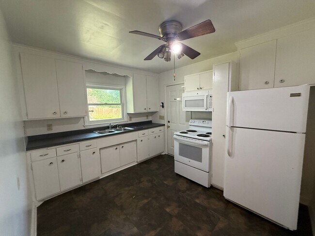
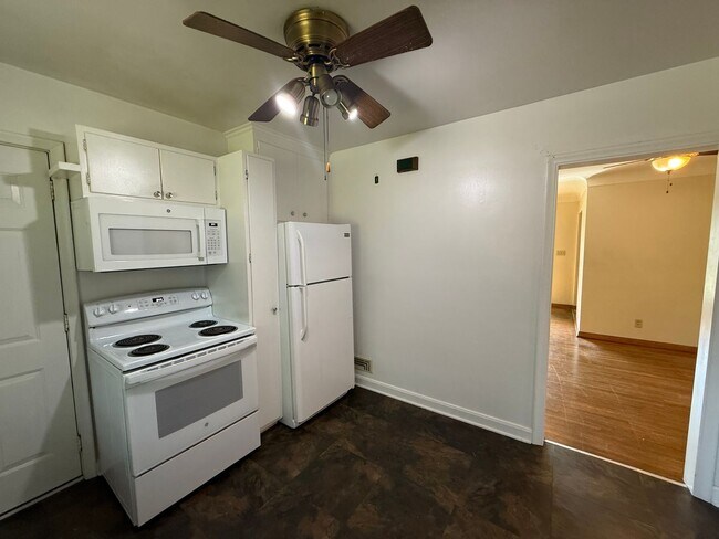
$2,295 / Month
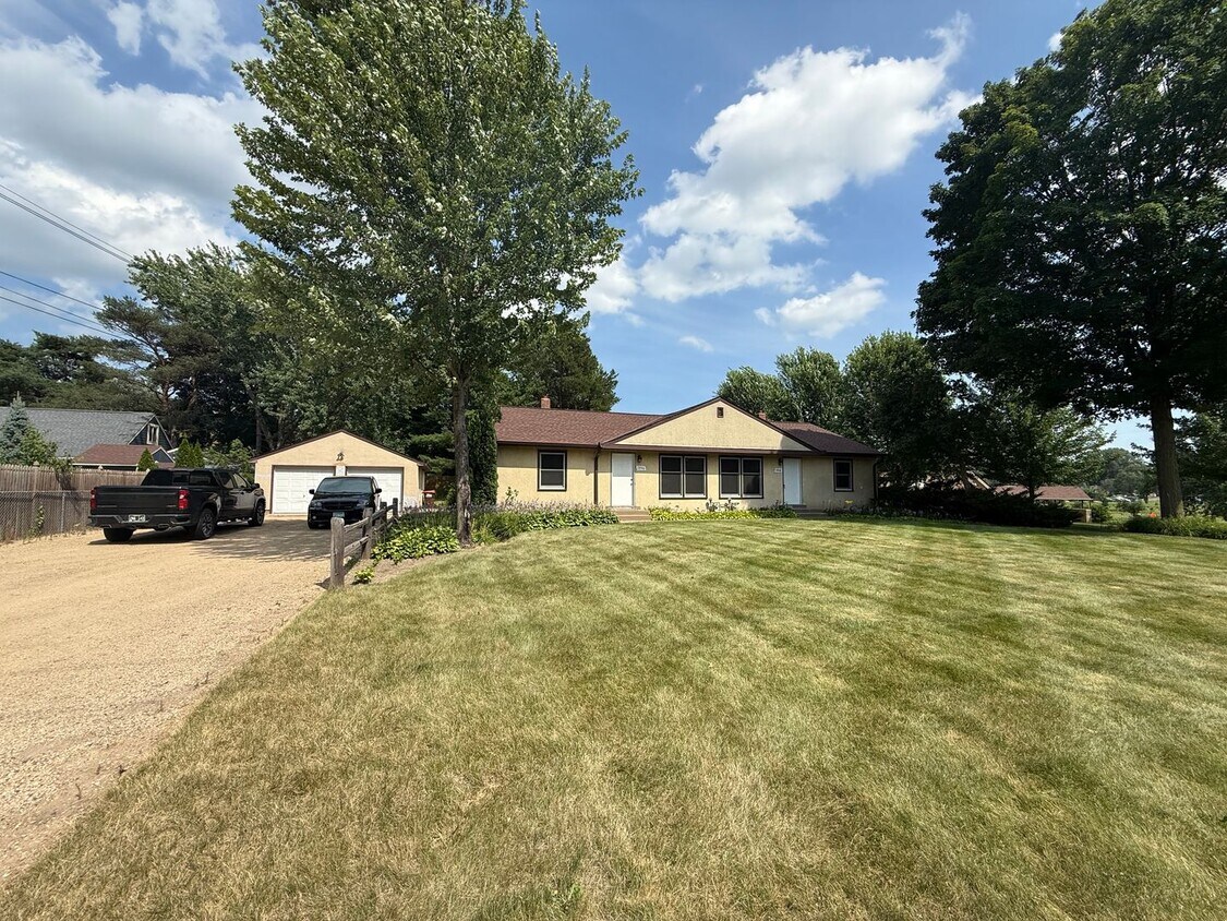
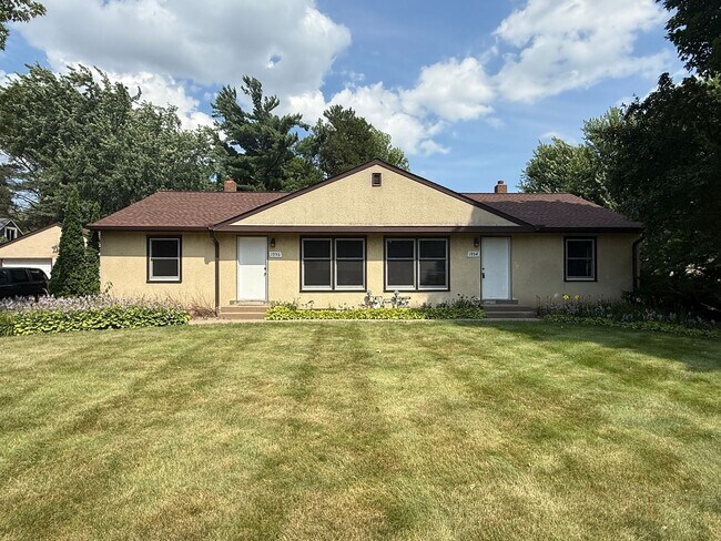
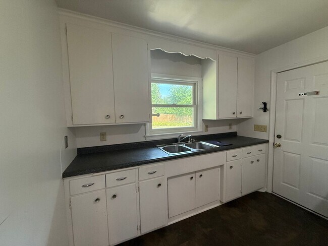
1956-1956 Hazelwood St Unit 1956
Saint Paul, MN 55109
1 Day Ago
Favorites
612-246-5834
-
Bedrooms
3
-
Bathrooms
1
-
Square Feet
1,750 sq ft
-
Available
Available Now
1956-1956 Hazelwood St Unit 1956

Favorites
Thanks to some odd geography, Maplewood has something of a split personality. This first-ring St. Paul suburb can be described as being shaped like a frying pan. The main business and residential area lies primarily to the north and east of St. Paul, while the chief amenities, such as the community center and an indoor mall, lie in the "pan." South Maplewood, or the "pan handle," runs south along Interstate 494 and has fewer business amenities. Residents of this area tend to shop in bordering Woodbury, since it takes a good half hour to get from the southern tip of Maplewood to the main northern business district.
Meanwhile, Oakdale lies between the two sections, just east of Maplewood's pan handle and north of Woodbury. This young suburb is a quiet bedroom community with a scattering of business districts. Cornfields make up its eastern portion, giving the area a distinctly rural vibe, even though it's just 10 minutes outside of downtown St. Paul.
Learn more about living in Maplewood-Oakdale
Education
| Colleges & Universities | Distance | ||
|---|---|---|---|
| Colleges & Universities | Distance | ||
| Drive: | 9 min | 4.2 mi | |
| Drive: | 9 min | 4.9 mi | |
| Drive: | 13 min | 7.0 mi | |
| Drive: | 19 min | 10.1 mi |
1956-1956 Hazelwood St Unit 1956 is within 9 minutes or 4.2 miles from Metropolitan State University. It is also near Century College and Saint Paul College.
Transportation options available in Saint Paul include Union Depot Station, located 5.3 miles from 1956-1956 Hazelwood St Unit 1956. 1956-1956 Hazelwood St Unit 1956 is near Minneapolis-St Paul International/Wold-Chamberlain, located 14.8 miles or 27 minutes away.
| Transit / Subway | Distance | ||
|---|---|---|---|
| Transit / Subway | Distance | ||
| Drive: | 12 min | 5.3 mi | |
| Drive: | 12 min | 5.4 mi | |
| Drive: | 11 min | 5.9 mi | |
| Drive: | 12 min | 6.0 mi | |
| Drive: | 11 min | 6.0 mi |
| Commuter Rail | Distance | ||
|---|---|---|---|
| Commuter Rail | Distance | ||
|
|
Drive: | 12 min | 5.3 mi |
|
|
Drive: | 25 min | 14.8 mi |
|
|
Drive: | 22 min | 15.7 mi |
|
|
Drive: | 33 min | 23.8 mi |
|
|
Drive: | 34 min | 25.5 mi |
| Airports | Distance | ||
|---|---|---|---|
| Airports | Distance | ||
|
Minneapolis-St Paul International/Wold-Chamberlain
|
Drive: | 27 min | 14.8 mi |
Time and distance from 1956-1956 Hazelwood St Unit 1956.
| Shopping Centers | Distance | ||
|---|---|---|---|
| Shopping Centers | Distance | ||
| Drive: | 3 min | 1.1 mi | |
| Drive: | 3 min | 1.2 mi | |
| Drive: | 4 min | 1.5 mi |
1956-1956 Hazelwood St Unit 1956 has 3 shopping centers within 1.5 miles, which is about a 4-minute drive. The miles and minutes will be for the farthest away property.
| Parks and Recreation | Distance | ||
|---|---|---|---|
| Parks and Recreation | Distance | ||
|
Keller Regional Park
|
Drive: | 4 min | 1.5 mi |
|
Phelan Regional Park
|
Drive: | 7 min | 2.6 mi |
|
Phalen Park
|
Drive: | 7 min | 2.9 mi |
|
Arlington/Arkwright Park
|
Drive: | 8 min | 3.2 mi |
|
Maplewood Nature Center
|
Drive: | 11 min | 5.4 mi |
1956-1956 Hazelwood St Unit 1956 has 5 parks within 5.4 miles, including Keller Regional Park, Phelan Regional Park, and Phalen Park.
| Hospitals | Distance | ||
|---|---|---|---|
| Hospitals | Distance | ||
| Drive: | 7 min | 3.2 mi | |
| Drive: | 11 min | 5.6 mi | |
| Drive: | 11 min | 5.7 mi |
1956-1956 Hazelwood St Unit 1956 has 3 hospitals within 5.7 miles, the nearest is Healtheast St. John's Hospital which is 3.2 miles away and a 7 minute drive.
| Military Bases | Distance | ||
|---|---|---|---|
| Military Bases | Distance | ||
| Drive: | 25 min | 13.5 mi |
1956-1956 Hazelwood St Unit 1956 is 13.5 miles and a 25 minute drive from Fort Snelling Military Reservation.
You May Also Like
Similar Rentals Nearby


What Are Walk Score®, Transit Score®, and Bike Score® Ratings?
Walk Score® measures the walkability of any address. Transit Score® measures access to public transit. Bike Score® measures the bikeability of any address.
What is a Sound Score Rating?
A Sound Score Rating aggregates noise caused by vehicle traffic, airplane traffic and local sources

1956-1956 Hazelwood St
Saint Paul, MN 55109