1916 Spangle Dr
Las Vegas, NV 89108
-
Bedrooms
3
-
Bathrooms
2
-
Square Feet
1,468 sq ft
-
Available
Available Sep 25
Highlights
- Fireplace
- Fenced Lot
- Vaulted Ceiling

About This Home
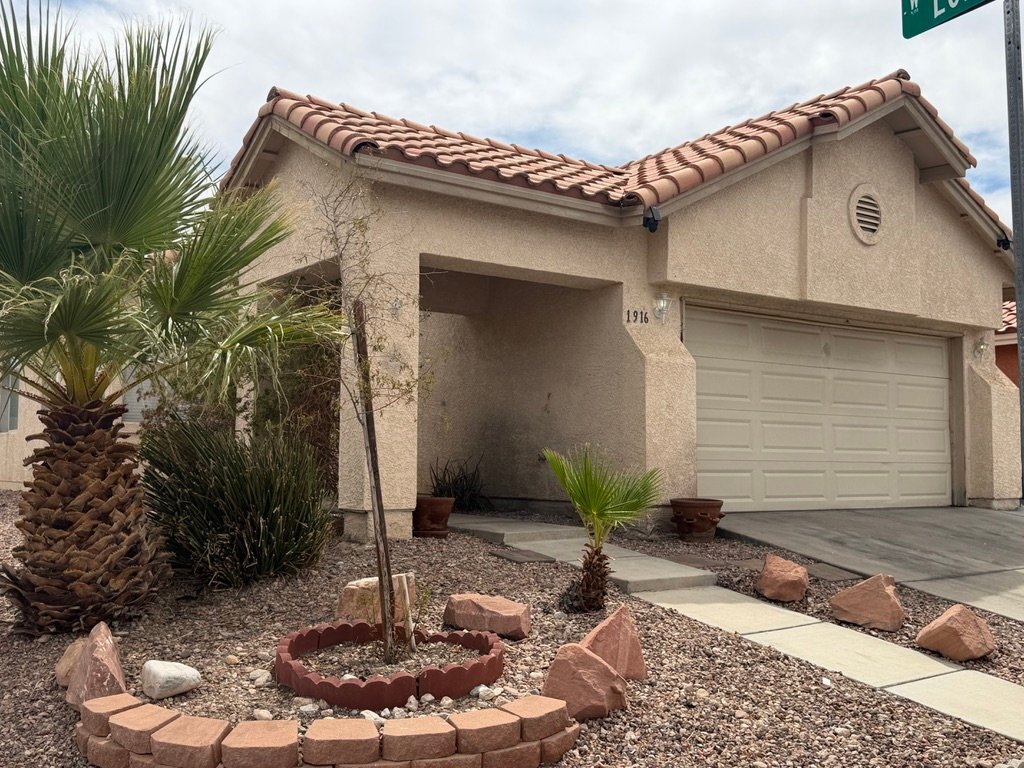
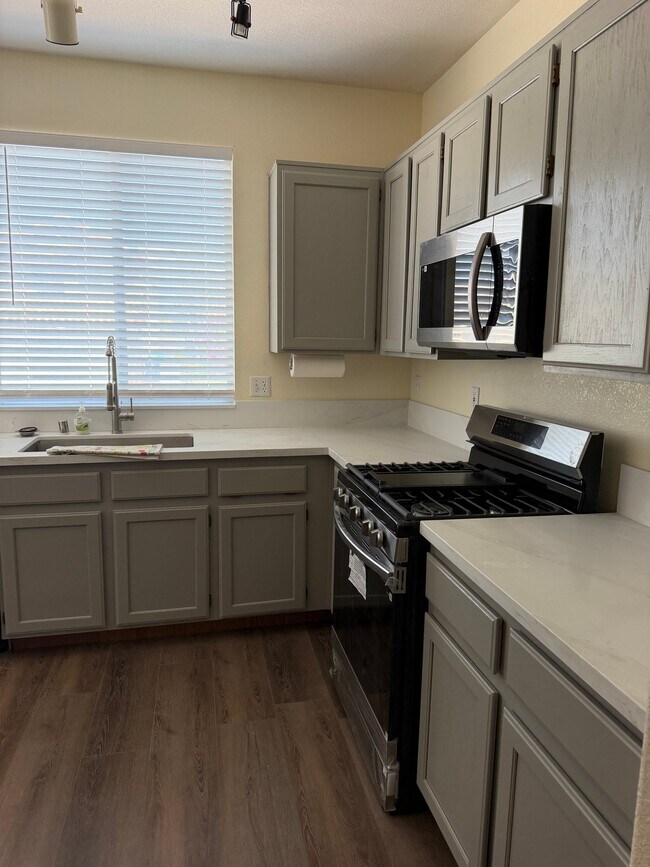
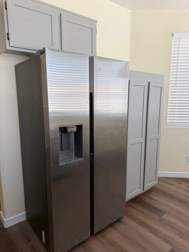
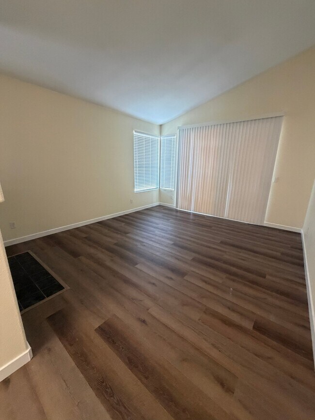
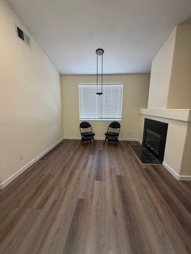
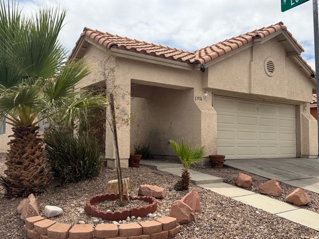
Property Id: 2855770 This isa beautiful one-story single-family home! BRAND NEW flooring, paint, window blinds and appliances! Enjoy: vaulted ceilings, double-sided fireplace facing dining room and living room, two-car garage with plenty of built-in shelves, and much more! The back yard patio is semi-shaded and framed with zero-scaping. No pets and no smoking. $2500 rent includes yard care, sewer and trash; tenants pay all other utilities. Near Rainbow X Lake Mead Blvds.; only three minutes from Best in the West Shopping Center. Check out the Virtual Tour:
1916 Spangle Dr is a house located in Clark County and the 89108 ZIP Code.
House Features
Washer/Dryer
Dishwasher
Microwave
Refrigerator
- Washer/Dryer
- Fireplace
- Dishwasher
- Disposal
- Microwave
- Oven
- Refrigerator
- Freezer
- Vaulted Ceiling
- Fenced Lot
Fees and Policies
The fees listed below are community-provided and may exclude utilities or add-ons. All payments are made directly to the property and are non-refundable unless otherwise specified. Use the Cost Calculator to determine costs based on your needs.
- One-Time Move-In Fees
-
Security Deposit Refundable - Refundable$2,500
- Parking
-
Garage--
Details
Utilities Included
-
Trash Removal
-
Sewer
Contact
- Phone Number
- Contact
-
Source

Tucked between Rancho Drive and the 95, Michael Way encompasses a number of prime suburban hotspots, all of them just six miles from the famous Las Vegas Strip. The area is classic Vegas with its towering palm trees, succulent gardens, and stucco homes. Three parks and the Las Vegas Golf Club round out Michael Way’s green space access, making for plenty of recreational escape from the desert landscape.
Chain restaurants and well-known retailers cater to most needs, but with the Strip so close there’s more unique fare and shopping to experience in just a matter of minutes. Domestic travelers will get plenty of use out of the North Las Vegas Airport that sits just across the 95, and those who commute for work by car are right next to the 15 and 95 junction.
Learn more about living in Michael Way- Washer/Dryer
- Fireplace
- Dishwasher
- Disposal
- Microwave
- Oven
- Refrigerator
- Freezer
- Vaulted Ceiling
- Fenced Lot
| Colleges & Universities | Distance | ||
|---|---|---|---|
| Colleges & Universities | Distance | ||
| Drive: | 9 min | 3.8 mi | |
| Drive: | 11 min | 6.3 mi | |
| Drive: | 16 min | 9.0 mi | |
| Drive: | 21 min | 11.2 mi |
Transportation options available in Las Vegas include Sahara Station, located 8.2 miles from 1916 Spangle Dr. 1916 Spangle Dr is near Harry Reid International, located 12.5 miles or 23 minutes away, and Boulder City Municipal, located 32.4 miles or 43 minutes away.
| Transit / Subway | Distance | ||
|---|---|---|---|
| Transit / Subway | Distance | ||
|
|
Drive: | 14 min | 8.2 mi |
|
|
Drive: | 16 min | 8.6 mi |
|
|
Drive: | 15 min | 8.8 mi |
|
|
Drive: | 17 min | 9.4 mi |
|
|
Drive: | 17 min | 10.0 mi |
| Airports | Distance | ||
|---|---|---|---|
| Airports | Distance | ||
|
Harry Reid International
|
Drive: | 23 min | 12.5 mi |
|
Boulder City Municipal
|
Drive: | 43 min | 32.4 mi |
Scores provided by
 What do Walkability, Transit, Drivability, and Bikeability mean?
Walkability measures the walking distance to day-to-day needs.
Transit measures access to public transportation.
Drivability measures congestion, parking availability, and access to major roads.
Bikeability measures the suitability for cycling.
How It Works
What do Walkability, Transit, Drivability, and Bikeability mean?
Walkability measures the walking distance to day-to-day needs.
Transit measures access to public transportation.
Drivability measures congestion, parking availability, and access to major roads.
Bikeability measures the suitability for cycling.
How It Works
Traffic
-Airport
-Businesses
-Scores provided by
HowLoud What is a Sound Score Rating? A Sound Score Rating aggregates noise caused by vehicle traffic, airplane traffic and local sources. How It WorksTime and distance from 1916 Spangle Dr.
| Shopping Centers | Distance | ||
|---|---|---|---|
| Shopping Centers | Distance | ||
| Walk: | 6 min | 0.3 mi | |
| Walk: | 7 min | 0.4 mi | |
| Walk: | 7 min | 0.4 mi |
| Parks and Recreation | Distance | ||
|---|---|---|---|
| Parks and Recreation | Distance | ||
|
Springs Preserve
|
Drive: | 9 min | 4.6 mi |
|
Spring Mountains National Recreation Area
|
Drive: | 8 min | 5.0 mi |
|
DISCOVERY Children's Museum
|
Drive: | 11 min | 7.2 mi |
|
Las Vegas Natural History Museum
|
Drive: | 11 min | 7.2 mi |
|
Old Las Vegas Mormon State Historic Park
|
Drive: | 12 min | 7.3 mi |
| Hospitals | Distance | ||
|---|---|---|---|
| Hospitals | Distance | ||
| Drive: | 5 min | 2.7 mi | |
| Drive: | 7 min | 3.5 mi | |
| Drive: | 10 min | 5.8 mi |
| Military Bases | Distance | ||
|---|---|---|---|
| Military Bases | Distance | ||
| Drive: | 29 min | 16.2 mi |
You May Also Like
1916 Spangle Dr
Las Vegas, NV 89108