
$3,195
/ Month
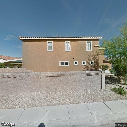
1753 W Gentle Brook St
North Las Vegas, NV 89084
Today
Favorites
702-857-0396
-
Bedrooms
6
-
Bathrooms
4
-
Square Feet
--
-
Available
Available Now
1753 W Gentle Brook St

Favorites
Situated roughly nine miles north of Las Vegas proper, El Dorado is near major roadways including I-15, US-95, and the Bruce Woodbury Beltway. This proximity to major thoroughfares draws those seeking Las Vegas apartments with easy access the city and outlying areas. El Dorado Park – part of the Las Vegas parks system – provides ample green spaces and has soccer fields and picnic areas.
Locals need look no further than the neighborhood for numerous dining options. Amazing Thai Restaurant on West Ann draws rave reviews for its spicy basil fried rice, and Little Greek on Simmons Street draws crowds with its jumbo gyros. Winchell’s Pub provides traditional American fare, complete with top-notch beer and great service.
Learn more about living in El Dorado
Education
| Colleges & Universities | Distance | ||
|---|---|---|---|
| Colleges & Universities | Distance | ||
| Drive: | 15 min | 8.0 mi | |
| Drive: | 17 min | 9.3 mi | |
| Drive: | 23 min | 12.8 mi | |
| Drive: | 28 min | 14.8 mi |
1753 W Gentle Brook St is within 15 minutes or 8.0 miles from Southern Nevada, Cheyenne. It is also near Nev. State Coll., Shadow Lane and Southern Nevada, Charleston.
Schools


Public Elementary School
Grades PK-5
718 Students
Attendance Zone
Public Middle School
Grades 6-8
1,402 Students
Attendance Zone
Public High School
Grades 9-12
2,750 Students
Attendance Zone
Private Elementary, Middle & High School
Grades K-12
103 Students
Nearby
Private Elementary School
Grades PK-5
304 Students
Nearby
School data provided by
 The GreatSchools Rating helps parents compare schools within a state based on a variety of school quality indicators and provides a helpful picture of how effectively each school serves all of its students. Ratings are on a scale of 1 (below average) to 10 (above average) and can include test scores, college readiness, academic progress, advanced courses, equity, discipline and attendance data. We also advise parents to visit schools, consider other information on school performance and programs, and consider family needs as part of the school selection process.
View GreatSchools Rating Methodology
Data provided by GreatSchools.org © 2025. All rights reserved.
View GreatSchools Rating Methodology
Data provided by GreatSchools.org © 2025. All rights reserved.
Transportation options available in North Las Vegas include Sahara Station, located 11.1 miles from 1753 W Gentle Brook St. 1753 W Gentle Brook St is near Harry Reid International, located 16.0 miles or 30 minutes away, and Boulder City Municipal, located 34.8 miles or 49 minutes away.
| Transit / Subway | Distance | ||
|---|---|---|---|
| Transit / Subway | Distance | ||
|
|
Drive: | 21 min | 11.1 mi |
| Airports | Distance | ||
|---|---|---|---|
| Airports | Distance | ||
|
Harry Reid International
|
Drive: | 30 min | 16.0 mi |
|
Boulder City Municipal
|
Drive: | 49 min | 34.8 mi |
Time and distance from 1753 W Gentle Brook St.
| Shopping Centers | Distance | ||
|---|---|---|---|
| Shopping Centers | Distance | ||
| Walk: | 17 min | 0.9 mi | |
| Drive: | 3 min | 1.3 mi | |
| Drive: | 3 min | 1.3 mi |
1753 W Gentle Brook St has 3 shopping centers within 1.3 miles, which is about a 3-minute walk. The miles and minutes will be for the farthest away property.
| Parks and Recreation | Distance | ||
|---|---|---|---|
| Parks and Recreation | Distance | ||
|
Craig Ranch Regional Park
|
Drive: | 8 min | 3.1 mi |
|
Spring Mountains National Recreation Area
|
Drive: | 12 min | 6.1 mi |
|
College of Southern Nevada Planetarium
|
Drive: | 14 min | 7.7 mi |
|
Old Las Vegas Mormon State Historic Park
|
Drive: | 15 min | 8.7 mi |
|
Floyd Lamb Park
|
Drive: | 20 min | 9.5 mi |
1753 W Gentle Brook St has 5 parks within 9.5 miles, including Craig Ranch Regional Park, Spring Mountains National Recreation Area, and College of Southern Nevada Planetarium.
| Hospitals | Distance | ||
|---|---|---|---|
| Hospitals | Distance | ||
| Drive: | 12 min | 8.1 mi | |
| Drive: | 14 min | 8.1 mi | |
| Drive: | 16 min | 9.3 mi |
1753 W Gentle Brook St has 3 hospitals within 9.3 miles, the nearest is Centennial Hills Hospital Medical Center which is 8.1 miles away and a 12 minute drive.
| Military Bases | Distance | ||
|---|---|---|---|
| Military Bases | Distance | ||
| Drive: | 26 min | 13.6 mi |
1753 W Gentle Brook St is 13.6 miles and a 26 minute drive from Nellis Air Force Base.
You May Also Like
Similar Rentals Nearby
-
-

-
 $2,8004 Beds, 3.5 Baths, 3,170 sq ftHouse for Rent
 -

-

-

-

-

-

-

What Are Walk Score®, Transit Score®, and Bike Score® Ratings?
Walk Score® measures the walkability of any address. Transit Score® measures access to public transit. Bike Score® measures the bikeability of any address.
What is a Sound Score Rating?
A Sound Score Rating aggregates noise caused by vehicle traffic, airplane traffic and local sources

1753 W Gentle Brook St
North Las Vegas, NV 89084