
Miami World Tower
710 NE 1st Ave,
Miami, FL 33132
$2,565 - $6,810 Total Monthly Price
Studio - 2 Beds
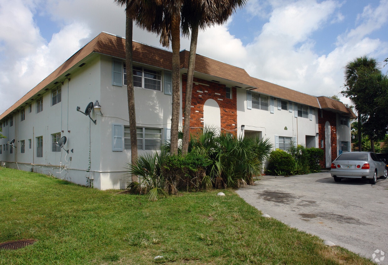
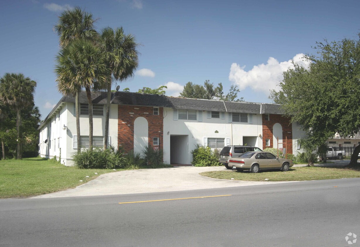
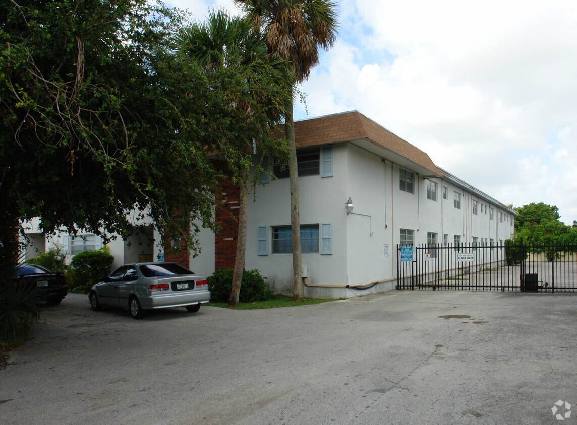

At 15700 NW 2nd Ave in Miami, FL, you've discovered your new home. This apartment community is located on Nw 2nd Ave in Miami. The professional leasing team is ready to help match you with your perfect new home. Schedule a time to see the current floorplan options. Contact us or drop by the leasing office to schedule your tour and find your new place at 15700 NW 2nd Ave.
Camelot Apartments is an apartment community located in Miami/Dade County and the 33169 ZIP Code. This area is served by the Miami-Dade County Public Schools attendance zone.
Heating
Oven
Range
Kitchen
Approximately 10 miles north of Downtown Miami sits Biscayne Gardens East, a large suburb with versatile rental options ranging from studio apartments to condos. Commuters appreciate the area's close proximity to Interstate 95, which forms the western border of the neighborhood. A quick eight-mile drive to the east takes locals to the beautiful shores of Haulover Beach.
Diverse dining options in the area boast something for every palette, with many establishments strewn along North Miami Avenue. For a little recreation or some outdoor time, head over to Biscayne Gardens Park, a spacious park in the center of the neighborhood complete with walking paths, palm trees, and a lovely duck pond. The expansive Oleta River State Park is also just a short drive away.
Learn more about living in Biscayne Gardens EastCompare neighborhood and city base rent averages by bedroom.
| Biscayne Gardens East | Miami, FL | |
|---|---|---|
| Studio | $2,001 | $2,089 |
| 1 Bedroom | $1,455 | $2,209 |
| 2 Bedrooms | $2,116 | $2,815 |
| 3 Bedrooms | - | $3,579 |
| Colleges & Universities | Distance | ||
|---|---|---|---|
| Colleges & Universities | Distance | ||
| Drive: | 8 min | 3.0 mi | |
| Drive: | 9 min | 4.2 mi | |
| Drive: | 10 min | 4.7 mi | |
| Drive: | 13 min | 5.9 mi |


Transportation options available in Miami include School Board, located 10.1 miles from Camelot Apartments. Camelot Apartments is near Fort Lauderdale/Hollywood International, located 12.8 miles or 19 minutes away, and Miami International, located 16.0 miles or 30 minutes away.
| Transit / Subway | Distance | ||
|---|---|---|---|
| Transit / Subway | Distance | ||
|
|
Drive: | 17 min | 10.1 mi |
|
|
Drive: | 16 min | 10.4 mi |
|
|
Drive: | 17 min | 10.6 mi |
|
|
Drive: | 17 min | 10.7 mi |
|
Airport Station
|
Drive: | 24 min | 13.1 mi |
| Commuter Rail | Distance | ||
|---|---|---|---|
| Commuter Rail | Distance | ||
|
|
Drive: | 3 min | 1.6 mi |
|
|
Drive: | 9 min | 4.5 mi |
|
|
Drive: | 10 min | 5.6 mi |
|
|
Drive: | 14 min | 8.0 mi |
|
|
Drive: | 16 min | 8.7 mi |
| Airports | Distance | ||
|---|---|---|---|
| Airports | Distance | ||
|
Fort Lauderdale/Hollywood International
|
Drive: | 19 min | 12.8 mi |
|
Miami International
|
Drive: | 30 min | 16.0 mi |
Scores provided by
Traffic
-Airport
-Businesses
-Scores provided by
HowLoud What is a Sound Score Rating? A Sound Score Rating aggregates noise caused by vehicle traffic, airplane traffic and local sources. How It WorksTime and distance from Camelot Apartments.
| Shopping Centers | Distance | ||
|---|---|---|---|
| Shopping Centers | Distance | ||
| Walk: | 13 min | 0.7 mi | |
| Walk: | 15 min | 0.8 mi | |
| Walk: | 20 min | 1.0 mi |
| Parks and Recreation | Distance | ||
|---|---|---|---|
| Parks and Recreation | Distance | ||
|
Enchanted Forest Elaine Gordon Park
|
Drive: | 7 min | 3.4 mi |
|
Arch Creek Park & Nature Center
|
Drive: | 8 min | 3.5 mi |
|
Greynolds Park
|
Drive: | 11 min | 4.5 mi |
|
Oleta River State Park
|
Drive: | 14 min | 4.8 mi |
|
Miramar Pineland
|
Drive: | 12 min | 6.4 mi |
| Hospitals | Distance | ||
|---|---|---|---|
| Hospitals | Distance | ||
| Drive: | 8 min | 4.7 mi | |
| Drive: | 10 min | 6.0 mi | |
| Drive: | 13 min | 7.9 mi |
Pets Allowed Fitness Center Pool In Unit Washer & Dryer Stainless Steel Appliances

Pets Allowed Dishwasher Balcony Patio Elevator
What Are Walk Score®, Transit Score®, and Bike Score® Ratings?
Walk Score® measures the walkability of any address. Transit Score® measures access to public transit. Bike Score® measures the bikeability of any address.
What is a Sound Score Rating?
A Sound Score Rating aggregates noise caused by vehicle traffic, airplane traffic and local sources.

15700 NW 2nd Ave
Miami, FL 33169


