$4,570 / Month
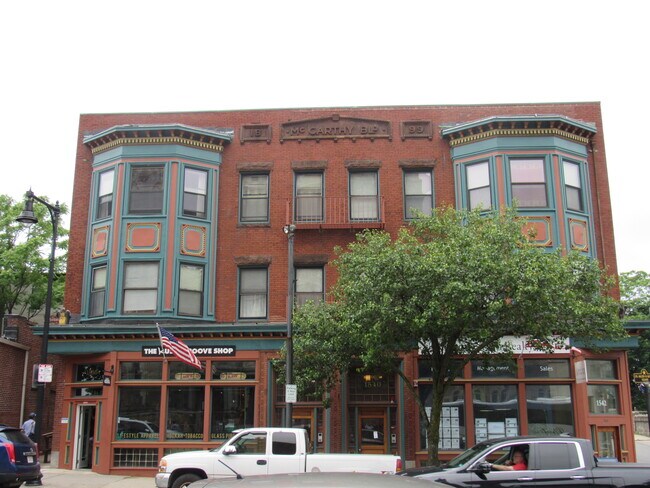
1540 Tremont St Unit 2R
Boston, MA 02120
2 Weeks Ago
Favorites
1540 Tremont St Unit 2R

Favorites
Check Back Soon for Upcoming Availability
| Beds | Baths | Average SF |
|---|---|---|
| 3 Bedrooms 3 Bedrooms 3 Br | 1 Bath 1 Bath 1 Ba | 1,000 SF |
Fees and Policies
The fees below are based on community-supplied data and may exclude additional fees and utilities.
- Dogs Allowed
-
Fees not specified
- Cats Allowed
-
Fees not specified
- Parking
-
Street--
Details
Utilities Included
-
Water
Property Information
-
4 units
About This Property
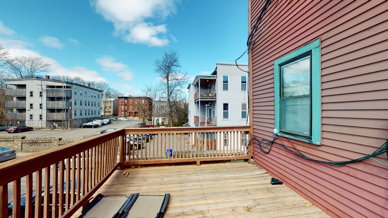
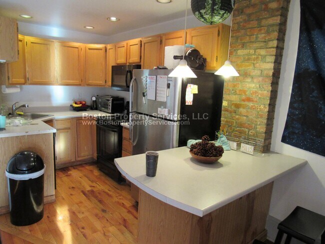
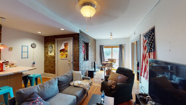
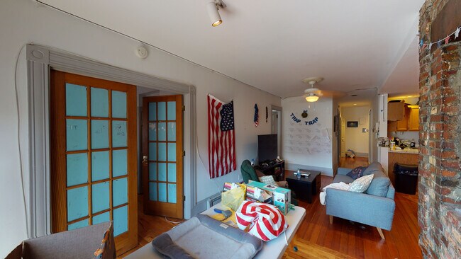
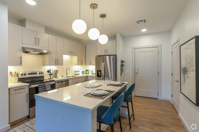
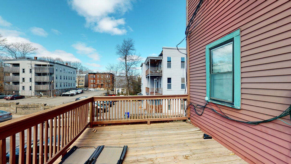
VERY LARGE APARTMENT ON TREMONT ST, SPARKLING WOOD FLOORS, EXPOSED BRICK INTERIOR, KITCHEN ISLAND, OVERSIZED OPEN CONCEPT, BIG BEDROOMS (SEE LAYOUT). SUNNY EXPOSURE. VIDEO AVAILABLE, CALL DAN, AVAILABLE 9/1, PET OK, NO SECURITY DEPOSIT REQ'D. RIGHT NEXT TO GREEN & ORANGE LINE TRAINS, EASY WALK TO COLLEGES / LONGWOOD MED. - 5 minute walk to Huntington Ave and Longwood Medical - Directly between Brigham Circle Green Line and Roxbury Crossings Orange Line - Pets OK - Large bedrooms, living room overlooks Tremont Street - Next to several coffee shops & restaurants
1540 Tremont St is an apartment community located in Suffolk County and the 02120 ZIP Code.
Apartment Features
- Dishwasher
- Kitchen
- Hardwood Floors
- Laundry Facilities
Location
Get Directions
Boston is the iconic capital and largest city of Massachusetts, known for its historical significance, top-notch culinary scene, and beautiful Bayfront views. Nestled on Massachusetts Bay, Boston is home to numerous universities including Harvard University, Boston College, Northeastern University, the University of Massachusetts-Boston, the Berklee College of Music, and the Benjamin Franklin Institute of Technology. In fact, there are 54 colleges and universities in the Boston area, dating all the way back to 1636 when Harvard was established.
Boston played a crucial role in the American Revolution, being the site of major events like the Boston Massacre and the Boston Tea Party. This city is filled with historic sites, landmarks, and architecture like the Boston Common, the first park in the country, dating back to 1624. Locals frequent Freedom Trail for its walking park that begins at the park and leads past several historic sites, including Paul Revere’s House and Faneuil Hall.
Learn more about living in Boston
Amenities
- Dishwasher
- Kitchen
- Hardwood Floors
- Laundry Facilities
Expenses
Utilities Included
Water
Included
Education
| Colleges & Universities | Distance | ||
|---|---|---|---|
| Colleges & Universities | Distance | ||
| Walk: | 6 min | 0.4 mi | |
| Walk: | 6 min | 0.4 mi | |
| Walk: | 11 min | 0.6 mi | |
| Drive: | 3 min | 1.5 mi |
1540 Tremont St Unit 2R is within 6 minutes or 0.4 mile from MCPHS University, Boston. It is also near MassArt and Wentworth Inst. of Technology.
Transportation options available in Boston include Brigham Circle Station, located 0.3 mile from 1540 Tremont St Unit 2R. 1540 Tremont St Unit 2R is near General Edward Lawrence Logan International, located 6.7 miles or 13 minutes away.
| Transit / Subway | Distance | ||
|---|---|---|---|
| Transit / Subway | Distance | ||
|
|
Walk: | 5 min | 0.3 mi |
|
|
Walk: | 5 min | 0.3 mi |
|
|
Walk: | 6 min | 0.3 mi |
|
|
Walk: | 7 min | 0.4 mi |
|
|
Walk: | 10 min | 0.6 mi |
| Commuter Rail | Distance | ||
|---|---|---|---|
| Commuter Rail | Distance | ||
|
|
Walk: | 15 min | 0.8 mi |
| Drive: | 4 min | 2.0 mi | |
|
|
Drive: | 4 min | 2.1 mi |
|
|
Drive: | 7 min | 2.1 mi |
|
|
Drive: | 9 min | 4.8 mi |
| Airports | Distance | ||
|---|---|---|---|
| Airports | Distance | ||
|
General Edward Lawrence Logan International
|
Drive: | 13 min | 6.7 mi |
Time and distance from 1540 Tremont St Unit 2R.
| Shopping Centers | Distance | ||
|---|---|---|---|
| Shopping Centers | Distance | ||
| Walk: | 13 min | 0.7 mi | |
| Drive: | 3 min | 1.6 mi | |
| Drive: | 4 min | 1.6 mi |
1540 Tremont St Unit 2R has 3 shopping centers within 1.6 miles, which is about a 4-minute walk. The miles and minutes will be for the farthest away property.
| Parks and Recreation | Distance | ||
|---|---|---|---|
| Parks and Recreation | Distance | ||
|
Roxbury Heritage State Park
|
Walk: | 12 min | 0.6 mi |
|
Frederick Law Olmsted National Historic Site
|
Drive: | 4 min | 1.9 mi |
|
John Fitzgerald Kennedy National Historic Site
|
Drive: | 5 min | 1.9 mi |
|
Charles River Reservation
|
Drive: | 4 min | 2.1 mi |
|
Coit Observatory
|
Drive: | 5 min | 2.3 mi |
1540 Tremont St Unit 2R has 5 parks within 2.3 miles, including Roxbury Heritage State Park, Coit Observatory, and Charles River Reservation.
| Hospitals | Distance | ||
|---|---|---|---|
| Hospitals | Distance | ||
| Walk: | 8 min | 0.4 mi | |
| Walk: | 10 min | 0.5 mi | |
| Walk: | 10 min | 0.5 mi |
1540 Tremont St Unit 2R has 3 hospitals within 0.5 mile, the nearest is Brigham and Women's Hospital which is 0.4 mile away and a 8 minute walk.
| Military Bases | Distance | ||
|---|---|---|---|
| Military Bases | Distance | ||
| Drive: | 27 min | 14.9 mi | |
| Drive: | 30 min | 15.6 mi |
1540 Tremont St Unit 2R is 14.9 miles from US Military Reservation, and is convenient to other military bases, including Hanscom Air Force Base.
You May Also Like
Similar Rentals Nearby


What Are Walk Score®, Transit Score®, and Bike Score® Ratings?
Walk Score® measures the walkability of any address. Transit Score® measures access to public transit. Bike Score® measures the bikeability of any address.
What is a Sound Score Rating?
A Sound Score Rating aggregates noise caused by vehicle traffic, airplane traffic and local sources
1540 Tremont St
Boston, MA 02120