
Living at NoHo
11059 McCormick St,
North Hollywood, CA 91601
$2,192 - $3,841 Total Monthly Price
Studio - 3 Beds
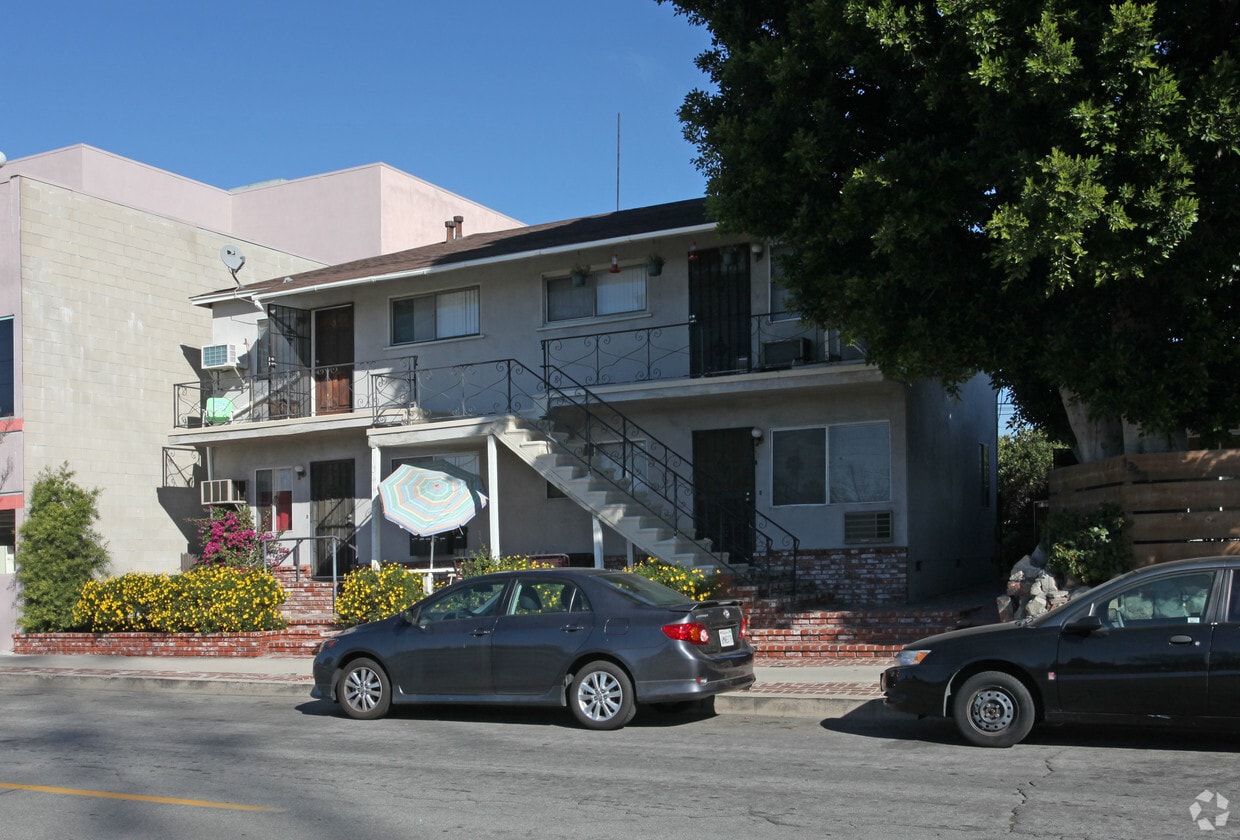
Discover 1344-1346 N Whitnall Hwy in Burbank, CA. The 91505 location is an ideal place to live. Schedule a time to check out the current floorplan options. The leasing staff is waiting to show you all that this community has in store. Stop by the leasing office to check current floorplan availability.
1344-1346 N Whitnall Hwy is an apartment community located in Los Angeles County and the 91505 ZIP Code. This area is served by the Burbank Unified School District attendance zone.
Located a few blocks from Warner Brothers Studios, Walt Disney Studios, and Burbank Studios, Chandler Park is a predominately residential neighborhood. Compared to other Los Angeles communities, Chandler Park is known for having more affordable rentals, but there are upscale options available as well. Great for renters of all ages, Chandler Park offers an abundance of amenities. Restaurants, retailers, small businesses, and more can be found along Burbank Boulevard and Victory Boulevard.
If you want to live like a local, be sure to explore West Magnolia Boulevard, a long thoroughfare that stretches into Magnolia Park known for housing production companies, edit bays, lavish salons, trendy eateries, eclectic antique shops, stylish boutiques, costume stores, camera stores, yoga studios and more. By living in Burbank, you’ll also have easy access to great schools, parks, and major LA attractions like Universal Studios Hollywood, the Hollywood Bowl, Griffith Park, and more.
Learn more about living in Chandler ParkCompare neighborhood and city base rent averages by bedroom.
| Chandler Park | Burbank, CA | |
|---|---|---|
| Studio | $2,426 | $1,907 |
| 1 Bedroom | $2,982 | $2,235 |
| 2 Bedrooms | $3,862 | $2,950 |
| 3 Bedrooms | $5,067 | $3,986 |
| Colleges & Universities | Distance | ||
|---|---|---|---|
| Colleges & Universities | Distance | ||
| Drive: | 4 min | 2.4 mi | |
| Drive: | 7 min | 3.2 mi | |
| Drive: | 8 min | 4.0 mi | |
| Drive: | 12 min | 6.1 mi |


Transportation options available in Burbank include North Hollywood Station, located 1.7 miles from 1344-1346 N Whitnall Hwy. 1344-1346 N Whitnall Hwy is near Bob Hope, located 3.4 miles or 7 minutes away, and Los Angeles International, located 25.0 miles or 36 minutes away.
| Transit / Subway | Distance | ||
|---|---|---|---|
| Transit / Subway | Distance | ||
|
|
Drive: | 3 min | 1.7 mi |
|
|
Drive: | 5 min | 2.7 mi |
|
|
Drive: | 11 min | 6.0 mi |
|
|
Drive: | 11 min | 6.5 mi |
|
|
Drive: | 12 min | 7.3 mi |
| Commuter Rail | Distance | ||
|---|---|---|---|
| Commuter Rail | Distance | ||
|
|
Drive: | 4 min | 2.1 mi |
| Drive: | 5 min | 2.7 mi | |
|
|
Drive: | 6 min | 3.4 mi |
|
|
Drive: | 8 min | 4.4 mi |
|
|
Drive: | 14 min | 8.2 mi |
| Airports | Distance | ||
|---|---|---|---|
| Airports | Distance | ||
|
Bob Hope
|
Drive: | 7 min | 3.4 mi |
|
Los Angeles International
|
Drive: | 36 min | 25.0 mi |
Scores provided by
Traffic
-Airport
-Businesses
-Scores provided by
HowLoud What is a Sound Score Rating? A Sound Score Rating aggregates noise caused by vehicle traffic, airplane traffic and local sources. How It WorksTime and distance from 1344-1346 N Whitnall Hwy.
| Shopping Centers | Distance | ||
|---|---|---|---|
| Shopping Centers | Distance | ||
| Walk: | 7 min | 0.4 mi | |
| Walk: | 11 min | 0.6 mi | |
| Drive: | 2 min | 1.2 mi |
| Parks and Recreation | Distance | ||
|---|---|---|---|
| Parks and Recreation | Distance | ||
|
Runyon Canyon
|
Drive: | 13 min | 6.6 mi |
|
Los Angeles Zoo
|
Drive: | 18 min | 7.6 mi |
|
Sooky Goldman Nature Center
|
Drive: | 20 min | 8.3 mi |
|
Griffith Observatory
|
Drive: | 19 min | 10.9 mi |
|
Griffith Park
|
Drive: | 29 min | 13.2 mi |
| Hospitals | Distance | ||
|---|---|---|---|
| Hospitals | Distance | ||
| Drive: | 5 min | 2.7 mi | |
| Drive: | 10 min | 6.3 mi | |
| Drive: | 10 min | 6.5 mi |
| Military Bases | Distance | ||
|---|---|---|---|
| Military Bases | Distance | ||
| Drive: | 36 min | 27.6 mi | |
| Drive: | 51 min | 37.2 mi | |
| Drive: | 54 min | 39.4 mi |
Pets Allowed Fitness Center Pool Maintenance on site High-Speed Internet Controlled Access EV Charging
Pets Allowed In Unit Washer & Dryer Maintenance on site Heat Controlled Access Elevator
What Are Walk Score®, Transit Score®, and Bike Score® Ratings?
Walk Score® measures the walkability of any address. Transit Score® measures access to public transit. Bike Score® measures the bikeability of any address.
What is a Sound Score Rating?
A Sound Score Rating aggregates noise caused by vehicle traffic, airplane traffic and local sources.


