1180 Boylston St
1180 Boylston St,
Boston,
MA
02215
2 Weeks Ago
Favorites
1180 Boylston St

Favorites
Check Back Soon for Upcoming Availability
Fees and Policies
The fees below are based on community-supplied data and may exclude additional fees and utilities.
- Cats Allowed
-
Fees not specified
-
Weight limit--
-
Pet Limit--
- Parking
-
Street--
Details
Lease Options
-
12 Months
Property Information
-
3 units
About 1180 Boylston St Boston, MA 02215
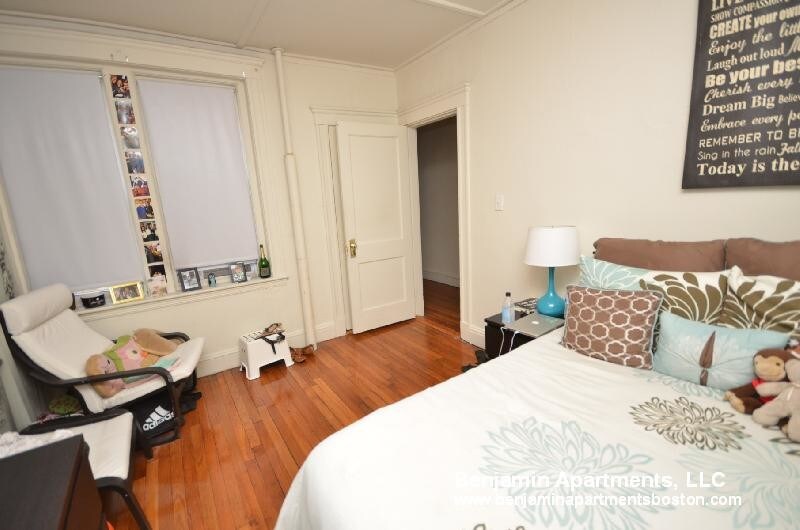
Spectacular 2 Bed (1 split) and 1 Bath available in Fenway! Modern kitchen with granite counter tops. Spacious rooms with high ceilings, sunny windows, and beautiful hardwood floors.Updated bathroom. Heat and hot water included. Broker's fee equivalent to half-month!!! No security deposit paid!! Cats (only) allowed. Laundry in building. Convenient location close to Green and Orange Line! Nearby Fenway Park, Hynes Convention Center, Charles River, Target, and more! Lease start available 09/01/2019. Please contact Justin for more information or to set up a showing. Bus: 66, Tremont St @ Sewall St (0.60 mi) Bus: 47, Ruggles St @ Annunciation Rd (0.18 mi) Bus: 28, Ruggles (0.19 mi) Bus: 22, Tremont St @ Prentiss St (0.41 mi) Bus: 43, Tremont St @ Columbus Ave (0.32 mi) Bus: 39, Huntington Ave @ Forsyth Way (0.04 mi) Tram: E, Northeastern University (0.08 mi) Rail: Franklin Line, Ruggles (0.22 mi) Subway: Orange Line, Ruggles (0.22 mi) Bus: 9, Louis Prang St @ Evans Way (0.30 mi) Bus: 1, Massachusetts Ave @ Huntington Ave (0.42 mi) Bus: 55, Queensberry St @ Jersey St (0.39 mi) Bus: 8, 132 Brookline Ave opp Fullerton St (0.63 mi)
1180 Boylston St is an apartment community located in Suffolk County and the 02215 ZIP Code.
Apartment Features
Hardwood Floors
Granite Countertops
Instant Hot Water
Kitchen
- Granite Countertops
- Kitchen
- Instant Hot Water
- Hardwood Floors
- Laundry Facilities
Location
Get Directions
Tree-filled, historic, and packed with educational opportunity, there's no other neighborhood quite like Fenway. The neighborhood may be most well-known for its titular attraction, Fenway Park, home of the Boston Red Sox. However, the area is also renowned for its sprawling greenspace. The name "Fenway" refers to the neighborhood’s lush parkway and tree-filled paths that wind lazily through the area, forming part of Frederick Law Olmsted’s “Emerald Necklace Plan” (a chain of parks throughout Boston). The Fenway opened in 1876, and its route includes the Museum of Fine Arts and the Isabella Steward Gardner Museum.
Learn more about living in FenwayBelow are rent ranges for similar nearby apartments
| Beds | Average Size | Lowest | Typical | Premium |
|---|---|---|---|---|
| Studio Studio Studio | 2658 Sq Ft | $1,850 | $2,509 | $7,280 |
| 1 Bed 1 Bed 1 Bed | 2762-2764 Sq Ft | $1,900 | $3,212 | $9,141 |
| 2 Beds 2 Beds 2 Beds | 2891-2893 Sq Ft | $2,600 | $4,118 | $17,500 |
| 3 Beds 3 Beds 3 Beds | 3212-3213 Sq Ft | $1,610 | $5,108 | $14,732 |
| 4 Beds 4 Beds 4 Beds | 5283-5285 Sq Ft | $1,400 | $7,547 | $100,000 |
Amenities
- Granite Countertops
- Kitchen
- Instant Hot Water
- Hardwood Floors
- Laundry Facilities
Education
| Colleges & Universities | Distance | ||
|---|---|---|---|
| Colleges & Universities | Distance | ||
| Walk: | 8 min | 0.4 mi | |
| Walk: | 10 min | 0.6 mi | |
| Walk: | 14 min | 0.7 mi | |
| Walk: | 15 min | 0.8 mi |
1180 Boylston St is within 8 minutes or 0.4 mile from Berklee College of Music. It is also near Lesley Univ., Art Institute and Northeastern University.
Transportation options available in Boston include Kenmore Station, located 0.4 mile from 1180 Boylston St. 1180 Boylston St is near General Edward Lawrence Logan International, located 5.8 miles or 13 minutes away.
| Transit / Subway | Distance | ||
|---|---|---|---|
| Transit / Subway | Distance | ||
|
|
Walk: | 7 min | 0.4 mi |
|
|
Walk: | 7 min | 0.4 mi |
|
|
Walk: | 12 min | 0.6 mi |
|
|
Walk: | 12 min | 0.6 mi |
|
|
Walk: | 13 min | 0.7 mi |
| Commuter Rail | Distance | ||
|---|---|---|---|
| Commuter Rail | Distance | ||
|
|
Walk: | 18 min | 0.9 mi |
|
|
Drive: | 6 min | 1.3 mi |
| Drive: | 5 min | 2.1 mi | |
|
|
Drive: | 7 min | 2.2 mi |
|
|
Drive: | 6 min | 3.6 mi |
| Airports | Distance | ||
|---|---|---|---|
| Airports | Distance | ||
|
General Edward Lawrence Logan International
|
Drive: | 13 min | 5.8 mi |
Time and distance from 1180 Boylston St.
| Shopping Centers | Distance | ||
|---|---|---|---|
| Shopping Centers | Distance | ||
| Walk: | 4 min | 0.3 mi | |
| Walk: | 18 min | 0.9 mi | |
| Drive: | 8 min | 4.6 mi |
1180 Boylston St has 3 shopping centers within 4.6 miles, which is about a 8-minute walk. The miles and minutes will be for the farthest away property.
| Parks and Recreation | Distance | ||
|---|---|---|---|
| Parks and Recreation | Distance | ||
|
Charles River Reservation
|
Walk: | 15 min | 0.8 mi |
|
Coit Observatory
|
Drive: | 2 min | 1.2 mi |
|
Boston Public Garden
|
Drive: | 5 min | 1.6 mi |
|
Roxbury Heritage State Park
|
Drive: | 5 min | 1.9 mi |
|
John Fitzgerald Kennedy National Historic Site
|
Drive: | 4 min | 2.1 mi |
1180 Boylston St has 5 parks within 2.1 miles, including Charles River Reservation, Coit Observatory, and Boston Public Garden.
| Hospitals | Distance | ||
|---|---|---|---|
| Hospitals | Distance | ||
| Walk: | 14 min | 0.8 mi | |
| Walk: | 19 min | 1.0 mi | |
| Drive: | 3 min | 1.4 mi |
1180 Boylston St has 3 hospitals within 1.4 miles, the nearest is Beth Israel Deaconess Medical Center which is 0.8 mile away and a 14 minute walk.
| Military Bases | Distance | ||
|---|---|---|---|
| Military Bases | Distance | ||
| Drive: | 28 min | 15.0 mi | |
| Drive: | 28 min | 15.9 mi |
1180 Boylston St is 15.0 miles from Hanscom Air Force Base, and is convenient to other military bases, including US Military Reservation.
You May Also Like
Similar Rentals Nearby


What Are Walk Score®, Transit Score®, and Bike Score® Ratings?
Walk Score® measures the walkability of any address. Transit Score® measures access to public transit. Bike Score® measures the bikeability of any address.
What is a Sound Score Rating?
A Sound Score Rating aggregates noise caused by vehicle traffic, airplane traffic and local sources