$2,350 / Month
1175 Boylston St Unit 15
Boston, MA 02215
2 Weeks Ago
Favorites
1175 Boylston St Unit 15

Favorites
Check Back Soon for Upcoming Availability
| Beds | Baths | Average SF |
|---|---|---|
| Studio Studio 0 Br | 1 Bath 1 Bath 1 Ba | 500 SF |
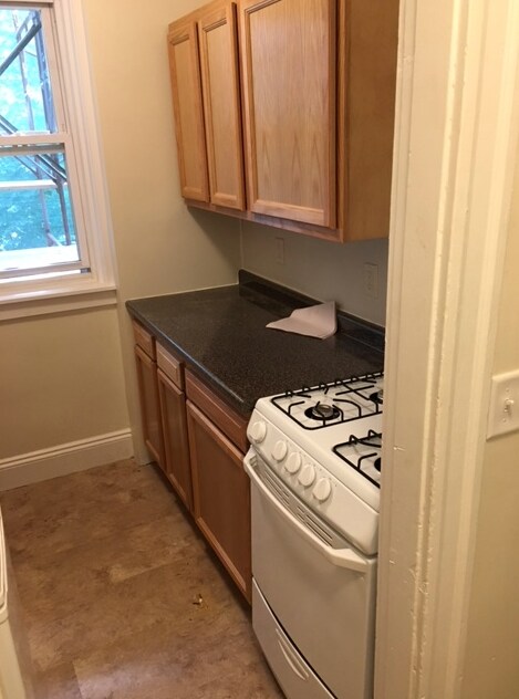
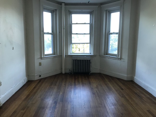
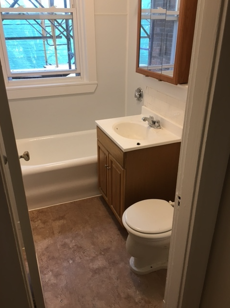
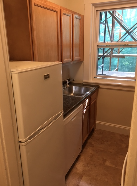
About This Property
Available now, this apartment features heat and hot water included in the rent, making it a great deal. The kitchen has been recently updated in 2021, and the bathroom was completely renovated in 2020. This rear/side unit is in a professionally managed building on Boylston Street in the Fenway neighborhood. There's no broker fee and no security deposit required! The location is ideal, just a stone's throw away from the Longwood Medical area, Boston University, Northeastern University, Beacon Street, Kenmore Square, Commonwealth Avenue, Brookline, and Park Drive. Transportation Bus: 66 Tremont St @ Sewall St (0.60 mi) Bus: 47 Ruggles (0.22 mi) Bus: 28 Tremont St opp Prentiss St (0.44 mi) Bus: 22 Tremont St @ Prentiss St (0.42 mi) Bus: 43 Tremont St @ Columbus Ave (0.32 mi) Bus: 39 Huntington Ave @ Forsyth Way (0.04 mi) Tram: E Northeastern University (0.08 mi) Subway: Orange Line Ruggles (0.19 mi) Rail: Providence/Stoughton Line Ruggles (0.20 mi) Bus: 19 Louis Prang St @ Evans Way (0.30 mi) Bus: 1 Massachusetts Ave @ Huntington Ave (0.42 mi) Bus: 55 Queensberry St @ Jersey St (0.39 mi) Bus: 8 132 Brookline Ave opp Fullerton St (0.63 mi) Bus: 57 Belvidere St @ Huntington Ave (0.64 mi)
1175 Boylston St is an apartment community located in Suffolk County and the 02215 ZIP Code.
Apartment Features
- Kitchen
- Instant Hot Water
- Laundry Facilities
Fees and Policies
The fees below are based on community-supplied data and may exclude additional fees and utilities.
- Cats Allowed
-
Fees not specified
-
Weight limit--
-
Pet Limit--
Details
Utilities Included
-
Gas
-
Water
-
Electricity
-
Heat
-
Sewer
Lease Options
-
12 Months
Location
Get Directions
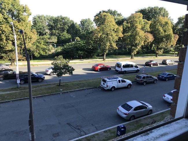
Tree-filled, historic, and packed with educational opportunity, there's no other neighborhood quite like Fenway. The neighborhood may be most well-known for its titular attraction, Fenway Park, home of the Boston Red Sox. However, the area is also renowned for its sprawling greenspace. The name "Fenway" refers to the neighborhood’s lush parkway and tree-filled paths that wind lazily through the area, forming part of Frederick Law Olmsted’s “Emerald Necklace Plan” (a chain of parks throughout Boston). The Fenway opened in 1876, and its route includes the Museum of Fine Arts and the Isabella Steward Gardner Museum.
Learn more about living in FenwayBelow are rent ranges for similar nearby apartments
| Beds | Average Size | Lowest | Typical | Premium |
|---|---|---|---|---|
| Studio Studio Studio | 2082-2083 Sq Ft | $1,800 | $2,577 | $7,710 |
| 1 Bed 1 Bed 1 Bed | 2407-2409 Sq Ft | $1,350 | $3,351 | $10,870 |
| 2 Beds 2 Beds 2 Beds | 2843-2845 Sq Ft | $2,350 | $4,132 | $27,610 |
| 3 Beds 3 Beds 3 Beds | 3349-3351 Sq Ft | $1,395 | $5,184 | $25,000 |
| 4 Beds 4 Beds 4 Beds | 5582-5584 Sq Ft | $1,500 | $7,215 | $20,090 |
Amenities
- Kitchen
- Instant Hot Water
- Laundry Facilities
Expenses
Utilities Included
Gas, Water, Electricity, Heat, Sewer
Included
Education
| Colleges & Universities | Distance | ||
|---|---|---|---|
| Colleges & Universities | Distance | ||
| Walk: | 9 min | 0.5 mi | |
| Walk: | 11 min | 0.6 mi | |
| Walk: | 15 min | 0.8 mi | |
| Drive: | 4 min | 1.1 mi |
1175 Boylston St Unit 15 is within 9 minutes or 0.5 mile from Berklee College of Music. It is also near Lesley Univ., Art Institute and Emmanuel College.
Transportation options available in Boston include Kenmore Station, located 0.4 mile from 1175 Boylston St Unit 15. 1175 Boylston St Unit 15 is near General Edward Lawrence Logan International, located 6.1 miles or 14 minutes away.
| Transit / Subway | Distance | ||
|---|---|---|---|
| Transit / Subway | Distance | ||
|
|
Walk: | 7 min | 0.4 mi |
|
|
Walk: | 8 min | 0.5 mi |
|
|
Walk: | 13 min | 0.7 mi |
|
|
Walk: | 14 min | 0.7 mi |
|
|
Drive: | 4 min | 1.2 mi |
| Commuter Rail | Distance | ||
|---|---|---|---|
| Commuter Rail | Distance | ||
|
|
Drive: | 3 min | 1.1 mi |
|
|
Drive: | 6 min | 1.4 mi |
|
|
Drive: | 7 min | 2.2 mi |
| Drive: | 6 min | 2.3 mi | |
|
|
Drive: | 7 min | 3.8 mi |
| Airports | Distance | ||
|---|---|---|---|
| Airports | Distance | ||
|
General Edward Lawrence Logan International
|
Drive: | 14 min | 6.1 mi |
Time and distance from 1175 Boylston St Unit 15.
| Shopping Centers | Distance | ||
|---|---|---|---|
| Shopping Centers | Distance | ||
| Walk: | 2 min | 0.1 mi | |
| Walk: | 18 min | 0.9 mi | |
| Drive: | 9 min | 4.8 mi |
1175 Boylston St Unit 15 has 3 shopping centers within 4.8 miles, which is about a 9-minute walk. The miles and minutes will be for the farthest away property.
| Parks and Recreation | Distance | ||
|---|---|---|---|
| Parks and Recreation | Distance | ||
|
Charles River Reservation
|
Walk: | 15 min | 0.8 mi |
|
Coit Observatory
|
Drive: | 3 min | 1.5 mi |
|
Boston Public Garden
|
Drive: | 5 min | 1.7 mi |
|
John Fitzgerald Kennedy National Historic Site
|
Drive: | 5 min | 2.1 mi |
|
Roxbury Heritage State Park
|
Drive: | 6 min | 2.2 mi |
1175 Boylston St Unit 15 has 5 parks within 2.2 miles, including Charles River Reservation, Coit Observatory, and Boston Public Garden.
| Hospitals | Distance | ||
|---|---|---|---|
| Hospitals | Distance | ||
| Walk: | 14 min | 0.8 mi | |
| Walk: | 19 min | 1.0 mi | |
| Drive: | 3 min | 1.4 mi |
1175 Boylston St Unit 15 has 3 hospitals within 1.4 miles, the nearest is Beth Israel Deaconess Medical Center which is 0.8 mile away and a 14 minute walk.
| Military Bases | Distance | ||
|---|---|---|---|
| Military Bases | Distance | ||
| Drive: | 30 min | 14.9 mi | |
| Drive: | 29 min | 15.9 mi |
1175 Boylston St Unit 15 is 14.9 miles from Hanscom Air Force Base, and is convenient to other military bases, including US Military Reservation.
You May Also Like
Similar Rentals Nearby


What Are Walk Score®, Transit Score®, and Bike Score® Ratings?
Walk Score® measures the walkability of any address. Transit Score® measures access to public transit. Bike Score® measures the bikeability of any address.
What is a Sound Score Rating?
A Sound Score Rating aggregates noise caused by vehicle traffic, airplane traffic and local sources

1175 Boylston St
Boston, MA 02215