
$2,300
/ Month
11 Tetlow St Unit 47
Boston, MA 02115
1 Day Ago
Favorites
603-721-1631
-
Bedrooms
Studio
-
Bathrooms
1
-
Square Feet
395 sq ft
-
Available
Available Sep 1
Highlights
- Property is near public transit
- Jogging Path
- No Cooling
- Park
- Shops
- Hot Water Heating System
11 Tetlow St Unit 47

Favorites
About This Home
$2,400 deposit,
Available Sep 1
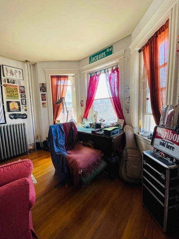
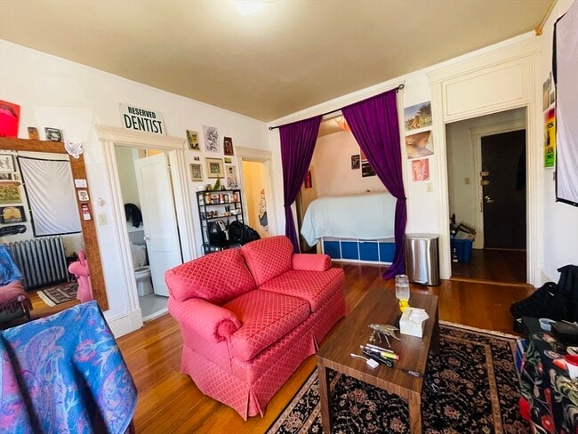
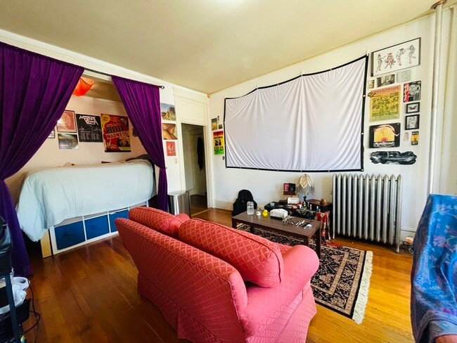
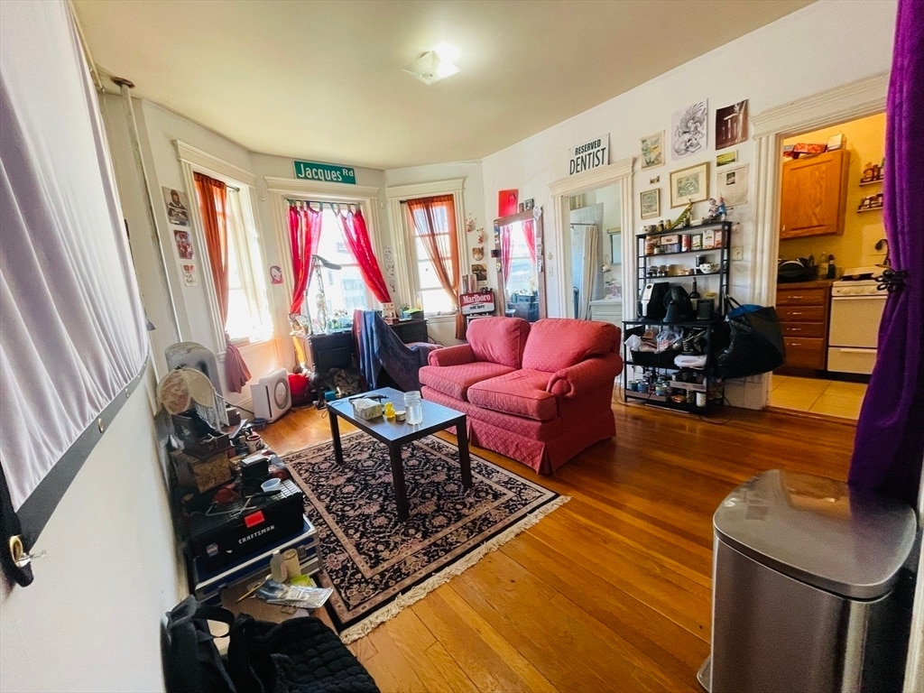
Spacious studio apartment with alcove available for 09/01/2025! The unit features: hardwood floors,natural light,intercom,elevator in the building,heat and hot water included in the rent. Card operated laundry facilities in the basement. Amazing location,near museums,universities,shopping and parks! Video tour available! Cats allowed for $25/mo. MLS# 73419027
11 Tetlow St is an apartment community located in Suffolk County and the 02115 ZIP Code.
* Price shown is base rent and may not include non-optional fees and utilities. Price, availability, fees, and any applicable rent special are subject to change without notice.
* Square footage definitions vary. Displayed square footage is approximate.
Home Details
Accessible Home Design
Entry on the 4th floor
Bedrooms and Bathrooms
1 Full Bathroom
Home Design
Apartment
Interior Spaces
395 Sq Ft Home
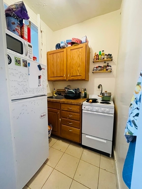
Kitchen
Range
Listing and Financial Details
Security Deposit $2,400
Property Available on 9/1/25
12 Month Lease Term
Assessor Parcel Number 3358613
Rent includes heat, hot water, electricity, gas, water, sewer, trash collection, snow removal, gardener
Location
Property is near public transit
Property is near schools
Lot Details
395 Sq Ft Lot
Near Conservation Area
Utilities
No Cooling
Hot Water Heating System
Community Details
Amenities
Shops
Laundry Facilities
Overview
No Home Owners Association
Pet Policy
Call for details about the types of pets allowed
Recreation
Jogging Path
Park
Bike Trail
Fees and Policies
The fees below are based on community-supplied data and may exclude additional fees and utilities.
Pet policies are negotiable.
Contact
- Listed by Olesea Bejan | Charlesgate Realty Group,llc
- Phone Number
-
Source
 MLS Property Information Network
The property listing data and information set forth herein were provided to MLS Property Information Network, Inc. from third party sources, including sellers, lessors and public records, and were compiled by MLS Property Information Network, Inc. The property listing data and information are for the personal, non-commercial use of consumers having a good faith interest in purchasing or leasing listed properties of the type displayed to them and may not be used for any purpose other than to identify prospective properties which such consumers may have a good faith interest in purchasing or leasing. MLS Property Information Network, Inc. and its subscribers disclaim any and all representations and warranties as to the accuracy of the property listing data and information set forth herein. All properties are subject to prior sale, change or withdrawal. Copyright © 2025 MLS Property Information Network, Inc. All rights reserved.
Location
Get Directions
Amenities
- Range
- Refrigerator
Tree-filled, historic, and packed with educational opportunity, there's no other neighborhood quite like Fenway. The neighborhood may be most well-known for its titular attraction, Fenway Park, home of the Boston Red Sox. However, the area is also renowned for its sprawling greenspace. The name "Fenway" refers to the neighborhood’s lush parkway and tree-filled paths that wind lazily through the area, forming part of Frederick Law Olmsted’s “Emerald Necklace Plan” (a chain of parks throughout Boston). The Fenway opened in 1876, and its route includes the Museum of Fine Arts and the Isabella Steward Gardner Museum.
Learn more about living in Fenway
Education
| Colleges & Universities | Distance | ||
|---|---|---|---|
| Colleges & Universities | Distance | ||
| Walk: | 3 min | 0.2 mi | |
| Walk: | 3 min | 0.2 mi | |
| Walk: | 5 min | 0.3 mi | |
| Walk: | 6 min | 0.3 mi |
11 Tetlow St Unit 47 is within 3 minutes or 0.2 mile from MassArt. It is also near MCPHS University, Boston and Simmons College.
Transportation options available in Boston include Longwood Medical Area Station, located 0.2 mile from 11 Tetlow St Unit 47. 11 Tetlow St Unit 47 is near General Edward Lawrence Logan International, located 6.7 miles or 13 minutes away.
| Transit / Subway | Distance | ||
|---|---|---|---|
| Transit / Subway | Distance | ||
|
|
Walk: | 3 min | 0.2 mi |
|
|
Walk: | 5 min | 0.3 mi |
|
|
Walk: | 6 min | 0.4 mi |
|
|
Walk: | 10 min | 0.5 mi |
|
|
Walk: | 15 min | 0.8 mi |
| Commuter Rail | Distance | ||
|---|---|---|---|
| Commuter Rail | Distance | ||
|
|
Walk: | 12 min | 0.6 mi |
|
|
Drive: | 7 min | 1.9 mi |
| Drive: | 5 min | 2.3 mi | |
|
|
Drive: | 5 min | 2.5 mi |
|
|
Drive: | 8 min | 4.5 mi |
| Airports | Distance | ||
|---|---|---|---|
| Airports | Distance | ||
|
General Edward Lawrence Logan International
|
Drive: | 13 min | 6.7 mi |
Time and distance from 11 Tetlow St Unit 47.
| Shopping Centers | Distance | ||
|---|---|---|---|
| Shopping Centers | Distance | ||
| Walk: | 9 min | 0.5 mi | |
| Walk: | 16 min | 0.9 mi | |
| Drive: | 9 min | 5.4 mi |
11 Tetlow St Unit 47 has 3 shopping centers within 5.4 miles, which is about a 9-minute walk. The miles and minutes will be for the farthest away property.
| Parks and Recreation | Distance | ||
|---|---|---|---|
| Parks and Recreation | Distance | ||
|
Roxbury Heritage State Park
|
Drive: | 3 min | 1.4 mi |
|
Coit Observatory
|
Drive: | 4 min | 1.6 mi |
|
Charles River Reservation
|
Drive: | 3 min | 1.7 mi |
|
John Fitzgerald Kennedy National Historic Site
|
Drive: | 5 min | 2.0 mi |
|
Frederick Law Olmsted National Historic Site
|
Drive: | 4 min | 2.1 mi |
11 Tetlow St Unit 47 has 5 parks within 2.1 miles, including Roxbury Heritage State Park, Coit Observatory, and Charles River Reservation.
| Hospitals | Distance | ||
|---|---|---|---|
| Hospitals | Distance | ||
| Walk: | 7 min | 0.4 mi | |
| Walk: | 11 min | 0.6 mi | |
| Walk: | 11 min | 0.6 mi |
11 Tetlow St Unit 47 has 3 hospitals within 0.6 mile, the nearest is Boston Children's Hospital which is 0.4 mile away and a 7 minute walk.
| Military Bases | Distance | ||
|---|---|---|---|
| Military Bases | Distance | ||
| Drive: | 29 min | 14.9 mi | |
| Drive: | 27 min | 15.1 mi |
11 Tetlow St Unit 47 is 14.9 miles from Hanscom Air Force Base, and is convenient to other military bases, including US Military Reservation.
You May Also Like
Similar Rentals Nearby


What Are Walk Score®, Transit Score®, and Bike Score® Ratings?
Walk Score® measures the walkability of any address. Transit Score® measures access to public transit. Bike Score® measures the bikeability of any address.
What is a Sound Score Rating?
A Sound Score Rating aggregates noise caused by vehicle traffic, airplane traffic and local sources
11 Tetlow St
Boston, MA 02115