$2,500
/ Month
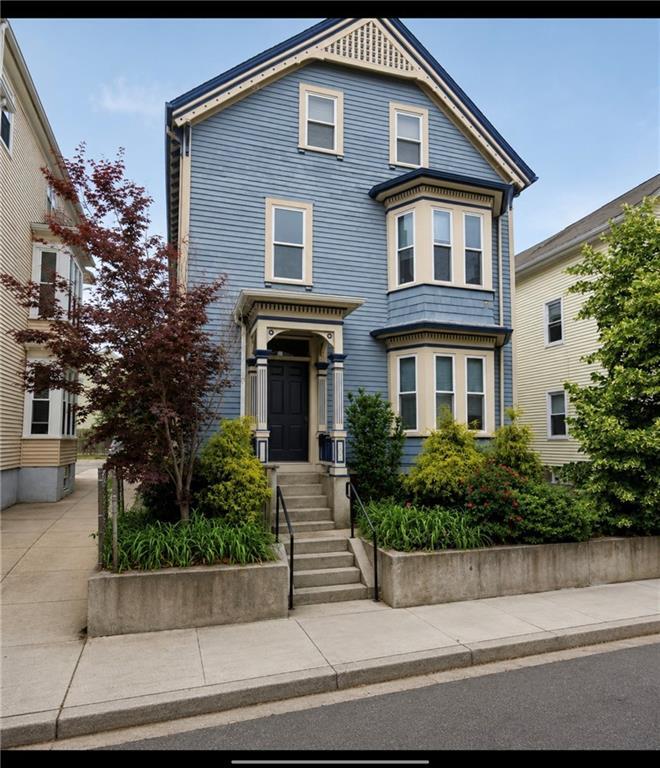
107 Ring St
Providence, RI 02909
Favorites
401-591-7148
-
Bedrooms
3
-
Bathrooms
1
-
Square Feet
1,100 sq ft
-
Available
Available Now
Highlight
- Forced Air Heating and Cooling System
107 Ring St

Favorites
About This Home
$2,500 deposit,
Available Now
MLS ID 1416823
107 Ring St is an apartment community located in Providence County and the 02909 ZIP Code.
* Price shown is base rent. Excludes user-selected optional fees and variable or usage-based fees and required charges due at or prior to move-in or at move-out. Price, availability, fees, and any applicable rent special are subject to change without notice.
* Square footage definitions vary. Displayed square footage is approximate.
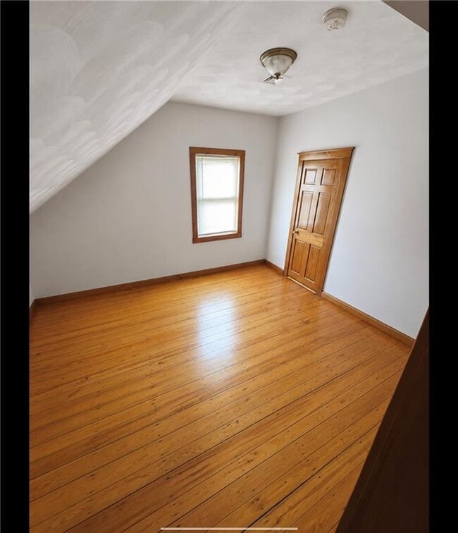
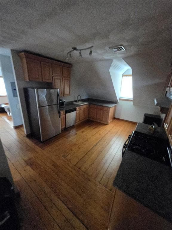
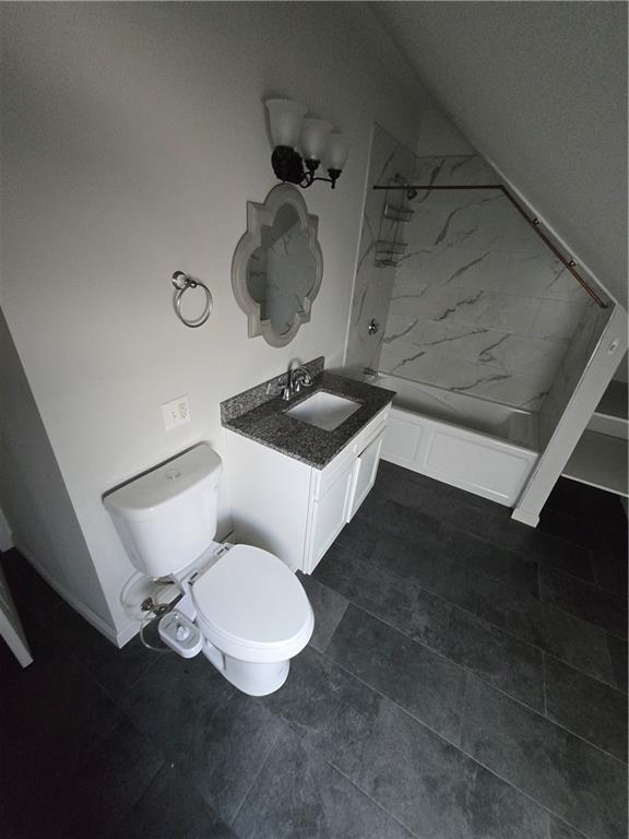
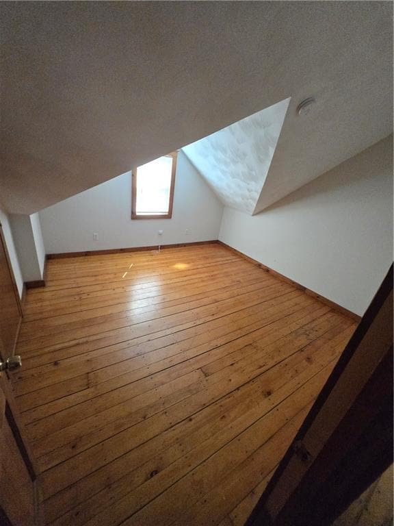
Home Details
Bedrooms and Bathrooms
1 Full Bathroom
3 Bedrooms
Home Design
Apartment
Entry on the 3rd floor
Interior Spaces
1,100 Sq Ft Home
1-Story Property
Listing and Financial Details
Property Available on 7/1/26
12 Month Lease Term
Assessor Parcel Number 107RINGSTPROV
Utilities
Forced Air Heating and Cooling System
Heating System Uses Gas
Community Details
Overview
3 Units
No Home Owners Association
Pet Policy
Pets Allowed
Fees and Policies
The fees listed below are community-provided and may exclude utilities or add-ons. All payments are made directly to the property and are non-refundable unless otherwise specified. Use the Cost Calculator to determine costs based on your needs.
Property Fee Disclaimer: Based on community-supplied data and independent market research. Subject to change without notice. May exclude fees for mandatory or optional services and usage-based utilities.
Contact
- Listed by Jacob Spragg | Fab Living
- Phone Number
- Contact
-
Source
State Wide MLS of Rhode Island, Inc.
Copyright © 2026 State Wide MLS of Rhode Island, Inc. All rights reserved. All information provided by the listing agent/broker is deemed reliable but is not guaranteed and should be independently verified.
Location
Get Directions
Also referred to as the Armory District or simply the West End, West End Providence is the largest neighborhood in the city. This diverse, historic neighborhood is home to the Cranston Street Armory, a landmark listed as its own National Historic District. The armory was built in 1907 and is often used as a filming location by movie studios. The West End underwent revitalization during recent years and continues to offer amazing amenities. The West End is known for its authentic eateries, quirky shops, a vibrant youth arts scene, and strong sense of community. Despite being the largest neighborhood in the city, the West End feels close-knit with community organizations like the West Broadway Neighborhood Association bringing together family and friends to preserve the cultural richness of the area. Fittingly, the West End has a wide range of rentals available ranging from highly affordable to upscale.
Learn more about living in West End Providence
Amenities
- Air Conditioning
Education
| Colleges & Universities | Distance | ||
|---|---|---|---|
| Colleges & Universities | Distance | ||
| Drive: | 4 min | 1.3 mi | |
| Drive: | 3 min | 1.5 mi | |
| Drive: | 5 min | 1.7 mi | |
| Drive: | 5 min | 2.0 mi |
107 Ring St is within 4 minutes or 1.3 miles from C.C. of Rhode Island, Downcity. It is also near Johnson & Wales Univ Downcity and Rhode Island School of Design.
Getting Around
 What do Walkability, Transit, Drivability, and Bikeability mean?
Walkability measures the walking distance to day-to-day needs.
Transit measures access to public transportation.
Drivability measures congestion, parking availability, and access to major roads.
Bikeability measures the suitability for cycling.
How It Works
What do Walkability, Transit, Drivability, and Bikeability mean?
Walkability measures the walking distance to day-to-day needs.
Transit measures access to public transportation.
Drivability measures congestion, parking availability, and access to major roads.
Bikeability measures the suitability for cycling.
How It Works
Very Walkable
Walkability
80
/ 100
Some Public Transit
Transit
50
/ 100
Moderately Drivable
Drivability
60
/ 100
Moderately Bikeable
Bikeability
70
/ 100
Scores provided by
-
Soundscore™
-
/ 100
Traffic
-Airport
-Businesses
-Scores provided by
HowLoud What is a Sound Score Rating? A Sound Score Rating aggregates noise caused by vehicle traffic, airplane traffic and local sources. How It WorksYou May Also Like
-
Highland Hills
210 Highland Corporate Dr
Cumberland, RI 02864
$3,215 - $3,400
3 Br 12.0 mi
-
The Oasis at Plainville
85 Washington St
Plainville, MA 02762
$3,725 Total Monthly Price
3 Br 12 Month Lease 14.5 mi
-
The Point at Wrentham
50 Ledgeview Way
Wrentham, MA 02093
$3,806 - $4,045 Total Monthly Price
3 Br 16.5 mi
Similar Rentals Nearby


107 Ring St
Providence, RI 02909