
AdMo Heights
1777 Columbia Rd NW,
Washington, DC 20009
$1,969 - $2,472
Studio - 1 Bed
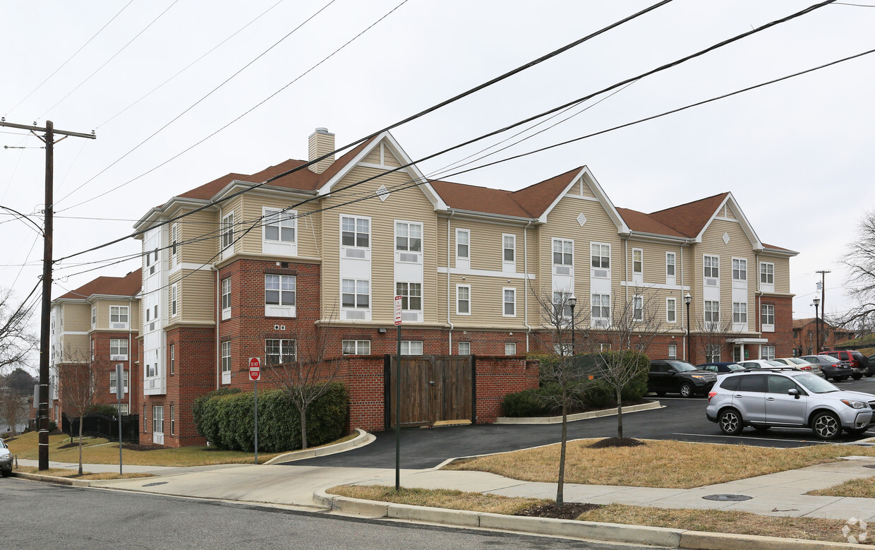
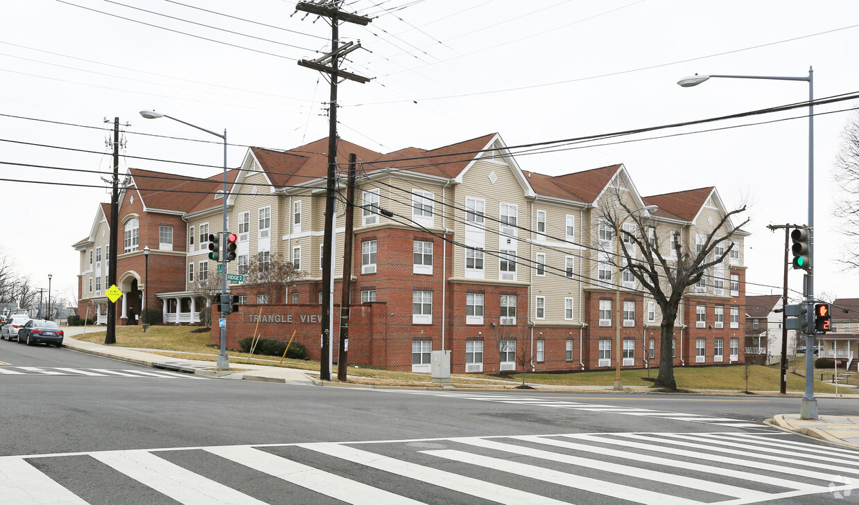
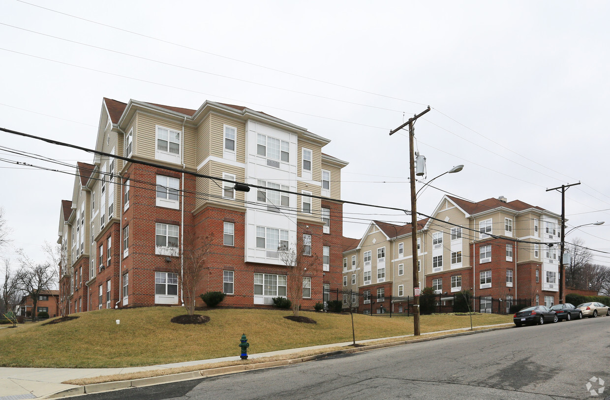
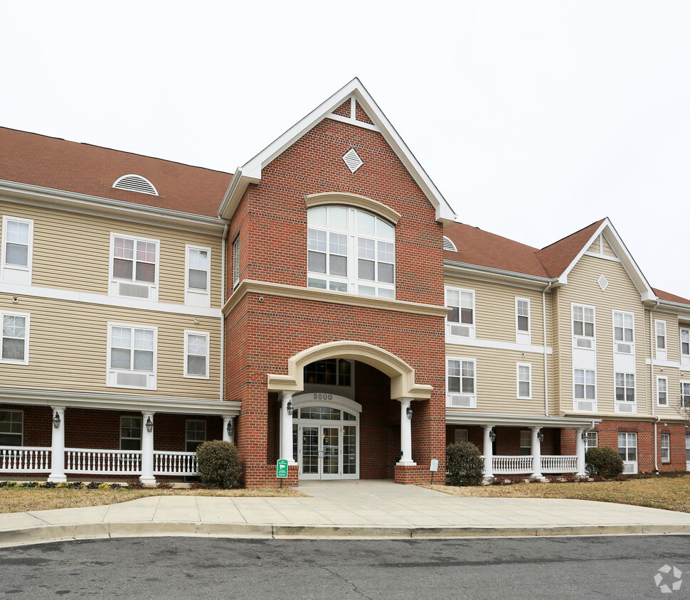
Find true Washington living at Triangle View. This community can be found on B St. Se in Washington. The community staff is ready and waiting for you to come by for a tour. Be sure to come for a visit to see the available floorplan options. It's time to get moving on finding your next place. Contact or stop by Triangle View to talk about leasing your next apartment!
Triangle View is an apartment community located in District of Columbia County and the 20019 ZIP Code. This area is served by the District Of Columbia Public Schools attendance zone.
Elevator
Business Center
Property Manager on Site
Gameroom
Air Conditioning
Refrigerator
Oven
Range
The residential neighborhood of Fort Dupont sits just east of the Anacostia River in Southeast Washington, DC. The neighborhood has ample green space provided by two adjacent parks — Fort Circle Park and Fort Chaplin Park — and distinguishes itself within the Greater Anacostia area by housing the only public indoor ice rink in Washington, DC.
There’s a diverse mix of rentals in Fort Dupont, from more recent and upscale developments to long-standing apartment homes closer to the Anacostia River. Proximity to the Benning Road Metro Station makes Fort Dupont perfect for the Capitol Hill commuter who wishes to reside outside the bustle of DC.
Learn more about living in Fort DupontCompare neighborhood and city base rent averages by bedroom.
| Fort Dupont | Washington, DC | |
|---|---|---|
| Studio | $1,573 | $1,815 |
| 1 Bedroom | $1,223 | $2,240 |
| 2 Bedrooms | $1,374 | $3,075 |
| 3 Bedrooms | $2,187 | $3,937 |
| Colleges & Universities | Distance | ||
|---|---|---|---|
| Colleges & Universities | Distance | ||
| Drive: | 7 min | 3.5 mi | |
| Drive: | 8 min | 4.4 mi | |
| Drive: | 8 min | 4.4 mi | |
| Drive: | 8 min | 4.9 mi |


Transportation options available in Washington include Benning Road, located 0.9 mile from Triangle View. Triangle View is near Ronald Reagan Washington Ntl, located 8.7 miles or 17 minutes away, and Baltimore/Washington International Thurgood Marshall, located 28.5 miles or 42 minutes away.
| Transit / Subway | Distance | ||
|---|---|---|---|
| Transit / Subway | Distance | ||
|
|
Walk: | 17 min | 0.9 mi |
|
|
Drive: | 3 min | 1.2 mi |
| Drive: | 3 min | 1.7 mi | |
|
|
Drive: | 4 min | 2.2 mi |
| Drive: | 4 min | 2.2 mi |
| Commuter Rail | Distance | ||
|---|---|---|---|
| Commuter Rail | Distance | ||
|
|
Drive: | 6 min | 3.7 mi |
|
|
Drive: | 7 min | 3.9 mi |
|
|
Drive: | 9 min | 4.6 mi |
|
|
Drive: | 9 min | 4.6 mi |
|
|
Drive: | 12 min | 6.3 mi |
| Airports | Distance | ||
|---|---|---|---|
| Airports | Distance | ||
|
Ronald Reagan Washington Ntl
|
Drive: | 17 min | 8.7 mi |
|
Baltimore/Washington International Thurgood Marshall
|
Drive: | 42 min | 28.5 mi |
Time and distance from Triangle View.
| Shopping Centers | Distance | ||
|---|---|---|---|
| Shopping Centers | Distance | ||
| Walk: | 10 min | 0.5 mi | |
| Walk: | 11 min | 0.6 mi | |
| Walk: | 17 min | 0.9 mi |
| Parks and Recreation | Distance | ||
|---|---|---|---|
| Parks and Recreation | Distance | ||
|
Fort Dupont Park
|
Drive: | 3 min | 1.1 mi |
|
Kingman and Heritage Island Park
|
Drive: | 3 min | 1.7 mi |
|
Frederick Douglass National Historic Site
|
Drive: | 7 min | 2.8 mi |
|
Washington Youth Garden
|
Drive: | 5 min | 3.2 mi |
|
National Arboretum
|
Drive: | 9 min | 4.0 mi |
| Hospitals | Distance | ||
|---|---|---|---|
| Hospitals | Distance | ||
| Drive: | 11 min | 4.5 mi | |
| Drive: | 10 min | 4.9 mi | |
| Drive: | 12 min | 4.9 mi |
| Military Bases | Distance | ||
|---|---|---|---|
| Military Bases | Distance | ||
| Drive: | 8 min | 3.7 mi | |
| Drive: | 13 min | 4.7 mi |
Pets Allowed Fitness Center Pool Dishwasher Refrigerator Kitchen
What Are Walk Score®, Transit Score®, and Bike Score® Ratings?
Walk Score® measures the walkability of any address. Transit Score® measures access to public transit. Bike Score® measures the bikeability of any address.
What is a Sound Score Rating?
A Sound Score Rating aggregates noise caused by vehicle traffic, airplane traffic and local sources

3600 B St SE
Washington, DC 20019


