
AdMo Heights
1777 Columbia Rd NW,
Washington, DC 20009
$1,639 - $2,478
Studio - 1 Bed

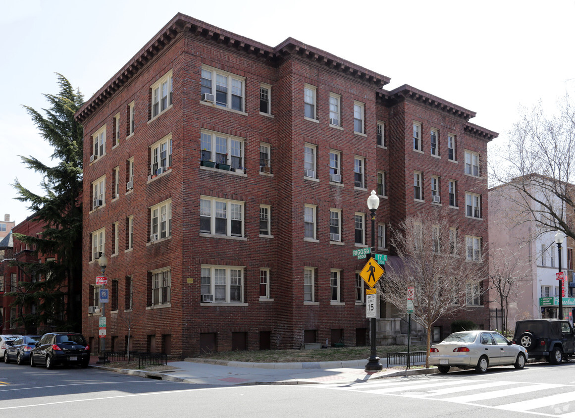
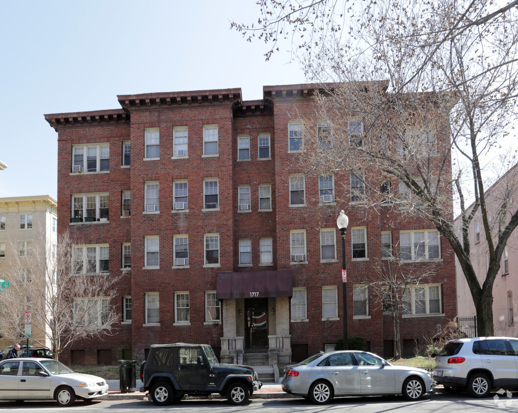


Explore your new apartment at The Traymore in Washington, DC. The 17th St. Nw setting in the 20009 Zip code of Washington is a unique place for you to move to. From amenities to floorplan options, the leasing staff will be ready to help you find your perfect fit. Enjoy a wide selection of fantastic amenities like tile floors, high-speed internet access, and smoke free options. Contact us or drop by to schedule a tour and find your new home at The Traymore.
The Traymore is an apartment community located in District of Columbia County and the 20009 ZIP Code. This area is served by the District Of Columbia Public Schools attendance zone.
High Speed Internet Access
Hardwood Floors
Tile Floors
Smoke Free
Legendary Americans from Frederick Douglass to Woodrow Wilson have called Dupont Circle home at various points over the past two centuries, and it continues to be a highly desirable place to live. The historic architecture of the neighborhood (particularly in the Victorian-era rowhouses) contributes to a distinctly European flair in much of Dupont Circle. This, combined with the presence of numerous foreign embassies and countless international restaurants, creates an unparalleled cosmopolitan atmosphere.
The dining scene also includes a vast selection of more traditional eateries, low-key coffee shops, and convenient grocery stores, giving most folks the option to pick up a quick bite to eat or a week’s worth of necessities with ease. For off hours, museums and galleries are close at hand, and the eclectic nightlife offerings span from alternative rock venues to glitzy clubs to high-end cocktail bars.
Learn more about living in Dupont Circle| Colleges & Universities | Distance | ||
|---|---|---|---|
| Colleges & Universities | Distance | ||
| Walk: | 7 min | 0.4 mi | |
| Walk: | 9 min | 0.5 mi | |
| Drive: | 4 min | 1.3 mi | |
| Drive: | 4 min | 1.5 mi |


Transportation options available in Washington include Dupont Circle, located 0.6 mile from The Traymore. The Traymore is near Ronald Reagan Washington Ntl, located 5.9 miles or 11 minutes away, and Washington Dulles International, located 27.1 miles or 44 minutes away.
| Transit / Subway | Distance | ||
|---|---|---|---|
| Transit / Subway | Distance | ||
|
|
Walk: | 10 min | 0.6 mi |
|
|
Walk: | 15 min | 0.8 mi |
|
|
Walk: | 15 min | 0.8 mi |
|
|
Walk: | 17 min | 0.9 mi |
|
|
Drive: | 3 min | 1.2 mi |
| Commuter Rail | Distance | ||
|---|---|---|---|
| Commuter Rail | Distance | ||
|
|
Drive: | 5 min | 2.4 mi |
|
|
Drive: | 5 min | 2.5 mi |
|
|
Drive: | 5 min | 2.6 mi |
|
|
Drive: | 6 min | 2.6 mi |
|
|
Drive: | 8 min | 4.6 mi |
| Airports | Distance | ||
|---|---|---|---|
| Airports | Distance | ||
|
Ronald Reagan Washington Ntl
|
Drive: | 11 min | 5.9 mi |
|
Washington Dulles International
|
Drive: | 44 min | 27.1 mi |
Time and distance from The Traymore.
| Shopping Centers | Distance | ||
|---|---|---|---|
| Shopping Centers | Distance | ||
| Walk: | 16 min | 0.9 mi | |
| Drive: | 4 min | 1.4 mi | |
| Drive: | 3 min | 1.6 mi |
| Parks and Recreation | Distance | ||
|---|---|---|---|
| Parks and Recreation | Distance | ||
|
National Geographic Museum
|
Walk: | 10 min | 0.6 mi |
|
Meridian Hill Park
|
Walk: | 12 min | 0.7 mi |
|
Mary McLeod Bethune Council House NHS
|
Walk: | 13 min | 0.7 mi |
|
Carter G. Woodson Home National Historic Site
|
Walk: | 18 min | 0.9 mi |
|
National Zoo
|
Drive: | 6 min | 1.8 mi |
| Hospitals | Distance | ||
|---|---|---|---|
| Hospitals | Distance | ||
| Drive: | 4 min | 1.2 mi | |
| Drive: | 3 min | 1.4 mi | |
| Drive: | 5 min | 2.3 mi |
| Military Bases | Distance | ||
|---|---|---|---|
| Military Bases | Distance | ||
| Drive: | 8 min | 3.3 mi | |
| Drive: | 8 min | 3.5 mi | |
| Drive: | 9 min | 4.7 mi |
What Are Walk Score®, Transit Score®, and Bike Score® Ratings?
Walk Score® measures the walkability of any address. Transit Score® measures access to public transit. Bike Score® measures the bikeability of any address.
What is a Sound Score Rating?
A Sound Score Rating aggregates noise caused by vehicle traffic, airplane traffic and local sources
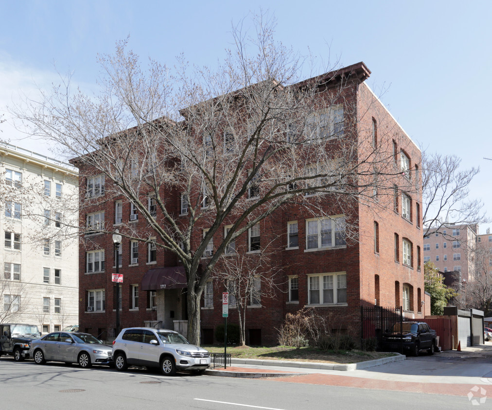
1717 17th St NW
Washington, DC 20009


