
Moment
650 Portland Ave S,
Minneapolis, MN 55415
Studio - 2 Beds $1,465 - $5,618
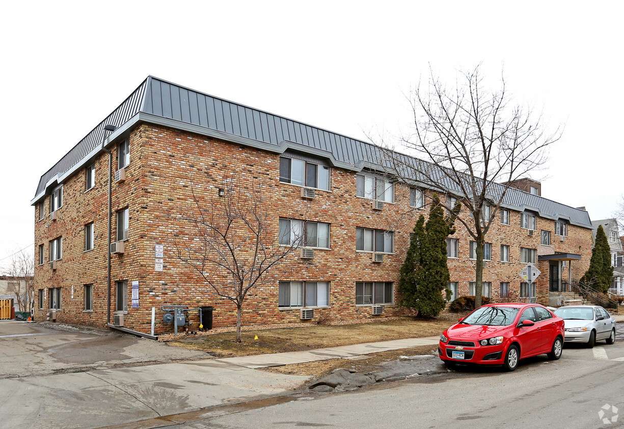
The Bryant completely updated. Spacious 1 & 2 bedroom layouts with all new everything! Enjoy living in a classic area with and updated look! Right out your door you'll find everything to make life fun and easy - from fabulous restaurants to trendy shopping to neighborhood coffee shops. Join one of Steven Scott's Uptown communities. You'll be glad you did!
The Bryant is an apartment community located in Hennepin County and the 55405 ZIP Code. This area is served by the Minneapolis Public School Dist. attendance zone.
Instalaciones de lavandería
Control de accesos
Almacenamiento de bicicletas
Property manager in situ
Aire acondicionado
Lavavajillas
Acceso a Internet de alta velocidad
Suelos de madera maciza
Within the Calhoun-Isles community, Lowry Hill sits just west of Downtown Minneapolis. The population of this area provides a close-knit community of approximately 4,000 residents. Defined by its historical architecture, Lowry Hill's houses display a Victorian style. However, other styles, such as Prairie and Romanesque, make appearances, too. There are upscale apartment communities available here as well, making Lowry Hill an increasingly popular option for those who want to remain close to the city center.
Learn more about living in Lowry Hill| Colleges & Universities | Distance | ||
|---|---|---|---|
| Colleges & Universities | Distance | ||
| Walk: | 18 min | 1.0 mi | |
| Drive: | 5 min | 1.6 mi | |
| Drive: | 5 min | 1.9 mi | |
| Drive: | 6 min | 3.2 mi |


Transportation options available in Minneapolis include Warehouse District/Hennepin Avenue Station, located 1.7 miles from The Bryant. The Bryant is near Minneapolis-St Paul International/Wold-Chamberlain, located 11.2 miles or 21 minutes away.
| Transit / Subway | Distance | ||
|---|---|---|---|
| Transit / Subway | Distance | ||
|
|
Drive: | 5 min | 1.7 mi |
|
|
Drive: | 6 min | 1.9 mi |
|
|
Drive: | 6 min | 2.0 mi |
| Drive: | 6 min | 2.2 mi | |
|
|
Drive: | 7 min | 2.3 mi |
| Commuter Rail | Distance | ||
|---|---|---|---|
| Commuter Rail | Distance | ||
|
|
Drive: | 7 min | 2.3 mi |
|
|
Drive: | 15 min | 9.1 mi |
|
|
Drive: | 17 min | 11.1 mi |
|
|
Drive: | 29 min | 20.3 mi |
|
|
Drive: | 31 min | 21.9 mi |
| Airports | Distance | ||
|---|---|---|---|
| Airports | Distance | ||
|
Minneapolis-St Paul International/Wold-Chamberlain
|
Drive: | 21 min | 11.2 mi |
Time and distance from The Bryant.
| Shopping Centers | Distance | ||
|---|---|---|---|
| Shopping Centers | Distance | ||
| Walk: | 4 min | 0.3 mi | |
| Walk: | 11 min | 0.6 mi | |
| Walk: | 15 min | 0.8 mi |
| Parks and Recreation | Distance | ||
|---|---|---|---|
| Parks and Recreation | Distance | ||
|
Mueller Park
|
Walk: | 7 min | 0.4 mi |
|
Thomas Lowry Park
|
Walk: | 8 min | 0.4 mi |
|
Minneapolis Sculpture Garden
|
Walk: | 12 min | 0.7 mi |
|
Cowles Conservatory
|
Walk: | 13 min | 0.7 mi |
|
Whittier Park
|
Walk: | 14 min | 0.7 mi |
| Hospitals | Distance | ||
|---|---|---|---|
| Hospitals | Distance | ||
| Drive: | 5 min | 1.9 mi | |
| Drive: | 6 min | 2.2 mi | |
| Drive: | 6 min | 2.2 mi |
| Military Bases | Distance | ||
|---|---|---|---|
| Military Bases | Distance | ||
| Drive: | 16 min | 8.2 mi |
What Are Walk Score®, Transit Score®, and Bike Score® Ratings?
Walk Score® measures the walkability of any address. Transit Score® measures access to public transit. Bike Score® measures the bikeability of any address.
What is a Sound Score Rating?
A Sound Score Rating aggregates noise caused by vehicle traffic, airplane traffic and local sources

2101 Bryant Ave S
Minneapolis, MN 55405


