
Moment
650 Portland Ave S,
Minneapolis, MN 55415
Studio - 2 Beds $1,501 - $5,618

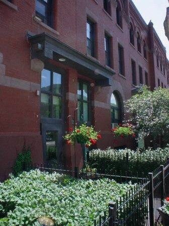
The Adams offers 76 efficiency apartment units that are home to many. The streetscape surrounding The Adams incorporates historic lighting, attractive plantings and public gateway art heralding the entryway to downtown Minneapolis and the Elliot Park neighborhood.
The Adams is an apartment community located in Hennepin County and the 55404 ZIP Code. This area is served by the Minneapolis Public School Dist. attendance zone.
High Speed Internet Access
Refrigerator
Smoke Free
Oven
One of the area's oldest neighborhoods, Elliot Park is a tight-knit community with historic character. Located just one mile from Downtown Minneapolis and 12 miles from St. Paul, the area has some unique shops and restaurants. With an excellent school system and plentiful recreational activities, Elliot Park provides residents with a conveniently active lifestyle. There’s an array of apartments and single-family homes that provides renters with amazing options for living in Elliot Park.
Learn more about living in Elliot Park| Colleges & Universities | Distance | ||
|---|---|---|---|
| Colleges & Universities | Distance | ||
| Walk: | 7 min | 0.4 mi | |
| Walk: | 12 min | 0.6 mi | |
| Walk: | 18 min | 0.9 mi | |
| Drive: | 6 min | 2.7 mi |


Transportation options available in Minneapolis include Government Plaza Station, located 0.5 mile from The Adams. The Adams is near Minneapolis-St Paul International/Wold-Chamberlain, located 10.2 miles or 21 minutes away.
| Transit / Subway | Distance | ||
|---|---|---|---|
| Transit / Subway | Distance | ||
|
|
Walk: | 10 min | 0.5 mi |
|
|
Walk: | 11 min | 0.6 mi |
|
|
Walk: | 14 min | 0.7 mi |
|
|
Walk: | 17 min | 0.9 mi |
| Walk: | 19 min | 1.0 mi |
| Commuter Rail | Distance | ||
|---|---|---|---|
| Commuter Rail | Distance | ||
|
|
Drive: | 5 min | 1.4 mi |
|
|
Drive: | 15 min | 10.1 mi |
|
|
Drive: | 16 min | 10.5 mi |
|
|
Drive: | 30 min | 21.2 mi |
|
|
Drive: | 31 min | 22.9 mi |
| Airports | Distance | ||
|---|---|---|---|
| Airports | Distance | ||
|
Minneapolis-St Paul International/Wold-Chamberlain
|
Drive: | 21 min | 10.2 mi |
Time and distance from The Adams.
| Shopping Centers | Distance | ||
|---|---|---|---|
| Shopping Centers | Distance | ||
| Walk: | 13 min | 0.7 mi | |
| Walk: | 14 min | 0.7 mi | |
| Walk: | 17 min | 0.9 mi |
| Parks and Recreation | Distance | ||
|---|---|---|---|
| Parks and Recreation | Distance | ||
|
Franklin Steele Square
|
Walk: | 6 min | 0.3 mi |
|
Elliot Park
|
Walk: | 8 min | 0.4 mi |
|
Stevens Square Park
|
Walk: | 14 min | 0.8 mi |
|
Peavey Park
|
Walk: | 15 min | 0.8 mi |
|
Loring Park
|
Walk: | 17 min | 0.9 mi |
| Hospitals | Distance | ||
|---|---|---|---|
| Hospitals | Distance | ||
| Walk: | 7 min | 0.4 mi | |
| Drive: | 4 min | 1.2 mi | |
| Drive: | 4 min | 1.6 mi |
| Military Bases | Distance | ||
|---|---|---|---|
| Military Bases | Distance | ||
| Drive: | 16 min | 7.2 mi |
What Are Walk Score®, Transit Score®, and Bike Score® Ratings?
Walk Score® measures the walkability of any address. Transit Score® measures access to public transit. Bike Score® measures the bikeability of any address.
What is a Sound Score Rating?
A Sound Score Rating aggregates noise caused by vehicle traffic, airplane traffic and local sources
500 S 10th St
Minneapolis, MN 55404


