
Hazel National Landing
3030 S Potomac Ave,
Arlington, VA 22202
$2,135 - $6,199
Studio - 2 Beds

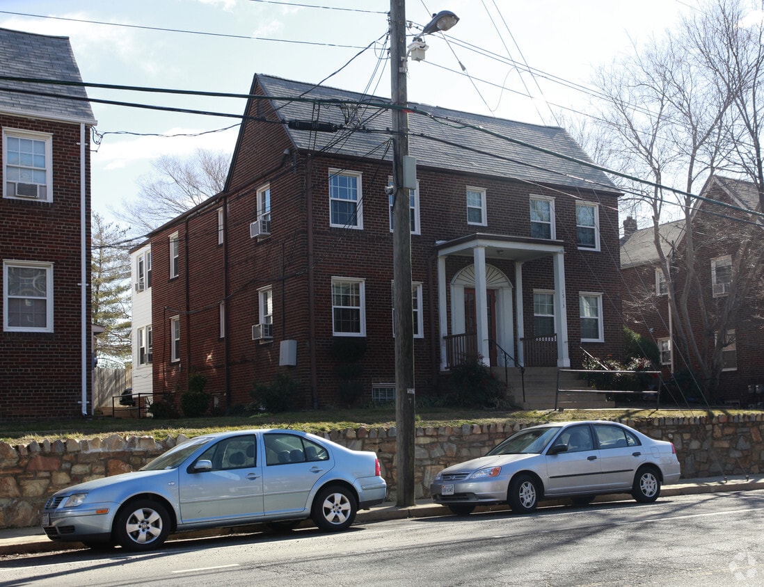

Discover Rhodes Street in Arlington. This community can be found in the 22209 area of Arlington. Schedule a time to check out the apartment floorplan options. From location to floorplan options, the community staff is ready and waiting to help you find the perfect place. Come see Rhodes Street today.
Rhodes Street is an apartment community located in Arlington County and the 22209 ZIP Code. This area is served by the Arlington County Public Schools attendance zone.
Air Conditioning
Dishwasher
Hardwood Floors
Heating
Directly across the Potomac River from Washington, D.C., Arlington is less a suburb than an extension of the nation’s capital. It’s the home of the Pentagon, Arlington National Cemetery, and Ronald Reagan Washington National Airport, with a number of waterfront parks offering beautiful views across the river to the National Mall.
The community provides a wide range of living options, from apartments, townhomes, and duplexes to condos and houses. A major reason for Arlington’s popularity is that there is so much to do. Washington may be packed with monuments, museums, and other sightseeing landmarks, but Arlington holds the advantage when it comes to the more day-to-day shopping, dining, entertainment, and nightlife.
You’ll have several options for getting around town or into D.C., whether you choose to drive, take the Metro, or ride your bike — Arlington has earned a silver rating from the League of American Bicyclists.
Learn more about living in Arlington| Colleges & Universities | Distance | ||
|---|---|---|---|
| Colleges & Universities | Distance | ||
| Drive: | 5 min | 1.6 mi | |
| Drive: | 6 min | 2.2 mi | |
| Drive: | 5 min | 2.7 mi | |
| Drive: | 8 min | 3.1 mi |


Transportation options available in Arlington include Court House, Orange,Silver Line Center Platform, located 0.6 mile from Rhodes Street. Rhodes Street is near Ronald Reagan Washington Ntl, located 5.4 miles or 10 minutes away, and Washington Dulles International, located 24.8 miles or 40 minutes away.
| Transit / Subway | Distance | ||
|---|---|---|---|
| Transit / Subway | Distance | ||
| Walk: | 10 min | 0.6 mi | |
|
|
Walk: | 14 min | 0.7 mi |
|
|
Drive: | 4 min | 1.6 mi |
|
|
Drive: | 3 min | 1.7 mi |
|
|
Drive: | 5 min | 1.9 mi |
| Commuter Rail | Distance | ||
|---|---|---|---|
| Commuter Rail | Distance | ||
|
|
Drive: | 8 min | 3.8 mi |
|
|
Drive: | 8 min | 3.8 mi |
|
|
Drive: | 7 min | 3.9 mi |
|
|
Drive: | 9 min | 4.9 mi |
|
|
Drive: | 10 min | 5.1 mi |
| Airports | Distance | ||
|---|---|---|---|
| Airports | Distance | ||
|
Ronald Reagan Washington Ntl
|
Drive: | 10 min | 5.4 mi |
|
Washington Dulles International
|
Drive: | 40 min | 24.8 mi |
Time and distance from Rhodes Street.
| Shopping Centers | Distance | ||
|---|---|---|---|
| Shopping Centers | Distance | ||
| Walk: | 6 min | 0.3 mi | |
| Walk: | 17 min | 0.9 mi | |
| Drive: | 4 min | 1.5 mi |
| Parks and Recreation | Distance | ||
|---|---|---|---|
| Parks and Recreation | Distance | ||
|
Fort Bennett Park and Palisades Trail
|
Walk: | 14 min | 0.8 mi |
|
Old Stone House
|
Drive: | 5 min | 1.9 mi |
|
Fort C.F. Smith Park & Historic Site
|
Drive: | 6 min | 2.1 mi |
|
Lincoln Memorial
|
Drive: | 5 min | 2.4 mi |
|
Theodore Roosevelt Island Park
|
Drive: | 6 min | 3.1 mi |
| Hospitals | Distance | ||
|---|---|---|---|
| Hospitals | Distance | ||
| Drive: | 7 min | 2.4 mi | |
| Drive: | 4 min | 2.8 mi | |
| Drive: | 7 min | 2.8 mi |
| Military Bases | Distance | ||
|---|---|---|---|
| Military Bases | Distance | ||
| Drive: | 4 min | 1.8 mi |

What Are Walk Score®, Transit Score®, and Bike Score® Ratings?
Walk Score® measures the walkability of any address. Transit Score® measures access to public transit. Bike Score® measures the bikeability of any address.
What is a Sound Score Rating?
A Sound Score Rating aggregates noise caused by vehicle traffic, airplane traffic and local sources
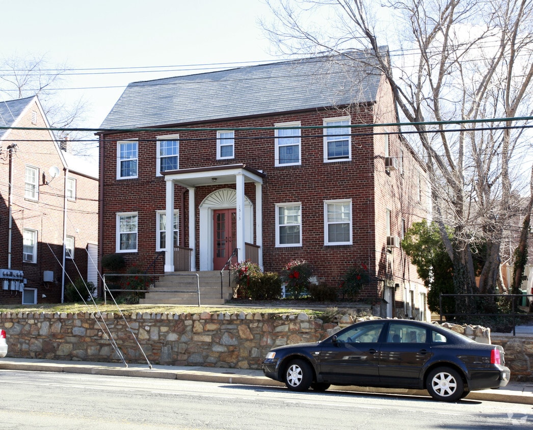
1513 N Rhodes St
Arlington, VA 22209


