
Living at NoHo
11059 McCormick St,
North Hollywood, CA 91601
$2,248 - $3,858 Total Monthly Price
Studio - 3 Beds

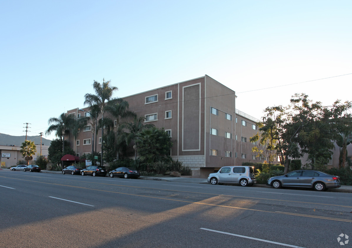

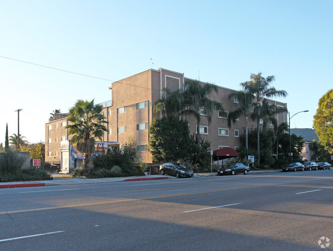
Come enjoy Burbank living at Park Verdugo Apartments. The 320 W Verdugo Ave location in the Rancho Adjacent neighborhood of Burbank has much to offer its residents. The leasing staff is ready to help you find your perfect home. Contact us today to schedule a tour and find your new place at Park Verdugo Apartments.
Park Verdugo Apartments is an apartment community located in Los Angeles County and the 91506 ZIP Code. This area is served by the Burbank Unified School District attendance zone.
Aire acondicionado
Acceso a Internet de alta velocidad
Nevera
Libre de humo
Rancho Adjacent, near the center of Burbank, combines a mixture of single-family homes, apartments, small and large commercial areas, industrial zones, and city government buildings. Residents enjoy the convenience of having a variety goods and services within a short drive. Rancho Adjacent borders the horse-oriented neighborhood known as Rancho just south of the community.
Bordered by Verdugo and Alameda Avenues, Rancho Adjacent stretches from Hollywood Way across Interstate 5 to Glenoaks Boulevard. Olive Avenue cuts diagonally through the neighborhood and is lined with restaurants and small businesses. Rancho Adjacent also lies just north of the Ventura Freeway, a major east-west link across the San Fernando Valley. Downtown Los Angeles rests 13 miles south of Rancho Adjacent, making this compact community a great choice no matter where your commute takes you.
Learn more about living in Rancho AdjacentCompare neighborhood and city base rent averages by bedroom.
| Rancho Adjacent | Burbank, CA | |
|---|---|---|
| Studio | $1,960 | $1,929 |
| 1 Bedroom | $1,843 | $2,224 |
| 2 Bedrooms | $2,294 | $2,921 |
| 3 Bedrooms | $2,720 | $3,926 |
| Colleges & Universities | Distance | ||
|---|---|---|---|
| Colleges & Universities | Distance | ||
| Drive: | 4 min | 2.2 mi | |
| Drive: | 8 min | 4.3 mi | |
| Drive: | 9 min | 5.7 mi | |
| Drive: | 12 min | 6.1 mi |


Transportation options available in Burbank include Universal City/Studio City, located 4.7 miles from Park Verdugo Apartments. Park Verdugo Apartments is near Bob Hope, located 6.1 miles or 11 minutes away, and Los Angeles International, located 25.4 miles or 38 minutes away.
| Transit / Subway | Distance | ||
|---|---|---|---|
| Transit / Subway | Distance | ||
|
|
Drive: | 8 min | 4.7 mi |
|
|
Drive: | 8 min | 5.2 mi |
|
|
Drive: | 11 min | 6.4 mi |
|
|
Drive: | 11 min | 6.8 mi |
|
|
Drive: | 11 min | 7.4 mi |
| Commuter Rail | Distance | ||
|---|---|---|---|
| Commuter Rail | Distance | ||
|
|
Drive: | 3 min | 1.3 mi |
| Drive: | 7 min | 3.9 mi | |
|
|
Drive: | 8 min | 4.1 mi |
|
|
Drive: | 8 min | 5.4 mi |
|
|
Drive: | 9 min | 6.5 mi |
| Airports | Distance | ||
|---|---|---|---|
| Airports | Distance | ||
|
Bob Hope
|
Drive: | 11 min | 6.1 mi |
|
Los Angeles International
|
Drive: | 38 min | 25.4 mi |
Scores provided by
Traffic
-Airport
-Businesses
-Scores provided by
HowLoud What is a Sound Score Rating? A Sound Score Rating aggregates noise caused by vehicle traffic, airplane traffic and local sources. How It WorksTime and distance from Park Verdugo Apartments.
| Shopping Centers | Distance | ||
|---|---|---|---|
| Shopping Centers | Distance | ||
| Walk: | 7 min | 0.4 mi | |
| Walk: | 8 min | 0.4 mi | |
| Walk: | 11 min | 0.6 mi |
| Parks and Recreation | Distance | ||
|---|---|---|---|
| Parks and Recreation | Distance | ||
|
Los Angeles Zoo
|
Drive: | 13 min | 3.9 mi |
|
Bird Sanctuary
|
Drive: | 11 min | 6.4 mi |
|
Griffith Observatory
|
Drive: | 15 min | 7.6 mi |
|
Griffith Park
|
Drive: | 24 min | 9.8 mi |
|
La Tuna Canyon Park
|
Drive: | 15 min | 10.3 mi |
| Hospitals | Distance | ||
|---|---|---|---|
| Hospitals | Distance | ||
| Drive: | 3 min | 1.4 mi | |
| Drive: | 7 min | 5.1 mi | |
| Drive: | 9 min | 6.0 mi |
| Military Bases | Distance | ||
|---|---|---|---|
| Military Bases | Distance | ||
| Drive: | 35 min | 27.0 mi |
What Are Walk Score®, Transit Score®, and Bike Score® Ratings?
Walk Score® measures the walkability of any address. Transit Score® measures access to public transit. Bike Score® measures the bikeability of any address.
What is a Sound Score Rating?
A Sound Score Rating aggregates noise caused by vehicle traffic, airplane traffic and local sources.
320 W Alameda Ave
Burbank, CA 91506


