
Moment
650 Portland Ave S,
Minneapolis, MN 55415
Studio - 2 Beds $1,501 - $5,661
We will accommodate tours via Facebook messenger to respect social distancing."
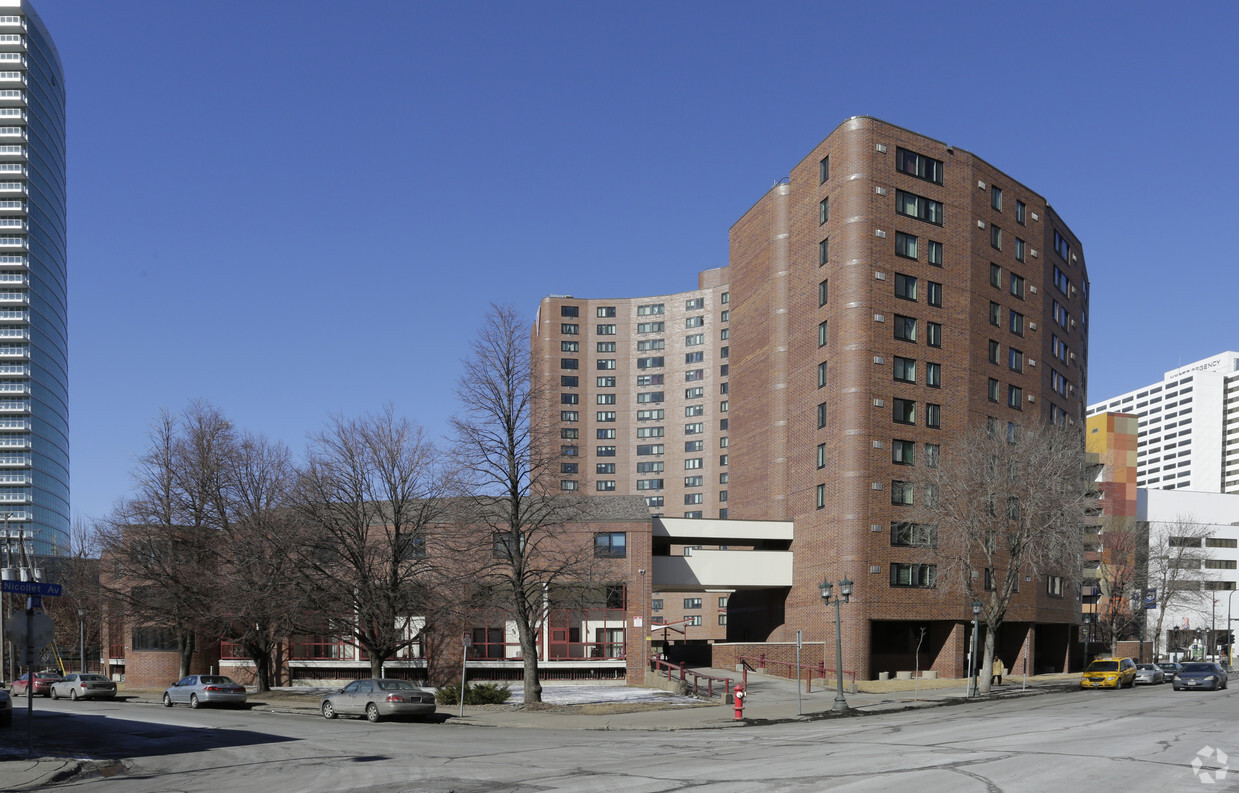
Nicollet Towers is an apartment community located in Hennepin County and the 55403 ZIP Code. This area is served by the Minneapolis Public School Dist. attendance zone.
High Speed Internet Access
Smoke Free
Heating
Range
Positioned on the southwestern edge of Downtown Minneapolis, Loring Park combines the natural beauty of its namesake park with a close proximity to the vibrant and bustling heart of the city. Known colloquially as the Central Park of the Minneapolis, this diverse neighborhood offers the ideal compromise of living downtown yet still being able to enjoy a beautiful, natural setting.
Nestled between the Minneapolis Convention Center and the intersection of I-94 and I-394, Loring Park is close to everything you love about Minneapolis, from the Walker Art Center to Target Field—home of the Minnesota Twins. Nearby performance venues include Orpheum Theatre, State Theatre, and First Avenue. Just minutes from Loring Park, you'll find the University of Minnesota, the Minneapolis Institute of Art, Bde Maka Ska Park, and the Children's Minnesota Hospital.
Learn more about living in Loring Park| Colleges & Universities | Distance | ||
|---|---|---|---|
| Colleges & Universities | Distance | ||
| Walk: | 6 min | 0.4 mi | |
| Walk: | 7 min | 0.4 mi | |
| Walk: | 19 min | 1.0 mi | |
| Drive: | 7 min | 3.2 mi |


Transportation options available in Minneapolis include Nicollet Mall Station, located 0.8 mile from Nicollet Towers. Nicollet Towers is near Minneapolis-St Paul International/Wold-Chamberlain, located 12.6 miles or 21 minutes away.
| Transit / Subway | Distance | ||
|---|---|---|---|
| Transit / Subway | Distance | ||
|
|
Walk: | 15 min | 0.8 mi |
|
|
Walk: | 17 min | 0.9 mi |
|
|
Drive: | 4 min | 1.1 mi |
|
|
Drive: | 4 min | 1.2 mi |
| Drive: | 4 min | 1.3 mi |
| Commuter Rail | Distance | ||
|---|---|---|---|
| Commuter Rail | Distance | ||
|
|
Drive: | 4 min | 1.3 mi |
|
|
Drive: | 15 min | 9.1 mi |
|
|
Drive: | 18 min | 11.0 mi |
|
|
Drive: | 29 min | 20.2 mi |
|
|
Drive: | 31 min | 21.9 mi |
| Airports | Distance | ||
|---|---|---|---|
| Airports | Distance | ||
|
Minneapolis-St Paul International/Wold-Chamberlain
|
Drive: | 21 min | 12.6 mi |
Time and distance from Nicollet Towers.
| Shopping Centers | Distance | ||
|---|---|---|---|
| Shopping Centers | Distance | ||
| Walk: | 7 min | 0.4 mi | |
| Walk: | 17 min | 0.9 mi | |
| Drive: | 4 min | 1.3 mi |
| Parks and Recreation | Distance | ||
|---|---|---|---|
| Parks and Recreation | Distance | ||
|
Loring Park
|
Walk: | 3 min | 0.2 mi |
|
Stevens Square Park
|
Walk: | 9 min | 0.5 mi |
|
Cowles Conservatory
|
Walk: | 10 min | 0.6 mi |
|
Minneapolis Sculpture Garden
|
Walk: | 11 min | 0.6 mi |
|
Franklin Steele Square
|
Walk: | 15 min | 0.8 mi |
| Hospitals | Distance | ||
|---|---|---|---|
| Hospitals | Distance | ||
| Drive: | 4 min | 1.3 mi | |
| Drive: | 5 min | 1.7 mi | |
| Drive: | 6 min | 2.1 mi |
| Military Bases | Distance | ||
|---|---|---|---|
| Military Bases | Distance | ||
| Drive: | 17 min | 8.1 mi |
What Are Walk Score®, Transit Score®, and Bike Score® Ratings?
Walk Score® measures the walkability of any address. Transit Score® measures access to public transit. Bike Score® measures the bikeability of any address.
What is a Sound Score Rating?
A Sound Score Rating aggregates noise caused by vehicle traffic, airplane traffic and local sources

1350 Nicollet Mall
Minneapolis, MN 55403


