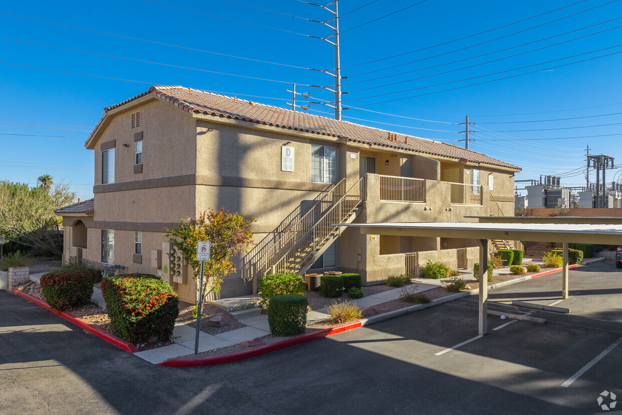
Mannetta Lane
1401 N Michael Way,
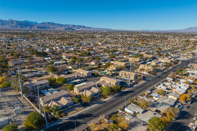
Las Vegas,
NV
89108
2 Weeks Ago
|
Edit
Favorites
Mannetta Lane

Favorites
Highlights
- Pool
- Spa
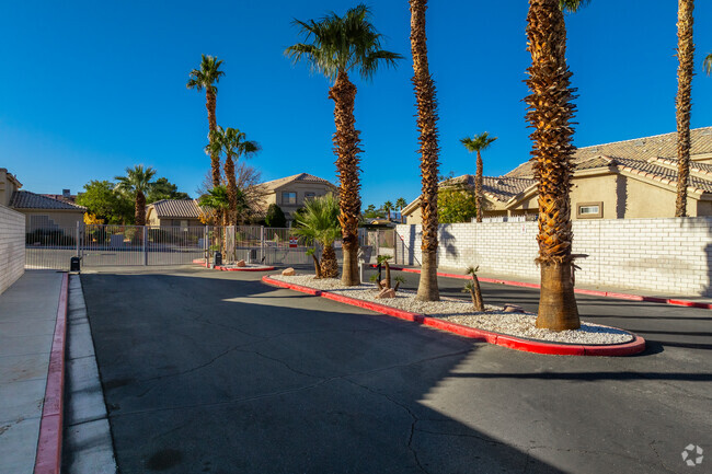
- Gated
- Grill
- Balcony
- Hardwood Floors
Pricing & Floor Plans
Check Back Soon for Upcoming Availability
Fees and Policies
Details
Property Information
-
Built in 2000
-
90 units/2 stories
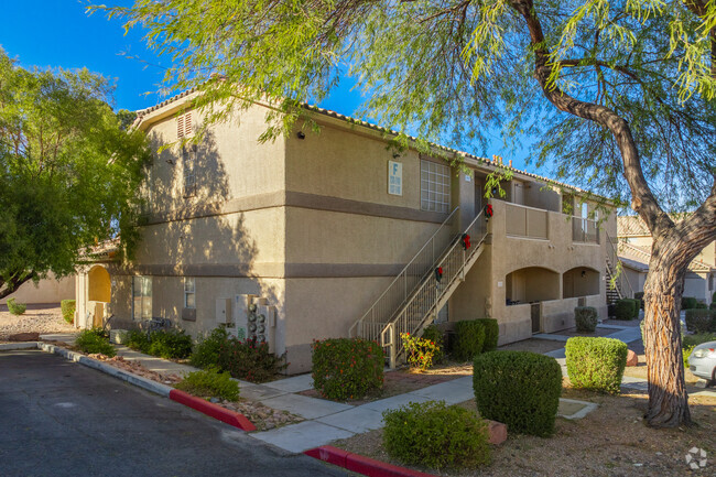
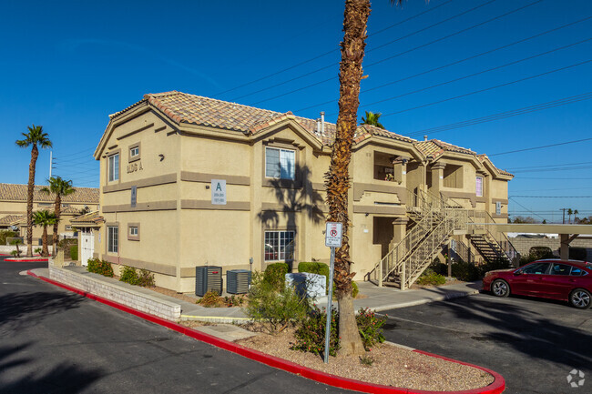
About Mannetta Lane
Thanks for your interest in Mannetta Lane. Located at 1401 N Michael Way in Las Vegas, this community is convenient to everything. The leasing team is ready to help you find your new home. It's time to find your new home. Contact or stop by the Mannetta Lane leasing office to learn more about our community.
Mannetta Lane is an apartment community located in Clark County and the 89108 ZIP Code. This area is served by the Clark County attendance zone.
Community Amenities
Pool
Fitness Center
Clubhouse
Grill
- Clubhouse
- Fitness Center
- Spa
- Pool
- Gated
- Grill
Apartment Features
Air Conditioning
Hardwood Floors
Refrigerator
Tub/Shower
- Air Conditioning
- Heating
- Tub/Shower
- Kitchen
- Oven
- Range
- Refrigerator
- Hardwood Floors
- Balcony
Location
Get Directions
Tucked between Rancho Drive and the 95, Michael Way encompasses a number of prime suburban hotspots, all of them just six miles from the famous Las Vegas Strip. The area is classic Vegas with its towering palm trees, succulent gardens, and stucco homes. Three parks and the Las Vegas Golf Club round out Michael Way’s green space access, making for plenty of recreational escape from the desert landscape.
Chain restaurants and well-known retailers cater to most needs, but with the Strip so close there’s more unique fare and shopping to experience in just a matter of minutes. Domestic travelers will get plenty of use out of the North Las Vegas Airport that sits just across the 95, and those who commute for work by car are right next to the 15 and 95 junction.
Learn more about living in Michael WayBelow are rent ranges for similar nearby apartments
Amenities
- Clubhouse
- Gated
- Grill
- Fitness Center
- Spa
- Pool
- Air Conditioning
- Heating
- Tub/Shower
- Kitchen
- Oven
- Range
- Refrigerator
- Hardwood Floors
- Balcony
Average Prices by Area
Compare neighborhood and city base rent averages by bedroom.
| Michael Way | Las Vegas, NV | |
|---|---|---|
| Studio | $1,088 | $988 |
| 1 Bedroom | $1,199 | $1,267 |
| 2 Bedrooms | $1,431 | $1,521 |
| 3 Bedrooms | $1,717 | $1,837 |
Education
| Colleges & Universities | Distance | ||
|---|---|---|---|
| Colleges & Universities | Distance | ||
| Drive: | 8 min | 3.4 mi | |
| Drive: | 8 min | 4.6 mi | |
| Drive: | 15 min | 8.4 mi | |
| Drive: | 18 min | 9.6 mi |
Mannetta Lane is within 8 minutes or 3.4 miles from Southern Nevada, Charleston. It is also near Nev. State Coll., Shadow Lane and Southern Nevada, Cheyenne.
Schools


Public Elementary School
Grades PK-5
607 Students
Attendance Zone
Public Middle School
Grades 6-8
1,195 Students
Attendance Zone
Public High School
Grades 9-12
2,949 Students
Attendance Zone
Private Elementary School
Grades PK-2
Nearby
Private Elementary, Middle & High School
Grades K-12
153 Students
Nearby
Private Elementary & Middle School
Grades K-8
239 Students
Nearby
School data provided by
 The GreatSchools Rating helps parents compare schools within a state based on a variety of school quality indicators and provides a helpful picture of how effectively each school serves all of its students. Ratings are on a scale of 1 (below average) to 10 (above average) and can include test scores, college readiness, academic progress, advanced courses, equity, discipline and attendance data. We also advise parents to visit schools, consider other information on school performance and programs, and consider family needs as part of the school selection process.
View GreatSchools Rating Methodology
Data provided by GreatSchools.org © 2026. All rights reserved.
View GreatSchools Rating Methodology
Data provided by GreatSchools.org © 2026. All rights reserved.
Transportation options available in Las Vegas include Sahara Station, located 6.5 miles from Mannetta Lane. Mannetta Lane is near Harry Reid International, located 10.8 miles or 20 minutes away, and Boulder City Municipal, located 31.1 miles or 41 minutes away.
| Transit / Subway | Distance | ||
|---|---|---|---|
| Transit / Subway | Distance | ||
|
|
Drive: | 12 min | 6.5 mi |
|
|
Drive: | 14 min | 6.9 mi |
|
|
Drive: | 12 min | 7.5 mi |
|
|
Drive: | 15 min | 7.5 mi |
|
|
Drive: | 15 min | 8.4 mi |
| Airports | Distance | ||
|---|---|---|---|
| Airports | Distance | ||
|
Harry Reid International
|
Drive: | 20 min | 10.8 mi |
|
Boulder City Municipal
|
Drive: | 41 min | 31.1 mi |
Time and distance from Mannetta Lane.
| Shopping Centers | Distance | ||
|---|---|---|---|
| Shopping Centers | Distance | ||
| Walk: | 12 min | 0.7 mi | |
| Walk: | 13 min | 0.7 mi | |
| Walk: | 15 min | 0.8 mi |
Mannetta Lane has 3 shopping centers within 0.8 mile, which is about a 15-minute walk. The miles and minutes will be for the farthest away property.
| Parks and Recreation | Distance | ||
|---|---|---|---|
| Parks and Recreation | Distance | ||
|
Springs Preserve
|
Drive: | 6 min | 2.5 mi |
|
Spring Mountains National Recreation Area
|
Drive: | 9 min | 5.3 mi |
|
DISCOVERY Children's Museum
|
Drive: | 9 min | 5.8 mi |
|
Las Vegas Natural History Museum
|
Drive: | 9 min | 5.9 mi |
|
Old Las Vegas Mormon State Historic Park
|
Drive: | 9 min | 6.0 mi |
Mannetta Lane has 5 parks within 6.0 miles, including Springs Preserve, Spring Mountains National Recreation Area, and Las Vegas Natural History Museum.
| Hospitals | Distance | ||
|---|---|---|---|
| Hospitals | Distance | ||
| Drive: | 5 min | 2.5 mi | |
| Drive: | 6 min | 3.8 mi | |
| Drive: | 8 min | 4.3 mi |
Mannetta Lane has 3 hospitals within 4.3 miles, the nearest is Southern Nevada Adult Mental Health Services which is 2.5 miles away and a 5 minute drive.
| Military Bases | Distance | ||
|---|---|---|---|
| Military Bases | Distance | ||
| Drive: | 28 min | 15.6 mi |
Mannetta Lane is 15.6 miles and a 28 minute drive from Nellis Air Force Base.
You May Also Like
-
The Allister
5145 Rawhide St
Las Vegas, NV 89122
$1,228 - $1,793 Total Monthly Price
1-3 Br 10.9 mi
-
Pacific Islands in Green Valley
2151 N Green Valley Pky
Henderson, NV 89074
$1,398 - $2,243 Total Monthly Price
1-3 Br 11.9 mi
-
Palm Villas at Whitney Ranch
650 Whitney Ranch Dr
Henderson, NV 89014
$1,318 - $2,473 Total Monthly Price
1-3 Br 12.4 mi
Does Mannetta Lane have in-unit laundry?
Mannetta Lane does not offer in-unit laundry or shared facilities. Please contact the property to learn about nearby laundry options.
What utilities are included in rent at Mannetta Lane?
Utilities are not included in rent. Residents should plan to set up and pay for all services separately.
Is parking available at Mannetta Lane?
Contact this property for parking details.
Is Mannetta Lane pet-friendly?
Mannetta Lane does not allow pets, though service animals are always welcome in accordance with applicable laws.
Does Mannetta Lane have move-in specials?
Mannetta Lane is not currently offering any rent specials. Check back soon, as promotions change frequently.
Does Mannetta Lane offer Matterport 3D tours?
While Mannetta Lane does not offer Matterport 3D tours, renters can request a tour directly through our online platform.
Similar Rentals Nearby
-
-
-
-
1 Bed$1,242+2 Beds$1,317+Total Monthly PriceTotal Monthly Price NewPrices include required monthly fees of $62.Base Rent:1 Bed$1,180+2 Beds$1,255+1 Month Free
Pets Allowed Fitness Center Pool Dishwasher Refrigerator Kitchen
-
1 Bed$1,110+2 Beds$1,365+Total Monthly Price12 Month LeaseTotal Monthly Price NewPrices include required monthly fees of $80.Base Rent:1 Bed$1,030+2 Beds$1,285+Specials
Fitness Center Pool In Unit Washer & Dryer Stainless Steel Appliances Ceiling Fans Granite Countertops Furnished
-
1 Bed$1,664+2 Beds$2,001+3 Beds$2,400+Total Monthly PriceTotal Monthly Price NewPrices include base rent and required monthly fees of $265. Variable costs based on usage may apply.Base Rent:1 Bed$1,399+2 Beds$1,736+3 Beds$2,135+Specials
Pets Allowed Fitness Center Pool Maintenance on site Stainless Steel Appliances Granite Countertops Playground
-
1 Bed$1,002+2 Beds$1,177+3 Beds$1,865+Total Monthly PriceTotal Monthly Price NewPrices include base rent and required monthly fees. Variable costs based on usage may apply.2 Months Free
Pets Allowed Fitness Center Pool Dishwasher Kitchen In Unit Washer & Dryer
-
1 Bed$1,394+2 Beds$1,479+3 Beds$1,719+Total Monthly PriceTotal Monthly Price NewPrices include base rent and required monthly fees of $64. Variable costs based on usage may apply.Base Rent:1 Bed$1,330+2 Beds$1,415+3 Beds$1,655+Specials
Pets Allowed Fitness Center In Unit Washer & Dryer Maintenance on site Stainless Steel Appliances Business Center Granite Countertops
-
1 Bed$1,1502 Beds$1,5003 Beds$1,800Total Monthly PriceTotal Monthly Price NewPrices include base rent and required monthly fees. Variable costs based on usage may apply.
Pets Allowed Fitness Center Pool Dishwasher Refrigerator Kitchen
-
1 Bed$1,144+2 Beds$1,294+3 Beds$1,849+Total Monthly PriceTotal Monthly Price NewPrices include base rent and required monthly fees. Variable costs based on usage may apply.1 Month Free
Pets Allowed Pool Dishwasher Kitchen In Unit Washer & Dryer Balcony Disposal


What Are Walk Score®, Transit Score®, and Bike Score® Ratings?
Walk Score® measures the walkability of any address. Transit Score® measures access to public transit. Bike Score® measures the bikeability of any address.
What is a Sound Score Rating?
A Sound Score Rating aggregates noise caused by vehicle traffic, airplane traffic and local sources
Property Manager Responded