
Junction at 7760
7760 McCallum Blvd,
Dallas, TX 75252
$883 - $1,116 Total Monthly Price
Studio - 1 Bed
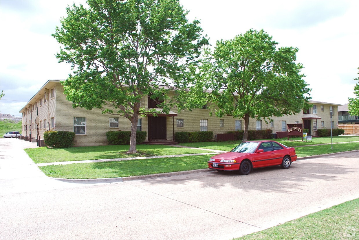
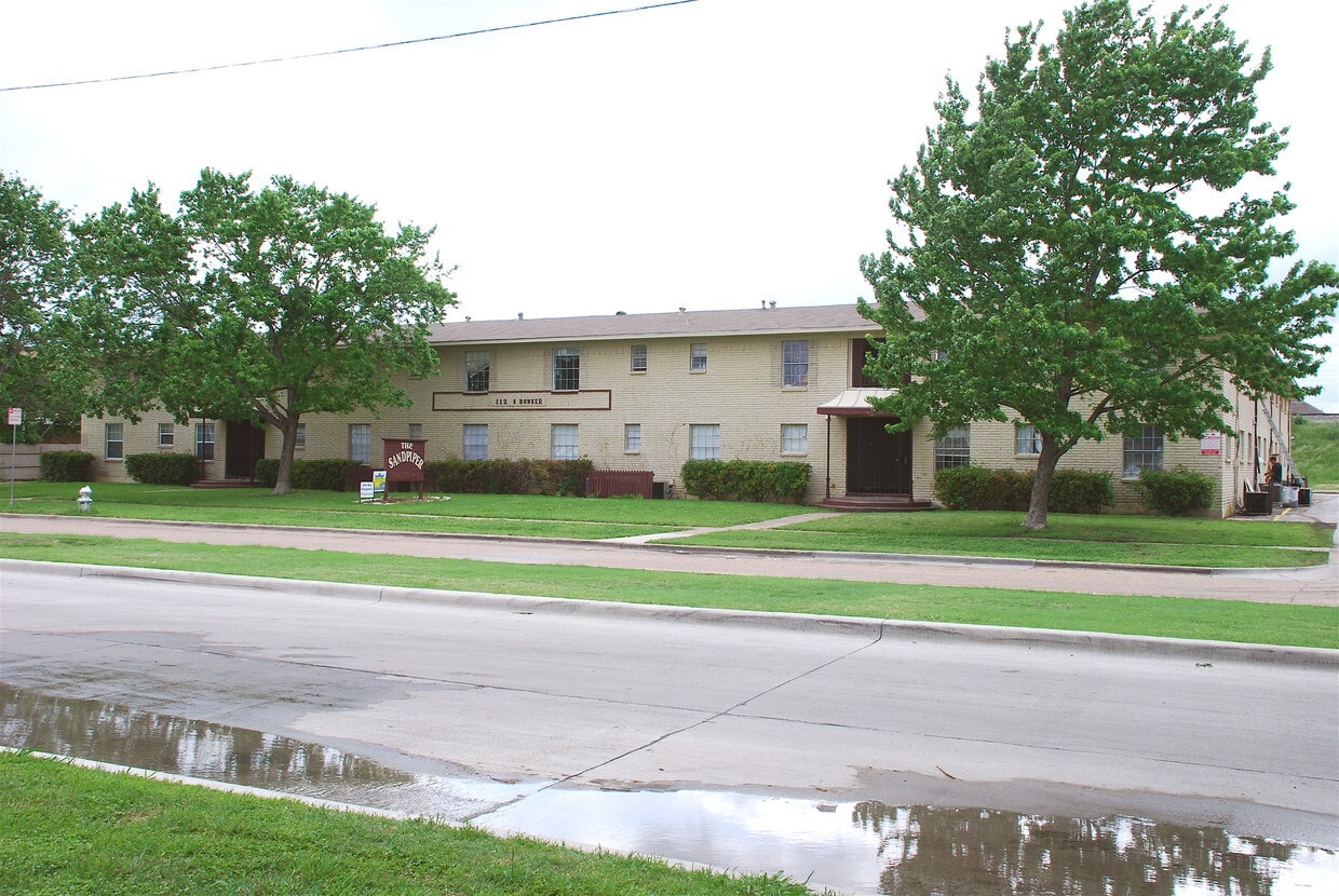
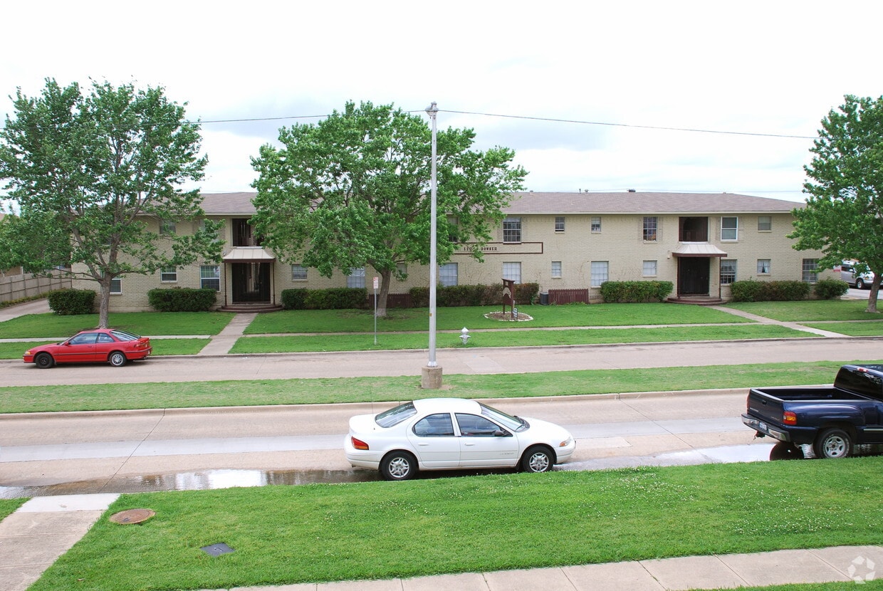

Sandpiper Apartments in Richardson is ready for you to visit. This community is located in Richardson on S. Bowser Rd. in the 75081 area. The professional leasing team is excited to help you find your perfect new place. Come by to check out the apartment floorplan options. Contact us or drop by the leasing office to check the current floorplan availability and find your new place at Sandpiper Apartments.
High Oaks West is an apartment community located in Dallas County and the 75081 ZIP Code. This area is served by the Richardson Independent School District attendance zone.
Air Conditioning
Heating
Oven
Range
Richardson, Texas, sits at the crossroads of Dallas and Collin counties, functioning as a well-established inner suburb that draws on proximity to both Dallas and Plano without feeling like a satellite of either. The city's identity is anchored by the University of Texas at Dallas and the renowned Telecom Corridor, a concentrated stretch hosting major names in telecommunications and technology, including AT&T, Cisco Systems, Samsung, and Texas Instruments. Blue Cross Blue Shield of Texas is also headquartered here, giving the local economy a broad, diversified foundation.
Neighborhoods like Canyon Creek and Heights Park offer a settled, tree-lined character, while the CityLine district delivers a more contemporary pace with walkable mixed-use development. The Charles W. Eisemann Center for Performing Arts brings Broadway tours and classical performances to residents throughout the year.
Learn more about living in Richardson| Colleges & Universities | Distance | ||
|---|---|---|---|
| Colleges & Universities | Distance | ||
| Drive: | 7 min | 2.8 mi | |
| Drive: | 11 min | 5.0 mi | |
| Drive: | 13 min | 8.0 mi | |
| Drive: | 15 min | 8.6 mi |


Transportation options available in Richardson include Spring Valley, located 2.1 miles from High Oaks West. High Oaks West is near Dallas Love Field, located 16.4 miles or 25 minutes away, and Dallas-Fort Worth International, located 25.3 miles or 33 minutes away.
| Transit / Subway | Distance | ||
|---|---|---|---|
| Transit / Subway | Distance | ||
|
|
Drive: | 5 min | 2.1 mi |
|
|
Drive: | 6 min | 2.4 mi |
|
|
Drive: | 8 min | 3.5 mi |
|
|
Drive: | 7 min | 3.6 mi |
|
|
Drive: | 8 min | 3.8 mi |
| Commuter Rail | Distance | ||
|---|---|---|---|
| Commuter Rail | Distance | ||
|
|
Drive: | 20 min | 15.0 mi |
|
|
Drive: | 24 min | 16.6 mi |
|
|
Drive: | 23 min | 17.5 mi |
| Drive: | 28 min | 20.5 mi | |
|
|
Drive: | 28 min | 20.6 mi |
| Airports | Distance | ||
|---|---|---|---|
| Airports | Distance | ||
|
Dallas Love Field
|
Drive: | 25 min | 16.4 mi |
|
Dallas-Fort Worth International
|
Drive: | 33 min | 25.3 mi |
Scores provided by
Traffic
-Airport
-Businesses
-Scores provided by
HowLoud What is a Sound Score Rating? A Sound Score Rating aggregates noise caused by vehicle traffic, airplane traffic and local sources. How It WorksTime and distance from High Oaks West.
| Shopping Centers | Distance | ||
|---|---|---|---|
| Shopping Centers | Distance | ||
| Walk: | 7 min | 0.4 mi | |
| Walk: | 16 min | 0.9 mi | |
| Walk: | 19 min | 1.0 mi |
| Parks and Recreation | Distance | ||
|---|---|---|---|
| Parks and Recreation | Distance | ||
|
Terrace Park
|
Walk: | 11 min | 0.6 mi |
|
Huffhines Park
|
Drive: | 3 min | 1.3 mi |
|
Richland Park
|
Drive: | 5 min | 2.0 mi |
|
Berkner Park
|
Drive: | 5 min | 2.1 mi |
|
Duck Creek Linear Park
|
Drive: | 6 min | 2.2 mi |
| Hospitals | Distance | ||
|---|---|---|---|
| Hospitals | Distance | ||
| Drive: | 9 min | 5.1 mi | |
| Drive: | 10 min | 5.5 mi | |
| Drive: | 13 min | 6.4 mi |
| Military Bases | Distance | ||
|---|---|---|---|
| Military Bases | Distance | ||
| Drive: | 37 min | 26.7 mi | |
| Drive: | 66 min | 49.4 mi |
Pets Allowed Pool Walk-In Closets Stainless Steel Appliances Granite Countertops Hardwood Floors
Pets Allowed Fitness Center Pool Hardwood Floors Elevator Washer & Dryer Hookups Tennis Court
What Are Walk Score®, Transit Score®, and Bike Score® Ratings?
Walk Score® measures the walkability of any address. Transit Score® measures access to public transit. Bike Score® measures the bikeability of any address.
What is a Sound Score Rating?
A Sound Score Rating aggregates noise caused by vehicle traffic, airplane traffic and local sources.


