
Moment
650 Portland Ave S,
Minneapolis, MN 55415
Studio - 2 Beds $1,454 - $5,403

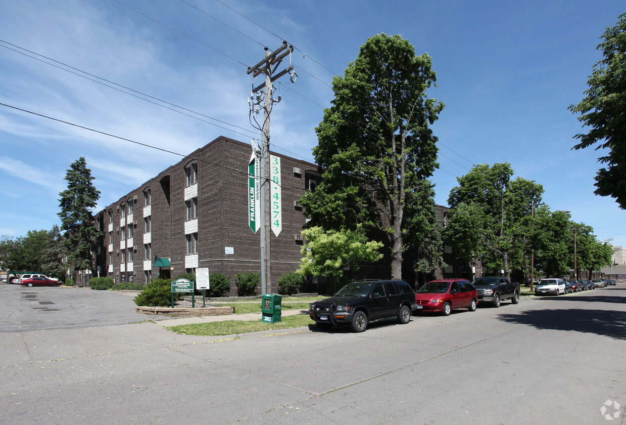
Franklin Housing Co-op is located in the historic Seward neighborhood near the West Bank of the U of M campus and Augsburg College. Additionally, Franklin Co-op is centrally located, making it a great choice for students at any Minneapolis college or university. Because of its proximity to downtown Minneapolis, the light rail and the bus line, the highway and Saint Paul, it’s a breeze to travel anywhere in the Twin Cities when you live at the Franklin Co-op!
Franklin Housing Co-op is an apartment community located in Hennepin County and the 55406 ZIP Code. This area is served by the Minneapolis Public School Dist. attendance zone.
Pool
Fitness Center
Grill
Sauna
Air Conditioning
Dishwasher
High Speed Internet Access
Refrigerator
One of five neighborhoods in the greater Longfellow Community, Seward lies southeast of downtown Minneapolis and is bordered on its east side by the Mississippi River. The University of Minnesota campus lies just to the northeast, across the river. The availability of local goods and services inside this compact area give residents reason to brag. It’s been likened to a borough in New York City: civic-minded, grass-roots oriented, outgoing, and infused with a strong sense of identity. As one of the older neighborhoods in Minneapolis, Seward has a long history and strong efforts to preserve its historic buildings.
Learn more about living in Seward| Colleges & Universities | Distance | ||
|---|---|---|---|
| Colleges & Universities | Distance | ||
| Walk: | 7 min | 0.4 mi | |
| Drive: | 4 min | 1.7 mi | |
| Drive: | 5 min | 2.6 mi | |
| Drive: | 8 min | 3.9 mi |

Transportation options available in Minneapolis include Franklin Avenue Station, located 0.5 mile from Franklin Housing Co-op. Franklin Housing Co-op is near Minneapolis-St Paul International/Wold-Chamberlain, located 9.3 miles or 19 minutes away.
| Transit / Subway | Distance | ||
|---|---|---|---|
| Transit / Subway | Distance | ||
|
|
Walk: | 10 min | 0.5 mi |
|
|
Walk: | 17 min | 0.9 mi |
| Drive: | 3 min | 1.5 mi | |
| Drive: | 5 min | 1.8 mi | |
| Drive: | 4 min | 1.8 mi |
| Commuter Rail | Distance | ||
|---|---|---|---|
| Commuter Rail | Distance | ||
|
|
Drive: | 8 min | 2.9 mi |
|
|
Drive: | 13 min | 8.3 mi |
|
|
Drive: | 17 min | 11.5 mi |
|
|
Drive: | 31 min | 22.6 mi |
|
|
Drive: | 33 min | 24.3 mi |
| Airports | Distance | ||
|---|---|---|---|
| Airports | Distance | ||
|
Minneapolis-St Paul International/Wold-Chamberlain
|
Drive: | 19 min | 9.3 mi |
Time and distance from Franklin Housing Co-op.
| Shopping Centers | Distance | ||
|---|---|---|---|
| Shopping Centers | Distance | ||
| Walk: | 5 min | 0.3 mi | |
| Walk: | 19 min | 1.0 mi | |
| Drive: | 4 min | 1.2 mi |
| Parks and Recreation | Distance | ||
|---|---|---|---|
| Parks and Recreation | Distance | ||
|
Matthews Park
|
Walk: | 12 min | 0.6 mi |
|
Cedar Avenue Field Park
|
Walk: | 16 min | 0.8 mi |
|
East Phillips Park
|
Walk: | 16 min | 0.9 mi |
|
Riverside Park
|
Drive: | 4 min | 1.1 mi |
|
East River Flats Park
|
Drive: | 6 min | 2.0 mi |
| Hospitals | Distance | ||
|---|---|---|---|
| Hospitals | Distance | ||
| Walk: | 6 min | 0.3 mi | |
| Drive: | 4 min | 1.6 mi | |
| Drive: | 5 min | 1.7 mi |
| Military Bases | Distance | ||
|---|---|---|---|
| Military Bases | Distance | ||
| Drive: | 14 min | 6.3 mi |
What Are Walk Score®, Transit Score®, and Bike Score® Ratings?
Walk Score® measures the walkability of any address. Transit Score® measures access to public transit. Bike Score® measures the bikeability of any address.
What is a Sound Score Rating?
A Sound Score Rating aggregates noise caused by vehicle traffic, airplane traffic and local sources
2300 E Franklin Ave
Minneapolis, MN 55406


