
Everly
2000 2nd St SW,
Washington, DC 20024
Studio - 2 Beds $2,173 - $6,570
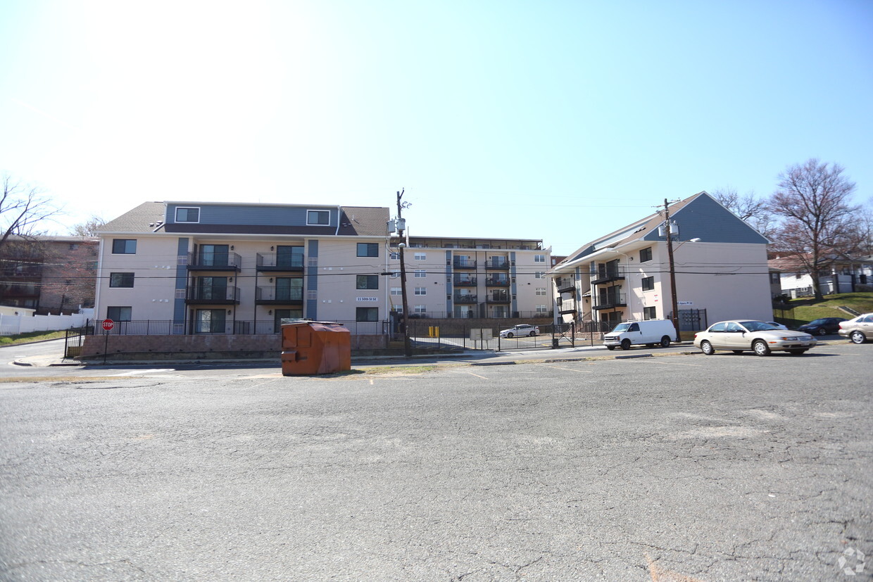

Discover East of The River. You'll find this community at 4945 Ayers Pl SE in the 20019 area of Washington. The professional leasing team is eager for you to come see our property. Contact us or stop by today.
East of The River is an apartment community located in District of Columbia County and the 20019 ZIP Code. This area is served by the District Of Columbia Public Schools attendance zone.
A triangular-shaped community wedged between Capitol View and Capitol Heights, Marshall Heights is roughly eight miles southeast of Downtown Washington, DC. Bordered by East Capitol Street on the north, Southern Avenue on the south, and Benning Road on the west, this neighborhood is part of DC's Seventh Ward. A walkable landscape means the few cafes and shops in the area can be reached in just minutes. With its proximity to downtown and fast commute times, apartments in Marshall Heights are ideal for those who want a suburban home while still enjoying easy access to DC.
Learn more about living in Marshall Heights| Colleges & Universities | Distance | ||
|---|---|---|---|
| Colleges & Universities | Distance | ||
| Drive: | 8 min | 4.1 mi | |
| Drive: | 9 min | 5.0 mi | |
| Drive: | 9 min | 5.0 mi | |
| Drive: | 11 min | 6.1 mi |


Transportation options available in Washington include Benning Road, located 0.5 mile from East of The River. East of The River is near Ronald Reagan Washington Ntl, located 10.5 miles or 19 minutes away, and Baltimore/Washington International Thurgood Marshall, located 28.4 miles or 43 minutes away.
| Transit / Subway | Distance | ||
|---|---|---|---|
| Transit / Subway | Distance | ||
|
|
Walk: | 9 min | 0.5 mi |
|
Capitol Heights, Blue/Silver Line Center Platform
|
Drive: | 3 min | 1.3 mi |
|
|
Drive: | 5 min | 1.7 mi |
|
|
Drive: | 4 min | 1.8 mi |
|
|
Drive: | 4 min | 2.1 mi |
| Commuter Rail | Distance | ||
|---|---|---|---|
| Commuter Rail | Distance | ||
|
|
Drive: | 7 min | 4.3 mi |
|
|
Drive: | 9 min | 4.5 mi |
|
|
Drive: | 11 min | 5.8 mi |
|
|
Drive: | 11 min | 5.8 mi |
|
|
Drive: | 13 min | 6.2 mi |
| Airports | Distance | ||
|---|---|---|---|
| Airports | Distance | ||
|
Ronald Reagan Washington Ntl
|
Drive: | 19 min | 10.5 mi |
|
Baltimore/Washington International Thurgood Marshall
|
Drive: | 43 min | 28.4 mi |
Time and distance from East of The River.
| Shopping Centers | Distance | ||
|---|---|---|---|
| Shopping Centers | Distance | ||
| Walk: | 7 min | 0.4 mi | |
| Walk: | 7 min | 0.4 mi | |
| Drive: | 2 min | 1.1 mi |
| Parks and Recreation | Distance | ||
|---|---|---|---|
| Parks and Recreation | Distance | ||
|
Fort Dupont Park
|
Drive: | 5 min | 1.7 mi |
|
Kingman and Heritage Island Park
|
Drive: | 4 min | 2.3 mi |
|
Washington Youth Garden
|
Drive: | 6 min | 3.8 mi |
|
Frederick Douglass National Historic Site
|
Drive: | 11 min | 4.1 mi |
|
National Arboretum
|
Drive: | 11 min | 4.5 mi |
| Hospitals | Distance | ||
|---|---|---|---|
| Hospitals | Distance | ||
| Drive: | 8 min | 3.6 mi | |
| Drive: | 14 min | 5.4 mi | |
| Drive: | 14 min | 5.6 mi |
| Military Bases | Distance | ||
|---|---|---|---|
| Military Bases | Distance | ||
| Drive: | 10 min | 4.6 mi | |
| Drive: | 13 min | 6.8 mi |
What Are Walk Score®, Transit Score®, and Bike Score® Ratings?
Walk Score® measures the walkability of any address. Transit Score® measures access to public transit. Bike Score® measures the bikeability of any address.
What is a Sound Score Rating?
A Sound Score Rating aggregates noise caused by vehicle traffic, airplane traffic and local sources

4945 Ayers Pl SE
Washington, DC 20019


