
Pioneer Endicott
141 4th St E,
Saint Paul, MN 55101
$1,137 - $2,425 Total Monthly Price
Studio - 2 Beds

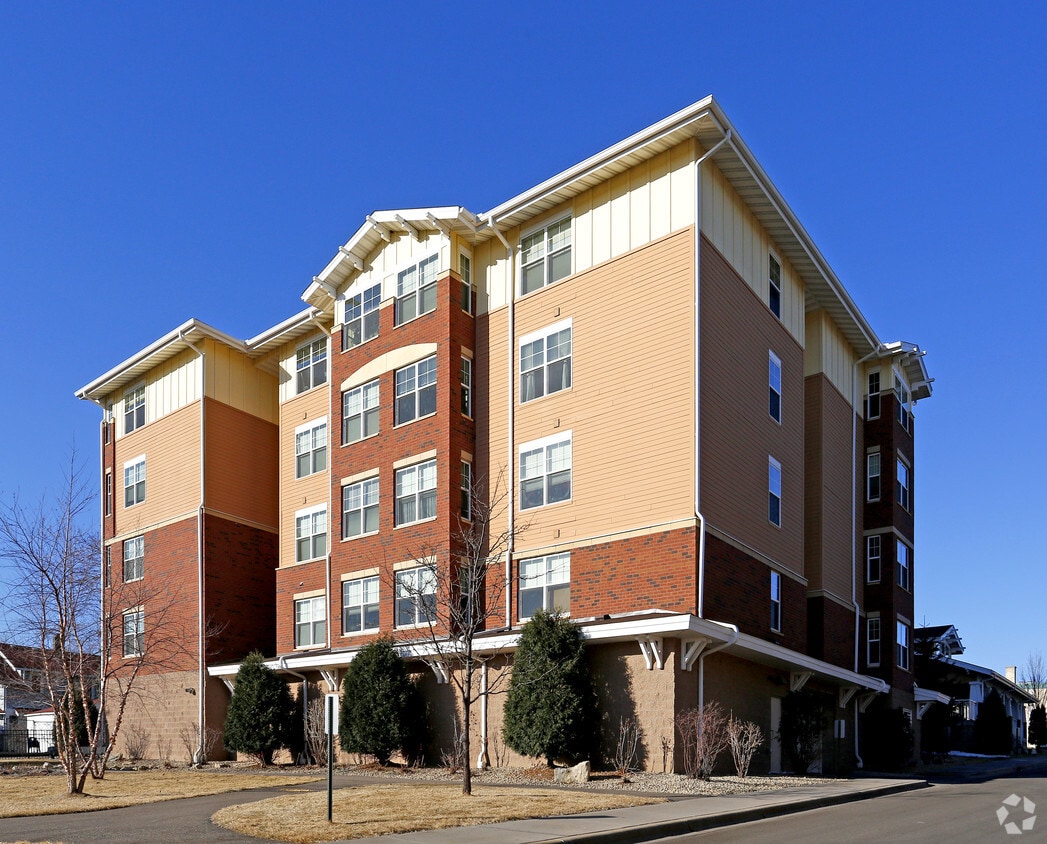
Check out Carty Heights in St. Paul, MN. This property is situated in the Lexington Hamline North area of St. Paul. When you choose an apartment at Carty Heights, you'll have a wide selection of features and amenities including: breakfast/coffee concierge, smoke-free options, and convenient on-site parking options. The professional leasing team is ready to help you find your perfect home. Give us a call now to learn more about our community.
Carty Heights is an apartment community located in Ramsey County and the 55104 ZIP Code. This area is served by the St. Paul Public School District attendance zone.
Property Manager on Site
Walking/Biking Trails
Breakfast/Coffee Concierge
On-Site Retail
Washer/Dryer
Air Conditioning
High Speed Internet Access
Smoke Free
Living in Saint Paul combines metropolitan energy with neighborhood charm in Minnesota's capital city. Situated along the Mississippi River's bluffs, the city offers an extensive parks system, including Como Park Zoo and Conservatory, which features botanical gardens and year-round exhibits. Housing options span from historic properties along Summit Avenue to contemporary apartments in Lowertown. Current rental data shows one-bedroom apartments average $1,261 per month, reflecting a 2.2% annual increase, while two-bedroom units typically rent for $1,611, up 2.2% from the previous year.
Each Saint Paul neighborhood has its own distinct character, from Cathedral Hill's Victorian mansions to Lowertown's converted warehouses. The city hosts several higher education institutions, including Macalester College and the University of St. Thomas. Saint Paul's legacy as a major river port and railroad hub remains evident in its preserved architecture and cultural attractions.
Learn more about living in Saint PaulCompare neighborhood and city base rent averages by bedroom.
| Lexington-Hamline North | Saint Paul, MN | |
|---|---|---|
| Studio | $1,218 | $1,164 |
| 1 Bedroom | $1,513 | $1,297 |
| 2 Bedrooms | $2,128 | $1,657 |
| 3 Bedrooms | - | $2,198 |
| Colleges & Universities | Distance | ||
|---|---|---|---|
| Colleges & Universities | Distance | ||
| Walk: | 13 min | 0.7 mi | |
| Drive: | 6 min | 1.8 mi | |
| Drive: | 4 min | 2.0 mi | |
| Drive: | 5 min | 2.5 mi |


Transportation options available in Saint Paul include Lexington Pkwy Station, located 0.3 mile from Carty Heights. Carty Heights is near Minneapolis-St Paul International/Wold-Chamberlain, located 8.0 miles or 16 minutes away.
| Transit / Subway | Distance | ||
|---|---|---|---|
| Transit / Subway | Distance | ||
| Walk: | 5 min | 0.3 mi | |
| Walk: | 13 min | 0.7 mi | |
| Drive: | 3 min | 1.2 mi | |
| Drive: | 2 min | 1.3 mi | |
| Drive: | 3 min | 1.4 mi |
| Commuter Rail | Distance | ||
|---|---|---|---|
| Commuter Rail | Distance | ||
|
|
Drive: | 7 min | 3.7 mi |
|
|
Drive: | 15 min | 7.7 mi |
|
|
Drive: | 23 min | 16.3 mi |
|
|
Drive: | 33 min | 25.1 mi |
|
|
Drive: | 34 min | 26.7 mi |
| Airports | Distance | ||
|---|---|---|---|
| Airports | Distance | ||
|
Minneapolis-St Paul International/Wold-Chamberlain
|
Drive: | 16 min | 8.0 mi |
Scores provided by
Traffic
-Airport
-Businesses
-Scores provided by
HowLoud What is a Sound Score Rating? A Sound Score Rating aggregates noise caused by vehicle traffic, airplane traffic and local sources. How It WorksTime and distance from Carty Heights.
| Shopping Centers | Distance | ||
|---|---|---|---|
| Shopping Centers | Distance | ||
| Walk: | 3 min | 0.2 mi | |
| Walk: | 14 min | 0.7 mi |
| Parks and Recreation | Distance | ||
|---|---|---|---|
| Parks and Recreation | Distance | ||
|
Macalester College Observatory
|
Drive: | 4 min | 2.0 mi |
|
Marjorie McNeely Conservatory
|
Drive: | 6 min | 2.3 mi |
|
Western Park
|
Drive: | 4 min | 2.3 mi |
|
Como Park
|
Drive: | 6 min | 2.4 mi |
|
Newell Park
|
Drive: | 6 min | 2.6 mi |
| Hospitals | Distance | ||
|---|---|---|---|
| Hospitals | Distance | ||
| Drive: | 5 min | 2.6 mi | |
| Drive: | 6 min | 2.8 mi | |
| Drive: | 5 min | 2.8 mi |
| Military Bases | Distance | ||
|---|---|---|---|
| Military Bases | Distance | ||
| Drive: | 15 min | 6.7 mi |
Pets Allowed Fitness Center Pool Dishwasher Refrigerator Clubhouse Maintenance on site
High-Speed Internet Laundry Facilities
Pets Allowed Fitness Center Pool Dishwasher Refrigerator Kitchen
Pets Allowed Fitness Center Pool Dishwasher Refrigerator Kitchen In Unit Washer & Dryer
Pets Allowed Pool Dishwasher Microwave Granite Countertops
What Are Walk Score®, Transit Score®, and Bike Score® Ratings?
Walk Score® measures the walkability of any address. Transit Score® measures access to public transit. Bike Score® measures the bikeability of any address.
What is a Sound Score Rating?
A Sound Score Rating aggregates noise caused by vehicle traffic, airplane traffic and local sources.
412 Dunlap St
Saint Paul, MN 55104


