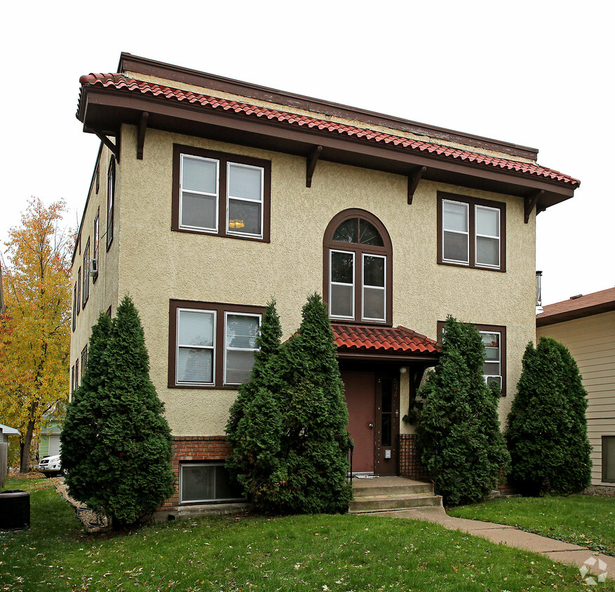


946 Randolph Ave
946 Randolph Ave,
Saint Paul,
MN
55102
-
Monthly Rent
$875
Plus Fees12 Month Lease
-
Bedrooms
1 bd
-
Bathrooms
1 ba
-
Square Feet
750 sq ft

Pricing & Floor Plans
Check Back Soon for Upcoming Availability
| Beds | Baths | Average SF | Availability |
|---|---|---|---|
| 1 Bedroom 1 Bedroom 1 Br | 1 Bath 1 Bath 1 Ba | 750 SF | Not Available |
Fees and Policies
The fees listed below are community-provided and may exclude utilities or add-ons. All payments are made directly to the property and are non-refundable unless otherwise specified.
-
One-Time Basics
-
Due at Application
-
Application Fee Per ApplicantCharged per applicant.$0
-
-
Due at Move-In
-
Administrative FeeCharged per unit.$0
-
-
Due at Application
-
Surface Lot
-
Storage Unit
-
Storage DepositCharged per rentable item.$0
-
Storage RentCharged per rentable item.$0 / mo
-
Property Fee Disclaimer: Based on community-supplied data and independent market research. Subject to change without notice. May exclude fees for mandatory or optional services and usage-based utilities.
Details
Utilities Included
-
Gas
-
Water
-
Heat
-
Trash Removal
-
Sewer
Lease Options
-
12 mo
Property Information
-
Built in 1925
-
6 units/2 stories
About 946 Randolph Ave Saint Paul, MN 55102
Great garden level 1 bedroom, paid water, laundry in bldg., off street parking. Allow 24 hours notice for scheduling. Sorry no pets or assistance programs.
946 Randolph Ave is an apartment community located in Ramsey County and the 55102 ZIP Code. This area is served by the St. Paul Public School District attendance zone.
Contact
Community Amenities
- Laundry Facilities
Apartment Features
High Speed Internet Access
Stainless Steel Appliances
Smoke Free
Heating
- High Speed Internet Access
- Heating
- Smoke Free
- Stainless Steel Appliances
Often referred to as the “West End,” West Seventh is a convenient neighborhood located on the Riverview Corridor transit system, making travel to Downtown Saint Paul, the Minneapolis-Saint Paul Airport, and the Mall of America simple for locals.
Residents of West Seventh enjoy direct access to Interstate 35E and Xcel Energy Center. There are a plethora of amenities and attractions along the Mississippi River – from parks to historic landmarks and the High Bridge Dog Park.
Many of West Seventh’s restaurants are found along 7th Street West, like Bad Weather Brewing Company, Cossetta’s, and JR Mac’s Bar & Grill. Residents adore the proximity to the airport, and Saint Paul attractions and shopping.
Learn more about living in West SeventhCompare neighborhood and city base rent averages by bedroom.
| West Seventh | Saint Paul, MN | |
|---|---|---|
| Studio | $1,200 | $1,116 |
| 1 Bedroom | $1,549 | $1,285 |
| 2 Bedrooms | $2,106 | $1,623 |
| 3 Bedrooms | $2,709 | $2,222 |
- Laundry Facilities
- High Speed Internet Access
- Heating
- Smoke Free
- Stainless Steel Appliances
| Monday | By Appointment |
|---|---|
| Tuesday | By Appointment |
| Wednesday | By Appointment |
| Thursday | By Appointment |
| Friday | By Appointment |
| Saturday | By Appointment |
| Sunday | By Appointment |
| Colleges & Universities | Distance | ||
|---|---|---|---|
| Colleges & Universities | Distance | ||
| Drive: | 5 min | 2.1 mi | |
| Drive: | 7 min | 2.3 mi | |
| Drive: | 5 min | 2.3 mi | |
| Drive: | 6 min | 3.0 mi |


View GreatSchools Rating Methodology
Data provided by GreatSchools.org © 2026. All rights reserved.
Transportation options available in Saint Paul include Lexington Pkwy Station, located 2.4 miles from 946 Randolph Ave. 946 Randolph Ave is near Minneapolis-St Paul International/Wold-Chamberlain, located 6.3 miles or 12 minutes away.
| Transit / Subway | Distance | ||
|---|---|---|---|
| Transit / Subway | Distance | ||
| Drive: | 6 min | 2.4 mi | |
| Drive: | 6 min | 2.8 mi | |
| Drive: | 7 min | 3.3 mi | |
| Drive: | 7 min | 3.3 mi | |
| Drive: | 7 min | 3.6 mi |
| Commuter Rail | Distance | ||
|---|---|---|---|
| Commuter Rail | Distance | ||
|
|
Drive: | 6 min | 3.6 mi |
|
|
Drive: | 19 min | 9.6 mi |
|
|
Drive: | 26 min | 19.5 mi |
|
|
Drive: | 37 min | 27.6 mi |
|
|
Drive: | 38 min | 29.3 mi |
| Airports | Distance | ||
|---|---|---|---|
| Airports | Distance | ||
|
Minneapolis-St Paul International/Wold-Chamberlain
|
Drive: | 12 min | 6.3 mi |
Time and distance from 946 Randolph Ave.
| Shopping Centers | Distance | ||
|---|---|---|---|
| Shopping Centers | Distance | ||
| Drive: | 3 min | 1.2 mi | |
| Drive: | 4 min | 1.3 mi | |
| Drive: | 3 min | 1.7 mi |
| Parks and Recreation | Distance | ||
|---|---|---|---|
| Parks and Recreation | Distance | ||
|
Highland Park and Golf Course
|
Drive: | 3 min | 1.4 mi |
|
Macalester College Observatory
|
Drive: | 5 min | 2.1 mi |
|
Irvine Park
|
Drive: | 5 min | 2.4 mi |
|
Cherokee Regional Park
|
Drive: | 8 min | 3.6 mi |
|
Crosby Farm Regional Park
|
Drive: | 7 min | 3.9 mi |
| Hospitals | Distance | ||
|---|---|---|---|
| Hospitals | Distance | ||
| Drive: | 4 min | 2.1 mi | |
| Drive: | 5 min | 2.8 mi | |
| Drive: | 6 min | 3.3 mi |
| Military Bases | Distance | ||
|---|---|---|---|
| Military Bases | Distance | ||
| Drive: | 11 min | 5.0 mi |
946 Randolph Ave Photos
-
Primary Photo
-
-
-
-
Nearby Apartments
Within 50 Miles of 946 Randolph Ave Saint Paul, MN 55102
While 946 Randolph Ave does not provide in‑unit laundry, on‑site laundry facilities are available for shared resident use.
Select utilities are included in rent at 946 Randolph Ave, including gas, water, heat, trash removal, and sewer. Residents are responsible for any other utilities not listed.
Parking is available at 946 Randolph Ave. Contact this property for details.
946 Randolph Ave does not allow pets, though service animals are always welcome in accordance with applicable laws.
A good rule of thumb is to spend no more than 30% of your gross income on rent. Based on the lowest available rent of $875 for a one-bedroom, you would need to earn about $35,000 per year to qualify. Want to double-check your budget? Calculate how much rent you can afford with our Rent Affordability Calculator.
946 Randolph Ave is not currently offering any rent specials. Check back soon, as promotions change frequently.
While 946 Randolph Ave does not offer Matterport 3D tours, renters can request a tour directly through our online platform.
What Are Walk Score®, Transit Score®, and Bike Score® Ratings?
Walk Score® measures the walkability of any address. Transit Score® measures access to public transit. Bike Score® measures the bikeability of any address.
What is a Sound Score Rating?
A Sound Score Rating aggregates noise caused by vehicle traffic, airplane traffic and local sources.

946 Randolph Ave
Saint Paul, MN 55102
Property Manager Responded