
Moment
650 Portland Ave S,
Minneapolis, MN 55415
Studio - 2 Beds $1,501 - $5,618

Bedrooms
Studio - 3 bd
Bathrooms
1 - 2 ba
Square Feet
800 - 950 sq ft
904-912 is an apartment community located in Hennepin County and the 55404 ZIP Code. This area is served by the Minneapolis Public School Dist. attendance zone.
Washer/Dryer
Air Conditioning
Wi-Fi
Heating
One of five neighborhoods in the greater Longfellow Community, Seward lies southeast of downtown Minneapolis and is bordered on its east side by the Mississippi River. The University of Minnesota campus lies just to the northeast, across the river. The availability of local goods and services inside this compact area give residents reason to brag. It’s been likened to a borough in New York City: civic-minded, grass-roots oriented, outgoing, and infused with a strong sense of identity. As one of the older neighborhoods in Minneapolis, Seward has a long history and strong efforts to preserve its historic buildings.
Learn more about living in Seward| Colleges & Universities | Distance | ||
|---|---|---|---|
| Colleges & Universities | Distance | ||
| Walk: | 7 min | 0.4 mi | |
| Drive: | 4 min | 1.5 mi | |
| Drive: | 5 min | 2.5 mi | |
| Drive: | 9 min | 4.2 mi |

Transportation options available in Minneapolis include Franklin Avenue Station, located 0.3 mile from 904-912. 904-912 is near Minneapolis-St Paul International/Wold-Chamberlain, located 9.1 miles or 18 minutes away.
| Transit / Subway | Distance | ||
|---|---|---|---|
| Transit / Subway | Distance | ||
|
|
Walk: | 5 min | 0.3 mi |
|
|
Walk: | 12 min | 0.7 mi |
| Drive: | 4 min | 1.5 mi | |
| Drive: | 3 min | 1.6 mi | |
| Drive: | 6 min | 2.0 mi |
| Commuter Rail | Distance | ||
|---|---|---|---|
| Commuter Rail | Distance | ||
|
|
Drive: | 8 min | 2.8 mi |
|
|
Drive: | 14 min | 8.5 mi |
|
|
Drive: | 17 min | 11.5 mi |
|
|
Drive: | 31 min | 23.7 mi |
|
|
Drive: | 32 min | 25.3 mi |
| Airports | Distance | ||
|---|---|---|---|
| Airports | Distance | ||
|
Minneapolis-St Paul International/Wold-Chamberlain
|
Drive: | 18 min | 9.1 mi |
Time and distance from 904-912.
| Shopping Centers | Distance | ||
|---|---|---|---|
| Shopping Centers | Distance | ||
| Walk: | 2 min | 0.1 mi | |
| Walk: | 14 min | 0.8 mi | |
| Walk: | 19 min | 1.0 mi |
| Parks and Recreation | Distance | ||
|---|---|---|---|
| Parks and Recreation | Distance | ||
|
Cedar Avenue Field Park
|
Walk: | 11 min | 0.6 mi |
|
East Phillips Park
|
Walk: | 12 min | 0.6 mi |
|
Currie Park
|
Walk: | 15 min | 0.8 mi |
|
Riverside Park
|
Drive: | 4 min | 1.2 mi |
|
East River Flats Park
|
Drive: | 6 min | 1.8 mi |
| Hospitals | Distance | ||
|---|---|---|---|
| Hospitals | Distance | ||
| Walk: | 8 min | 0.4 mi | |
| Drive: | 4 min | 1.5 mi | |
| Drive: | 4 min | 1.7 mi |
| Military Bases | Distance | ||
|---|---|---|---|
| Military Bases | Distance | ||
| Drive: | 13 min | 6.1 mi |
What Are Walk Score®, Transit Score®, and Bike Score® Ratings?
Walk Score® measures the walkability of any address. Transit Score® measures access to public transit. Bike Score® measures the bikeability of any address.
What is a Sound Score Rating?
A Sound Score Rating aggregates noise caused by vehicle traffic, airplane traffic and local sources
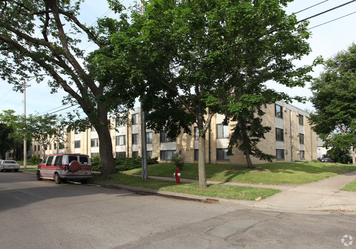
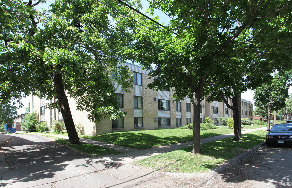
904 21st Ave S
Minneapolis, MN 55404


