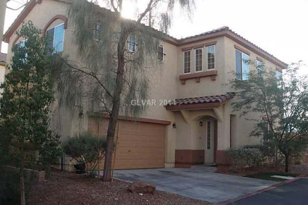
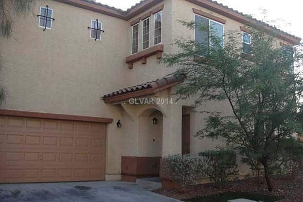
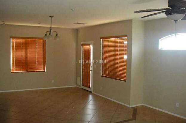
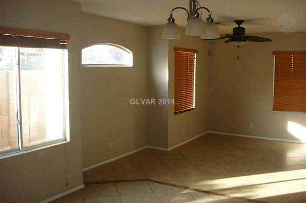
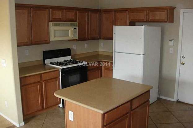
$1,645 Total Monthly Price

8957 Miller Point Ct

,

Las Vegas, NV 89149

2 Weeks Ago
| Edit

Under 30 minutes

Commute Time is calculated at rush hour.
Share Listing
Favorites
  • Bedrooms

    3

  • Bathrooms

    3

  • Square Feet

    1,837 sq ft

8957 Miller Point Ct
Share Listing
Favorites

Contact

  • Listed by Locayt
Neighborhood

Situated in the rapidly expanding northwest corner of Las Vegas, Centennial Hills rests about 16 miles from Downtown and 18 miles from the Strip. Boasting vast mountain views and a laidback pace, Centennial Hills serves as a suburban reprieve from city life.

Parks abound in Centennial Hills. Among the many are Centennial Hills Park, Mountain Crest Park, and Majestic Park. Nearby Floyd Lamb Park and Red Rock Canyon National Conservation Area offer additional opportunities for outdoor adventure as well. Golfers delight in the presence of Painted Desert Golf Club and Silverstone Golf Club. Shoppers relish the convenience and variety Centennial Centre provides.

Ample major roadway access allows Centennial Hills residents to venture into the city at any time.

Learn more about living in Centennial Hills 
Education
Colleges & Universities Distance
Drive: 18 min 11.9 mi
Drive: 24 min 14.4 mi
Drive: 20 min 15.3 mi
Drive: 31 min 20.2 mi
8957 Miller Point Ct is within 18 minutes or 11.9 miles from Southern Nevada, Charleston. It is also near Nev. State Coll., Shadow Lane and Southern Nevada, Cheyenne.
Transportation

8957 Miller Point Ct is near Harry Reid International, located 21.5 miles or 32 minutes away, and Boulder City Municipal, located 41.4 miles or 52 minutes away.

Airports Distance
Airports Distance
Harry Reid International
Drive: 32 min 21.5 mi
Boulder City Municipal
Drive: 52 min 41.4 mi
Getting Around
Moderately Walkable
Walkability
60 / 100
Limited Public Transit
Transit
20 / 100
Moderately Drivable
Drivability
70 / 100
Fairly Bikeable
Bikeability
40 / 100

Scores provided by

What do Walkability, Transit, Drivability, and Bikeability mean? Walkability measures the walking distance to day-to-day needs. Transit measures access to public transportation. Drivability measures congestion, parking availability, and access to major roads. Bikeability measures the suitability for cycling. How It Works
-
Soundscore
- / 100

Traffic

-

Airport

-

Businesses

-

Scores provided by

HowLoud What is a Sound Score Rating? A Sound Score Rating aggregates noise caused by vehicle traffic, airplane traffic and local sources. How It Works
Points of Interest

Time and distance from 8957 Miller Point Ct.

Shopping Centers Distance
Walk: 10 min 0.5 mi
Walk: 12 min 0.6 mi
Walk: 17 min 0.9 mi
8957 Miller Point Ct has 3 shopping centers within 0.9 mile, which is about a 17-minute walk. The miles and minutes will be for the farthest away property.
Parks and Recreation Distance
Floyd Lamb Park
Drive: 9 min 3.1 mi
Spring Mountains National Recreation Area
Drive: 9 min 5.3 mi
Craig Ranch Regional Park
Drive: 18 min 10.8 mi
8957 Miller Point Ct has 3 parks within 10.8 miles, including Floyd Lamb Park, Spring Mountains National Recreation Area, and Craig Ranch Regional Park.
Hospitals Distance
Hospitals Distance
Walk: 15 min 0.8 mi
Drive: 10 min 7.1 mi
Drive: 18 min 13.1 mi
8957 Miller Point Ct has 3 hospitals within 13.1 miles, the nearest is Centennial Hills Hospital Medical Center which is 0.8 mile away and a 15 minute walk.
Military Bases Distance
Drive: 34 min 20.6 mi
8957 Miller Point Ct is 20.6 miles and a 34 minute drive from Nellis Air Force Base.

You May Also Like

Similar Rentals Nearby