8114 Anna Ct
Falls Church, VA 22042
-
Bedrooms
2
-
Bathrooms
2
-
Square Feet
--
-
Available
Available Now
Highlights
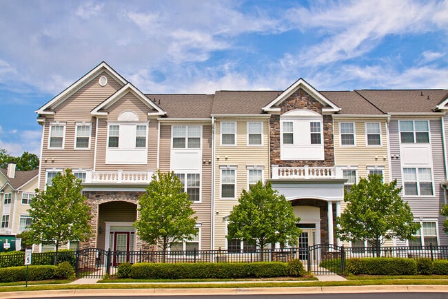
- Colonial Architecture
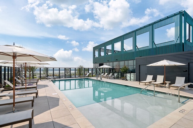
- Community Pool
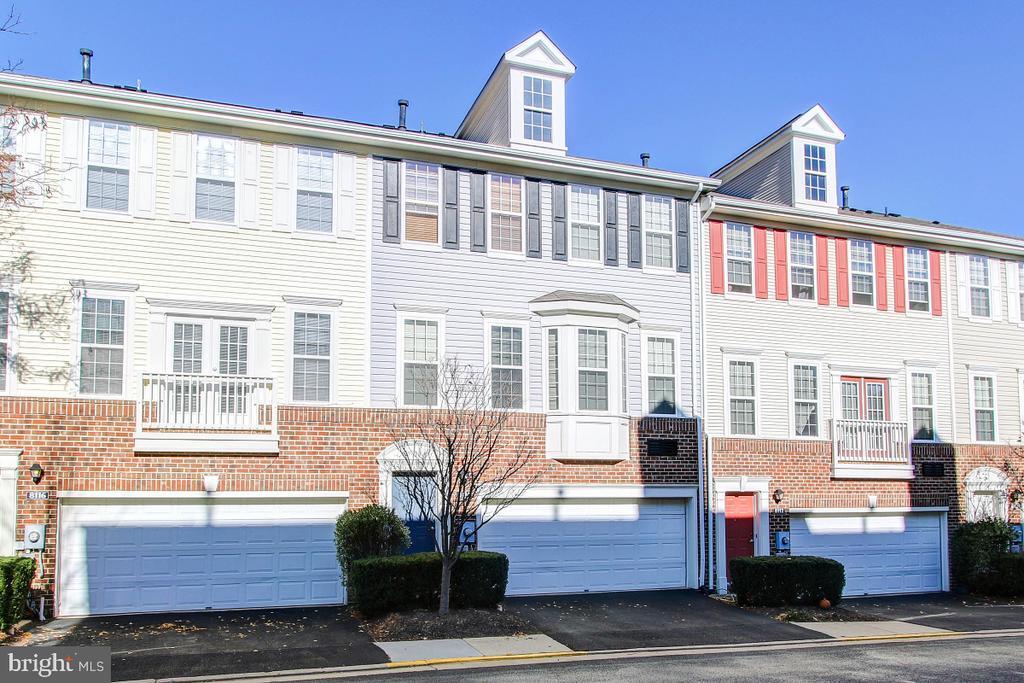
- 2 Car Direct Access Garage
- Level Entry For Accessibility
- Forced Air Heating and Cooling System
- Playground

About This Home
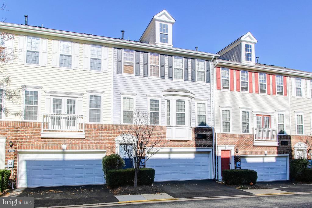
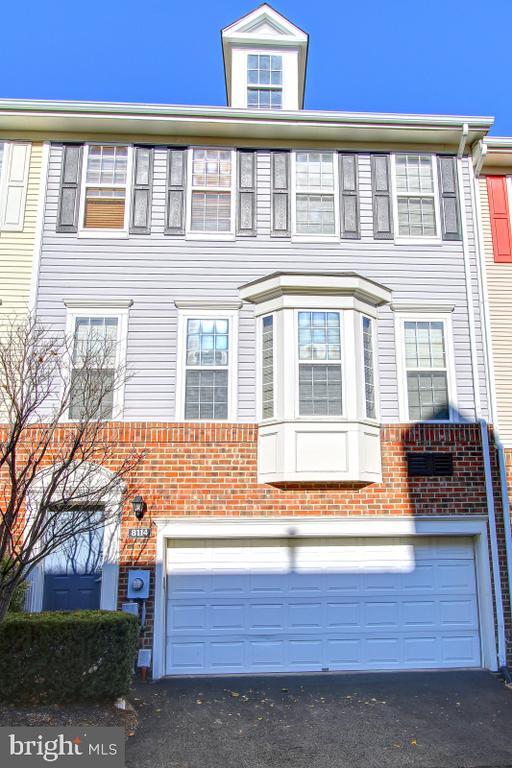
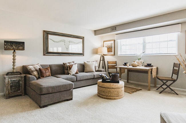
Available October 1, 2025 – Spacious 3-Level Townhouse in Prime Location! Combination lock on front door. Welcome home to this bright and spacious 3-level, 2-bedroom, 2-bathroom townhouse with an attached oversized 2-car garage and extended storage space. Perfect for young professionals, couples, or small families, this home combines the comfort of a quiet, private community with unbeatable convenience. This home includes the convenience of a washer and dryer in the home. Just a 2-minute drive to Routes 66, 29, 50, 495, Gallows Rd, and Inova Fairfax Hospital, and only minutes from Tysons Corner. For even more convenience, you’ll be within walking distance to the Mosaic District and Dunn Loring Metro Station, with a WMATA/Fairfax County bus stop right at the end of the street. Don’t miss this rare opportunity to live in a home that offers both peace and accessibility in one of the most desirable locations in Northern Virginia.
8114 Anna Ct is a townhome located in Fairfax County and the 22042 ZIP Code. This area is served by the Fairfax County Public Schools attendance zone.
Home Details
Home Type
Year Built
Accessible Home Design
Bedrooms and Bathrooms
Home Design
Interior Spaces
Kitchen
Laundry
Listing and Financial Details
Outdoor Features
Parking
Utilities
Community Details
Overview
Pet Policy
Recreation
Contact
- Listed by Timothy Carl Brockhoff | Century 21 New Millennium
- Phone Number
- Contact
-
Source
 Bright MLS, Inc.
- Dishwasher
Spanning roughly two square miles, Falls Church is a quaint city with unique charm and an incredibly tight-knit community. With top-notch school systems, safe neighborhoods, and proximity to the nation’s capital, Falls Church is a highly sought-after area with immense desirability.
Known as “the little city,” Falls Church is regarded as the number one healthiest community in the country. It’s healthy, active residents push the community to thrive through their persistence for educational growth, community involvement, and the continual betterment of their city.
Public transportation, historic homes, shopping centers, community parks, local restaurants, and lively theaters line this city’s walkable streets. Delve into casual cuisine at Clare & Don’s Beach Shack, grab a craft beer at the Mad Fox Brewing Company, explore the Cherry Hill Farmhouse, or catch a live performance at the State Theatre. Just a quick commute to Washington D.C.
Learn more about living in Falls Church| Colleges & Universities | Distance | ||
|---|---|---|---|
| Colleges & Universities | Distance | ||
| Drive: | 9 min | 4.3 mi | |
| Drive: | 16 min | 6.5 mi | |
| Drive: | 16 min | 7.2 mi | |
| Drive: | 16 min | 8.0 mi |
 The GreatSchools Rating helps parents compare schools within a state based on a variety of school quality indicators and provides a helpful picture of how effectively each school serves all of its students. Ratings are on a scale of 1 (below average) to 10 (above average) and can include test scores, college readiness, academic progress, advanced courses, equity, discipline and attendance data. We also advise parents to visit schools, consider other information on school performance and programs, and consider family needs as part of the school selection process.
View GreatSchools Rating Methodology
Data provided by GreatSchools.org © 2025. All rights reserved.
Transportation options available in Falls Church include Tysons Corner, located 4.6 miles from 8114 Anna Ct. 8114 Anna Ct is near Ronald Reagan Washington Ntl, located 12.5 miles or 26 minutes away, and Washington Dulles International, located 18.8 miles or 34 minutes away.
| Transit / Subway | Distance | ||
|---|---|---|---|
| Transit / Subway | Distance | ||
|
|
Drive: | 9 min | 4.6 mi |
|
|
Drive: | 9 min | 4.6 mi |
|
|
Drive: | 10 min | 4.9 mi |
|
|
Drive: | 10 min | 5.3 mi |
|
|
Drive: | 14 min | 7.8 mi |
| Commuter Rail | Distance | ||
|---|---|---|---|
| Commuter Rail | Distance | ||
|
|
Drive: | 15 min | 7.8 mi |
|
|
Drive: | 15 min | 8.0 mi |
|
|
Drive: | 20 min | 10.1 mi |
|
|
Drive: | 22 min | 11.2 mi |
|
|
Drive: | 21 min | 11.3 mi |
| Airports | Distance | ||
|---|---|---|---|
| Airports | Distance | ||
|
Ronald Reagan Washington Ntl
|
Drive: | 26 min | 12.5 mi |
|
Washington Dulles International
|
Drive: | 34 min | 18.8 mi |
Time and distance from 8114 Anna Ct.
| Shopping Centers | Distance | ||
|---|---|---|---|
| Shopping Centers | Distance | ||
| Walk: | 9 min | 0.5 mi | |
| Walk: | 11 min | 0.6 mi | |
| Walk: | 11 min | 0.6 mi |
| Parks and Recreation | Distance | ||
|---|---|---|---|
| Parks and Recreation | Distance | ||
|
Eakin Community Park
|
Drive: | 5 min | 2.0 mi |
|
Gateway Regional Park
|
Drive: | 7 min | 3.0 mi |
|
Hidden Oaks Nature Center
|
Drive: | 8 min | 3.4 mi |
|
Nottoway Park
|
Drive: | 9 min | 4.1 mi |
|
W&OD Trail
|
Drive: | 9 min | 4.5 mi |
| Hospitals | Distance | ||
|---|---|---|---|
| Hospitals | Distance | ||
| Walk: | 20 min | 1.1 mi | |
| Drive: | 3 min | 1.1 mi | |
| Drive: | 9 min | 4.6 mi |
| Military Bases | Distance | ||
|---|---|---|---|
| Military Bases | Distance | ||
| Drive: | 19 min | 9.5 mi |
You May Also Like
Similar Rentals Nearby
What Are Walk Score®, Transit Score®, and Bike Score® Ratings?
Walk Score® measures the walkability of any address. Transit Score® measures access to public transit. Bike Score® measures the bikeability of any address.
What is a Sound Score Rating?
A Sound Score Rating aggregates noise caused by vehicle traffic, airplane traffic and local sources
