$1,800 / Month
74 Otis St Unit 2R
Cambridge, MA 02141
4 Days Ago
Favorites
-
Bedrooms
1
-
Bathrooms
1
-
Square Feet
9,999 sq ft
-
Available
Available Jul 1
74 Otis St Unit 2R

Favorites
About This Home
12 Month Lease,
$1,800 deposit,
Available Jul 1
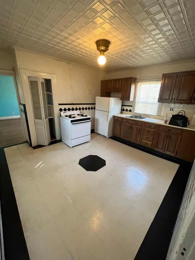
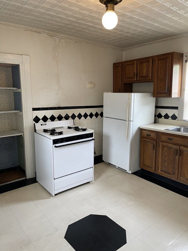
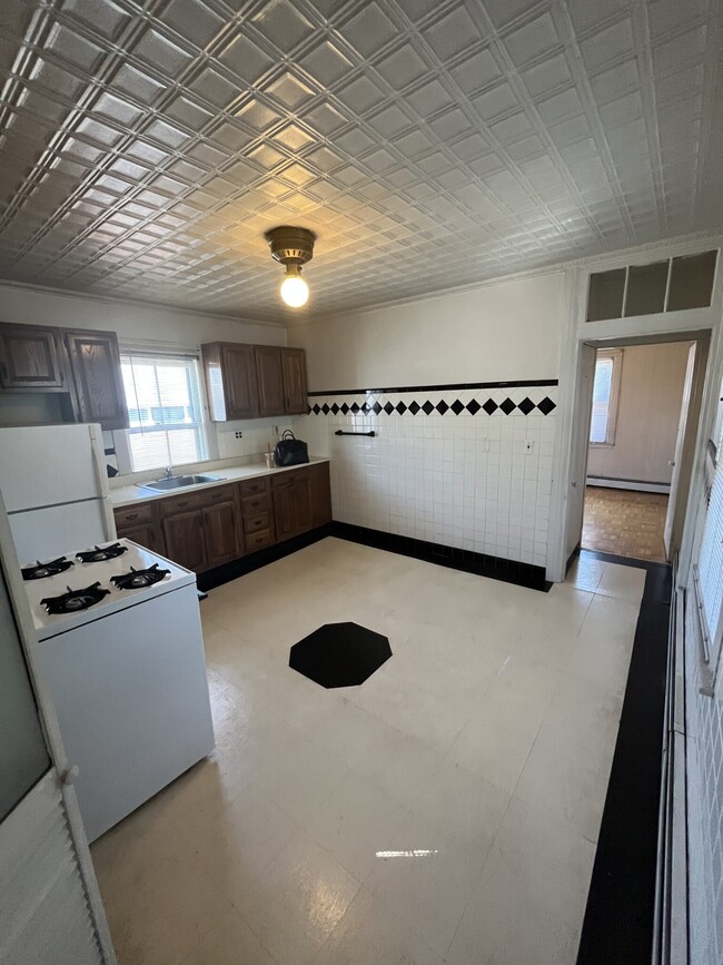
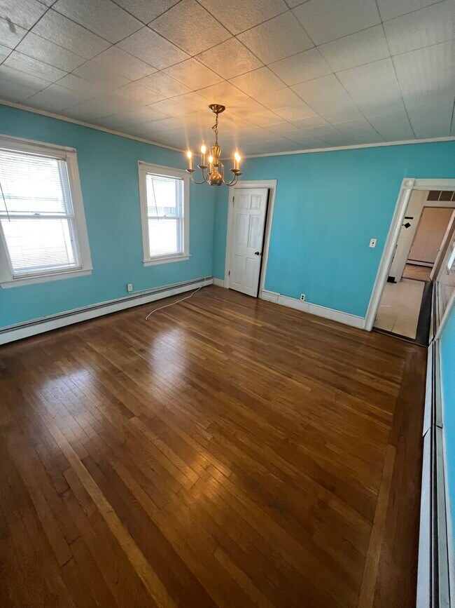
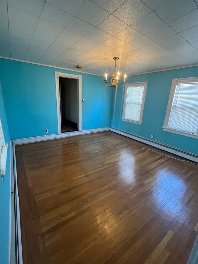
**Available 7/1 Sunny Cambridge 1 BD 1 BA apartment. This unit is in a great location, the Lechmere Green Line stop is about 1/4 mile away and it is about 3/4 mile to Kendall Square! There is no laundry and no dishwasher but there is a laundromat 1 block away. The unit is dated but everything is functional. There is an eat-in kitchen with a gas stove, pantry, and tile floors. The living room is spacious, with hardwood floors, a closet, and great natural light.
74 Otis St is an apartment community located in Middlesex County and the 02141 ZIP Code.
* Price shown is base rent and may not include non-optional fees and utilities.
Price, availability, fees, and any applicable rent special are subject to change without notice.
* Square footage definitions vary. Displayed square footage is approximate.
Fees and Policies
The fees below are based on community-supplied data and may exclude additional fees and utilities.
- Parking
-
Street--
Details
Property Information
-
3 units
Contact
- Contact
Location
Get Directions
Nestled along the Charles River, Cambridge is home to both Harvard University and the Massachusetts Institute of Technology, two world-class universities that are located just two miles from one another. This one-of-a-kind college town stands as a historical, cultural, and education hub for the state of Massachusetts. Cambridge offers a charming atmosphere and unbeatable proximity to big-city living with its central location in the Boston metro area, located just three miles west of Downtown Boston.
Nicknamed the “City of Squares” for its intersecting commercial districts, Cambridge offers residents direct access to urban amenities. Kendall Square can be compared to Silicon Valley due to its continuously growing concentration of start-ups. Central Square is your go-to for international restaurants, and Inman Square is a top pick for shopping, cafes, and nightlife. Art is alive and well in Cambridge, between street murals and sculptures and art galleries dotting the city streets.
Learn more about living in Cambridge
Education
| Colleges & Universities | Distance | ||
|---|---|---|---|
| Colleges & Universities | Distance | ||
| Drive: | 3 min | 1.3 mi | |
| Drive: | 5 min | 1.8 mi | |
| Drive: | 5 min | 2.3 mi | |
| Drive: | 6 min | 2.3 mi |
74 Otis St Unit 2R is within 5 minutes or 2.3 miles from Bunker Hill Community College. It is also near MIT and Suffolk University.
Transportation options available in Cambridge include Lechmere, located 0.3 mile from 74 Otis St Unit 2R. 74 Otis St Unit 2R is near General Edward Lawrence Logan International, located 4.5 miles or 10 minutes away.
| Transit / Subway | Distance | ||
|---|---|---|---|
| Transit / Subway | Distance | ||
| Walk: | 6 min | 0.3 mi | |
| Walk: | 13 min | 0.7 mi | |
| Drive: | 2 min | 1.1 mi | |
| Drive: | 6 min | 2.3 mi | |
| Drive: | 5 min | 2.6 mi |
| Commuter Rail | Distance | ||
|---|---|---|---|
| Commuter Rail | Distance | ||
| Drive: | 4 min | 1.4 mi | |
|
|
Drive: | 8 min | 2.5 mi |
|
|
Drive: | 7 min | 2.9 mi |
| Drive: | 9 min | 4.1 mi | |
| Drive: | 9 min | 4.2 mi |
| Airports | Distance | ||
|---|---|---|---|
| Airports | Distance | ||
|
General Edward Lawrence Logan International
|
Drive: | 10 min | 4.5 mi |
Time and distance from 74 Otis St Unit 2R.
| Shopping Centers | Distance | ||
|---|---|---|---|
| Shopping Centers | Distance | ||
| Walk: | 9 min | 0.5 mi | |
| Walk: | 10 min | 0.5 mi | |
| Drive: | 3 min | 1.2 mi |
74 Otis St Unit 2R has 3 shopping centers within 1.2 miles, which is about a 3-minute walk. The miles and minutes will be for the farthest away property.
| Parks and Recreation | Distance | ||
|---|---|---|---|
| Parks and Recreation | Distance | ||
|
Museum of Science
|
Walk: | 13 min | 0.7 mi |
|
Boston African American National Historic Site
|
Drive: | 6 min | 2.0 mi |
|
Boston National Historical Park
|
Drive: | 5 min | 2.3 mi |
|
Boston Public Garden
|
Drive: | 6 min | 2.4 mi |
|
Charles River Reservation
|
Drive: | 7 min | 2.6 mi |
74 Otis St Unit 2R has 5 parks within 2.6 miles, including Museum of Science, Boston African American National Historic Site, and Boston Public Garden.
| Hospitals | Distance | ||
|---|---|---|---|
| Hospitals | Distance | ||
| Drive: | 4 min | 1.5 mi | |
| Drive: | 4 min | 1.5 mi | |
| Drive: | 4 min | 1.7 mi |
74 Otis St Unit 2R has 3 hospitals within 1.7 miles, the nearest is Massachusetts Eye and Ear Infirmary which is 1.5 miles away and a 4 minute drive.
| Military Bases | Distance | ||
|---|---|---|---|
| Military Bases | Distance | ||
| Drive: | 27 min | 13.6 mi | |
| Drive: | 33 min | 18.0 mi |
74 Otis St Unit 2R is 13.6 miles from Hanscom Air Force Base, and is convenient to other military bases, including US Military Reservation.
74 Otis St Unit 2R Photos
What Are Walk Score®, Transit Score®, and Bike Score® Ratings?
Walk Score® measures the walkability of any address. Transit Score® measures access to public transit. Bike Score® measures the bikeability of any address.
What is a Sound Score Rating?
A Sound Score Rating aggregates noise caused by vehicle traffic, airplane traffic and local sources

74 Otis St
Cambridge, MA 02141