$2,300
Total Monthly Price
12 Month Lease
68 Sherwood St Unit 1
Boston, MA 02131
2 Weeks Ago
Favorites
68 Sherwood St Unit 1

Favorites
Check Back Soon for Upcoming Availability
| Beds | Baths | Average SF |
|---|---|---|
| 2 Bedrooms 2 Bedrooms 2 Br | 1 Bath 1 Bath 1 Ba | 900 SF |
Fees and Policies
The fees below are based on community-supplied data and may exclude additional fees and utilities.
- Dogs Allowed
-
Fees not specified
- Cats Allowed
-
Fees not specified
- Parking
-
Street--
Details
Utilities Included
-
Water
-
Trash Removal
-
Sewer
Property Information
-
2 units
About This Property
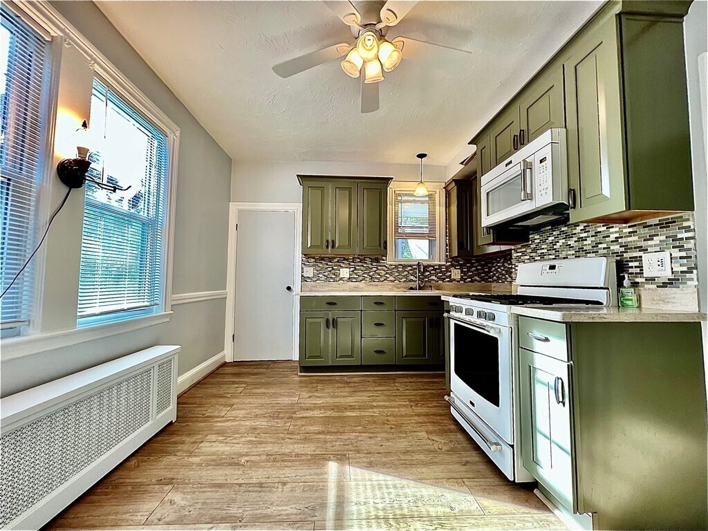
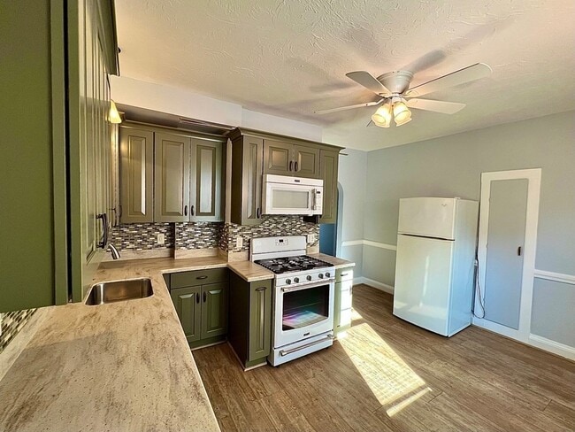
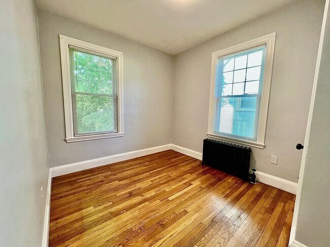
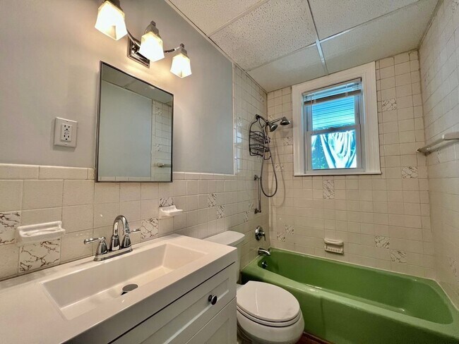
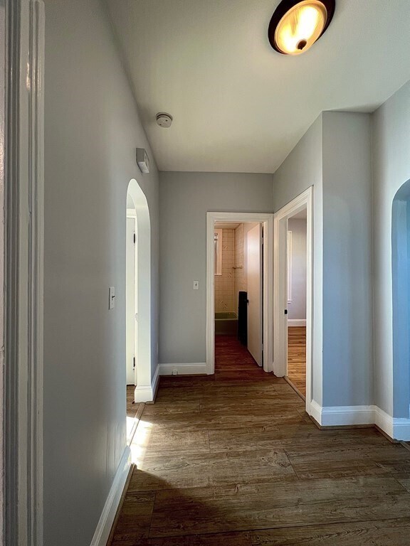
Moments from Roslindale Village. Fabulous, spacious, sunlit 2 bedroom, 1 bathroom apartment. Mellow hardwood floors, updated kitchen, dedicated new washer/dryer in the basement. Private screened-in porch perfect for summer evenings and morning coffee. Close to bus routes, trains, restaurants, and shops. Group showing on Friday June 3 from 5-6:30pm. ******Oil Heat*****
68 Sherwood St is an apartment community located in Suffolk County and the 02131 ZIP Code.
Apartment Features
Washer/Dryer
Dishwasher
Hardwood Floors
Smoke Free
- Washer/Dryer
- Smoke Free
- Dishwasher
- Kitchen
- Hardwood Floors
- Basement
- Porch
Location
Get Directions
Lower Washington-Mount Hope is a walkable neighborhood about eight miles south of Boston via Interstate 93 or public transit. Despite this area’s dense population, Lower Washington-Mount Hope has many wooded areas, and large parks like Bussey Brook Meadow and Franklin Park surround the neighborhood. Along with residential neighborhoods, a few shops and eateries can be found in town along American Legion Highway. Many residents travel to the western corner of town to get to the shopping plaza off Corinth Street for all the necessities. The western part of the neighborhood is also where most of the rentals in this area are located. Apartments, condos, and townhomes ranging from moderately priced to luxury can be found here.
Learn more about living in Lower Washington-Mount HopeBelow are rent ranges for similar nearby apartments
| Beds | Average Size | Lowest | Typical | Premium |
|---|---|---|---|---|
| Studio Studio Studio | 700 Sq Ft | $2,230 | $2,478 | $3,100 |
| 1 Bed 1 Bed 1 Bed | 835 Sq Ft | $1,463 | $2,710 | $3,238 |
| 2 Beds 2 Beds 2 Beds | 1505 Sq Ft | $2,200 | $2,923 | $3,587 |
| 3 Beds 3 Beds 3 Beds | 1192 Sq Ft | $1,000 | $3,270 | $4,425 |
| 4 Beds 4 Beds 4 Beds | 7066 Sq Ft | $3,800 | $4,960 | $5,300 |
Amenities
- Washer/Dryer
- Smoke Free
- Dishwasher
- Kitchen
- Hardwood Floors
- Basement
- Porch
Expenses
Utilities Included
Water, Trash Removal, Sewer
Included
Education
| Colleges & Universities | Distance | ||
|---|---|---|---|
| Colleges & Universities | Distance | ||
| Drive: | 10 min | 3.9 mi | |
| Drive: | 8 min | 4.2 mi | |
| Drive: | 9 min | 4.7 mi | |
| Drive: | 9 min | 4.8 mi |
68 Sherwood St Unit 1 is within 10 minutes or 3.9 miles from Curry College. It is also near Wentworth Inst. of Technology and MCPHS University, Boston.
Transportation options available in Boston include Forest Hills Station, located 1.4 miles from 68 Sherwood St Unit 1. 68 Sherwood St Unit 1 is near General Edward Lawrence Logan International, located 9.6 miles or 19 minutes away.
| Transit / Subway | Distance | ||
|---|---|---|---|
| Transit / Subway | Distance | ||
|
|
Drive: | 3 min | 1.4 mi |
|
|
Drive: | 4 min | 2.2 mi |
|
|
Drive: | 5 min | 2.5 mi |
|
|
Drive: | 6 min | 2.7 mi |
|
|
Drive: | 7 min | 3.1 mi |
| Commuter Rail | Distance | ||
|---|---|---|---|
| Commuter Rail | Distance | ||
|
|
Walk: | 11 min | 0.6 mi |
|
|
Drive: | 3 min | 1.4 mi |
|
|
Drive: | 5 min | 1.6 mi |
|
|
Drive: | 6 min | 2.1 mi |
| Drive: | 4 min | 2.1 mi |
| Airports | Distance | ||
|---|---|---|---|
| Airports | Distance | ||
|
General Edward Lawrence Logan International
|
Drive: | 19 min | 9.6 mi |
Time and distance from 68 Sherwood St Unit 1.
| Shopping Centers | Distance | ||
|---|---|---|---|
| Shopping Centers | Distance | ||
| Walk: | 15 min | 0.8 mi | |
| Walk: | 18 min | 0.9 mi | |
| Drive: | 3 min | 1.5 mi |
68 Sherwood St Unit 1 has 3 shopping centers within 1.5 miles, which is about a 3-minute walk. The miles and minutes will be for the farthest away property.
| Parks and Recreation | Distance | ||
|---|---|---|---|
| Parks and Recreation | Distance | ||
|
Mass Audubon's Boston Nature Center and Wildlife Sanctuary
|
Drive: | 4 min | 1.4 mi |
|
Arnold Arboretum of Harvard University
|
Drive: | 5 min | 1.7 mi |
|
Stony Brook Reservation
|
Drive: | 6 min | 2.5 mi |
|
Franklin Park Zoo
|
Drive: | 7 min | 3.2 mi |
|
Brook Farm Historic Site
|
Drive: | 9 min | 3.9 mi |
68 Sherwood St Unit 1 has 5 parks within 3.9 miles, including Mass Audubon's Boston Nature Center and Wildlife Sanctuary, Arnold Arboretum of Harvard University, and Stony Brook Reservation.
| Hospitals | Distance | ||
|---|---|---|---|
| Hospitals | Distance | ||
| Drive: | 6 min | 2.4 mi | |
| Drive: | 6 min | 2.7 mi | |
| Drive: | 5 min | 2.9 mi |
68 Sherwood St Unit 1 has 3 hospitals within 2.9 miles, the nearest is Bournewood Hospital which is 2.4 miles away and a 6 minute drive.
| Military Bases | Distance | ||
|---|---|---|---|
| Military Bases | Distance | ||
| Drive: | 29 min | 15.4 mi |
68 Sherwood St Unit 1 is 15.4 miles and a 29 minute drive from US Military Reservation.
You May Also Like
-
Waterfall Hills at Canton
55 Waterfall Dr
Canton, MA 02021
$2,925 - $3,465 Plus Fees
2 Br 12 Month Lease 9.4 mi
-
The 305, A Broadstone Community
305 Winter St
Waltham, MA 02451
$3,682 - $5,523 Total Monthly Price
2-3 Br 10.4 mi
-
The Point at Weymouth
39 Trotter Rd
Weymouth, MA 02190
$2,656 - $4,916 Plus Fees
2-3 Br 12.6 mi
Similar Rentals Nearby
-
-
-
-
$4,725 - $5,375
Plus Fees2 Beds
2 Months FreePets Allowed Fitness Center Dishwasher Refrigerator Kitchen In Unit Washer & Dryer
-
Total Monthly Price New
$5,800 - $9,340
Total Monthly PriceBase Rent$5,800 - $9,340Utilities & EssentialsVariesTotal Monthly Price$5,800 - $9,34012 Month Lease2-3 Beds
1 Month FreePets Allowed Fitness Center Dishwasher Refrigerator Kitchen In Unit Washer & Dryer
-
-
-
-
-


What Are Walk Score®, Transit Score®, and Bike Score® Ratings?
Walk Score® measures the walkability of any address. Transit Score® measures access to public transit. Bike Score® measures the bikeability of any address.
What is a Sound Score Rating?
A Sound Score Rating aggregates noise caused by vehicle traffic, airplane traffic and local sources

68 Sherwood St
Boston, MA 02131