
Living at NoHo
11059 McCormick St,
North Hollywood, CA 91601
$2,248 - $3,858 Total Monthly Price
Studio - 3 Beds

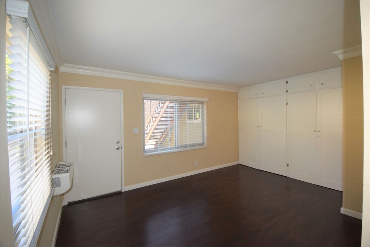
609 Hollywood Way, this is a charming studio apartment conveniently located near the many Entertainment Studios in Burbank! Minutes from the NoHo Arts District, Downtown Burbank and its restaurants and shopping. A short walk to the Whitnall Highway Park South. Target, Smart & Final and Porto's Bakery are also minutes away.
609 N Hollywood Way is an apartment community located in Los Angeles County and the 91505 ZIP Code. This area is served by the Los Angeles Unified Rocp School District attendance zone.
Unique Features
Air Conditioning
Hardwood Floors
Refrigerator
Tub/Shower
Magnolia Park is an eclectic neighborhood in west Burbank home to funky shops, art galleries, and thrift stores that sit side-by-side to create a charming oasis. This close-knit neighborhood and park-like community is just 14 miles northwest of Downtown Los Angeles and only two miles west of Downtown Burbank. Enjoy annual movie nights, seasonal events, and food truck festivals when you become a renter in Magnolia Park. Locals enjoy strolling or biking up to Magnolia Boulevard to grab a bite to eat. Porto’s Bakery and Café is a famous Cuban bakery that attracts people from all over the city. The single-family homes and apartments for rent in this neighborhood range from affordable to upscale, and locals regularly spend their leisure time in the very park that gives the neighborhood its name.
Learn more about living in Magnolia ParkCompare neighborhood and city base rent averages by bedroom.
| Magnolia Park | Burbank, CA | |
|---|---|---|
| Studio | $2,000 | $1,929 |
| 1 Bedroom | $2,273 | $2,224 |
| 2 Bedrooms | $2,697 | $2,921 |
| 3 Bedrooms | $3,453 | $3,926 |
| Colleges & Universities | Distance | ||
|---|---|---|---|
| Colleges & Universities | Distance | ||
| Walk: | 19 min | 1.0 mi | |
| Drive: | 9 min | 3.9 mi | |
| Drive: | 9 min | 4.8 mi | |
| Drive: | 10 min | 5.5 mi |


Transportation options available in Burbank include Universal City/Studio City, located 2.4 miles from 609 N Hollywood Way. 609 N Hollywood Way is near Bob Hope, located 4.4 miles or 9 minutes away, and Los Angeles International, located 25.9 miles or 36 minutes away.
| Transit / Subway | Distance | ||
|---|---|---|---|
| Transit / Subway | Distance | ||
|
|
Drive: | 5 min | 2.4 mi |
|
|
Drive: | 5 min | 2.4 mi |
|
|
Drive: | 9 min | 4.7 mi |
|
|
Drive: | 9 min | 5.1 mi |
|
|
Drive: | 10 min | 5.9 mi |
| Commuter Rail | Distance | ||
|---|---|---|---|
| Commuter Rail | Distance | ||
|
|
Drive: | 6 min | 2.4 mi |
|
|
Drive: | 6 min | 2.9 mi |
| Drive: | 7 min | 3.4 mi | |
|
|
Drive: | 9 min | 5.1 mi |
|
|
Drive: | 11 min | 7.5 mi |
| Airports | Distance | ||
|---|---|---|---|
| Airports | Distance | ||
|
Bob Hope
|
Drive: | 9 min | 4.4 mi |
|
Los Angeles International
|
Drive: | 36 min | 25.9 mi |
Scores provided by
Traffic
-Airport
-Businesses
-Scores provided by
HowLoud What is a Sound Score Rating? A Sound Score Rating aggregates noise caused by vehicle traffic, airplane traffic and local sources. How It WorksTime and distance from 609 N Hollywood Way.
| Shopping Centers | Distance | ||
|---|---|---|---|
| Shopping Centers | Distance | ||
| Walk: | 3 min | 0.2 mi | |
| Walk: | 12 min | 0.6 mi | |
| Walk: | 12 min | 0.6 mi |
| Parks and Recreation | Distance | ||
|---|---|---|---|
| Parks and Recreation | Distance | ||
|
Runyon Canyon
|
Drive: | 11 min | 5.2 mi |
|
Los Angeles Zoo
|
Drive: | 16 min | 6.2 mi |
|
Bird Sanctuary
|
Drive: | 14 min | 8.5 mi |
|
Griffith Observatory
|
Drive: | 18 min | 9.7 mi |
|
Griffith Park
|
Drive: | 27 min | 11.9 mi |
| Hospitals | Distance | ||
|---|---|---|---|
| Hospitals | Distance | ||
| Drive: | 3 min | 1.4 mi | |
| Drive: | 10 min | 5.5 mi | |
| Drive: | 12 min | 6.9 mi |
| Military Bases | Distance | ||
|---|---|---|---|
| Military Bases | Distance | ||
| Drive: | 36 min | 19.7 mi |
What Are Walk Score®, Transit Score®, and Bike Score® Ratings?
Walk Score® measures the walkability of any address. Transit Score® measures access to public transit. Bike Score® measures the bikeability of any address.
What is a Sound Score Rating?
A Sound Score Rating aggregates noise caused by vehicle traffic, airplane traffic and local sources.
605-609 N Hollywood Way
Burbank, CA 91505


