

$3,295
/ Month
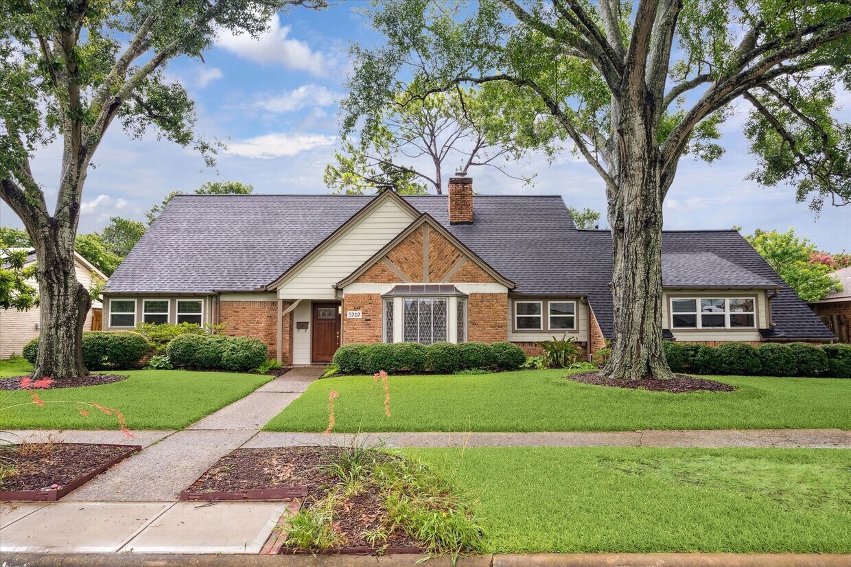
5707 Darnell St
Houston, TX 77096
Today
Favorites
713-306-7899
-
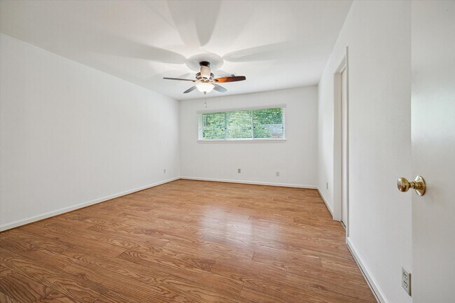
Bedrooms
4
-
Bathrooms
3
-
Square Feet
2,244 sq ft
-
Available
Available Now
Highlights
- Deck
- Traditional Architecture
- Private Yard
- Game Room
- Home Office
- Breakfast Room
5707 Darnell St

Favorites
About This Home
Available Now
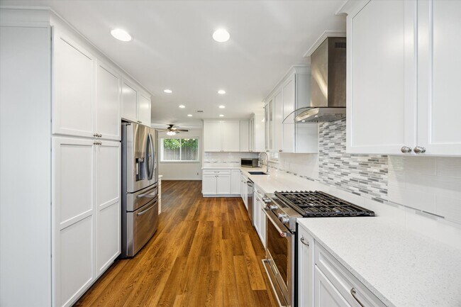
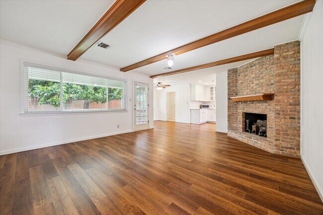
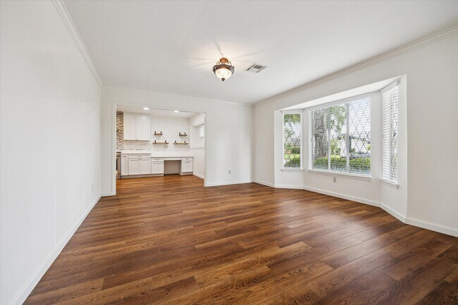
Charming 4-bedroom,2.5-bath home in the heart of Meyerland! Close to the Medical Center and only 20 minutes to Downtown. Features include a remodeled kitchen,exposed wood beam in the spacious family room,and a versatile game room upstairs. Two bedrooms conveniently located on the first floor. Gated driveway,move-in ready,and zoned to highly regarded Herod Elementary and Bellaire High School. Enjoy easy access to top-rated restaurants,shopping,and more. No known history of flooding. MLS# 16842296
5707 Darnell St is a house located in Harris County and the 77096 ZIP Code. This area is served by the Houston Independent attendance zone.
* Price shown is base rent and may not include non-optional fees and utilities. Price, availability, fees, and any applicable rent special are subject to change without notice.
* Square footage definitions vary. Displayed square footage is approximate.
Home Details
Home Type
Single Family Detached Home
Year Built
Built in 1964
Bedrooms and Bathrooms
Double Vanity
Bathtub with Shower
En-Suite Primary Bedroom
2.5 Bathrooms
4 Bedrooms
Eco-Friendly Details
Energy-Efficient Windows with Low Emissivity
Energy-Efficient Exposure or Shade
Energy-Efficient Insulation
Flooring
Tile
Vinyl Plank
Carpet
Vinyl
Home Design
Traditional Architecture
Home Security
Security System Owned
Fire and Smoke Detector
Interior Spaces
Game Room
Home Office
Breakfast Room
Family Room Off Kitchen
Living Room
2,244 Sq Ft Home
1-Story Property
Gas Log Fireplace
Kitchen
Convection Oven
Pots and Pans Drawers
Gas Oven
Gas Range
Microwave
Dishwasher
Disposal
Self-Closing Drawers
Laundry
Dryer
Washer
Listing and Financial Details
Property Available on 8/1/25
Long Term Lease
Lot Details
9,000 Sq Ft Lot
Private Yard
Sprinkler System
Outdoor Features
Deck
Patio
Parking
2 Car Attached Garage
Garage Door Opener
Driveway
Schools
Herod Elementary School
Fondren Middle School
Bellaire High School
Utilities
Central Heating and Cooling System
Heating System Uses Gas
Community Details
Overview
Meyerland Sec 10 Subdivision
Pet Policy
Call for details about the types of pets allowed
Pet Deposit Required
Security
Security Service
Contact
- Listed by Joan Bremner | Compass RE Texas,LLC - Memorial
- Phone Number
- Contact
-
Source
 Houston Association of REALTORS®
Copyright © 2025 Houston Association of Realtors. All rights reserved. All information provided by the listing agent/broker is deemed reliable but is not guaranteed and should be independently verified.
Location
Get Directions
Founded in 1955, Meyerland Area is a 6,000-acre community southwest of Houston and encompassed by beautiful homes near the Interstate 610 Loop and Beltway 8. In addition to many houses of worship, Meyerland Area is also home to the Meyerland Plaza shopping center on Beechnut Street.
Residents of this community are served by the Houston Independent School District. After the school day, kids enjoy playtime on the jungle gyms at Meyerland Park and Herbert Godwin Park. Numerous restaurants surround the plaza, and the Brays Bayou Greenway provides locals a scenic jog along the bayou.
Learn more about living in Meyerland Area
Education
| Colleges & Universities | Distance | ||
|---|---|---|---|
| Colleges & Universities | Distance | ||
| Drive: | 6 min | 2.2 mi | |
| Drive: | 11 min | 5.8 mi | |
| Drive: | 13 min | 5.9 mi | |
| Drive: | 17 min | 7.2 mi |
5707 Darnell St is within 6 minutes or 2.2 miles from Houston Baptist University. It is also near The Art Institute of Houston and UT Health Houston.
Schools


Public Elementary School
Grades PK-5
769 Students
Attendance Zone
Public Middle School
Grades 6-8
840 Students
Attendance Zone
Public High School
Grades 9-12
3,170 Students
Attendance Zone
Private Elementary & Middle School
Grades PK-8
155 Students
Nearby
Private Elementary School
Grades PK-5
296 Students
Nearby
Private Elementary & Middle School
Grades PK-7
66 Students
Nearby
Private Middle & High School
Grades 7-12
Nearby
School data provided by
 The GreatSchools Rating helps parents compare schools within a state based on a variety of school quality indicators and provides a helpful picture of how effectively each school serves all of its students. Ratings are on a scale of 1 (below average) to 10 (above average) and can include test scores, college readiness, academic progress, advanced courses, equity, discipline and attendance data. We also advise parents to visit schools, consider other information on school performance and programs, and consider family needs as part of the school selection process.
View GreatSchools Rating Methodology
Data provided by GreatSchools.org © 2025. All rights reserved.
View GreatSchools Rating Methodology
Data provided by GreatSchools.org © 2025. All rights reserved.
Transportation options available in Houston include Smith Lands, located 5.8 miles from 5707 Darnell St. 5707 Darnell St is near William P Hobby, located 17.6 miles or 32 minutes away, and George Bush Intcntl/Houston, located 31.3 miles or 41 minutes away.
| Transit / Subway | Distance | ||
|---|---|---|---|
| Transit / Subway | Distance | ||
|
|
Drive: | 12 min | 5.8 mi |
| Drive: | 13 min | 6.2 mi | |
|
|
Drive: | 14 min | 6.5 mi |
|
|
Drive: | 11 min | 6.5 mi |
|
|
Drive: | 11 min | 6.5 mi |
| Commuter Rail | Distance | ||
|---|---|---|---|
| Commuter Rail | Distance | ||
|
|
Drive: | 20 min | 11.7 mi |
| Airports | Distance | ||
|---|---|---|---|
| Airports | Distance | ||
|
William P Hobby
|
Drive: | 32 min | 17.6 mi |
|
George Bush Intcntl/Houston
|
Drive: | 41 min | 31.3 mi |
Time and distance from 5707 Darnell St.
| Shopping Centers | Distance | ||
|---|---|---|---|
| Shopping Centers | Distance | ||
| Walk: | 2 min | 0.1 mi | |
| Walk: | 11 min | 0.6 mi | |
| Walk: | 17 min | 0.9 mi |
5707 Darnell St has 3 shopping centers within 0.9 mile, which is about a 17-minute walk. The miles and minutes will be for the farthest away property.
| Parks and Recreation | Distance | ||
|---|---|---|---|
| Parks and Recreation | Distance | ||
|
Nature Discovery Center
|
Drive: | 7 min | 3.2 mi |
|
Club Creek Park and Vietnam Veterans Memorial
|
Drive: | 10 min | 4.4 mi |
|
Buffalo Bayou Paddling Trail
|
Drive: | 10 min | 4.8 mi |
|
Houston Maritime Museum
|
Drive: | 12 min | 5.8 mi |
|
Arthur Storey Park
|
Drive: | 12 min | 5.9 mi |
5707 Darnell St has 5 parks within 5.9 miles, including Nature Discovery Center, Club Creek Park and Vietnam Veterans Memorial, and Buffalo Bayou Paddling Trail.
| Hospitals | Distance | ||
|---|---|---|---|
| Hospitals | Distance | ||
| Drive: | 4 min | 2.0 mi | |
| Drive: | 5 min | 2.2 mi | |
| Drive: | 11 min | 5.3 mi |
5707 Darnell St has 3 hospitals within 5.3 miles, the nearest is West Oaks Hospital which is 2.0 miles away and a 4 minute drive.
| Military Bases | Distance | ||
|---|---|---|---|
| Military Bases | Distance | ||
| Drive: | 46 min | 32.0 mi | |
| Drive: | 75 min | 57.5 mi |
5707 Darnell St is 32.0 miles from Lyndon B Johnson Space Center, and is convenient to other military bases, including Pelican Spit Military Reservation.
You May Also Like
Similar Rentals Nearby


What Are Walk Score®, Transit Score®, and Bike Score® Ratings?
Walk Score® measures the walkability of any address. Transit Score® measures access to public transit. Bike Score® measures the bikeability of any address.
What is a Sound Score Rating?
A Sound Score Rating aggregates noise caused by vehicle traffic, airplane traffic and local sources
5707 Darnell St
Houston, TX 77096