
AVA Burbank
401 N Pass Ave,
Burbank, CA 91505
$1,715 - $3,840
Studio - 3 Beds

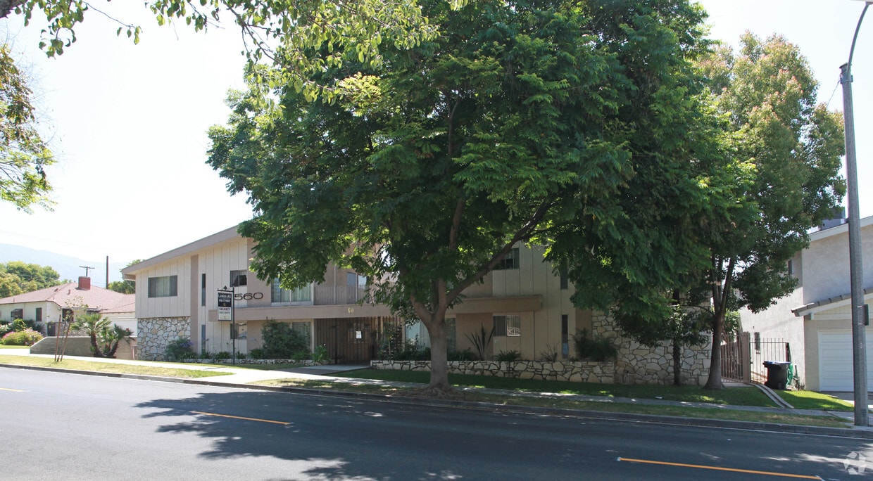
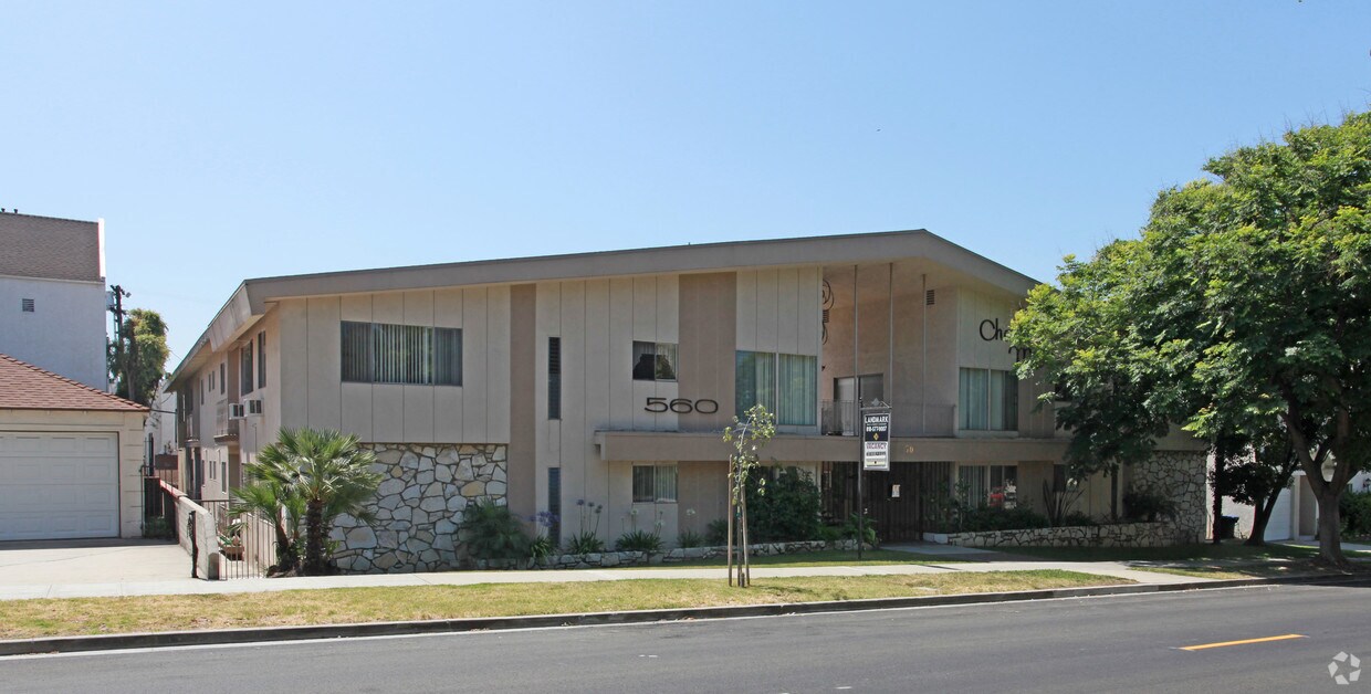
Explore your new home at 560 E Providencia Ave. This apartment community is located in the 91501 area of Burbank. Here at this community, the leasing staff is ready to help you in finding the perfect place to live. A unique variety of features and amenities are waiting for you here. Some of these include: balconies, rentable storage units, and high-speed internet access. At 560 E Providencia Ave you're new apartment awaits. Stop by the community today.
560 E Providencia Ave is an apartment community located in Los Angeles County and the 91501 ZIP Code. This area is served by the Burbank Unified attendance zone.
High Speed Internet Access
Smoke Free
Heating
Kitchen
Living in Burbank combines entertainment industry heritage with comfortable suburban living. As home to Warner Bros., Disney, and Netflix, the city's entertainment legacy shapes its character. The rental market currently shows average monthly rates ranging from $1,960 for studios to $5,337 for four-bedroom units, with moderate year-over-year increases ranging from 0.3% to 6.6%. One-bedroom apartments average $2,287, reflecting a 2.2% annual increase.
Each Burbank neighborhood has its own character - from the Rancho district with its equestrian zoning to Magnolia Park, where vintage shops and local boutiques line the streets. Outdoor spaces include Johnny Carson Park and the Chandler Bikeway, which connects residents to various parts of the city. The Media District houses major studios, while downtown features shopping at Burbank Town Center and an array of restaurants along San Fernando Boulevard.
Learn more about living in Burbank| Colleges & Universities | Distance | ||
|---|---|---|---|
| Colleges & Universities | Distance | ||
| Drive: | 8 min | 3.7 mi | |
| Drive: | 8 min | 4.0 mi | |
| Drive: | 11 min | 6.9 mi | |
| Drive: | 15 min | 8.2 mi |


Transportation options available in Burbank include North Hollywood Station, located 5.6 miles from 560 E Providencia Ave. 560 E Providencia Ave is near Bob Hope, located 6.6 miles or 12 minutes away, and Los Angeles International, located 26.6 miles or 41 minutes away.
| Transit / Subway | Distance | ||
|---|---|---|---|
| Transit / Subway | Distance | ||
|
|
Drive: | 10 min | 5.6 mi |
|
|
Drive: | 11 min | 5.8 mi |
|
|
Drive: | 15 min | 7.9 mi |
|
|
Drive: | 13 min | 8.1 mi |
|
|
Drive: | 13 min | 8.6 mi |
| Commuter Rail | Distance | ||
|---|---|---|---|
| Commuter Rail | Distance | ||
|
|
Drive: | 4 min | 1.8 mi |
|
|
Drive: | 8 min | 3.8 mi |
| Drive: | 7 min | 4.4 mi | |
|
|
Drive: | 9 min | 6.1 mi |
|
|
Drive: | 10 min | 6.6 mi |
| Airports | Distance | ||
|---|---|---|---|
| Airports | Distance | ||
|
Bob Hope
|
Drive: | 12 min | 6.6 mi |
|
Los Angeles International
|
Drive: | 41 min | 26.6 mi |
Time and distance from 560 E Providencia Ave.
| Shopping Centers | Distance | ||
|---|---|---|---|
| Shopping Centers | Distance | ||
| Walk: | 15 min | 0.8 mi | |
| Walk: | 15 min | 0.8 mi | |
| Walk: | 17 min | 0.9 mi |
| Parks and Recreation | Distance | ||
|---|---|---|---|
| Parks and Recreation | Distance | ||
|
Los Angeles Zoo
|
Drive: | 16 min | 5.3 mi |
|
Bird Sanctuary
|
Drive: | 13 min | 7.6 mi |
|
Griffith Observatory
|
Drive: | 17 min | 8.8 mi |
|
La Tuna Canyon Park
|
Drive: | 15 min | 10.0 mi |
|
Griffith Park
|
Drive: | 27 min | 11.0 mi |
| Hospitals | Distance | ||
|---|---|---|---|
| Hospitals | Distance | ||
| Drive: | 6 min | 2.9 mi | |
| Drive: | 10 min | 6.3 mi | |
| Drive: | 12 min | 7.2 mi |
| Military Bases | Distance | ||
|---|---|---|---|
| Military Bases | Distance | ||
| Drive: | 38 min | 28.2 mi |
What Are Walk Score®, Transit Score®, and Bike Score® Ratings?
Walk Score® measures the walkability of any address. Transit Score® measures access to public transit. Bike Score® measures the bikeability of any address.
What is a Sound Score Rating?
A Sound Score Rating aggregates noise caused by vehicle traffic, airplane traffic and local sources
560 E Providencia Ave
Burbank, CA 91501


