$2,350
/ Month
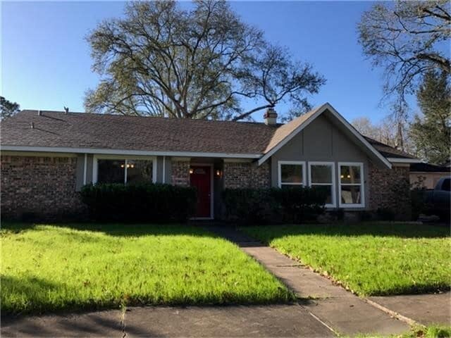
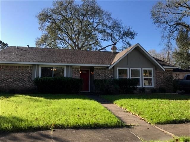
5519 Ariel St
Houston, TX 77096
Today
|
Edit
Favorites
713-306-0868
-
Bedrooms
3
-
Bathrooms
2
-
Square Feet
1,714 sq ft
-
Available
Available Now
Highlights
- Traditional Architecture
- Home Office
- 2 Car Detached Garage
- Central Heating and Cooling System
- 1-Story Property
5519 Ariel St

Favorites
About This Home
Available Now
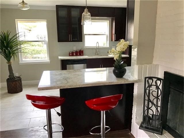
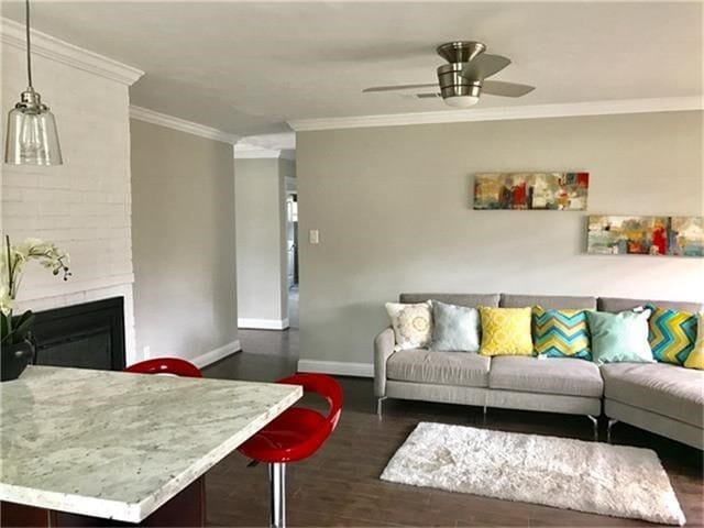
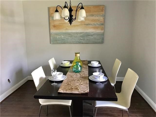
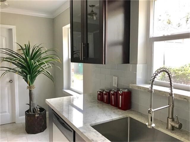
In nice schools area,zoom in Bellaire high school,walking distance to excellent elementary school. wood floor,fresh painting whole house,totally remodeled bathrooms. 10 minutes to Galleria,medical center,down town. stainless steel appliances. House is available and ready to move in. MLS# 7686996
5519 Ariel St is a house located in Harris County and the 77096 ZIP Code. This area is served by the Houston Independent attendance zone.
* Price shown is base rent. Excludes user-selected optional fees and variable or usage-based fees and required charges due at or prior to move-in or at move-out. Price, availability, fees, and any applicable rent special are subject to change without notice.
* Square footage definitions vary. Displayed square footage is approximate.
Home Details
Home Type
Single Family Detached Home
Year Built
Built in 1960
Bedrooms and Bathrooms
2 Full Bathrooms
3 Bedrooms
Home Design
Traditional Architecture
Interior Spaces
Home Office
1,714 Sq Ft Home
1-Story Property
Kitchen
Gas Oven
Microwave
Dishwasher
Disposal
Listing and Financial Details
Property Available on 11/29/25
Long Term Lease
Lot Details
7,504 Sq Ft Lot
Parking
2 Car Detached Garage
Schools
Herod Elementary School
Fondren Middle School
Bellaire High School
Utilities
Central Heating and Cooling System
Community Details
Overview
3 Units
Barkley Circle Subdivision
Pet Policy
Call for details about the types of pets allowed
Pet Deposit Required
Contact
- Listed by Jue Hu | Y & R International Corp.
- Phone Number
- Contact
-
Source
 Houston Association of REALTORS®
Copyright © 2026 Houston Association of Realtors. All rights reserved. All information provided by the listing agent/broker is deemed reliable but is not guaranteed and should be independently verified.
Location
Get Directions
Founded in 1955, Meyerland Area is a 6,000-acre community southwest of Houston and encompassed by beautiful homes near the Interstate 610 Loop and Beltway 8. In addition to many houses of worship, Meyerland Area is also home to the Meyerland Plaza shopping center on Beechnut Street.
Residents of this community are served by the Houston Independent School District. After the school day, kids enjoy playtime on the jungle gyms at Meyerland Park and Herbert Godwin Park. Numerous restaurants surround the plaza, and the Brays Bayou Greenway provides locals a scenic jog along the bayou.
Learn more about living in Meyerland Area
Education
| Colleges & Universities | Distance | ||
|---|---|---|---|
| Colleges & Universities | Distance | ||
| Drive: | 7 min | 2.6 mi | |
| Drive: | 8 min | 2.7 mi | |
| Drive: | 12 min | 5.9 mi | |
| Drive: | 14 min | 6.1 mi |
5519 Ariel St is within 7 minutes or 2.6 miles from Houston Christian University. It is also near Houston Baptist University and The Art Institute of Houston.
Schools


Public Elementary School
Grades PK-5
769 Students
Attendance Zone
Public Middle School
Grades 6-8
840 Students
Attendance Zone
Public High School
Grades 9-12
3,170 Students
Attendance Zone
Private Elementary School
Grades PK-5
296 Students
Nearby
Private Elementary & Middle School
Grades PK-8
155 Students
Nearby
Private Middle & High School
Grades 7-12
Nearby
School data provided by
 The GreatSchools Rating helps parents compare schools within a state based on a variety of school quality indicators and provides a helpful picture of how effectively each school serves all of its students. Ratings are on a scale of 1 (below average) to 10 (above average) and can include test scores, college readiness, academic progress, advanced courses, equity, discipline and attendance data. We also advise parents to visit schools, consider other information on school performance and programs, and consider family needs as part of the school selection process.
View GreatSchools Rating Methodology
Data provided by GreatSchools.org © 2026. All rights reserved.
View GreatSchools Rating Methodology
Data provided by GreatSchools.org © 2026. All rights reserved.
Transportation options available in Houston include Fannin South, located 6.2 miles from 5519 Ariel St. 5519 Ariel St is near William P Hobby, located 17.3 miles or 32 minutes away, and George Bush Intcntl/Houston, located 31.5 miles or 42 minutes away.
| Transit / Subway | Distance | ||
|---|---|---|---|
| Transit / Subway | Distance | ||
|
|
Drive: | 12 min | 6.2 mi |
|
|
Drive: | 12 min | 6.2 mi |
|
|
Drive: | 13 min | 6.3 mi |
| Drive: | 14 min | 6.3 mi | |
|
|
Drive: | 15 min | 6.6 mi |
| Commuter Rail | Distance | ||
|---|---|---|---|
| Commuter Rail | Distance | ||
|
|
Drive: | 21 min | 11.9 mi |
| Airports | Distance | ||
|---|---|---|---|
| Airports | Distance | ||
|
William P Hobby
|
Drive: | 32 min | 17.3 mi |
|
George Bush Intcntl/Houston
|
Drive: | 42 min | 31.5 mi |
Time and distance from 5519 Ariel St.
| Shopping Centers | Distance | ||
|---|---|---|---|
| Shopping Centers | Distance | ||
| Walk: | 12 min | 0.6 mi | |
| Walk: | 16 min | 0.8 mi | |
| Walk: | 18 min | 0.9 mi |
5519 Ariel St has 3 shopping centers within 0.9 mile, which is about a 18-minute walk. The miles and minutes will be for the farthest away property.
| Parks and Recreation | Distance | ||
|---|---|---|---|
| Parks and Recreation | Distance | ||
|
Nature Discovery Center
|
Drive: | 7 min | 3.4 mi |
|
Club Creek Park and Vietnam Veterans Memorial
|
Drive: | 11 min | 4.8 mi |
|
Buffalo Bayou Paddling Trail
|
Drive: | 12 min | 5.4 mi |
|
Houston Maritime Museum
|
Drive: | 13 min | 5.9 mi |
|
Arthur Storey Park
|
Drive: | 14 min | 6.4 mi |
5519 Ariel St has 5 parks within 6.4 miles, including Nature Discovery Center, Club Creek Park and Vietnam Veterans Memorial, and Buffalo Bayou Paddling Trail.
| Hospitals | Distance | ||
|---|---|---|---|
| Hospitals | Distance | ||
| Drive: | 6 min | 2.4 mi | |
| Drive: | 6 min | 2.6 mi | |
| Drive: | 12 min | 5.5 mi |
5519 Ariel St has 3 hospitals within 5.5 miles, the nearest is Behavioral Hospital of Bellaire which is 2.4 miles away and a 6 minute drive.
| Military Bases | Distance | ||
|---|---|---|---|
| Military Bases | Distance | ||
| Drive: | 47 min | 31.7 mi | |
| Drive: | 75 min | 57.2 mi |
5519 Ariel St is 31.7 miles from Lyndon B Johnson Space Center, and is convenient to other military bases, including Pelican Spit Military Reservation.
You May Also Like
Similar Rentals Nearby
-
-
-
-
-
-
1 / 37

-
1 / 48

-
-

-


What Are Walk Score®, Transit Score®, and Bike Score® Ratings?
Walk Score® measures the walkability of any address. Transit Score® measures access to public transit. Bike Score® measures the bikeability of any address.
What is a Sound Score Rating?
A Sound Score Rating aggregates noise caused by vehicle traffic, airplane traffic and local sources
5519 Ariel St
Houston, TX 77096