
$1,290
/ Month
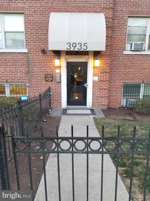
3935 S St SE
Washington, DC 20020
Today
|
Edit
Favorites
703-798-5976
-
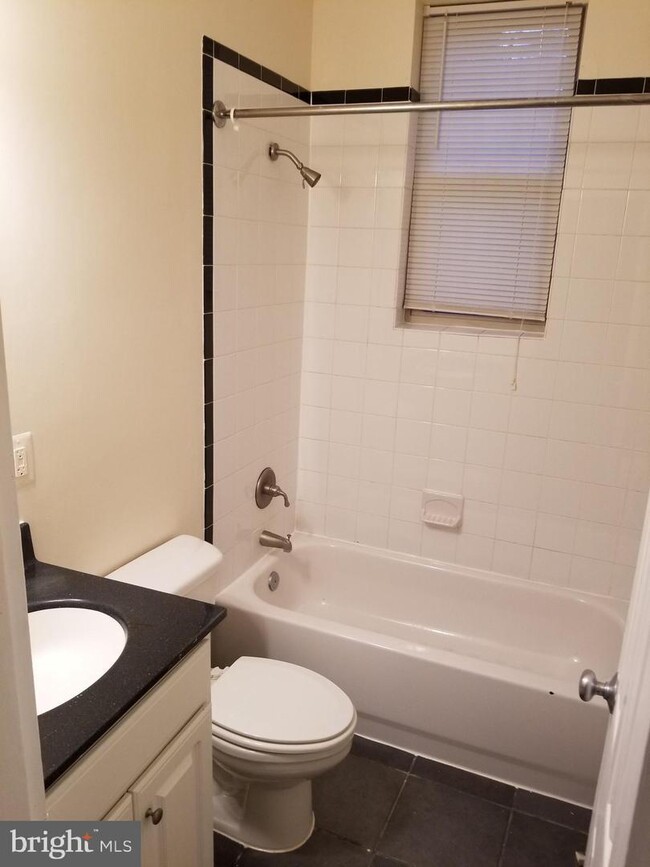
Bedrooms
1
-
Bathrooms
1
-
Square Feet
625 sq ft
-
Available
Available Now
3935 S St SE

Favorites
About This Home
$1,290 deposit,
Available Now
Amazing property with sizable master bedroom* Water and Gas Included* Location is steps from Pennsylvania Avenue SE, making it an easy commute to DC or PG County. Fresh, new paint throughout and new vinyl flooring. Public transportation is only minutes away and much more. Thank you 3935 S Street SE Unit A-2, Washington DC, 20019
3935 S St SE is a townhome located in District of Columbia County and the 20020 ZIP Code. This area is served by the District Of Columbia Public Schools attendance zone.
* Price shown is base rent. Excludes user-selected optional fees and variable or usage-based fees and required charges due at or prior to move-in or at move-out. Price, availability, fees, and any applicable rent special are subject to change without notice.
* Square footage definitions vary. Displayed square footage is approximate.
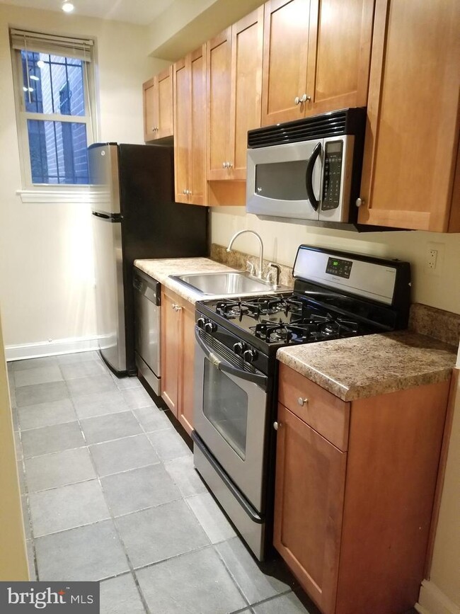
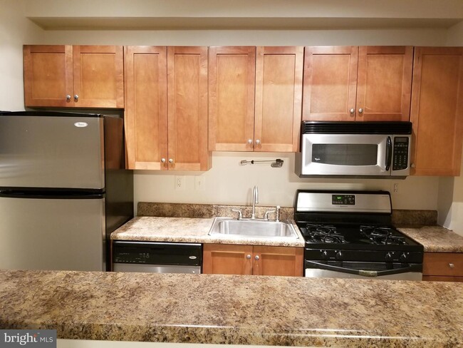
Townhome Features
Dishwasher
Microwave
Refrigerator
Disposal
- Dishwasher
- Disposal
- Microwave
- Refrigerator
Fees and Policies
The fees below are based on community-supplied data and may exclude additional fees and utilities.
- One-Time Move-In Fees
-
Security Deposit Refundable - Refundable$1,290
Contact
- Listed by Global
- Phone Number
- Contact
Location
Get Directions
Amenities
- Dishwasher
- Disposal
- Microwave
- Refrigerator
The residential neighborhood of Fort Dupont sits just east of the Anacostia River in Southeast Washington, DC. The neighborhood has ample green space provided by two adjacent parks — Fort Circle Park and Fort Chaplin Park — and distinguishes itself within the Greater Anacostia area by housing the only public indoor ice rink in Washington, DC.
There’s a diverse mix of rentals in Fort Dupont, from more recent and upscale developments to long-standing apartment homes closer to the Anacostia River. Proximity to the Benning Road Metro Station makes Fort Dupont perfect for the Capitol Hill commuter who wishes to reside outside the bustle of DC.
Learn more about living in Fort Dupont
Education
| Colleges & Universities | Distance | ||
|---|---|---|---|
| Colleges & Universities | Distance | ||
| Drive: | 11 min | 5.1 mi | |
| Drive: | 11 min | 5.1 mi | |
| Drive: | 12 min | 5.7 mi | |
| Drive: | 12 min | 5.8 mi |
3935 S St SE is within 11 minutes or 5.1 miles from Georgetown Law. It is also near Georgetown and Gallaudet University.
Schools


Public Elementary School
Grades PK-5
372 Students
Attendance Zone
Public Middle School
Grades 6-8
215 Students
Attendance Zone
Public High School
Grades 9-12
287 Students
Attendance Zone
Private Elementary, Middle & High School
Grades PK-12
149 Students
Nearby
Private Elementary & Middle School
Grades PK-8
130 Students
Nearby
School data provided by
 The GreatSchools Rating helps parents compare schools within a state based on a variety of school quality indicators and provides a helpful picture of how effectively each school serves all of its students. Ratings are on a scale of 1 (below average) to 10 (above average) and can include test scores, college readiness, academic progress, advanced courses, equity, discipline and attendance data. We also advise parents to visit schools, consider other information on school performance and programs, and consider family needs as part of the school selection process.
View GreatSchools Rating Methodology
Data provided by GreatSchools.org © 2026. All rights reserved.
View GreatSchools Rating Methodology
Data provided by GreatSchools.org © 2026. All rights reserved.
Transportation options available in Washington include Naylor Road, located 1.4 miles from 3935 S St SE. 3935 S St SE is near Ronald Reagan Washington Ntl, located 8.7 miles or 17 minutes away, and Baltimore/Washington International Thurgood Marshall, located 30.8 miles or 47 minutes away.
| Transit / Subway | Distance | ||
|---|---|---|---|
| Transit / Subway | Distance | ||
|
|
Drive: | 4 min | 1.4 mi |
|
|
Drive: | 6 min | 2.6 mi |
|
|
Drive: | 8 min | 2.9 mi |
|
|
Drive: | 8 min | 3.0 mi |
|
|
Drive: | 10 min | 3.5 mi |
| Commuter Rail | Distance | ||
|---|---|---|---|
| Commuter Rail | Distance | ||
|
|
Drive: | 12 min | 4.6 mi |
|
|
Drive: | 10 min | 4.7 mi |
|
|
Drive: | 10 min | 4.7 mi |
|
|
Drive: | 11 min | 6.0 mi |
|
|
Drive: | 14 min | 7.4 mi |
| Airports | Distance | ||
|---|---|---|---|
| Airports | Distance | ||
|
Ronald Reagan Washington Ntl
|
Drive: | 17 min | 8.7 mi |
|
Baltimore/Washington International Thurgood Marshall
|
Drive: | 47 min | 30.8 mi |
Time and distance from 3935 S St SE.
| Shopping Centers | Distance | ||
|---|---|---|---|
| Shopping Centers | Distance | ||
| Walk: | 3 min | 0.2 mi | |
| Walk: | 7 min | 0.4 mi | |
| Walk: | 36 min | 1.9 mi |
3935 S St SE has 3 shopping centers within 1.9 miles, which is about a 36-minute walk. The miles and minutes will be for the farthest away property.
| Parks and Recreation | Distance | ||
|---|---|---|---|
| Parks and Recreation | Distance | ||
|
Fort Dupont Park
|
Drive: | 4 min | 1.5 mi |
|
Oxon Cove Park
|
Drive: | 7 min | 2.8 mi |
|
Frederick Douglass National Historic Site
|
Drive: | 8 min | 2.9 mi |
|
Kenilworth Park & Aquatic Gardens
|
Drive: | 8 min | 3.2 mi |
|
Kingman and Heritage Island Park
|
Drive: | 7 min | 4.0 mi |
3935 S St SE has 5 parks within 4.0 miles, including Fort Dupont Park, Oxon Cove Park, and Frederick Douglass National Historic Site.
| Hospitals | Distance | ||
|---|---|---|---|
| Hospitals | Distance | ||
| Drive: | 9 min | 3.3 mi | |
| Drive: | 9 min | 3.5 mi | |
| Drive: | 14 min | 7.2 mi |
3935 S St SE has 3 hospitals within 7.2 miles, the nearest is St. Elizabeth's Hospital which is 3.3 miles away and a 9 minute drive.
| Military Bases | Distance | ||
|---|---|---|---|
| Military Bases | Distance | ||
| Drive: | 8 min | 3.5 mi | |
| Drive: | 11 min | 4.4 mi |
3935 S St SE is 3.5 miles from Washington Navy Yard, and is convenient to other military bases, including Anacostia Naval Station.
You May Also Like
Similar Rentals Nearby
-
-
-
1 Bed$2,795+2 Beds$3,928+3 Beds$7,191+Total Monthly PriceTotal Monthly Price NewPrices include required monthly fees of $142.Base Rent:1 Bed$2,653+2 Beds$3,786+3 Beds$7,049+2 Months Free
Pets Allowed Fitness Center Pool Dishwasher Refrigerator Kitchen
-
-
-
-
1 Bed$2,220+2 Beds$2,819+3 Beds$4,015+Total Monthly PriceTotal Monthly Price NewPrices include base rent and required monthly fees of $100. Variable costs based on usage may apply.Base Rent:1 Bed$2,120+2 Beds$2,719+3 Beds$3,915+2 Months Free
Pets Allowed Fitness Center Pool Dishwasher In Unit Washer & Dryer Clubhouse Business Center
-
1 Bed$2,170+2 Beds$4,154+3 Beds$6,592+Total Monthly PriceTotal Monthly Price NewPrices include required monthly fees of $15.Base Rent:1 Bed$2,155+2 Beds$4,139+3 Beds$6,577+Specials
Pets Allowed Fitness Center Pool Dishwasher Refrigerator Kitchen
-
-


What Are Walk Score®, Transit Score®, and Bike Score® Ratings?
Walk Score® measures the walkability of any address. Transit Score® measures access to public transit. Bike Score® measures the bikeability of any address.
What is a Sound Score Rating?
A Sound Score Rating aggregates noise caused by vehicle traffic, airplane traffic and local sources
3935 S St SE
Washington, DC 20020