
The Mayfair Apartment Homes
4254 Maple Leaf Dr,
New Orleans, LA 70131
$1,174 - $2,034
1-4 Beds


2 Story Apartment Complex called "THE STERLING APARTMENTS" located on St. Charles Ave. Mardi Gras Parade Route & Streetcar/Trolley Line
3615 St Charles Ave is an apartment community located in Orleans County and the 70115 ZIP Code. This area is served by the Orleans Parish attendance zone.
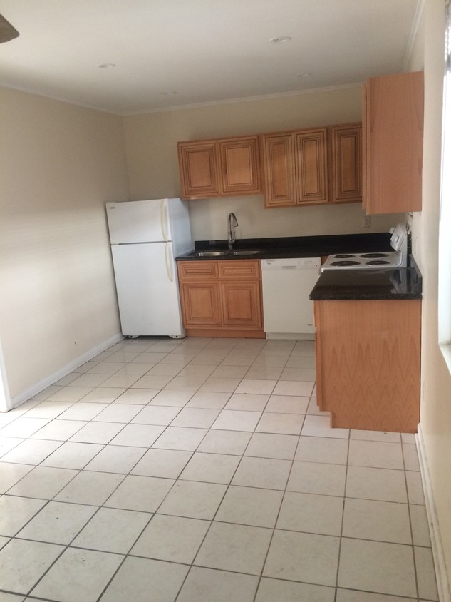
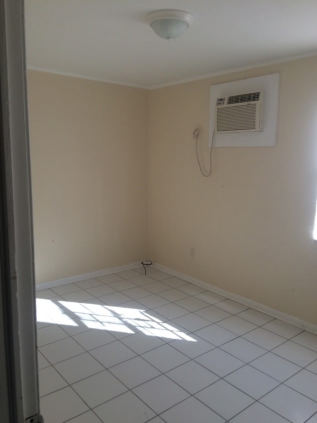
Air Conditioning
Dishwasher
Granite Countertops
Refrigerator
Milan, pronounced My-lan, is a charming neighborhood tucked between Central City and Freret. Milan is primarily residential, offering a broad range of apartments, condos, townhomes, and houses available for rent in both historic and modern structures.
The neighborhood sits in a convenient locale near the many diverse restaurants, shops, bars, and cafes of Freret Street, Saint Charles Street, and Magazine Street. Commuting from the community is a breeze with access to U.S. Route 90 and the Saint Charles Streetcar.
Learn more about living in Milan| Colleges & Universities | Distance | ||
|---|---|---|---|
| Colleges & Universities | Distance | ||
| Drive: | 5 min | 2.1 mi | |
| Drive: | 6 min | 2.8 mi | |
| Drive: | 7 min | 2.8 mi | |
| Drive: | 8 min | 2.9 mi |


Transportation options available in New Orleans include St Charles And Foucher, located 0.1 mile from 3615 St Charles Ave. 3615 St Charles Ave is near Louis Armstrong New Orleans International, located 16.7 miles or 25 minutes away.
| Transit / Subway | Distance | ||
|---|---|---|---|
| Transit / Subway | Distance | ||
|
|
Walk: | 1 min | 0.1 mi |
|
|
Walk: | 3 min | 0.2 mi |
|
|
Walk: | 3 min | 0.2 mi |
|
|
Walk: | 5 min | 0.3 mi |
|
|
Walk: | 7 min | 0.4 mi |
| Commuter Rail | Distance | ||
|---|---|---|---|
| Commuter Rail | Distance | ||
|
|
Drive: | 6 min | 2.3 mi |
|
|
Drive: | 44 min | 34.1 mi |
| Airports | Distance | ||
|---|---|---|---|
| Airports | Distance | ||
|
Louis Armstrong New Orleans International
|
Drive: | 25 min | 16.7 mi |
Time and distance from 3615 St Charles Ave.
| Shopping Centers | Distance | ||
|---|---|---|---|
| Shopping Centers | Distance | ||
| Drive: | 3 min | 1.2 mi | |
| Drive: | 3 min | 1.3 mi | |
| Drive: | 3 min | 1.3 mi |
| Parks and Recreation | Distance | ||
|---|---|---|---|
| Parks and Recreation | Distance | ||
|
Louisiana Children's Museum
|
Drive: | 6 min | 2.4 mi |
|
Audubon Insectarium
|
Drive: | 7 min | 2.7 mi |
|
Entergy IMAX Theatre
|
Drive: | 7 min | 2.8 mi |
|
Audubon Aquarium of the Americas
|
Drive: | 7 min | 2.8 mi |
|
Audubon Zoo
|
Drive: | 8 min | 3.1 mi |
| Hospitals | Distance | ||
|---|---|---|---|
| Hospitals | Distance | ||
| Walk: | 3 min | 0.2 mi | |
| Walk: | 5 min | 0.3 mi | |
| Drive: | 3 min | 1.5 mi |
| Military Bases | Distance | ||
|---|---|---|---|
| Military Bases | Distance | ||
| Drive: | 14 min | 6.4 mi |
What Are Walk Score®, Transit Score®, and Bike Score® Ratings?
Walk Score® measures the walkability of any address. Transit Score® measures access to public transit. Bike Score® measures the bikeability of any address.
What is a Sound Score Rating?
A Sound Score Rating aggregates noise caused by vehicle traffic, airplane traffic and local sources
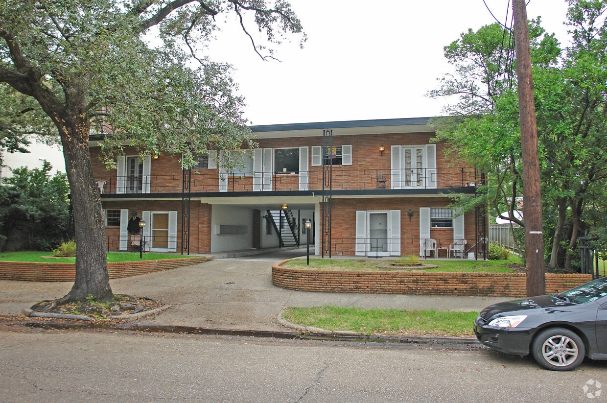
3615 St Charles Ave
New Orleans, LA 70115


