
Isle House
39 Bruton St,
San Francisco, CA 94130
$3,250 - $7,635
Studio - 3 Beds
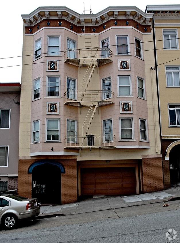
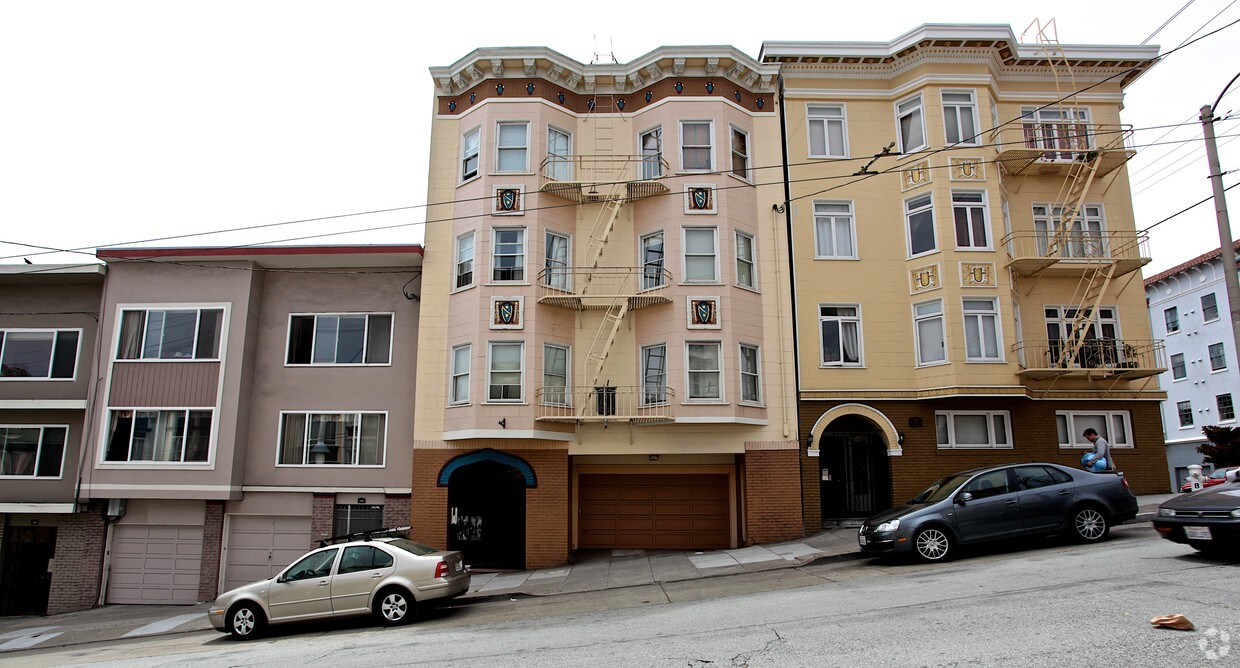
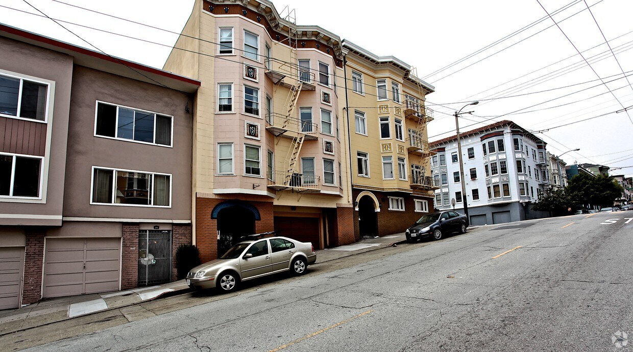

Find your next place to live at 349 Fillmore Street. In a location on Fillmore St. in San Francisco's 94117 Zip code, residents can easily connect with a number of attractions in the surrounding area. Be sure to check out the current floorplan options. The professional leasing staff is ready and waiting for you to visit. Visit 349 Fillmore Street today.
349 Fillmore Street is an apartment community located in San Francisco County and the 94117 ZIP Code. This area is served by the San Francisco Unified attendance zone.
Whether its beer and bar food or achieving a Zen-like state every morning, Lower Haight has it all, so you’ll never have to choose from the things you love again.
Because of its high concentration of sports bars, catching a 49ers game is easy and loads of fun with neighbors at your side. Trivia nights are hosted at the bars too, so there’s always something to look forward to after work.
Before it got its name, Lower Haight was “Pine Valley” because of its large pine tree collection. A well-balanced mix of Edwardian and Victorian buildings reveal a colorful San Francisco neighborhood, similar to the Painted Ladies tourist site.
Haight Street is dotted with delightful cafes and restaurants, yoga studios, art galleries, and apartments. When you shop here, think small – small business thrives just as much as the community’s bohemian vibe. SMFTA rail pickup locations are just blocks from Black Sand Brewery and the Tornado bar.
Learn more about living in Lower HaightCompare neighborhood and city base rent averages by bedroom.
| Lower Haight | San Francisco, CA | |
|---|---|---|
| Studio | $2,290 | $2,386 |
| 1 Bedroom | $3,439 | $3,161 |
| 2 Bedrooms | $4,560 | $4,307 |
| 3 Bedrooms | $6,587 | $5,641 |
| Colleges & Universities | Distance | ||
|---|---|---|---|
| Colleges & Universities | Distance | ||
| Drive: | 4 min | 1.5 mi | |
| Drive: | 5 min | 1.8 mi | |
| Drive: | 7 min | 2.2 mi | |
| Drive: | 8 min | 3.1 mi |


Transportation options available in San Francisco include Church St & Duboce Ave, located 0.3 mile from 349 Fillmore Street. 349 Fillmore Street is near San Francisco International, located 13.7 miles or 22 minutes away, and Metro Oakland International, located 21.2 miles or 32 minutes away.
| Transit / Subway | Distance | ||
|---|---|---|---|
| Transit / Subway | Distance | ||
|
|
Walk: | 5 min | 0.3 mi |
|
|
Walk: | 8 min | 0.4 mi |
| Walk: | 8 min | 0.5 mi | |
|
|
Walk: | 9 min | 0.5 mi |
|
|
Walk: | 9 min | 0.5 mi |
| Commuter Rail | Distance | ||
|---|---|---|---|
| Commuter Rail | Distance | ||
| Drive: | 5 min | 2.8 mi | |
| Drive: | 5 min | 2.8 mi | |
| Drive: | 7 min | 3.6 mi | |
| Drive: | 7 min | 3.6 mi | |
| Drive: | 10 min | 5.8 mi |
| Airports | Distance | ||
|---|---|---|---|
| Airports | Distance | ||
|
San Francisco International
|
Drive: | 22 min | 13.7 mi |
|
Metro Oakland International
|
Drive: | 32 min | 21.2 mi |
Time and distance from 349 Fillmore Street.
| Shopping Centers | Distance | ||
|---|---|---|---|
| Shopping Centers | Distance | ||
| Walk: | 12 min | 0.7 mi | |
| Walk: | 20 min | 1.0 mi | |
| Drive: | 4 min | 1.2 mi |
| Parks and Recreation | Distance | ||
|---|---|---|---|
| Parks and Recreation | Distance | ||
|
Buena Vista Park
|
Walk: | 16 min | 0.8 mi |
|
Randall Museum
|
Drive: | 4 min | 1.3 mi |
|
Conservatory of Flowers
|
Drive: | 5 min | 1.9 mi |
|
Children's Creativity Museum
|
Drive: | 5 min | 2.1 mi |
|
California Academy of Sciences
|
Drive: | 8 min | 2.6 mi |
| Hospitals | Distance | ||
|---|---|---|---|
| Hospitals | Distance | ||
| Walk: | 9 min | 0.5 mi | |
| Drive: | 4 min | 1.6 mi | |
| Drive: | 5 min | 1.8 mi |
| Military Bases | Distance | ||
|---|---|---|---|
| Military Bases | Distance | ||
| Drive: | 14 min | 4.9 mi | |
| Drive: | 14 min | 5.5 mi | |
| Drive: | 15 min | 7.3 mi |
What Are Walk Score®, Transit Score®, and Bike Score® Ratings?
Walk Score® measures the walkability of any address. Transit Score® measures access to public transit. Bike Score® measures the bikeability of any address.
What is a Sound Score Rating?
A Sound Score Rating aggregates noise caused by vehicle traffic, airplane traffic and local sources


