
3200 Washington
3200 Washington St,
Boston, MA 02130
$2,550 - $5,290 Total Monthly Price
Studio - 3 Beds 12 Month Lease
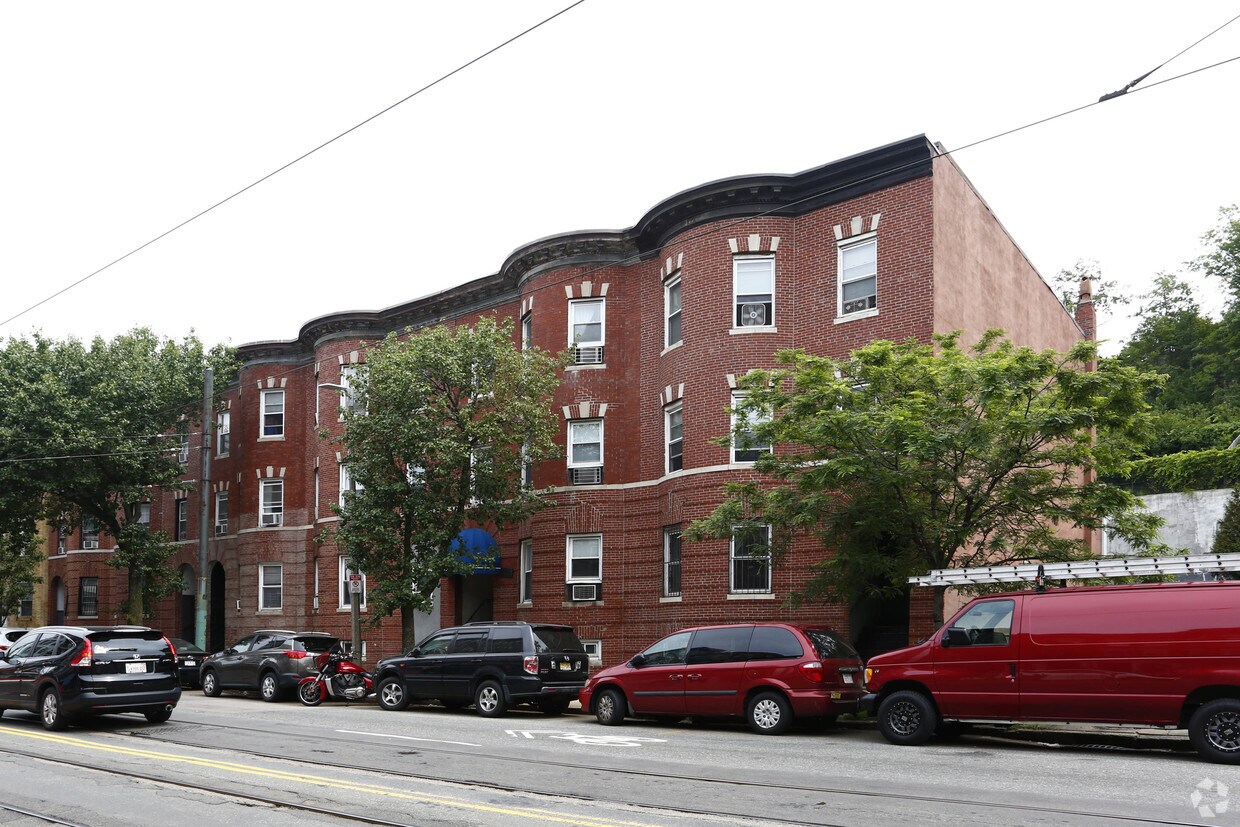
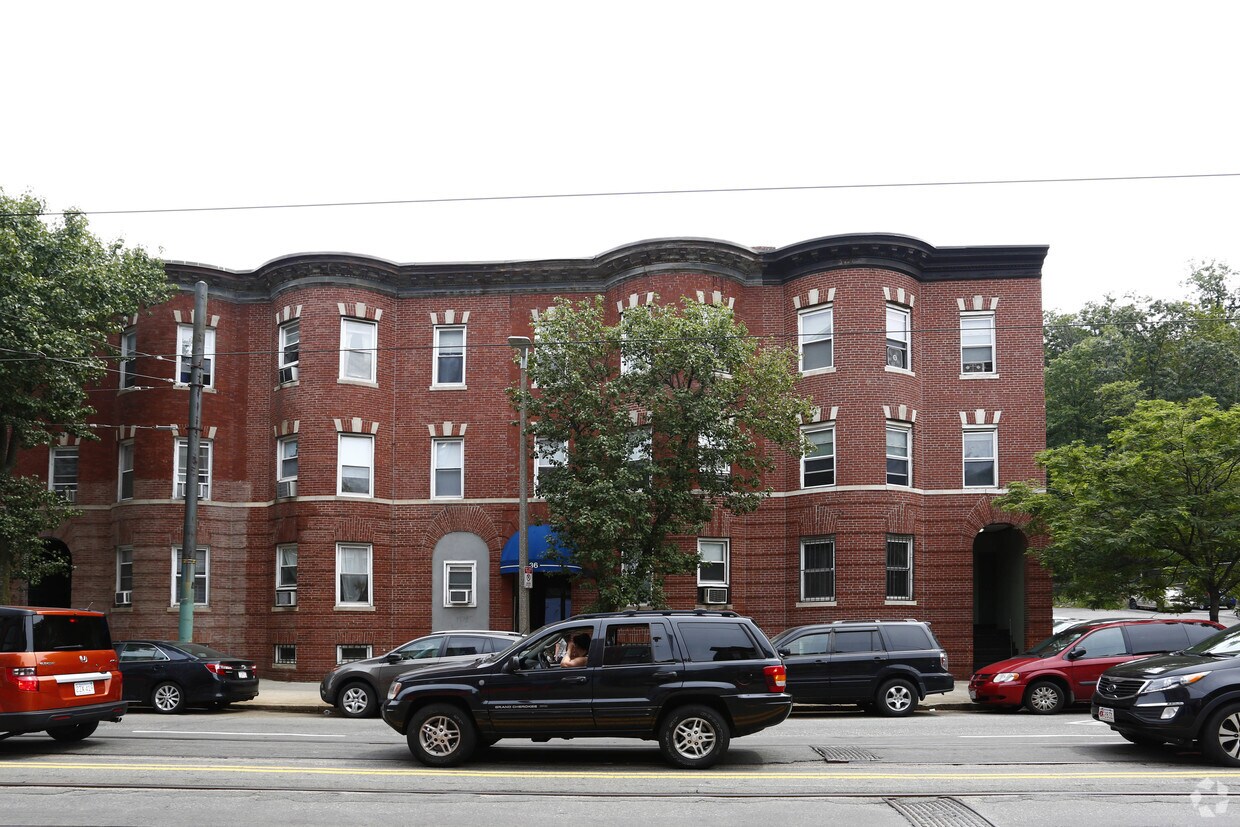
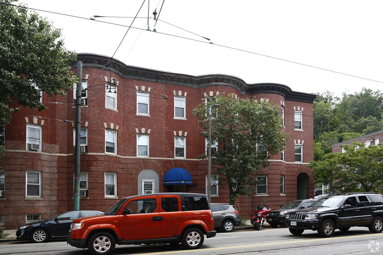
Discover your new home at 36 S Huntington Ave in Boston, MA. You'll find this community in the Mission Hill area of Boston. The professional leasing team is ready to help you find your new home. It's time to love where you live. Stop by for a visit today.
34-36 S Huntington Ave is an apartment community located in Suffolk County and the 02130 ZIP Code. This area is served by the Boston Public Schools attendance zone.
Widely recognized as one of Boston’s greenest and most diverse neighborhoods, Jamaica Plain (or “JP,” as locals call it) is surrounded by the city’s “Emerald Necklace” of parks. For residents in search of a respite from the busy streets and high energy of city life, Jamaica Plain offers a green getaway. Popular parks that surround the area include Olmsted Park, Southwest Corridor Park, and Mozart Park. Harvard’s Arnold Arboretum is one of the main attractions, taking up a large portion of the neighborhood’s south end. Much of the dining and entertainment lies along Centre Street, in the middle and northern sections of the neighborhood. Rail service connects Jamaica Plain to the rest of the Boston area, with several stops along the eastern edge of the neighborhood.
Professionals who inhabit this neighborhood love that JP is just 5 minutes outside of Downtown Boston. Commuting via car can be tricky – with busy streets and limited city parking, it may be easier to use rail service.
Learn more about living in Jamaica Plain| Colleges & Universities | Distance | ||
|---|---|---|---|
| Colleges & Universities | Distance | ||
| Walk: | 15 min | 0.8 mi | |
| Drive: | 2 min | 1.2 mi | |
| Drive: | 3 min | 1.4 mi | |
| Drive: | 3 min | 1.4 mi |


Transportation options available in Jamaica Plain include Riverway Station, located 0.0 mile from 34-36 S Huntington Ave. 34-36 S Huntington Ave is near General Edward Lawrence Logan International, located 7.4 miles or 14 minutes away.
| Transit / Subway | Distance | ||
|---|---|---|---|
| Transit / Subway | Distance | ||
|
|
Walk: | 2 min | 0.0 mi |
|
|
Walk: | 1 min | 0.1 mi |
|
|
Walk: | 4 min | 0.2 mi |
|
|
Walk: | 5 min | 0.3 mi |
|
|
Walk: | 7 min | 0.4 mi |
| Commuter Rail | Distance | ||
|---|---|---|---|
| Commuter Rail | Distance | ||
|
|
Drive: | 3 min | 1.5 mi |
|
|
Drive: | 6 min | 2.2 mi |
|
|
Drive: | 8 min | 2.6 mi |
|
|
Drive: | 9 min | 4.3 mi |
| Drive: | 15 min | 6.4 mi |
| Airports | Distance | ||
|---|---|---|---|
| Airports | Distance | ||
|
General Edward Lawrence Logan International
|
Drive: | 14 min | 7.4 mi |
Scores provided by
Traffic
-Airport
-Businesses
-Scores provided by
HowLoud What is a Sound Score Rating? A Sound Score Rating aggregates noise caused by vehicle traffic, airplane traffic and local sources. How It WorksTime and distance from 34-36 S Huntington Ave.
| Shopping Centers | Distance | ||
|---|---|---|---|
| Shopping Centers | Distance | ||
| Walk: | 12 min | 0.6 mi | |
| Drive: | 4 min | 1.4 mi | |
| Drive: | 5 min | 1.8 mi |
| Parks and Recreation | Distance | ||
|---|---|---|---|
| Parks and Recreation | Distance | ||
|
Frederick Law Olmsted National Historic Site
|
Drive: | 3 min | 1.3 mi |
|
Roxbury Heritage State Park
|
Drive: | 3 min | 1.5 mi |
|
John Fitzgerald Kennedy National Historic Site
|
Drive: | 4 min | 1.5 mi |
|
Coit Observatory
|
Drive: | 4 min | 2.2 mi |
|
Charles River Reservation
|
Drive: | 5 min | 2.6 mi |
| Hospitals | Distance | ||
|---|---|---|---|
| Hospitals | Distance | ||
| Walk: | 10 min | 0.6 mi | |
| Walk: | 11 min | 0.6 mi | |
| Walk: | 15 min | 0.8 mi |
| Military Bases | Distance | ||
|---|---|---|---|
| Military Bases | Distance | ||
| Drive: | 26 min | 14.3 mi | |
| Drive: | 30 min | 15.5 mi |
Pets Allowed Fitness Center In Unit Washer & Dryer High-Speed Internet Stainless Steel Appliances Package Service
Pets Allowed Fitness Center Pool Dishwasher Refrigerator Kitchen
Fitness Center Pool Dishwasher Kitchen In Unit Washer & Dryer Walk-In Closets
Pets Allowed Fitness Center In Unit Washer & Dryer Balcony Elevator Rooftop Deck
Fitness Center Clubhouse Balcony Granite Countertops Smoke Free Basketball Court
What Are Walk Score®, Transit Score®, and Bike Score® Ratings?
Walk Score® measures the walkability of any address. Transit Score® measures access to public transit. Bike Score® measures the bikeability of any address.
What is a Sound Score Rating?
A Sound Score Rating aggregates noise caused by vehicle traffic, airplane traffic and local sources.


