$8,500
Total Monthly Price
12 Month Lease
32 Warwick St
Boston, MA 02120
2 Weeks Ago
|
Edit
Favorites
-
Bedrooms
5
-
Bathrooms
3.5
-
Square Feet
1,900 sq ft
-
Available
Available Now
Highlights
- Hardwood Floors
- Smoke Free
32 Warwick St

Favorites
About This Home
12 Month Lease,
$8,500 deposit,
Available Now
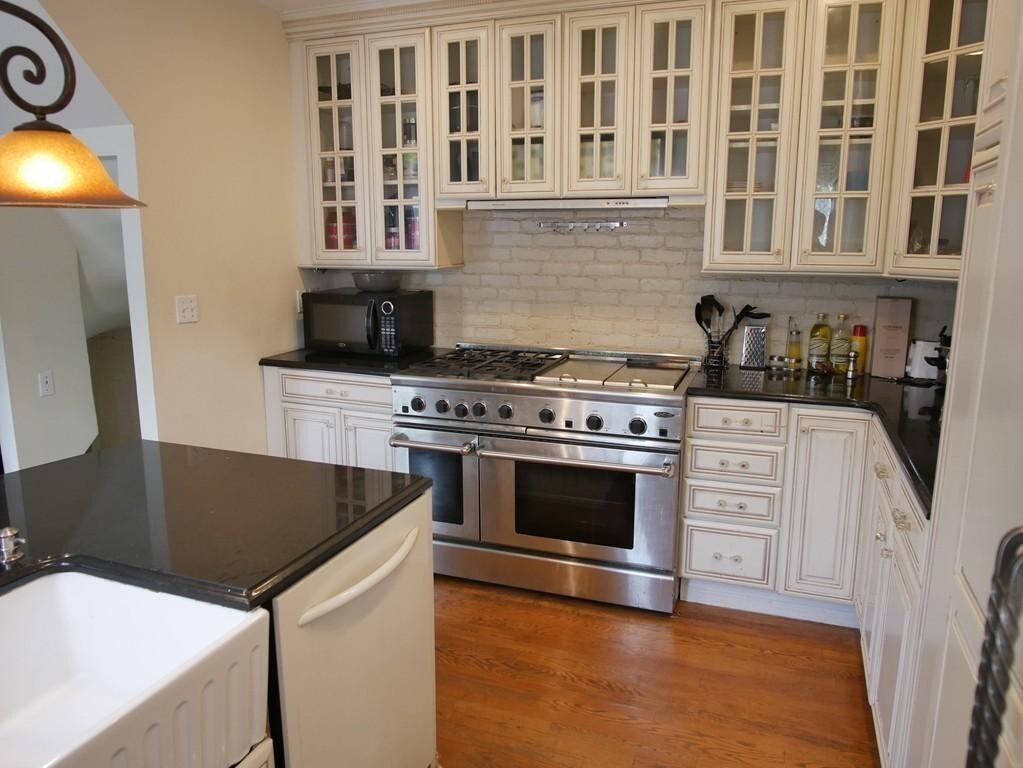
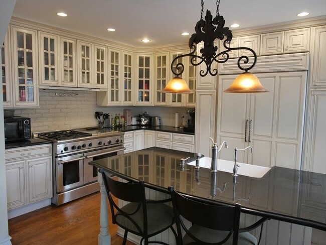
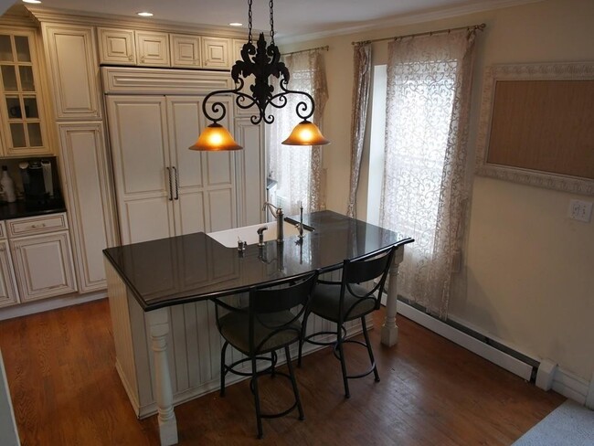
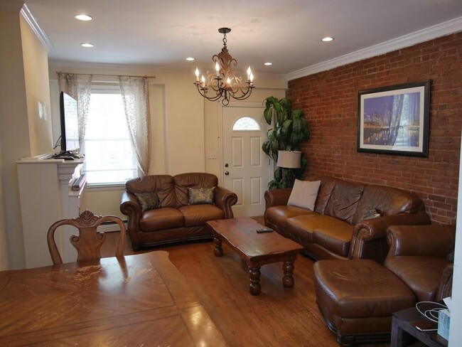
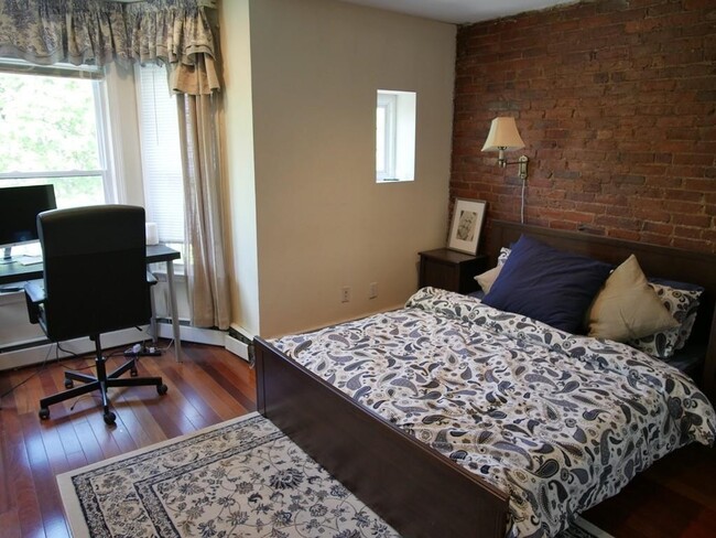
Spacious 5-bedroom, 3.5-bath unit spanning 1,836 sqft in the South End. Features a newly renovated kitchen with granite countertops and stainless steel appliances, hardwood floors throughout, and in-unit washer/dryer. Ideal for shared living with modern finishes and a functional layout.
32 Warwick St is an apartment community located in Suffolk County and the 02120 ZIP Code. This area is served by the Boston Public Schools attendance zone.
* Price shown is total price based on community-supplied monthly required fees. Excludes user-selected optional fees and variable or usage-based fees and required charges due at or prior to move-in or at move-out. Price, availability, fees, and any applicable rent special are subject to change without notice.
* Square footage definitions vary. Displayed square footage is approximate.
Apartment Features
Washer/Dryer
Dishwasher
Hardwood Floors
Granite Countertops
- Washer/Dryer
- Smoke Free
- Dishwasher
- Granite Countertops
- Stainless Steel Appliances
- Kitchen
- Hardwood Floors
- Storage Space
Fees and Policies
The fees below are based on community-supplied data and may exclude additional fees and utilities.
- Cats Allowed
-
Fees not specified
-
Weight limit--
-
Pet Limit--
Details
Property Information
-
4 units
Contact
- Contact
Location
Get Directions
Situated between the South End and Dudley Square, Lower Roxbury is a predominantly residential neighborhood brimming with apartments and town houses available for rent. Residents enjoy a walkable urban environment filled with diverse historical architecture.
Warren Street and Washington Street are the neighborhood’s main commercial thoroughfares, touting rows of specialty shops, markets, and eateries in historic buildings. Northeastern University, Wentworth Institute of Technology, and Massachusetts College of Art and Design are all just northwest of Lower Roxbury, offering the community a bevy of cultural and educational amenities. Getting around from Lower Roxbury is easy with access to multiple T stops on the Orange Line.
Learn more about living in Lower Roxbury
Education
| Colleges & Universities | Distance | ||
|---|---|---|---|
| Colleges & Universities | Distance | ||
| Walk: | 9 min | 0.5 mi | |
| Walk: | 12 min | 0.7 mi | |
| Walk: | 17 min | 0.9 mi | |
| Drive: | 4 min | 1.2 mi |
32 Warwick St is within 9 minutes or 0.5 mile from Northeastern University. It is also near Wentworth Inst. of Technology and MassArt.
Schools


Public Elementary & Middle School
Grades PK-8
724 Students
Attendance Zone
Public Elementary & Middle School
Grades PK-8
352 Students
Attendance Zone
Public Middle & High School
Grades 7-12
1,567 Students
Attendance Zone
Public Middle & High School
Grades 7-12
26 Students
Attendance Zone
Public High School
Grades 9-12
1,087 Students
Attendance Zone
Charter High School
Grades 9-12
364 Students
Attendance Zone
Private Elementary School
Grades PK-6
122 Students
Nearby
Private Elementary & Middle School
Grades 5-8
Nearby
Private Middle & High School
Grades 7-12
292 Students
Nearby
School data provided by
 The GreatSchools Rating helps parents compare schools within a state based on a variety of school quality indicators and provides a helpful picture of how effectively each school serves all of its students. Ratings are on a scale of 1 (below average) to 10 (above average) and can include test scores, college readiness, academic progress, advanced courses, equity, discipline and attendance data. We also advise parents to visit schools, consider other information on school performance and programs, and consider family needs as part of the school selection process.
View GreatSchools Rating Methodology
Data provided by GreatSchools.org © 2025. All rights reserved.
View GreatSchools Rating Methodology
Data provided by GreatSchools.org © 2025. All rights reserved.
Transportation options available in Boston include Massachusetts Ave Station (Orange Line), located 0.5 mile from 32 Warwick St. 32 Warwick St is near General Edward Lawrence Logan International, located 5.7 miles or 12 minutes away.
| Transit / Subway | Distance | ||
|---|---|---|---|
| Transit / Subway | Distance | ||
|
|
Walk: | 9 min | 0.5 mi |
|
|
Walk: | 11 min | 0.6 mi |
|
|
Walk: | 12 min | 0.6 mi |
|
|
Walk: | 14 min | 0.7 mi |
|
|
Walk: | 14 min | 0.8 mi |
| Commuter Rail | Distance | ||
|---|---|---|---|
| Commuter Rail | Distance | ||
|
|
Drive: | 3 min | 1.2 mi |
|
|
Drive: | 6 min | 1.5 mi |
| Drive: | 3 min | 1.5 mi | |
|
|
Drive: | 4 min | 1.6 mi |
|
|
Drive: | 8 min | 4.3 mi |
| Airports | Distance | ||
|---|---|---|---|
| Airports | Distance | ||
|
General Edward Lawrence Logan International
|
Drive: | 12 min | 5.7 mi |
Time and distance from 32 Warwick St.
| Shopping Centers | Distance | ||
|---|---|---|---|
| Shopping Centers | Distance | ||
| Drive: | 3 min | 1.5 mi | |
| Drive: | 10 min | 5.3 mi | |
| Drive: | 10 min | 5.5 mi |
32 Warwick St has 3 shopping centers within 5.5 miles, which is about a 10-minute drive. The miles and minutes will be for the farthest away property.
| Parks and Recreation | Distance | ||
|---|---|---|---|
| Parks and Recreation | Distance | ||
|
Roxbury Heritage State Park
|
Walk: | 15 min | 0.8 mi |
|
Boston Public Garden
|
Drive: | 5 min | 1.8 mi |
|
Charles River Reservation
|
Drive: | 5 min | 2.0 mi |
|
Boston African American National Historic Site
|
Drive: | 6 min | 2.3 mi |
|
Coit Observatory
|
Drive: | 6 min | 2.4 mi |
32 Warwick St has 5 parks within 2.4 miles, including Roxbury Heritage State Park, Boston Public Garden, and Charles River Reservation.
| Hospitals | Distance | ||
|---|---|---|---|
| Hospitals | Distance | ||
| Walk: | 14 min | 0.7 mi | |
| Drive: | 2 min | 1.2 mi | |
| Drive: | 3 min | 1.4 mi |
32 Warwick St has 3 hospitals within 1.4 miles, the nearest is Boston Medical Center which is 0.7 mile away and a 14 minute walk.
| Military Bases | Distance | ||
|---|---|---|---|
| Military Bases | Distance | ||
| Drive: | 29 min | 16.0 mi | |
| Drive: | 31 min | 16.2 mi |
32 Warwick St is 16.0 miles from US Military Reservation, and is convenient to other military bases, including Hanscom Air Force Base.
Amenities
- Washer/Dryer
- Smoke Free
- Dishwasher
- Granite Countertops
- Stainless Steel Appliances
- Kitchen
- Hardwood Floors
- Storage Space
32 Warwick St Photos
What Are Walk Score®, Transit Score®, and Bike Score® Ratings?
Walk Score® measures the walkability of any address. Transit Score® measures access to public transit. Bike Score® measures the bikeability of any address.
What is a Sound Score Rating?
A Sound Score Rating aggregates noise caused by vehicle traffic, airplane traffic and local sources

32 Warwick St
Boston, MA 02120