
Isle House
39 Bruton St,
San Francisco, CA 94130
$3,597 - $7,642 Total Monthly Price
Studio - 3 Beds
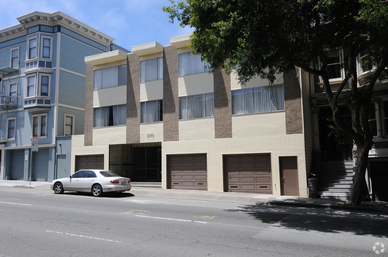
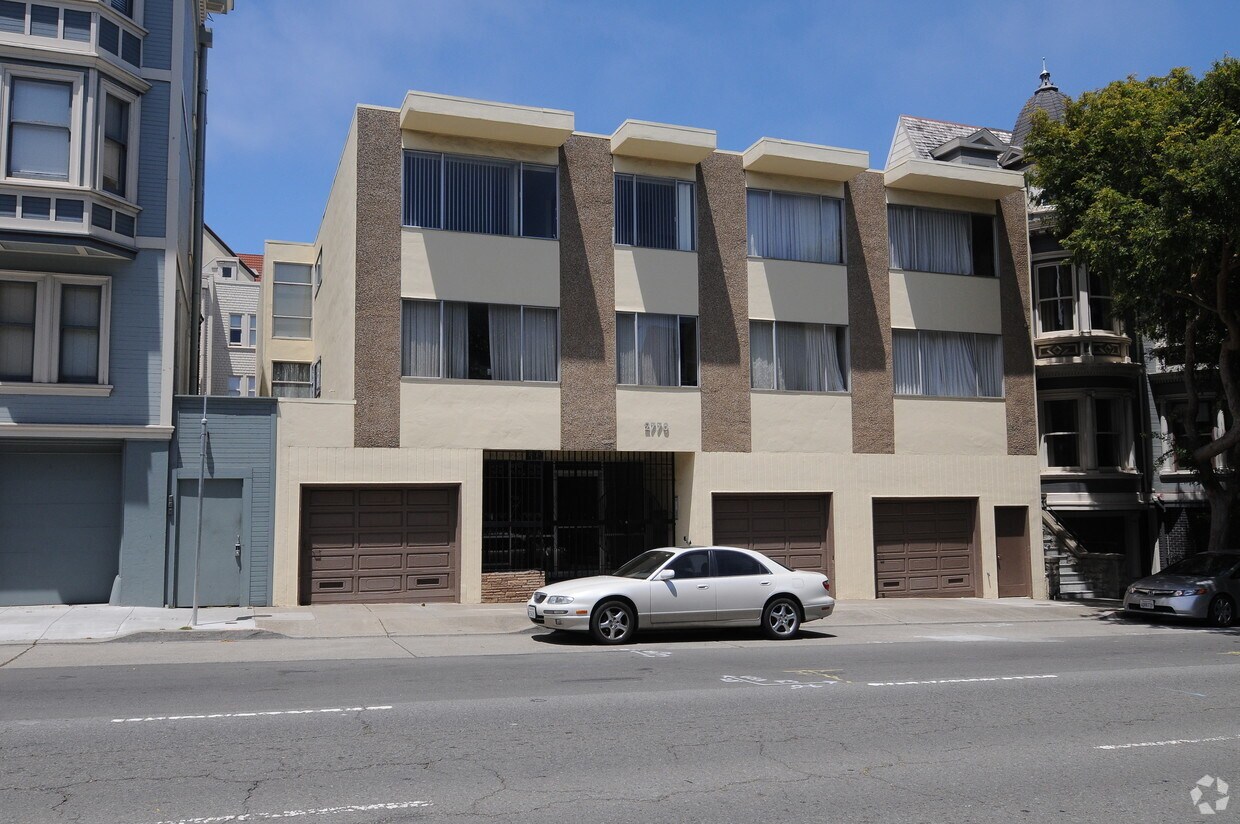

2770 Pine St is ready for you to move in. The 94115 location is an ideal place to live. From amenities to floorplan options, the leasing team is ready to help you find the perfect fit. Make a visit to see the available floorplan options. It's time to love where you live. Stop by for a visit today.
2770 Pine St is an apartment community located in San Francisco County and the 94115 ZIP Code. This area is served by the San Francisco Unified School District attendance zone.
Lower Pacific Heights is a vibrant San Francisco neighborhood situated between Pacific Heights, Japantown, the Fillmore District, and Laurel Heights. Formerly known as Upper Fillmore, Lower Pacific Heights offers residents a wide variety of apartments, condos, and houses available for rent, many of which boast scenic views due to the neighborhood’s hilly environment.
Lower Pacific Heights is regarded for its walkable layout, with many rentals situated within easy walking distance of the diverse restaurants, shops, coffeehouses, and bars that line Fillmore Street, the community’s main commercial thoroughfare. The neighborhood’s central locale is a major part of its allure, providing quick access to Union Square, the University of San Francisco, the Financial District, several prominent medical centers, tech employers, landmarks, and more.
Learn more about living in Lower Pacific HeightsCompare neighborhood and city base rent averages by bedroom.
| Lower Pacific Heights | San Francisco, CA | |
|---|---|---|
| Studio | $2,453 | $2,513 |
| 1 Bedroom | $2,985 | $3,306 |
| 2 Bedrooms | $4,376 | $4,493 |
| 3 Bedrooms | $5,567 | $5,679 |
| Colleges & Universities | Distance | ||
|---|---|---|---|
| Colleges & Universities | Distance | ||
| Walk: | 6 min | 0.3 mi | |
| Drive: | 3 min | 1.1 mi | |
| Drive: | 6 min | 2.0 mi | |
| Drive: | 9 min | 3.1 mi |


Transportation options available in San Francisco include Van Ness And California, located 1.2 miles from 2770 Pine St. 2770 Pine St is near San Francisco International, located 15.2 miles or 26 minutes away, and Metro Oakland International, located 21.2 miles or 35 minutes away.
| Transit / Subway | Distance | ||
|---|---|---|---|
| Transit / Subway | Distance | ||
|
|
Drive: | 3 min | 1.2 mi |
|
|
Drive: | 4 min | 1.4 mi |
|
|
Drive: | 4 min | 1.5 mi |
| Drive: | 6 min | 1.5 mi | |
| Drive: | 5 min | 1.7 mi |
| Commuter Rail | Distance | ||
|---|---|---|---|
| Commuter Rail | Distance | ||
| Drive: | 9 min | 4.4 mi | |
| Drive: | 15 min | 7.5 mi | |
| Drive: | 21 min | 10.7 mi | |
| Drive: | 20 min | 11.8 mi | |
|
|
Drive: | 24 min | 12.8 mi |
| Airports | Distance | ||
|---|---|---|---|
| Airports | Distance | ||
|
San Francisco International
|
Drive: | 26 min | 15.2 mi |
|
Metro Oakland International
|
Drive: | 35 min | 21.2 mi |
Time and distance from 2770 Pine St.
| Shopping Centers | Distance | ||
|---|---|---|---|
| Shopping Centers | Distance | ||
| Walk: | 14 min | 0.7 mi | |
| Walk: | 16 min | 0.8 mi | |
| Drive: | 4 min | 1.4 mi |
| Parks and Recreation | Distance | ||
|---|---|---|---|
| Parks and Recreation | Distance | ||
|
Exploratorium
|
Drive: | 4 min | 1.7 mi |
|
Conservatory of Flowers
|
Drive: | 4 min | 1.7 mi |
|
Buena Vista Park
|
Drive: | 6 min | 2.0 mi |
|
Randall Museum
|
Drive: | 7 min | 2.1 mi |
|
San Francisco Maritime National Historical Park
|
Drive: | 7 min | 2.7 mi |
| Hospitals | Distance | ||
|---|---|---|---|
| Hospitals | Distance | ||
| Walk: | 7 min | 0.4 mi | |
| Drive: | 4 min | 1.5 mi | |
| Drive: | 4 min | 1.6 mi |
| Military Bases | Distance | ||
|---|---|---|---|
| Military Bases | Distance | ||
| Drive: | 10 min | 3.6 mi | |
| Drive: | 11 min | 4.0 mi | |
| Drive: | 18 min | 7.3 mi |
Pets Allowed Dishwasher Walk-In Closets Balcony Maintenance on site CableReady Elevator
Pets Allowed Fitness Center In Unit Washer & Dryer Walk-In Closets Stainless Steel Appliances Hardwood Floors EV Charging
What Are Walk Score®, Transit Score®, and Bike Score® Ratings?
Walk Score® measures the walkability of any address. Transit Score® measures access to public transit. Bike Score® measures the bikeability of any address.
What is a Sound Score Rating?
A Sound Score Rating aggregates noise caused by vehicle traffic, airplane traffic and local sources.

2770 Pine St
San Francisco, CA 94115


