

$1,800
/ Month
2638 Skyview Ridge Ct
Houston, TX 77047
Today
|
Edit
Favorites
409-767-0315
-
Bedrooms
2
-
Bathrooms
2
-
Square Feet
1,102 sq ft
-
Available
Available Jan 1, 2026
Highlights
- Granite Countertops
- 1 Car Attached Garage
- Tile Flooring
- Central Heating and Cooling System
- Ceiling Fan
- 1-Story Property
2638 Skyview Ridge Ct

Favorites
About This Home
Available Jan 1, 2026
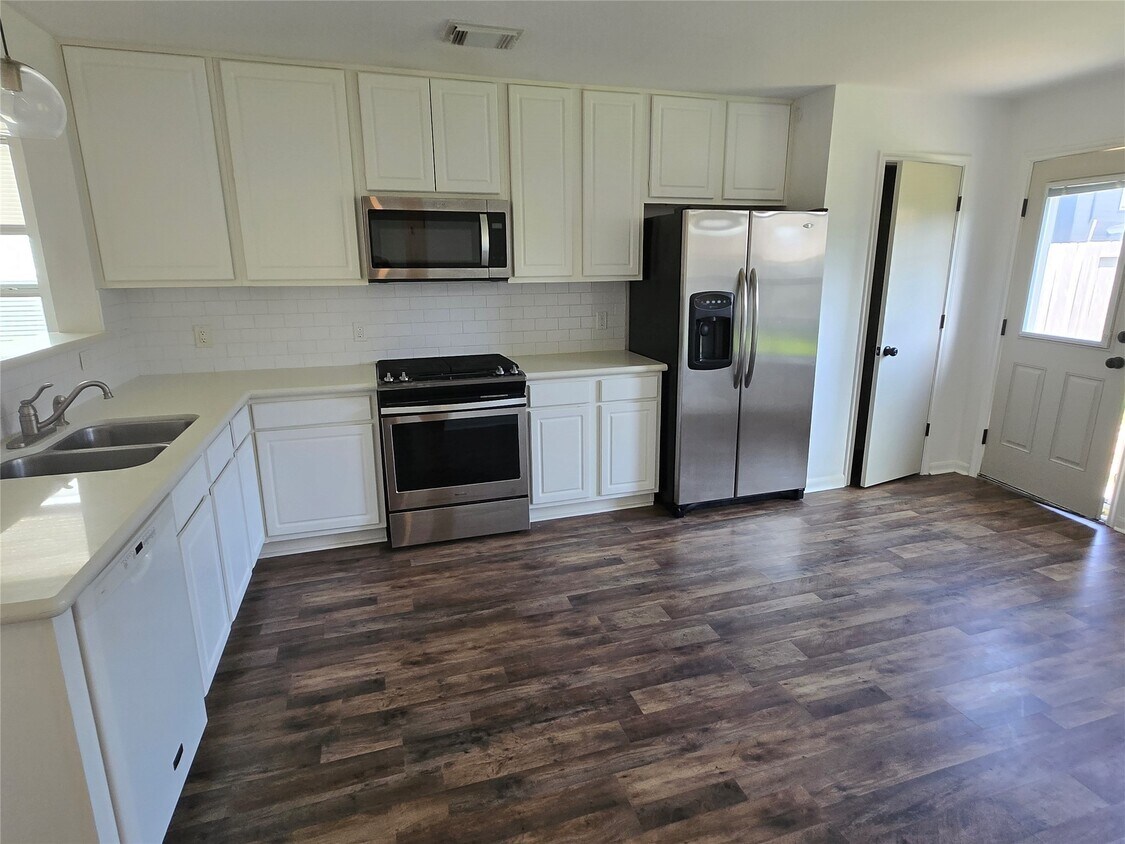
Conveniently located off 288 with easy access to the Medical Center and Downtown Houston,this 2Br/2Bth home with car garage has laminate wood floors and remodeled bathrooms. The split floor plan provides privacy,with the primary and secondary bedrooms on opposite sides of the living room. Washer,dryer,and refrigerator included. (looking for january 1st move in) MLS# 67955942
2638 Skyview Ridge Ct is a house located in Harris County and the 77047 ZIP Code. This area is served by the Houston Independent attendance zone.
* Price shown is base rent. Excludes user-selected optional fees and variable or usage-based fees and required charges due at or prior to move-in or at move-out. Price, availability, fees, and any applicable rent special are subject to change without notice.
* Square footage definitions vary. Displayed square footage is approximate.
Home Details
Home Type
Single Family Detached Home
Year Built
Built in 2006
Bedrooms and Bathrooms
2 Full Bathrooms
2 Bedrooms
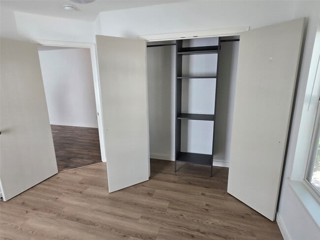
Flooring
Tile
Laminate
Interior Spaces
Ceiling Fan
1,102 Sq Ft Home
1-Story Property
Kitchen
Granite Countertops
Gas Range
Dishwasher
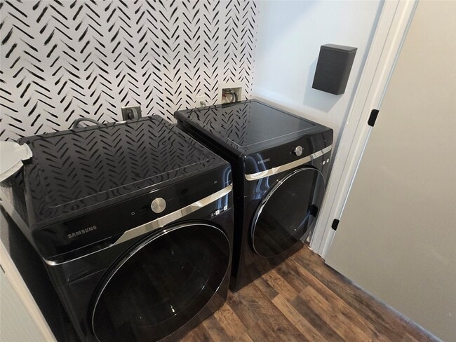
Laundry
Dryer
Washer
Listing and Financial Details
Property Available on 1/1/26
Long Term Lease
Lot Details
4,211 Sq Ft Lot
Parking
1 Car Attached Garage
Schools
Law Elementary School
Thomas Middle School
Worthing High School
Utilities
Central Heating and Cooling System
Heating System Uses Gas
Municipal Trash
Community Details
Overview
Skyview Park Sec 3 Subdivision
Pet Policy
Call for details about the types of pets allowed
Pet Deposit Required
Contact
- Listed by Roger Pallas-Nieto | Soluna Realty
- Phone Number
- Contact
-
Source
 Houston Association of REALTORS®
Copyright © 2025 Houston Association of Realtors. All rights reserved. All information provided by the listing agent/broker is deemed reliable but is not guaranteed and should be independently verified.
Location
Get Directions
South Acres-Crestmont Park is a modern Houston neighborhood that lies 10 miles south of downtown. With proximity to the South Freeway and the Sam Houston Tollway, this large neighborhood is perfect for the commuting crowd or anyone looking for a bit more space outside the hustle and bustle of Houston. Convenient to Hobby Airport and NRG Stadium, South Acres-Crestmont Park offers an affordable, convenient location with spacious single-family homes and affordable apartments for rent. While largely residential, you'll find plenty of shops, restaurants, and other businesses, especially along Cullen Boulevard.
Learn more about living in South Acres-Crestmont Park
Education
| Colleges & Universities | Distance | ||
|---|---|---|---|
| Colleges & Universities | Distance | ||
| Drive: | 14 min | 8.6 mi | |
| Drive: | 14 min | 8.9 mi | |
| Drive: | 15 min | 9.8 mi | |
| Drive: | 18 min | 10.4 mi |
2638 Skyview Ridge Ct is within 14 minutes or 8.9 miles from UT Health Houston. It is also near Texas Southern University and Baylor College of Medicine.
Schools


Public Elementary School
Grades PK-5
514 Students
Attendance Zone
Public Middle School
Grades 6-8
526 Students
Attendance Zone
Public High School
Grades 9-12
827 Students
Attendance Zone
Private Elementary, Middle & High School
Grades PK-11
Nearby
Private Elementary School
Grades PK-4
96 Students
Nearby
Private High School
Grades 9-12
211 Students
Nearby
School data provided by
 The GreatSchools Rating helps parents compare schools within a state based on a variety of school quality indicators and provides a helpful picture of how effectively each school serves all of its students. Ratings are on a scale of 1 (below average) to 10 (above average) and can include test scores, college readiness, academic progress, advanced courses, equity, discipline and attendance data. We also advise parents to visit schools, consider other information on school performance and programs, and consider family needs as part of the school selection process.
View GreatSchools Rating Methodology
Data provided by GreatSchools.org © 2025. All rights reserved.
View GreatSchools Rating Methodology
Data provided by GreatSchools.org © 2025. All rights reserved.
Transportation options available in Houston include Fannin South, located 5.9 miles from 2638 Skyview Ridge Ct. 2638 Skyview Ridge Ct is near William P Hobby, located 8.4 miles or 20 minutes away, and George Bush Intcntl/Houston, located 29.6 miles or 40 minutes away.
| Transit / Subway | Distance | ||
|---|---|---|---|
| Transit / Subway | Distance | ||
|
|
Drive: | 10 min | 5.9 mi |
|
|
Drive: | 11 min | 6.8 mi |
|
|
Drive: | 13 min | 7.5 mi |
| Drive: | 14 min | 9.0 mi | |
|
|
Drive: | 15 min | 9.2 mi |
| Commuter Rail | Distance | ||
|---|---|---|---|
| Commuter Rail | Distance | ||
|
|
Drive: | 20 min | 12.3 mi |
| Airports | Distance | ||
|---|---|---|---|
| Airports | Distance | ||
|
William P Hobby
|
Drive: | 20 min | 8.4 mi |
|
George Bush Intcntl/Houston
|
Drive: | 40 min | 29.6 mi |
Time and distance from 2638 Skyview Ridge Ct.
| Shopping Centers | Distance | ||
|---|---|---|---|
| Shopping Centers | Distance | ||
| Walk: | 11 min | 0.6 mi | |
| Drive: | 4 min | 1.2 mi | |
| Drive: | 4 min | 1.3 mi |
2638 Skyview Ridge Ct has 3 shopping centers within 1.3 miles, which is about a 4-minute walk. The miles and minutes will be for the farthest away property.
| Parks and Recreation | Distance | ||
|---|---|---|---|
| Parks and Recreation | Distance | ||
|
Houston Zoo
|
Drive: | 14 min | 8.4 mi |
|
Galveston Island State Park
|
Drive: | 15 min | 8.5 mi |
|
Houston Maritime Museum
|
Drive: | 15 min | 8.6 mi |
|
Hermann Park
|
Drive: | 15 min | 8.7 mi |
|
Lowrey Arboretum
|
Drive: | 17 min | 10.3 mi |
2638 Skyview Ridge Ct has 5 parks within 10.3 miles, including Galveston Island State Park, Houston Zoo, and Houston Maritime Museum.
| Hospitals | Distance | ||
|---|---|---|---|
| Hospitals | Distance | ||
| Drive: | 7 min | 3.4 mi | |
| Drive: | 11 min | 6.6 mi | |
| Drive: | 12 min | 7.3 mi |
2638 Skyview Ridge Ct has 3 hospitals within 7.3 miles, the nearest is Hca Houston Healthcare Pearland which is 3.4 miles away and a 7 minute drive.
| Military Bases | Distance | ||
|---|---|---|---|
| Military Bases | Distance | ||
| Drive: | 35 min | 23.0 mi | |
| Drive: | 64 min | 48.6 mi |
2638 Skyview Ridge Ct is 23.0 miles from Lyndon B Johnson Space Center, and is convenient to other military bases, including Pelican Spit Military Reservation.
You May Also Like
Similar Rentals Nearby


What Are Walk Score®, Transit Score®, and Bike Score® Ratings?
Walk Score® measures the walkability of any address. Transit Score® measures access to public transit. Bike Score® measures the bikeability of any address.
What is a Sound Score Rating?
A Sound Score Rating aggregates noise caused by vehicle traffic, airplane traffic and local sources
2638 Skyview Ridge Ct
Houston, TX 77047