
$2,700
Total Monthly Price
226 Irving St Unit 1
Framingham, MA 01702
Today
Favorites
617-817-5627
-
Bedrooms
2
-
Bathrooms
1
-
Square Feet
9,999 sq ft
-
Available
Available Now
Highlights
- Medical Services
- Deck
- Property is near public transit
- Cooling Available
- Shops
- 1-Story Property
226 Irving St Unit 1

Favorites
About This Home
$2,850 deposit,
Available Now
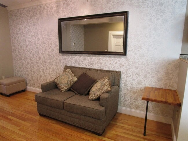
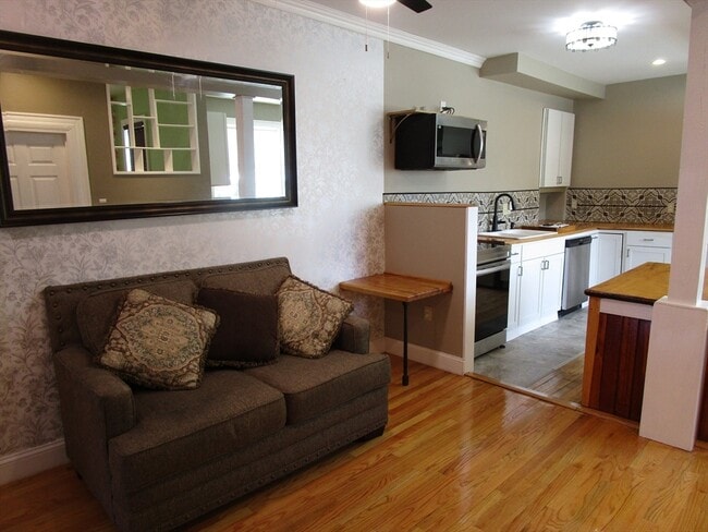
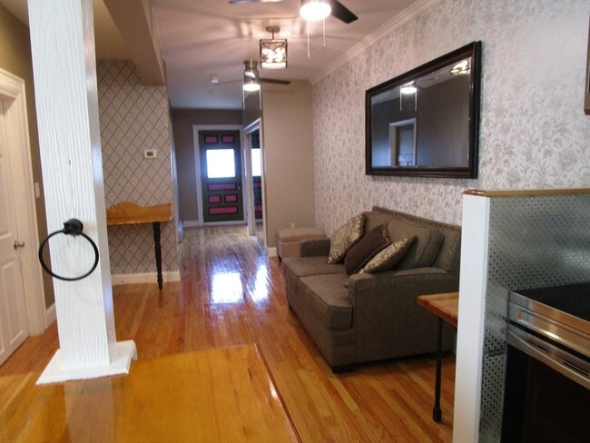
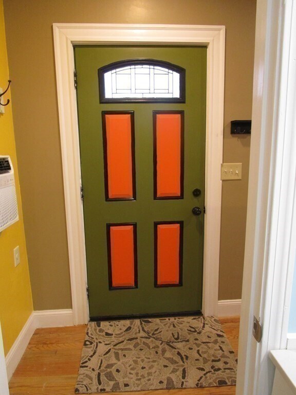
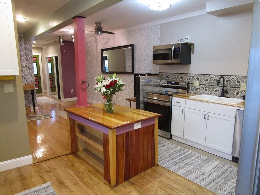
A 2 bedroom of color & wonder!! Enter into a world of charm & surprises. Heat and hot water included. Completely renovated home in the heart of Framingham. Discover antique French doors,century-old gleaming hardwood floors,hooks of dragon fly,remote control ceiling fans,etc. Enjoy the convenience of modern kitchen equipped with the latest appliances of stove,dishwasher,disposal,refrigerator,microwave,wine cooler,etc. Watch the world go by when relaxing in the back deck complete with barbecue. Rent includes heat,hot water,ground maintenance,snow removal,waste disposal,water & sewer. Close to shops,commuter rail,houses of worship,schools,restaurants,banks. Parking available. Pets welcome. MLS# 73382994
226 Irving St is an apartment community located in Middlesex County and the 01702 ZIP Code.
* Price shown is total price including community-supplied monthly required fees. Price, availability, fees, and any applicable rent special are subject to change without notice.
* Square footage definitions vary. Displayed square footage is approximate.
Home Details
Year Built
Built in 1892
Accessible Home Design
Entry on the 1st floor
Bedrooms and Bathrooms
1 Full Bathroom
2 Bedrooms
Home Design
Apartment
Interior Spaces
1-Story Property
9,999 Sq Ft Home
Kitchen
Range
Microwave
Dishwasher
Disposal
Listing and Financial Details
Security Deposit $2,850
Property Available on 5/30/25
12 Month Lease Term
Rent includes heat, hot water, water, sewer, trash collection, snow removal, gardener, parking
Location
Property is near public transit
Property is near schools
Lot Details
8,346 Sq Ft Lot
Outdoor Features
Deck
Parking
2 Car Parking Spaces
Utilities
Cooling Available
Heating System Uses Natural Gas
Community Details
Amenities
Medical Services
Shops
Coin Laundry
Overview
No Home Owners Association
Pet Policy
Pets Allowed
Fees and Policies
The fees below are based on community-supplied data and may exclude additional fees and utilities.
- Dogs Allowed
-
Fees not specified
- Cats Allowed
-
Fees not specified
Contact
- Listed by Jenny Ng | The Network Group
- Phone Number
-
Source
 MLS Property Information Network
The property listing data and information set forth herein were provided to MLS Property Information Network, Inc. from third party sources, including sellers, lessors and public records, and were compiled by MLS Property Information Network, Inc. The property listing data and information are for the personal, non-commercial use of consumers having a good faith interest in purchasing or leasing listed properties of the type displayed to them and may not be used for any purpose other than to identify prospective properties which such consumers may have a good faith interest in purchasing or leasing. MLS Property Information Network, Inc. and its subscribers disclaim any and all representations and warranties as to the accuracy of the property listing data and information set forth herein. All properties are subject to prior sale, change or withdrawal. Copyright © 2025 MLS Property Information Network, Inc. All rights reserved.
Location
Get Directions
Amenities
- Dishwasher
- Disposal
- Microwave
- Range
- Refrigerator
- Deck
Just west of Boston and East of Worcester sits Metro West, a region that houses a group of towns and cities with significant historical backgrounds. A total of 19 municipalities make up the core of this community, but other municipalities are considered to be a part of the Interstate 495/Metro West Corridor.
Learn more about living in Metro West
Education
| Colleges & Universities | Distance | ||
|---|---|---|---|
| Colleges & Universities | Distance | ||
| Drive: | 7 min | 2.5 mi | |
| Drive: | 15 min | 6.3 mi | |
| Drive: | 17 min | 8.3 mi | |
| Drive: | 24 min | 13.1 mi |
226 Irving St Unit 1 is within 7 minutes or 2.5 miles from Framingham State College. It is also near Wellesley College and Babson College.
Transportation options available in Framingham include Woodland Station, located 10.6 miles from 226 Irving St Unit 1. 226 Irving St Unit 1 is near General Edward Lawrence Logan International, located 25.2 miles or 39 minutes away, and Worcester Regional, located 26.7 miles or 47 minutes away.
| Transit / Subway | Distance | ||
|---|---|---|---|
| Transit / Subway | Distance | ||
|
|
Drive: | 20 min | 10.6 mi |
|
|
Drive: | 21 min | 10.7 mi |
|
|
Drive: | 21 min | 11.3 mi |
| Commuter Rail | Distance | ||
|---|---|---|---|
| Commuter Rail | Distance | ||
|
|
Walk: | 11 min | 0.6 mi |
|
|
Walk: | 13 min | 0.7 mi |
|
|
Drive: | 4 min | 1.4 mi |
|
|
Drive: | 8 min | 3.8 mi |
|
|
Drive: | 15 min | 4.9 mi |
| Airports | Distance | ||
|---|---|---|---|
| Airports | Distance | ||
|
General Edward Lawrence Logan International
|
Drive: | 39 min | 25.2 mi |
|
Worcester Regional
|
Drive: | 47 min | 26.7 mi |
Time and distance from 226 Irving St Unit 1.
| Shopping Centers | Distance | ||
|---|---|---|---|
| Shopping Centers | Distance | ||
| Walk: | 9 min | 0.5 mi | |
| Walk: | 12 min | 0.6 mi | |
| Drive: | 4 min | 1.6 mi |
226 Irving St Unit 1 has 3 shopping centers within 1.6 miles, which is about a 4-minute walk. The miles and minutes will be for the farthest away property.
| Parks and Recreation | Distance | ||
|---|---|---|---|
| Parks and Recreation | Distance | ||
|
Cowassock Woods and Ashland Town Forest
|
Drive: | 11 min | 4.5 mi |
|
Mass Audubon's Broadmoor Wildlife Sanctuary
|
Drive: | 9 min | 4.8 mi |
|
Callahan State Park
|
Drive: | 10 min | 4.8 mi |
|
Ashland State Park
|
Drive: | 12 min | 5.0 mi |
|
Cochituate State Park
|
Drive: | 20 min | 11.6 mi |
226 Irving St Unit 1 has 5 parks within 11.6 miles, including Cochituate State Park, Callahan State Park, and Cowassock Woods and Ashland Town Forest.
| Hospitals | Distance | ||
|---|---|---|---|
| Hospitals | Distance | ||
| Walk: | 19 min | 1.0 mi | |
| Drive: | 19 min | 10.2 mi | |
| Drive: | 19 min | 10.3 mi |
226 Irving St Unit 1 has 3 hospitals within 10.3 miles, the nearest is MetroWest Medical Center which is 1.0 miles away and a 19 minute walk.
| Military Bases | Distance | ||
|---|---|---|---|
| Military Bases | Distance | ||
| Drive: | 8 min | 3.8 mi | |
| Drive: | 35 min | 17.8 mi |
226 Irving St Unit 1 is 3.8 miles from US Military Reservation, and is convenient to other military bases, including Hanscom Air Force Base.
You May Also Like
Similar Rentals Nearby


What Are Walk Score®, Transit Score®, and Bike Score® Ratings?
Walk Score® measures the walkability of any address. Transit Score® measures access to public transit. Bike Score® measures the bikeability of any address.
What is a Sound Score Rating?
A Sound Score Rating aggregates noise caused by vehicle traffic, airplane traffic and local sources
226 Irving St
Framingham, MA 01702