
Isle House
39 Bruton St,
San Francisco, CA 94130
$3,202 - $7,642 Total Monthly Price
Studio - 3 Beds
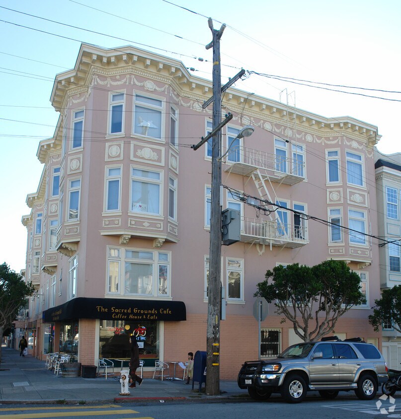
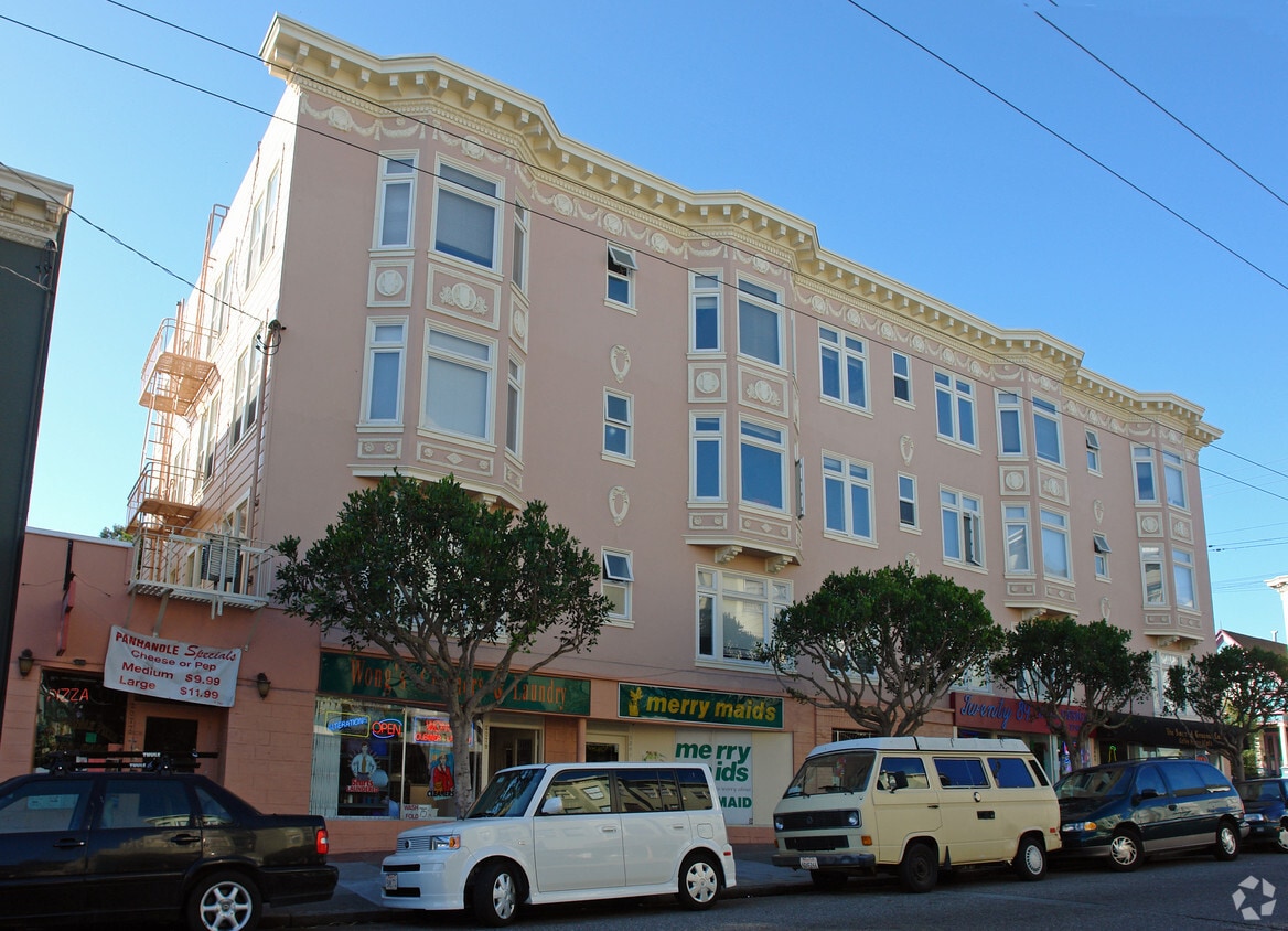

Find your new place at 2085 Clayton St. This community is located in the Panhandle area of San Francisco. The professional leasing team is eager for you to come see our property. Contact us today to discuss your new apartment and make your move to 2085 Clayton St.
2085 Clayton St is an apartment community located in San Francisco County and the 94117 ZIP Code. This area is served by the San Francisco Unified School District attendance zone.
Rent your apartment in the Panhandle neighborhood and enjoy San Francisco's Golden Gate Park any time you want. The neighborhood is only a block wide for much of its 10-block length, so most neighborhood rentals are within steps of Golden Gate Park's panhandle and the trails leading into the heart of that famous open space.
Find your neighbors at a picnic area in the panhandle or at a number of attractions at Golden Gate Park, such as the tranquil Japanese Gardens, the zoo, or the California Academy of Sciences. Explore the park's Spreckels Lake, where model boat lovers launch their creations. Head to the western edge of the park and find Ocean Beach roughly four miles away.
You'll find Tony's Cable Car Restaurant, a local burger hangout complete with old-style neon signs, less than a mile from the panhandle. The closest shopping malls include the Westfield San Francisco Centre and the Potrero Center, both about three miles east.
Learn more about living in PanhandleCompare neighborhood and city base rent averages by bedroom.
| Panhandle | San Francisco, CA | |
|---|---|---|
| Studio | $1,705 | $2,514 |
| 1 Bedroom | $2,954 | $3,306 |
| 2 Bedrooms | $4,101 | $4,499 |
| 3 Bedrooms | $2,309 | $5,679 |
| Colleges & Universities | Distance | ||
|---|---|---|---|
| Colleges & Universities | Distance | ||
| Walk: | 7 min | 0.4 mi | |
| Drive: | 4 min | 1.6 mi | |
| Drive: | 5 min | 1.7 mi | |
| Drive: | 9 min | 3.1 mi |


Transportation options available in San Francisco include Carl St & Cole St, located 0.6 mile from 2085 Clayton St. 2085 Clayton St is near San Francisco International, located 15.0 miles or 25 minutes away, and Metro Oakland International, located 22.5 miles or 36 minutes away.
| Transit / Subway | Distance | ||
|---|---|---|---|
| Transit / Subway | Distance | ||
| Walk: | 10 min | 0.6 mi | |
| Walk: | 13 min | 0.7 mi | |
|
|
Walk: | 17 min | 0.9 mi |
| Walk: | 18 min | 1.0 mi | |
|
|
Drive: | 3 min | 1.3 mi |
| Commuter Rail | Distance | ||
|---|---|---|---|
| Commuter Rail | Distance | ||
| Drive: | 9 min | 4.1 mi | |
| Drive: | 15 min | 7.2 mi | |
| Drive: | 20 min | 11.6 mi | |
| Drive: | 21 min | 12.0 mi | |
|
|
Drive: | 25 min | 14.1 mi |
| Airports | Distance | ||
|---|---|---|---|
| Airports | Distance | ||
|
San Francisco International
|
Drive: | 25 min | 15.0 mi |
|
Metro Oakland International
|
Drive: | 36 min | 22.5 mi |
Scores provided by
Traffic
-Airport
-Businesses
-Scores provided by
HowLoud What is a Sound Score Rating? A Sound Score Rating aggregates noise caused by vehicle traffic, airplane traffic and local sources. How It WorksTime and distance from 2085 Clayton St.
| Shopping Centers | Distance | ||
|---|---|---|---|
| Shopping Centers | Distance | ||
| Walk: | 18 min | 1.0 mi | |
| Drive: | 4 min | 1.6 mi | |
| Drive: | 5 min | 1.9 mi |
| Parks and Recreation | Distance | ||
|---|---|---|---|
| Parks and Recreation | Distance | ||
|
Conservatory of Flowers
|
Walk: | 9 min | 0.5 mi |
|
Buena Vista Park
|
Drive: | 3 min | 1.1 mi |
|
Randall Museum
|
Drive: | 4 min | 1.2 mi |
|
California Academy of Sciences
|
Drive: | 4 min | 1.3 mi |
|
Steinhart Aquarium
|
Drive: | 4 min | 1.4 mi |
| Hospitals | Distance | ||
|---|---|---|---|
| Hospitals | Distance | ||
| Walk: | 5 min | 0.3 mi | |
| Walk: | 19 min | 1.0 mi | |
| Walk: | 19 min | 1.0 mi |
| Military Bases | Distance | ||
|---|---|---|---|
| Military Bases | Distance | ||
| Drive: | 10 min | 3.6 mi | |
| Drive: | 11 min | 4.2 mi | |
| Drive: | 18 min | 8.6 mi |
Pets Allowed Dishwasher Walk-In Closets Balcony Maintenance on site CableReady Elevator
Pets Allowed Fitness Center In Unit Washer & Dryer Walk-In Closets Stainless Steel Appliances Hardwood Floors EV Charging
What Are Walk Score®, Transit Score®, and Bike Score® Ratings?
Walk Score® measures the walkability of any address. Transit Score® measures access to public transit. Bike Score® measures the bikeability of any address.
What is a Sound Score Rating?
A Sound Score Rating aggregates noise caused by vehicle traffic, airplane traffic and local sources.


