$849
Total Monthly Price
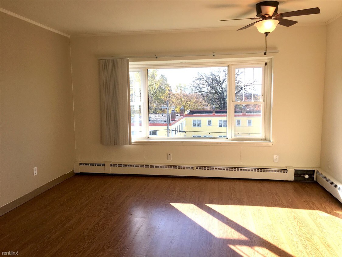
2040 W Saunders Ave
Saint Paul, MN 55116
Favorites
2040 W Saunders Ave

Favorites
Check Back Soon for Upcoming Availability
| Beds | Baths | Average SF |
|---|---|---|
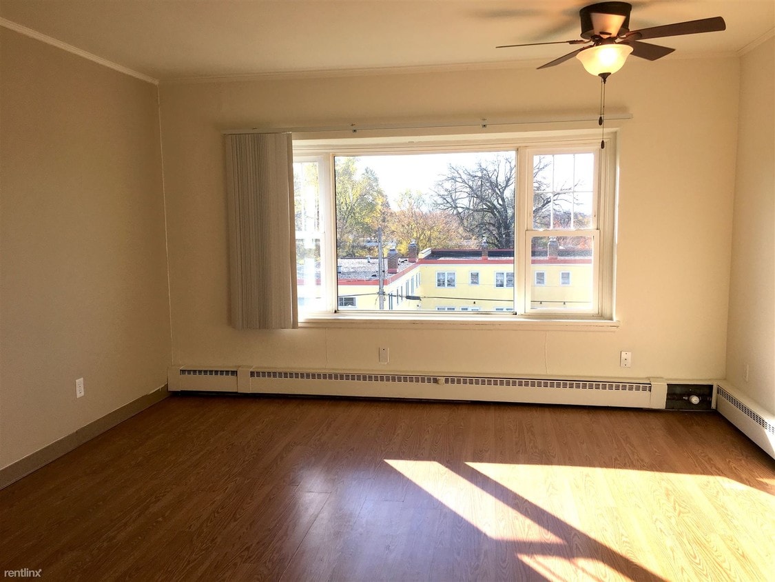
| 1 Bedroom 1 Bedroom 1 Br | 1 Bath 1 Bath 1 Ba | 583 SF |
Fees and Policies
The fees listed below are community-provided and may exclude utilities or add-ons. All payments are made directly to the property and are non-refundable unless otherwise specified.
- Cats Allowed
-
Fees not specified
-
Weight limit--
-
Pet Limit--
Details
Utilities Included
-
Water
-
Heat
About This Property
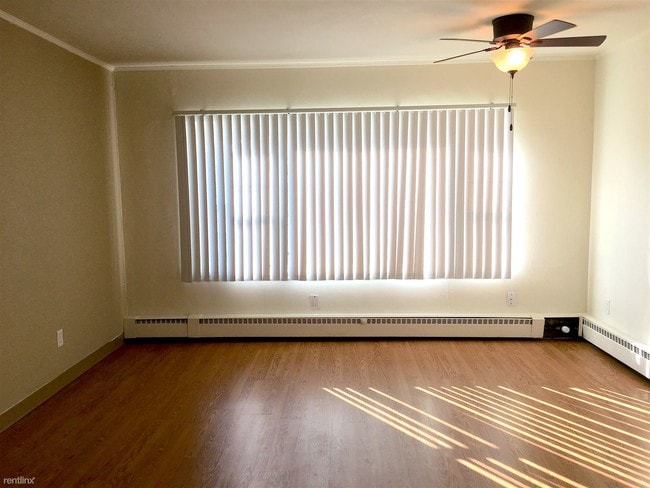
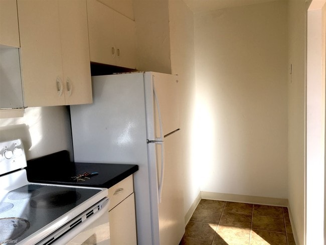
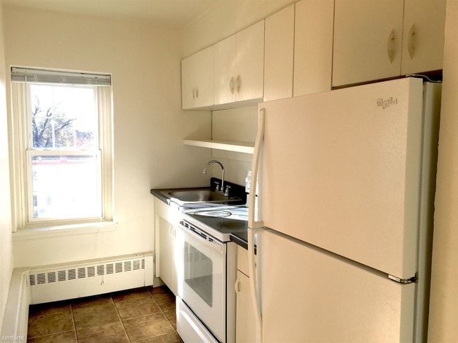
(952) 356-3104 - Located in the west corner of Highland Park, 1 mile from the breathtaking Mississippi River, the Twin Cities are in your hand when you live at 2040 Saunders Avenue. Perfect central location of the Twin Cities, just on the east side of the Mississippi! Cross on Ford Pkwy to Mpls in under ten minutes! You can also catch the 46E Bus 1 1/2 blocks from home on Cleveland/Saunders and get there in 15 minutes, among catching other bus lines wherever you may need to get! Half mile south of all your daily needs: Various eateries, boutiques, groceries, fitness gyms, city parks, and more! 12 month of lease FREE when you follow all lease terms. (RLNE5266640) Other Amenities: Smoke Free. Appliances: Washer & Dryer On-Site. Lease lengths: 12 Months. Utilities: Heat Included (Gas baseboard), Water Included, Trash Pick-up Included. Pet policies: Cats Allowed (Max 2 with non-refundable pet fee of $300/pet).
2040 W Saunders Ave is an apartment community located in Ramsey County and the 55116 ZIP Code.
Unique Features
- Cats Allowed - Max 2 with non-refundable pet fee of $300/pet
Features
- Laundry Facilities
2040 W Saunders Ave,
Saint Paul,
MN
55116
The Highland community lies in the southwestern corner of Saint Paul, just 10 miles from Downtown Minneapolis. Highland is to the north of Fort Snelling, adjacent to the Mississippi River.
A 50/50 blend of commercial and residential buildings, Highland residents enjoy plentiful shopping and restaurants near their apartments. Saint Catherine University resides here, and it’s in walking distance of local eateries at the corner of Cleveland Avenue South and Ford Parkway.
A predominantly residential neighborhood, there are tons of outdoor activities to do, like improving your game at the Highland National Golf Course or picnicking at Crosby Farm Park. For easy travel, residents are comforted by their proximity to Interstate 35E and the international airport. The amusement park and aquarium at Mall of America are a short 10-minute drive from Highland.
Learn more about living in HighlandBelow are rent ranges for similar nearby apartments
Amenities
- Laundry Facilities
- Cats Allowed - Max 2 with non-refundable pet fee of $300/pet
Expenses
Utilities Included
Water, Heat
Included
Education
| Colleges & Universities | Distance | ||
|---|---|---|---|
| Colleges & Universities | Distance | ||
| Drive: | 5 min | 1.6 mi | |
| Drive: | 5 min | 2.3 mi | |
| Drive: | 7 min | 2.8 mi | |
| Drive: | 9 min | 4.0 mi |
2040 W Saunders Ave is within 5 minutes or 1.6 miles from St. Catherine University. It is also near Univ. of St Thomas, St. Paul and Macalester College.
Transportation options available in Saint Paul include 50Th Street/Minnehaha Park Station, located 2.6 miles from 2040 W Saunders Ave. 2040 W Saunders Ave is near Minneapolis-St Paul International/Wold-Chamberlain, located 4.4 miles or 9 minutes away.
| Transit / Subway | Distance | ||
|---|---|---|---|
| Transit / Subway | Distance | ||
|
|
Drive: | 6 min | 2.6 mi |
|
|
Drive: | 6 min | 2.7 mi |
|
|
Drive: | 7 min | 3.0 mi |
|
|
Drive: | 7 min | 3.2 mi |
|
|
Drive: | 7 min | 3.5 mi |
| Commuter Rail | Distance | ||
|---|---|---|---|
| Commuter Rail | Distance | ||
|
|
Drive: | 11 min | 6.6 mi |
|
|
Drive: | 18 min | 7.6 mi |
|
|
Drive: | 27 min | 16.1 mi |
|
|
Drive: | 37 min | 25.9 mi |
|
|
Drive: | 38 min | 27.5 mi |
| Airports | Distance | ||
|---|---|---|---|
| Airports | Distance | ||
|
Minneapolis-St Paul International/Wold-Chamberlain
|
Drive: | 9 min | 4.4 mi |
Walkability Near 2040 W Saunders Ave Saint Paul, MN 55116
Getting Around
 What do Walkability, Transit, Drivability, and Bikeability mean?
Walkability measures the walking distance to day-to-day needs.
Transit measures access to public transportation.
Drivability measures congestion, parking availability, and access to major roads.
Bikeability measures the suitability for cycling.
How It Works
What do Walkability, Transit, Drivability, and Bikeability mean?
Walkability measures the walking distance to day-to-day needs.
Transit measures access to public transportation.
Drivability measures congestion, parking availability, and access to major roads.
Bikeability measures the suitability for cycling.
How It Works
Fairly Walkable
Walkability
50
/ 100
Some Public Transit
Transit
50
/ 100
Very Drivable
Drivability
80
/ 100
Moderately Bikeable
Bikeability
70
/ 100
Scores provided by
-
Soundscore™
-
/ 100
Traffic
-Airport
-Businesses
-Scores provided by
HowLoud What is a Sound Score Rating? A Sound Score Rating aggregates noise caused by vehicle traffic, airplane traffic and local sources. How It WorksTime and distance from 2040 W Saunders Ave.
| Shopping Centers | Distance | ||
|---|---|---|---|
| Shopping Centers | Distance | ||
| Walk: | 6 min | 0.3 mi | |
| Walk: | 8 min | 0.4 mi | |
| Walk: | 8 min | 0.5 mi |
2040 W Saunders Ave has 3 shopping centers within 0.5 mile, which is about a 8-minute walk. The miles and minutes will be for the farthest away property.
| Parks and Recreation | Distance | ||
|---|---|---|---|
| Parks and Recreation | Distance | ||
|
Hidden Falls Park
|
Walk: | 18 min | 0.9 mi |
|
Minnehaha Park
|
Drive: | 5 min | 1.9 mi |
|
Song of Hiawatha Garden
|
Drive: | 5 min | 1.9 mi |
|
Minnehaha Falls Pergola Garden
|
Drive: | 6 min | 2.0 mi |
|
Longfellow Gardens
|
Drive: | 6 min | 2.0 mi |
2040 W Saunders Ave has 5 parks within 2.0 miles, including Hidden Falls Park, Minnehaha Falls Pergola Garden, and Minnehaha Park.
| Hospitals | Distance | ||
|---|---|---|---|
| Hospitals | Distance | ||
| Drive: | 12 min | 5.9 mi | |
| Drive: | 11 min | 6.0 mi | |
| Drive: | 11 min | 6.2 mi |
2040 W Saunders Ave has 3 hospitals within 6.2 miles, the nearest is University of Minnesota Medical Center, Fairview which is 5.9 miles away and a 12 minute drive.
| Military Bases | Distance | ||
|---|---|---|---|
| Military Bases | Distance | ||
| Drive: | 8 min | 3.2 mi |
2040 W Saunders Ave is 3.2 miles and a 8 minute drive from Fort Snelling Military Reservation.
You May Also Like
-
Lake Pointe
3413-3433 53rd Ave N
Brooklyn Center, MN 55429
$1,129 - $1,469 Total Monthly Price
1-2 Br 11.5 mi
-
Cedar Hills
11050 Cedar Hills Blvd
Minnetonka, MN 55305
$1,345 - $1,825 Plus Fees
1-3 Br 12 Month Lease 11.7 mi
-
Lake Place Luxury Apartments & Townhomes
11445-11447 Anderson Lakes Pky
Eden Prairie, MN 55344
$1,900 - $1,905 Plus Fees
2 Br 12.5 mi
Similar Rentals Nearby
-
-
1 Bed$1,112Total Monthly PriceTotal Monthly Price NewPrices include required monthly fees of $67.Base Rent:1 Bed$1,045
High-Speed Internet Laundry Facilities
-
1 Bed$1,949+2 Beds$2,989+3 Beds$5,986Total Monthly PriceTotal Monthly Price NewPrices include required monthly fees of $4.Base Rent:1 Bed$1,945+2 Beds$2,985+3 Beds$5,982+1 Month Free
Pets Allowed Fitness Center Pool Dishwasher Refrigerator Clubhouse Maintenance on site
-
-
1 Bed$1,868+2 Beds$2,568+Total Monthly Price12 Month LeaseTotal Monthly Price NewPrices include required monthly fees of $68.Base Rent:1 Bed$1,730+2 Beds$2,380+Discounts
Pets Allowed Fitness Center Pool Dishwasher Refrigerator Kitchen In Unit Washer & Dryer
-
-
-
1 Bed$2,5152 Beds$2,920+3 Beds$3,450+Total Monthly Price12 Month LeaseTotal Monthly Price NewPrices include required monthly fees of $80.Base Rent:1 Bed$2,4352 Beds$2,840+3 Beds$3,370+1 Month Free
Pets Allowed Fitness Center Pool Dishwasher Refrigerator Kitchen
-
-
2 Beds$1,992+Total Monthly Price12 Month LeaseTotal Monthly Price NewPrices include required monthly fees of $17 - $47.Base Rent:2 Beds$1,975
Fitness Center Pool Clubhouse Maintenance on site Grill Elevator Fireplace


What Are Walk Score®, Transit Score®, and Bike Score® Ratings?
Walk Score® measures the walkability of any address. Transit Score® measures access to public transit. Bike Score® measures the bikeability of any address.
What is a Sound Score Rating?
A Sound Score Rating aggregates noise caused by vehicle traffic, airplane traffic and local sources.
2040 W Saunders Ave
Saint Paul, MN 55116