
Everly
2000 2nd St SW,
Washington, DC 20024
Studio - 2 Beds $2,173 - $6,570
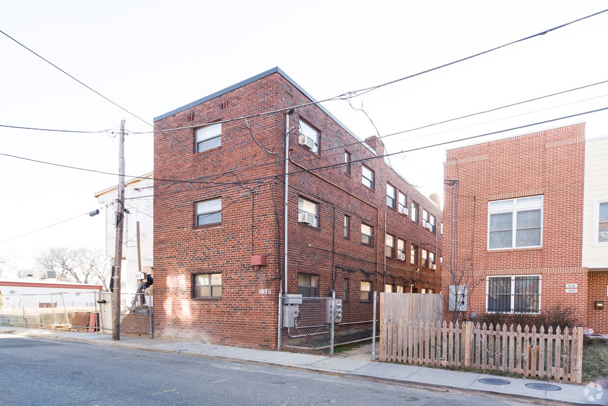

Find a new place to live at 1836-1844 Central Pl NE in Washington, DC. With a location on Central Pl Ne in Washington's 20002 Zip code, you can easily connect with a number of nearby highlights. The community staff will be ready to help you find your new home. Come by to check out the current floorplan options. Contact us or stop by today.
1836-1844 Central Pl NE is an apartment community located in District of Columbia County and the 20002 ZIP Code. This area is served by the District Of Columbia Public Schools attendance zone.
There's a secret in Washington, DC: the tiny, trendy neighborhood of Ivy City. If you haven't heard of it, you aren't alone -- this up-and-coming neighborhood was mostly industrial and largely forgotten for decades. But with a history dating back to the 1870s and charming row houses lining the streets, the whispers about Ivy City are growing louder. Luxury apartments in historic warehouses add elegance to the neighborhood, and bars, restaurants, and entertainment venues add a layer of energy and excitement.
Ivy City's unique name (there isn't an abundance of ivy and it isn't a city) dates back to Civil War-era poet Thomas Seaton Donoho. He named his house Ivy Hall and wrote a book of poems called "Ivywall" in 1860. Donoho dubbed the rural area he lived in "Ivy City" and the name stuck. Ivy City is located on the northeast side of Gallaudet University, extending along New York Avenue from Mt. Olivet Road to the intersection of New York Avenue with West Virginia Avenue.
Learn more about living in Ivy City| Colleges & Universities | Distance | ||
|---|---|---|---|
| Colleges & Universities | Distance | ||
| Walk: | 14 min | 0.8 mi | |
| Drive: | 6 min | 2.5 mi | |
| Drive: | 5 min | 2.6 mi | |
| Drive: | 5 min | 2.6 mi |


Transportation options available in Washington include Benning Rd And 15Th St Ne, located 1.5 miles from 1836-1844 Central Pl NE. 1836-1844 Central Pl NE is near Ronald Reagan Washington Ntl, located 7.6 miles or 14 minutes away, and Baltimore/Washington International Thurgood Marshall, located 29.0 miles or 43 minutes away.
| Transit / Subway | Distance | ||
|---|---|---|---|
| Transit / Subway | Distance | ||
| Drive: | 3 min | 1.5 mi | |
|
|
Drive: | 4 min | 1.5 mi |
| Drive: | 3 min | 1.6 mi | |
| Drive: | 3 min | 1.7 mi | |
|
|
Drive: | 4 min | 1.9 mi |
| Commuter Rail | Distance | ||
|---|---|---|---|
| Commuter Rail | Distance | ||
|
|
Drive: | 5 min | 2.1 mi |
|
|
Drive: | 6 min | 2.3 mi |
|
|
Drive: | 7 min | 3.5 mi |
|
|
Drive: | 7 min | 3.5 mi |
|
|
Drive: | 12 min | 5.1 mi |
| Airports | Distance | ||
|---|---|---|---|
| Airports | Distance | ||
|
Ronald Reagan Washington Ntl
|
Drive: | 14 min | 7.6 mi |
|
Baltimore/Washington International Thurgood Marshall
|
Drive: | 43 min | 29.0 mi |
Time and distance from 1836-1844 Central Pl NE.
| Shopping Centers | Distance | ||
|---|---|---|---|
| Shopping Centers | Distance | ||
| Walk: | 4 min | 0.2 mi | |
| Walk: | 14 min | 0.7 mi | |
| Drive: | 3 min | 1.3 mi |
| Parks and Recreation | Distance | ||
|---|---|---|---|
| Parks and Recreation | Distance | ||
|
Washington Youth Garden
|
Drive: | 2 min | 1.2 mi |
|
National Arboretum
|
Drive: | 6 min | 1.8 mi |
|
Kingman and Heritage Island Park
|
Drive: | 5 min | 2.1 mi |
|
Marian Koshland Science Museum
|
Drive: | 5 min | 2.5 mi |
|
Carter G. Woodson Home National Historic Site
|
Drive: | 5 min | 2.9 mi |
| Hospitals | Distance | ||
|---|---|---|---|
| Hospitals | Distance | ||
| Drive: | 6 min | 2.3 mi | |
| Drive: | 6 min | 2.9 mi | |
| Drive: | 8 min | 3.6 mi |
| Military Bases | Distance | ||
|---|---|---|---|
| Military Bases | Distance | ||
| Drive: | 7 min | 3.5 mi | |
| Drive: | 7 min | 3.5 mi |
What Are Walk Score®, Transit Score®, and Bike Score® Ratings?
Walk Score® measures the walkability of any address. Transit Score® measures access to public transit. Bike Score® measures the bikeability of any address.
What is a Sound Score Rating?
A Sound Score Rating aggregates noise caused by vehicle traffic, airplane traffic and local sources


