
Isle House
39 Bruton St,
San Francisco, CA 94130
$3,395 - $7,635
Studio - 3 Beds

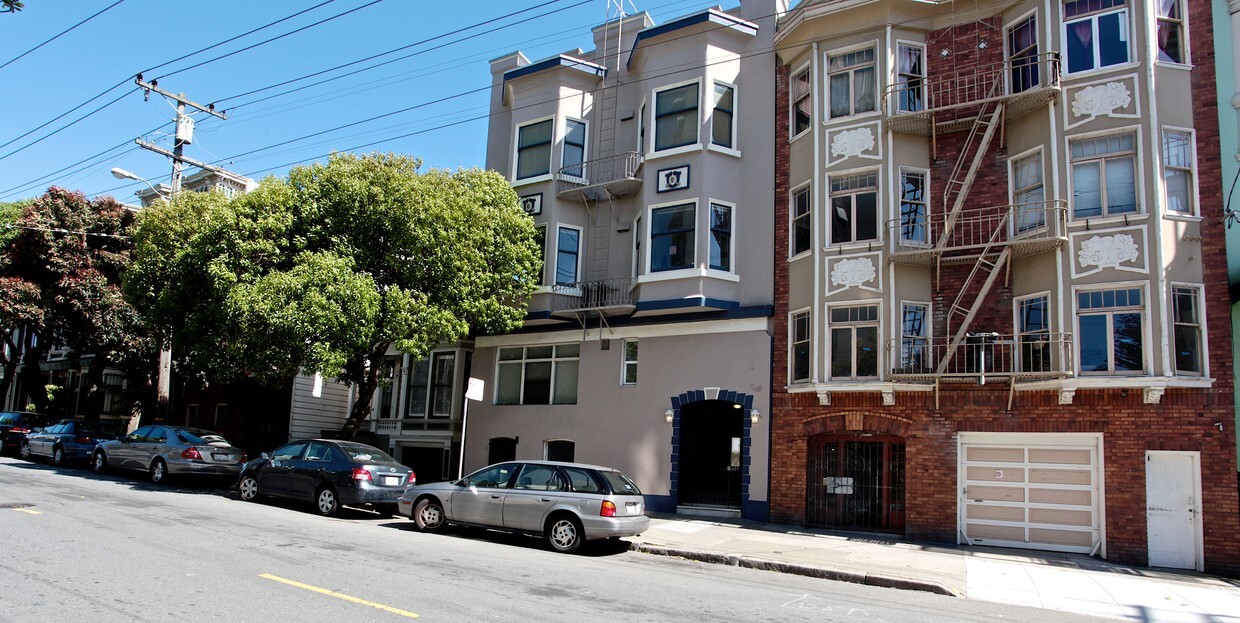
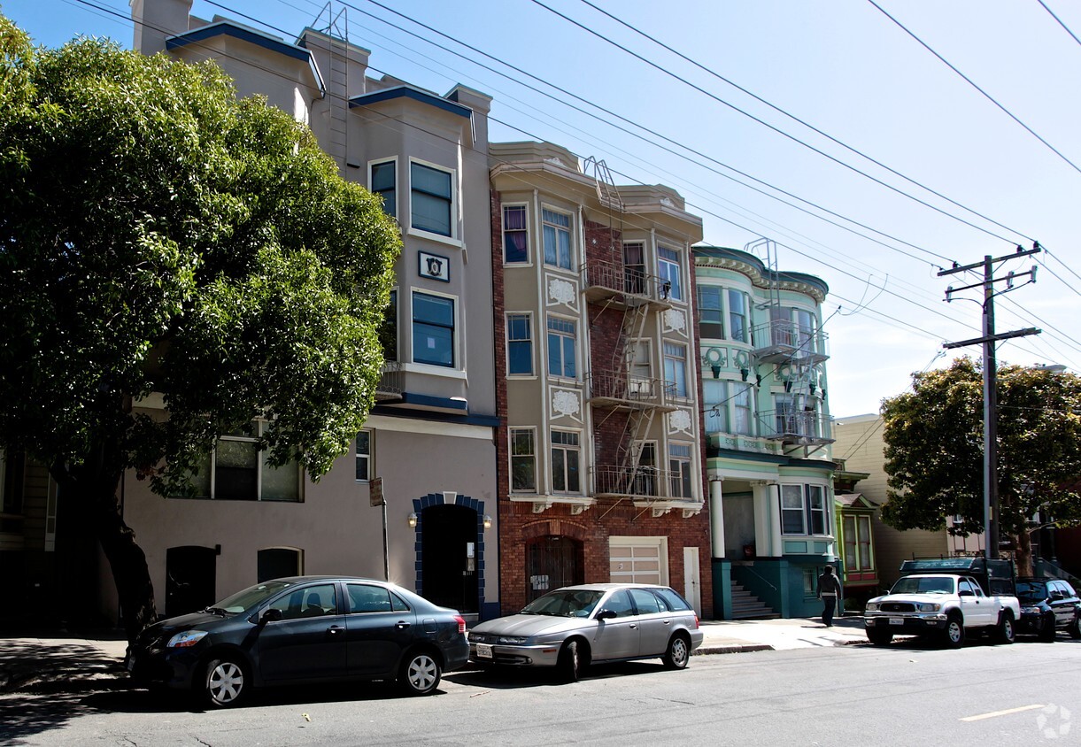

Find a new home at 1747 McAllister Street in San Francisco. These apartments are located at 1747 Mcallister St. in the 94115 area of San Francisco. The professional leasing staff is ready and waiting for you to come take a tour. Schedule a time to see the current floorplan options. Come see 1747 McAllister Street today.
1747 McAllister Street is an apartment community located in San Francisco County and the 94115 ZIP Code. This area is served by the San Francisco Unified attendance zone.
Air Conditioning
High Speed Internet Access
Smoke Free
Heating
Quiet, Convenient, Commuter, Park-Like
The North Park neighborhood of San Francisco has several names – NoPa, North of Panhandle, and Western Addition. It is north of the Panhandle – a large green space that extends from Golden Gate Park eastward. Whatever you want to call it, North Park features beautiful Victorian homes and a fantastic location. North Park is just east of the University of San Francisco, north of the Panhandle, and adjacent to Haight-Ashbury.
Less than a mile from the heart of Downtown San Francisco, it’s a quick walk or bus ride from the city's most-loved attractions. Visit the elegant Painted Ladies, located just east of North Park, or go shopping at Embarcadero Center. Catch a comedy show at the Punchline San Francisco, or visit Fisherman's Warf. Everything you love about San Francisco will be accessible from your North Park apartment.
Learn more about living in North ParkCompare neighborhood and city base rent averages by bedroom.
| North Park | San Francisco, CA | |
|---|---|---|
| Studio | $1,770 | $2,385 |
| 1 Bedroom | $2,011 | $3,182 |
| 2 Bedrooms | $2,599 | $4,339 |
| 3 Bedrooms | $4,167 | $5,641 |
| Colleges & Universities | Distance | ||
|---|---|---|---|
| Colleges & Universities | Distance | ||
| Walk: | 13 min | 0.7 mi | |
| Walk: | 15 min | 0.8 mi | |
| Drive: | 7 min | 2.4 mi | |
| Drive: | 7 min | 2.5 mi |


Transportation options available in San Francisco include Duboce And Noe, located 0.9 mile from 1747 McAllister Street. 1747 McAllister Street is near San Francisco International, located 14.6 miles or 24 minutes away, and Metro Oakland International, located 22.1 miles or 34 minutes away.
| Transit / Subway | Distance | ||
|---|---|---|---|
| Transit / Subway | Distance | ||
|
|
Walk: | 16 min | 0.9 mi |
|
|
Drive: | 4 min | 1.3 mi |
|
|
Drive: | 3 min | 1.3 mi |
| Drive: | 4 min | 1.3 mi | |
|
|
Drive: | 4 min | 1.5 mi |
| Commuter Rail | Distance | ||
|---|---|---|---|
| Commuter Rail | Distance | ||
| Drive: | 7 min | 3.7 mi | |
| Drive: | 7 min | 3.7 mi | |
| Drive: | 9 min | 4.5 mi | |
| Drive: | 9 min | 4.5 mi | |
| Drive: | 13 min | 6.7 mi |
| Airports | Distance | ||
|---|---|---|---|
| Airports | Distance | ||
|
San Francisco International
|
Drive: | 24 min | 14.6 mi |
|
Metro Oakland International
|
Drive: | 34 min | 22.1 mi |
Time and distance from 1747 McAllister Street.
| Shopping Centers | Distance | ||
|---|---|---|---|
| Shopping Centers | Distance | ||
| Walk: | 12 min | 0.6 mi | |
| Drive: | 4 min | 1.2 mi | |
| Drive: | 3 min | 1.2 mi |
| Parks and Recreation | Distance | ||
|---|---|---|---|
| Parks and Recreation | Distance | ||
|
Buena Vista Park
|
Walk: | 15 min | 0.8 mi |
|
Conservatory of Flowers
|
Walk: | 22 min | 1.1 mi |
|
Randall Museum
|
Drive: | 5 min | 1.2 mi |
|
California Academy of Sciences
|
Drive: | 5 min | 1.9 mi |
|
Steinhart Aquarium
|
Drive: | 6 min | 1.9 mi |
| Hospitals | Distance | ||
|---|---|---|---|
| Hospitals | Distance | ||
| Walk: | 9 min | 0.5 mi | |
| Walk: | 15 min | 0.8 mi | |
| Walk: | 17 min | 0.9 mi |
| Military Bases | Distance | ||
|---|---|---|---|
| Military Bases | Distance | ||
| Drive: | 12 min | 4.1 mi | |
| Drive: | 12 min | 4.7 mi | |
| Drive: | 17 min | 8.2 mi |
What Are Walk Score®, Transit Score®, and Bike Score® Ratings?
Walk Score® measures the walkability of any address. Transit Score® measures access to public transit. Bike Score® measures the bikeability of any address.
What is a Sound Score Rating?
A Sound Score Rating aggregates noise caused by vehicle traffic, airplane traffic and local sources


